Install
Ripley, WV Weather
Current conditions
Observed at Parkersburg, Mid-Ohio Valley Regional Airport · 32 min ago
Forecast
10-day-
Tonight
Mostly clear, with a low around 40. East wind 1 to 5 mph.
-
Saturday
Sunny, with a high near 70. Southeast wind around 3 mph.
-
Saturday Night
Clear, with a low around 40. East wind around 3 mph.
National Weather Service forecast updated 7 hrs ago.
Hourly
Hourly forecast- Now43°
- 2 AM42°
- 3 AM42°
- 4 AM41°
- 5 AM41°
- 6 AM40°
- 7 AM40°
- 8 AM40°
- 9 AM44°
- 10 AM49°
- 11 AM56°
- 12 PM62°
- 1 PM66°
- 2 PM68°
- 3 PM69°
- 4 PM70°
- 5 PM69°
- 6 PM66°
- 7 PM60°
- 8 PM53°
- 9 PM50°
- 10 PM49°
- 11 PM48°
- Sun12 AM46°
Daily forecast
Details- TonightOct 23Mostly Clear40°
- TodayOct 24Sunny40°70°
- SunOct 25Sunny40°71°
- MonOct 26Sunny42°72°
- TueOct 27Mostly Sunny46°72°
- WedOct 28Mostly Cloudy47°73°
- ThuOct 29Mostly Sunny46°74°
- FriOct 30Mostly Sunny71°
- SatOct 31Cloudy35°62°
Days after the National Weather Service's seven are MET Norway's outlook, a computer model with no forecaster's review.
Radar
Full mapWeather news in West Virginia
More weather news-
 Freeze expected tonight in six West Virginia counties before mild, dry week
CHARLESTON, W.Va. — One more frosty night is in store for parts of West Virginia before a mild, dry stretch settles in for the week ahead. The MetroNews forecast calls for a freeze tonight into early Monday in…
- A Long Stretch of Dry and Sunny Weather in West Virginia
WDTV 5 BRIDGEPORT, W.Va (WDTV) - Weather Overview: A Stretch of Sunny Days and Chilly Nights The next 10 days look mainly dry and sunny here in North Central West Virginia (NCWV). For each afternoon, temperatures reach…
-
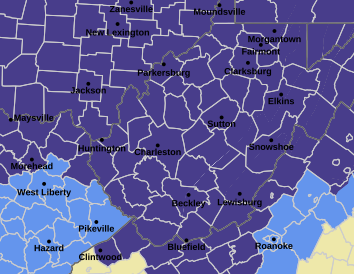 West Virginia under freeze warning for tonight
CHARLESTON, W.Va. — The National Weather has issued a freeze warning for the entire state for overnight Saturday into Sunday. The warning is posted for 1 a.m. to 9 a.m. Sunday. Meteorologists said sub-freezing…
-
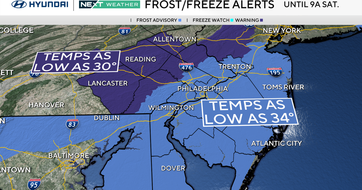 Freeze warning in effect for parts of Philadelphia region as chilly air moves in. Here's the weather forecast.
October 23, 2026 / 11:57 PM EDT / CBS Philadelphia With fall comes some frosty mornings, and that's exactly what's on tap this weekend in the Philadelphia region. Temperatures Saturday morning along the I-95 corridor…
-
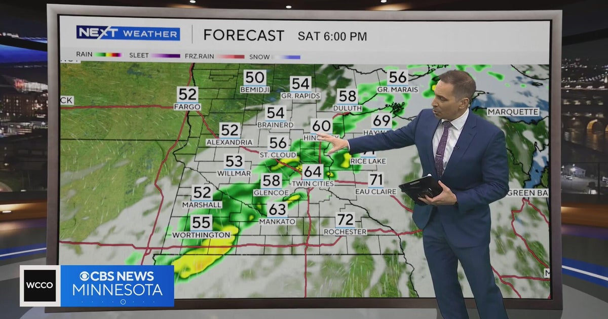 Minnesota weather to feature warm temps Saturday before cooldown | Oct. 23, 2026
CBS News Minnesota is a local news organization that is part of CBS News and Stations. Also referred to as WCCO-TV and channel 4, CBS News Minnesota offers local breaking news, weather coverage and investigative…
-
 Second storm to hit UK with more wind and rain as thousands remain without power
Rough sea along the Dorset coastline on Friday A second storm in as many days is set to batter parts of the UK, as thousands remain without power following powerful winds and heavy rain on Friday. Storm Boelo is…
-
 Before you crank up the thermostat, try these tips to keep your house warmer for longer
As the UK braces for a chilly weekend, with powerful winds and heavy rain hitting parts of the country, people are looking for ways to bring some warmth to their homes without cranking up the heating just yet. It is…
-
 Thunderstorms, heavy rain and flash flooding predicted for much of Australia
Parts of Queensland, Victoria and South Australia can expect severe storms on Saturday, moving into NSW and Tasmania by Sunday Severe thunderstorms and heavy rain will sweep across most Australian states this weekend…
-
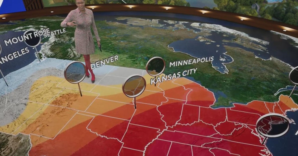 Fall weather in full force across Georgia this weekend
CBS News Atlanta is a local news organization that is part of CBS News and Stations. Also referred to as WUPA and channel 69, CBS News Atlanta offers local breaking news, weather coverage and investigative reporting…
-
 Minnesota weather: one last warm day, then a damp, cool change | Oct. 23, 2026
CBS News Minnesota is a local news organization that is part of CBS News and Stations. Also referred to as WCCO-TV and channel 4, CBS News Minnesota offers local breaking news, weather coverage and investigative…
Air quality
Acceptable. Unusually sensitive people should consider limiting prolonged outdoor exertion.
Charleston, WV reporting area · 1 hr ago. Data from AirNow (EPA and its state, local and tribal partners); preliminary and subject to change.
Sun & moon
Almanac
MonthlyRipley, records since 1941. Normals 1991–2020. Data from NOAA's Regional Climate Centers (ACIS).
Nearby
- Charleston 53 km
- Parkersburg 51 km
- Teays Valley 45 km
- South Charleston 50 km
- Saint Albans 49 km
- Vienna 58 km
- Cross Lanes 45 km
- Dunbar 51 km
- Nitro 46 km
- Hurricane 51 km
- Belpre 52 km
- Point Pleasant 37 km
Forecasters' discussion
From the National Weather Service office in RLX, issued 7 hrs ago
What Has Changed
No changes have been made to ongoing and quiet forecast.
Key Messages
1) Dry weather and morning river fog continues to be expected over the next 7 days, with patchy frost possible each morning through Monday.
Discussion
KEY MESSAGE 1...
The mid/upper-level pattern remains relatively unchanged from yesterday, with the apex of the subtropical ridge now shifting into the Upper Midwest. The Omega Block situated across the Lower 48 is still intact, but it will begin to collapse over the weekend as an amplified, neutrally-tilting trough digs eastward into the Desert Southwest. As this occurs, the core of the subtropical ridge will continue to gradually shift eastward and over the Deep South. This will keep the CWA dry, with warmer high temperatures to follow as geopotential height tendencies rise. Persistence forecasting has been applied to Saturday and beyond, with the crystal clear sky at night allowing for excellent radiational cooling and the development of typical river valley fog. Patchy frost can be expected across the higher terrain each morning through Monday, and the stagnant airmass will maintain calm-to-gentle winds.
Aviation
VFR conditions can be expected through the period with the exception of some late night early morning dense river valley fog.
FORECAST CONFIDENCE AND ALTERNATE SCENARIOS
FORECAST CONFIDENCE AND ALTERNATE SCENARIOS THROUGH 00Z SUNDAY...
ALTERNATE SCENARIOS: Timing and location of fog could vary.
EXPERIMENTAL TABLE OF FLIGHT CATEGORY OBJECTIVELY SHOWS CONSISTENCY OF WFO FORECAST TO AVAILABLE MODEL INFORMATION: H = HIGH: TAF CONSISTENT WITH ALL MODELS OR ALL BUT ONE MODEL. M = MEDIUM: TAF HAS VARYING LEVEL OF CONSISTENCY WITH MODELS. L = LOW: TAF INCONSISTENT WITH ALL MODELS OR ALL BUT ONE MODEL.
UTC 1HRLY 19 20 21 22 23 00 01 02 03 04 05 06 EDT 1HRLY 15 16 17 18 19 20 21 22 23 00 01 02 CRW CONSISTENCY H H H H H H H H H H H H HTS CONSISTENCY H H H H H H H H H H H H BKW CONSISTENCY H H H H H H H H H H H H EKN CONSISTENCY H H H H H H H H H H H H PKB CONSISTENCY H H H H H H H H H H H H CKB CONSISTENCY H H H H H H H H H H H H
Forecasts, observations and alerts in the United States come from the National Weather Service (NOAA); radar from NOAA's Multi-Radar Multi-Sensor system; satellite imagery from NASA's Global Imagery Browse Services (GIBS) and NOAA's GOES satellites; the map from the U.S. Geological Survey's National Map; air quality from AirNow (EPA and its partners); hurricane information from the National Hurricane Center; climate normals and records from NOAA's Regional Climate Centers (ACIS). Forecasts outside the United States and the UV index: MET Norway (CC BY 4.0); observations outside the U.S.: airport reports via NOAA's Aviation Weather Center. Place names: GeoNames (CC BY 4.0). Data are copied on a schedule and may lag the sources; for warnings that affect your safety, follow your local National Weather Service office and emergency officials. Weather news is drawn from the 4Search index and reflects what the press published. Terms of use.