Install
South Charleston, WV Weather
Current conditions
Observed at Charleston, Yeager Airport · 38 min ago
Forecast
10-day-
Tuesday
Mostly sunny, with a high near 74. Northeast wind around 1 mph.
-
Tuesday Night
Mostly cloudy, with a low around 50. East wind around 3 mph.
-
Wednesday
Mostly cloudy, with a high near 74. South wind 0 to 3 mph.
National Weather Service forecast updated 11 hrs ago.
Hourly
Hourly forecast- Now45°
- 8 AM45°
- 9 AM46°
- 10 AM51°
- 11 AM57°
- 12 PM64°
- 1 PM69°
- 2 PM71°
- 3 PM73°
- 4 PM73°
- 5 PM72°
- 6 PM68°
- 7 PM64°
- 8 PM58°
- 9 PM55°
- 10 PM53°
- 11 PM52°
- Wed12 AM52°
- 1 AM51°
- 2 AM51°
- 3 AM51°
- 4 AM51°
- 5 AM51°
- 6 AM51°
10-day forecast
Details- TonightOct 26Partly Cloudy44°
- TodayOct 27Mostly Sunny50°74°
- WedOct 28Mostly Cloudy49°74°
- ThuOct 29Sunny48°76°
- FriOct 30Mostly Sunny51°76°
- SatOct 31Mostly Cloudy18%56°75°
- SunNov 1Chance Rain Showers44%57°72°
- MonNov 2Chance Rain Showers41%73°
- TueNov 3Heavy rain0.48 in60°70°
- WedNov 4Heavy rain1.12 in64°74°
Days after the National Weather Service's seven are MET Norway's outlook, a computer model with no forecaster's review.
Radar
Full mapWeather news in West Virginia
More weather news-
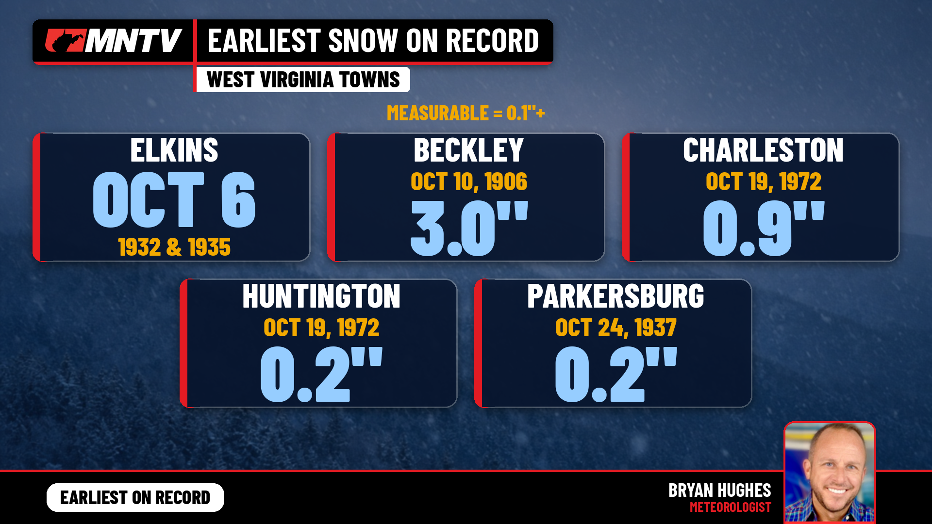 When does West Virginia usually see its first snow? Earlier than you might think
Every fall somebody asks the same question: when does the first snow usually show up in West Virginia? It’s a fair one. Leaves are still hanging on in a lot of places, football season is in full swing, and Halloween…
-
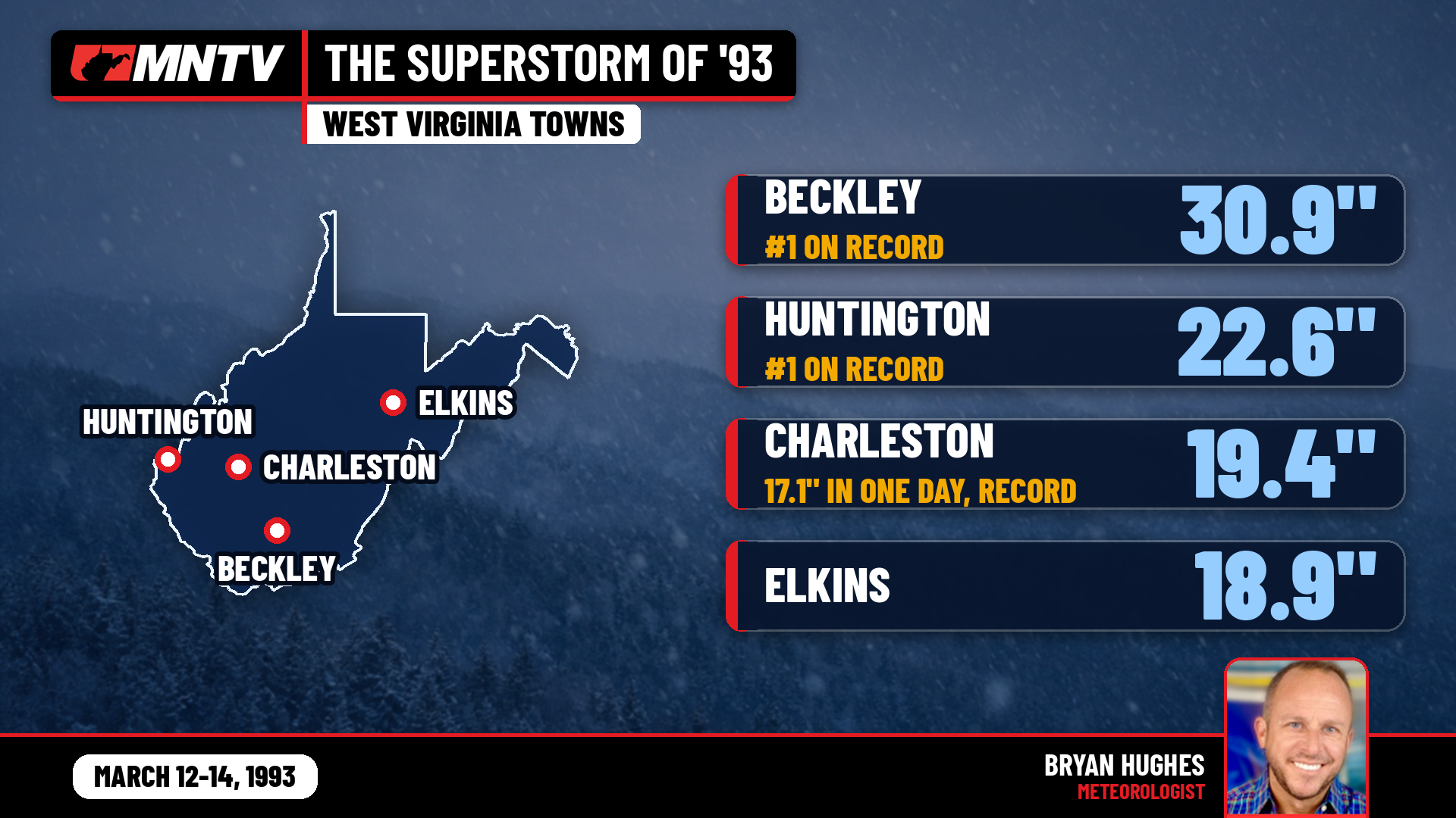 The Storm of the Century: When West Virginia Disappeared Under Feet of Snow
I’ve been forecasting West Virginia weather for 27 years, and there’s one storm folks still bring up at the grocery store, at ballgames, and in my Facebook comments: March 12-14, 1993. You might know it as the…
-
 Highs near 70 degrees on Tuesday in Chicago
WBZ This Morning 6am CBS News Chicago 5am CBS News Detroit 6am CBS News Miami 6am CBS News Philadelphia 6am KDKA-TV Morning News 6am CBS News Texas 5am
-
 Groton digs out from a foot of snow during nor'easter
March 14, 2023 / 5:01 PM EDT / CBS Boston GROTON - During Tuesday's nor'easter several communities experienced a wide variety of precipitations. Groton was not one of them. The snow fell consistently starting before…
-
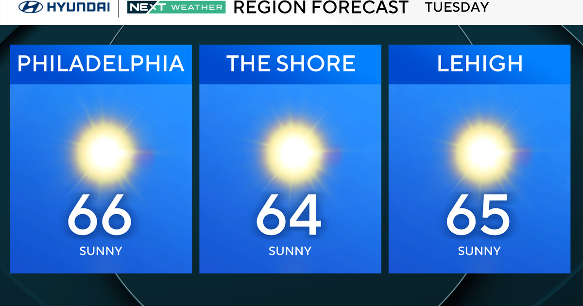 Slightly warmer start, but more of the same in Philadelphia region Tuesday. Here's the weather forecast.
October 27, 2026 / 12:00 AM EDT / CBS Philadelphia Tuesday will be a slightly warmer start to the day in the Philadelphia region, with high temperatures reaching the mid-60s. The NEXT big change in terms of rainfall…
-
 Nice fall North Carolina weather continues this week | Daylight saving time ends this weekend
Our stretch of beautiful fall weather continues this week. More sunshine Tuesday, but heavier clouds return by Wednesday. North Carolina weather is expected to remain dry through at least Halloween. Temperatures will…
-
 Monday evening First Alert Weather forecast 10/26/26
CBS News Bay Area is a local news organization that is part of CBS News and Stations. Also referred to as KPIX-TV and channel 5, CBS News Bay Area offers local breaking news, weather coverage and investigative…
-
 New weather warnings as third storm set to hit Scotland
Two new weather warnings have been issued as a third storm in a matter of days is set to batter Scotland. It comes as thousands of homes across the country remain without power in the aftermath of Storm Boelo. A yellow…
-
 Woodbury BMX racer dominating the competition at 14
CBS News Minnesota is a local news organization that is part of CBS News and Stations. Also referred to as WCCO-TV and channel 4, CBS News Minnesota offers local breaking news, weather coverage and investigative…
-
 Why some Minnesotans will pay more for health insurance in 2027
The high cost of healthcare is hitting Minnesotans hard. The issue is top of mind for many voters just eight days before the midterm elections. Caroline Cummings has more on the double-digit increases some could face in…
Air quality
Acceptable. Unusually sensitive people should consider limiting prolonged outdoor exertion.
Charleston, WV reporting area · 1 hr ago. Data from AirNow (EPA and its state, local and tribal partners); preliminary and subject to change.
Sun & moon
Almanac
MonthlyCharleston Area, records since 1892. Normals 1991–2020. Data from NOAA's Regional Climate Centers (ACIS).
Nearby
- Charleston 6 km
- Teays Valley 22 km
- Saint Albans 12 km
- Cross Lanes 10 km
- Dunbar 3 km
- Nitro 14 km
- Pea Ridge 54 km
- Hurricane 29 km
- Barboursville 52 km
- Sissonville 19 km
- Pinch 20 km
- Ripley 50 km
Forecasters' discussion
From the National Weather Service office in RLX, issued 1 hr ago
What Has Changed
12Z Aviation forecast discussion update. Slight modification to hourly temperatures and dew points were conducted to reflect current observations.
1233 AM update... Forecast trends remain on course heading into this weekend, with the extended dry spell coming to an end late Saturday night into Sunday morning.
Key Messages
1) Dry and warm weather rules the roost through the start of the weekend.
2) After an extended period of dry weather prevailing through the end of October, November opens up with the return of rain.
Discussion
KEY MESSAGE 1...
Surface analysis this morning depicts a frontal boundary draped north of the forecast area that is progged to slip down from the northeast during the day today. The lack of moisture associated with the boundary and strong upper level ridging aloft will mitigate any measurable precipitation with this feature as it remains nestled nearby.
As the influence of the upper ridge gradually lessens this week, a few subtleties to the forecast will ensue. With the frontal boundary nearby today into Wednesday, an increase in cloud coverage will take shape. Once the boundary retreats to the north as a warm front, the surface high will regain control for the end of the work week and promote ample sunshine once more. Additionally, post-frontal southwesterly flow will encourage a slight warm up that will mitigate any concern for frost/freeze messaging, as overnight lows grow milder within this regime. The ridge breaks down further into the weekend, with a pattern change progged to take shape beginning on Halloween.
KEY MESSAGE 2...
The predominant stretch of dry weather rounding out the second half of October comes to a conclusion this weekend as strengthening low pressure across the western US takes aim for the Ohio Valley. This will reintroduce measurable precipitation back into the forecast as early as late Saturday night into Sunday morning, and maintaining unsettled weather through the remainder of the extended forecast period. Timing and extent of this approaching disturbance will continue to be hashed out as we get closer to the weekend timeframe.
Aviation
VFR conditions remain favored through the majority of the TAF period, with the exception of early morning river valley fog. Nighttime satellite imagery shows a fog signature across the southern coalfields, meandering just south of CRW. Any restrictions caused by fog and low stratus noted this morning will erode by 14Z, branching back out into triumphant VFR for the day.
FORECAST CONFIDENCE AND ALTERNATE SCENARIOS THROUGH 12Z WEDNESDAY...
FORECAST CONFIDENCE: High; Medium in fog.
ALTERNATE SCENARIOS: Timing and location of fog could vary this morning.
EXPERIMENTAL TABLE OF FLIGHT CATEGORY OBJECTIVELY SHOWS CONSISTENCY OF WFO FORECAST TO AVAILABLE MODEL INFORMATION: H = HIGH: TAF CONSISTENT WITH ALL MODELS OR ALL BUT ONE MODEL. M = MEDIUM: TAF HAS VARYING LEVEL OF CONSISTENCY WITH MODELS. L = LOW: TAF INCONSISTENT WITH ALL MODELS OR ALL BUT ONE MODEL.
DATE TUE 10/27/26 UTC 1HRLY 07 08 09 10 11 12 13 14 15 16 17 18 EDT 1HRLY 03 04 05 06 07 08 09 10 11 12 13 14 CRW CONSISTENCY H H H H H H H H H H H H HTS CONSISTENCY H H H H H H H H H H H H BKW CONSISTENCY H H H H H H H H H H H H EKN CONSISTENCY H H H H H L H H H H H H PKB CONSISTENCY H H H H H L H H H H H H CKB CONSISTENCY H H H H H H H H H H H H
Forecasts, observations and alerts in the United States come from the National Weather Service (NOAA); radar from NOAA's Multi-Radar Multi-Sensor system; satellite imagery from NASA's Global Imagery Browse Services (GIBS) and NOAA's GOES satellites; the map from the U.S. Geological Survey's National Map; air quality from AirNow (EPA and its partners); hurricane information from the National Hurricane Center; climate normals and records from NOAA's Regional Climate Centers (ACIS). Forecasts outside the United States and the UV index: MET Norway (CC BY 4.0); observations outside the U.S.: airport reports via NOAA's Aviation Weather Center. Place names: GeoNames (CC BY 4.0). Data are copied on a schedule and may lag the sources; for warnings that affect your safety, follow your local National Weather Service office and emergency officials. Weather news is drawn from the 4Search index and reflects what the press published. Terms of use. How to use Weather