Install
Arizona City, AZ Weather
Current conditions
Observed at Chandler, Chandler Municipal Airport · 1 hr ago
Forecast
10-day-
Monday
Sunny, with a high near 80. East northeast wind 0 to 5 mph.
-
Monday Night
Clear, with a low around 54. East northeast wind 0 to 5 mph.
-
Tuesday
Sunny, with a high near 83. North northeast wind 0 to 5 mph.
National Weather Service forecast updated 1 day ago.
Hourly
Hourly forecast- Now52°
- 8 AM55°
- 9 AM62°
- 10 AM67°
- 11 AM71°
- 12 PM75°
- 1 PM78°
- 2 PM79°
- 3 PM80°
- 4 PM79°
- 5 PM78°
- 6 PM75°
- 7 PM72°
- 8 PM68°
- 9 PM65°
- 10 PM63°
- 11 PM61°
- Tue12 AM59°
- 1 AM58°
- 2 AM56°
- 3 AM55°
- 4 AM54°
- 5 AM54°
- 6 AM54°
10-day forecast
Details- TonightOct 24Mostly Clear53°
- SunOct 25Sunny52°77°
- TodayOct 26Sunny54°80°
- TueOct 27Sunny56°83°
- WedOct 28Mostly Sunny58°83°
- ThuOct 29Partly Sunny then Chance Rain Showers68%60°82°
- FriOct 30Showers And Thunderstorms Likely68%58°75°
- SatOct 31Chance Showers And Thunderstorms45%71°
- SunNov 1Rain0.35 in56°69°
- MonNov 2Sunny56°75°
Days after the National Weather Service's seven are MET Norway's outlook, a computer model with no forecaster's review.
Radar
Full mapWeather news in Arizona
More weather news-
 Tracking drier weather on tap for Arizona this week
Over the work week, dry conditions will continue as a ridge of high pressure builds into our state. Paul Horton has your First Alert forecast. Tracking drier weather on tap for Arizona this week Taking a sweet trip down…
-
 Tornadoes confirmed in Arizona
KOLD Tornadoes confirmed in Arizona Unusually high severe weather risk continues across Arizona through Thursday Severe storms and flash flooding likely across Arizona Wednesday and Thursday
-
 Warming trend builds before rain chances move back into Arizona
PHOENIX (AZFamily) — After an active and extreme weather week, look for a beautiful weekend in the Phoenix area with highs below average. Grab a light jacket this morning. You can expect lows in the 50s and 60s across…
-
 A touchdown forecast for Arizona’s Homecoming Weekend
TUCSON, Ariz. (13 News) - Cooling off and drying out here in Arizona. Dry forecast with cooler than normal temps through the weekend. In Tucson, expect upper 70s tomorrow before right at 80° on Sunday. Sunshine will…
-
 MOST ACCURATE FORECAST: Cooler, drier air settles into Arizona
PHOENIX — The powerful fall storm that brought severe weather to Arizona this week has moved out of the state. The storm system triggered 16 Tornado Warnings across Arizona on Wednesday and Thursday. A likely tornado…
-
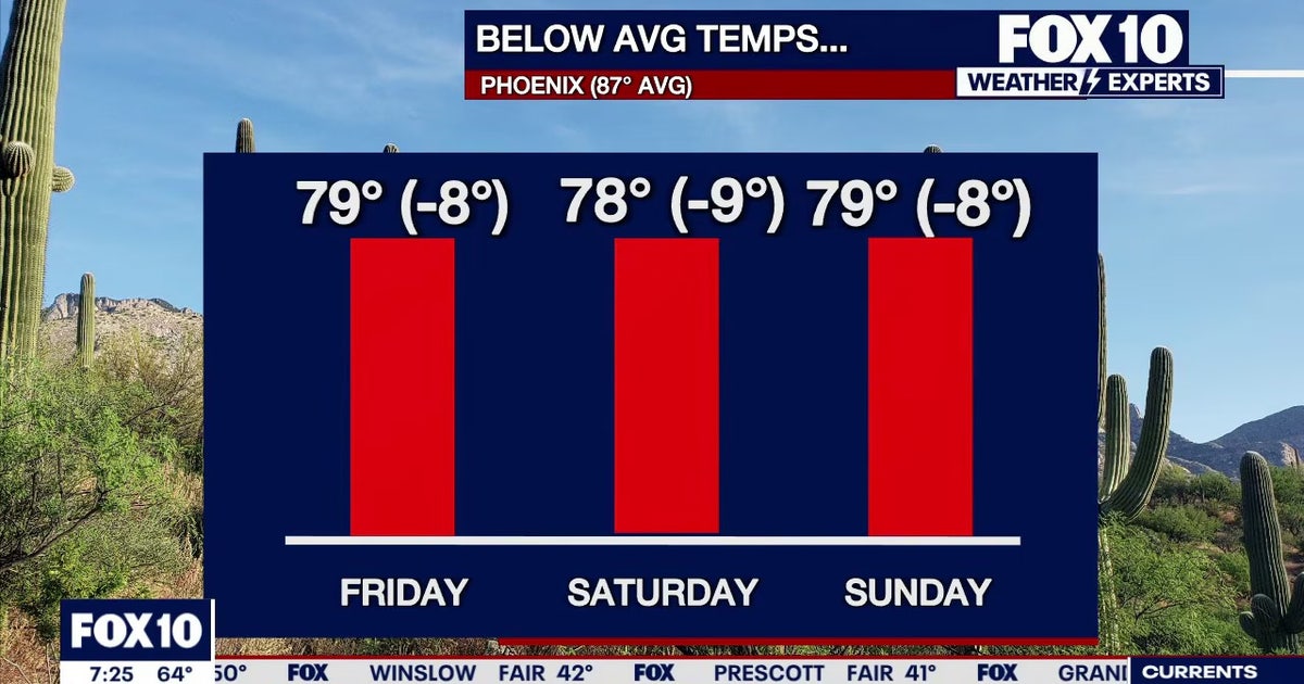 Arizona weather forecast: Cooler highs and sunny weekend skies in Phoenix
PHOENIX - Friday morning temperatures across Phoenix show most residents starting in the mid-to-upper 50s or low 60s. Wickenburg recorded upper 40s, while temperatures reached 59 degrees in Mesa, Phoenix-Mesa Gateway…
-
 Severe weather is leaving Arizona. Here’s what to expect next
After several days of severe weather across Arizona, mainly quiet conditions return for Friday and the weekend. Ian Schwartz has your First Alert forecast. PHOENIX (AZFamily) — After several days of severe weather…
-
 After a stormy few days in Arizona, sunshine and fall temps return Friday
TUCSON, Ariz. (13 News) - Tornado Watch in Cochise, Graham, and Greenlee Counties until 8pm tonight. Severe weather potential remains this afternoon and evening throughout Arizona. A Flood Watch is still valid for our…
-
 Golf Ball-Sized Hailstones Pummel Parts of Arizona in Rare Storm
Tornado watches were issued for several areas—the first in Arizona since 2010. What would you like to watch today?
-
 Tornado Watch in effect for parts of southeast Arizona
TUCSON, Ariz. (13 News) - Another active day across the state. Main threat will be heavy rain, strong winds, hail, and potentially a tornado. A Tornado Watch has been issued for to Graham, Greenlee, and Cochise counties…
Air quality
Air quality is satisfactory, and air pollution poses little or no risk.
Forecast
- MonModerate (51)
- TueModerate (52)
West Pinal, AZ reporting area · 1 hr ago. Data from AirNow (EPA and its state, local and tribal partners); preliminary and subject to change.
Sun & moon
Almanac
MonthlyCasa Grande, records since 1903. Normals 1991–2020. Data from NOAA's Regional Climate Centers (ACIS).
Nearby
- San Tan Valley 50 km
- Casa Grande 16 km
- Maricopa 49 km
- Marana 55 km
- Queen Creek 55 km
- Florence 40 km
- Eloy 11 km
- Sun Lakes 54 km
- Coolidge 29 km
- Avra Valley 49 km
- Sacaton 36 km
Forecasters' discussion
From the National Weather Service office in PSR, issued 2 hrs ago
Update
Updated 12Z Aviation Discussion.
Key Messages
- Temperatures will remain within the normal range through Thursday with lower desert highs mostly in the eighties.
- Dry and tranquil weather conditions will last through the middle of week with increasing clouds starting Wednesday.
- An unsettled weather pattern will return late week and last through the weekend with the best rain chances on Friday and Sunday.
Short Term
Quiet weather conditions have settled into the region under quasi-zonal westerly flow aloft. A dry air mass now in place will keep skies clear to mostly clear through Tuesday, while temperatures rise a bit under the modestly higher heights aloft. Daytime highs are expected to reach into the mid 80s across the lower deserts starting today and last through the middle part of the week despite increasing clouds starting Wednesday. Overnight lows will also fall within the normal range through Wednesday with lower desert readings mostly between 55-60 degrees.
Long Term
The weather pattern is expected to shift late this week with a deep trough getting carved out over the Pacific Northwest and southwestward to off the coast of California by Thursday. The polar jet associated with the northern stream system is expected to dip farther southward off the West Coast, while a stronger subtropical jet across the central Pacific shifts eastward toward Baja. Although these jet branches are not expected to phase together going into Friday, there is likely to be some combined energy reaching the Western U.S.
As the trough sets up to our west on Wednesday into Thursday, high level moisture will stream into our region, followed by increasing southerly moist flow in the lower levels Thursday night into Friday. Guidance is in very good agreement southerly low level moist advection will combine with some top-down saturation in the upper levels on Friday across southern and central Arizona. PWATs are shown to quickly rise to just above 200% of normal by Friday morning, while low level mixing ratios rise to a respectable 8-9 g/kg. This decent moisture is also expected to coincide with modest low level upslope forcing and quite strong mid and upper level ascent within the left exit region of the subtropical jet. Although we are still four days out, confidence is quite good in shower activity blossoming at some point Thursday night/Friday morning across south-central Arizona and lasting through much of Friday. Guidance also shows modest MUCAPE of 250-500 J/kg on Friday which should allow for some isolated to scattered weak thunderstorms. Shear values look to be on the low side, so at this point we are not anticipating any strong storms. Forecast QPF from Thursday night through Friday night currently averages around 0.50" across the Phoenix area to upwards of 0.75-1.00" in the higher terrain north of Phoenix. The higher end of guidance is at least double that, so it's not out of the question to have to worry about some minor flooding issues Friday. WPC has also included this area in a Slight Risk on their Day 5 ERO.
The Friday weather event will not be the last period of rain expected over the next week as another likely even stronger system is forecast to track east northeastward toward southern California and northern Baja on Saturday before moving through our region on Sunday. There is much more uncertainty with this second weather system compared to the first as there are notable timing and evolution differences. There are also some differences with the potential phasing of the polar and subtropical jet streams which if it occurs would likely result in a decent low pressure system developing within the base of the large scale trough. Models at least agree that there will be as much if not better moisture then the Friday system and stronger mid-level and frontal ascent. Given the uncertainty, QPF amounts are still quite volatile to any big changes in the strength of the system and track. However, so far ensemble mean QPF amounts indicate overall higher average amounts compared to Friday's event, as well as more widespread coverage. Rain chances could also extend into Monday, especially across eastern portions of Arizona.
Temperatures will take a hit later this week and through the weekend with NBM forecast highs dropping into a 75-80 degree range Friday and Saturday and even lower starting Sunday. The coolest air so far this fall should move in with the Sunday weather system as highs may fall to as the upper 60s to lower 70s for Sunday and Monday.
Forecasts, observations and alerts in the United States come from the National Weather Service (NOAA); radar from NOAA's Multi-Radar Multi-Sensor system; satellite imagery from NASA's Global Imagery Browse Services (GIBS) and NOAA's GOES satellites; the map from the U.S. Geological Survey's National Map; air quality from AirNow (EPA and its partners); hurricane information from the National Hurricane Center; climate normals and records from NOAA's Regional Climate Centers (ACIS). Forecasts outside the United States and the UV index: MET Norway (CC BY 4.0); observations outside the U.S.: airport reports via NOAA's Aviation Weather Center. Place names: GeoNames (CC BY 4.0). Data are copied on a schedule and may lag the sources; for warnings that affect your safety, follow your local National Weather Service office and emergency officials. Weather news is drawn from the 4Search index and reflects what the press published. Terms of use. How to use Weather