Install
El Paso, TX 88523 Weather
Current conditions
Observed at El Paso, El Paso International Airport · 1 hr ago
Forecast
10-day-
Overnight
Mostly cloudy, with a low around 65. East southeast wind around 5 mph.
-
Friday
A chance of showers and thunderstorms after 3pm. Sunny, with a high near 86. South southeast wind 6 to 10 mph, with gusts as high as 20 mph. Chance of precipitation is 60%. New rainfall amounts less than a tenth of an inch possible.
-
Friday Night
A chance of showers and thunderstorms. Mostly cloudy, with a low around 60. South southeast wind around 8 mph. Chance of precipitation is 80%. New rainfall amounts between a tenth and quarter of an inch possible.
National Weather Service forecast updated 2 hrs ago.
Hourly
Hourly forecast- Now68°14%
- 3 AM67°13%
- 4 AM67°10%
- 5 AM66°
- 6 AM65°
- 7 AM65°
- 8 AM68°
- 9 AM73°
- 10 AM77°
- 11 AM80°
- 12 PM82°
- 1 PM84°
- 2 PM85°11%
- 3 PM86°26%
- 4 PM85°45%
- 5 PM84°63%
- 6 PM78°82%
- 7 PM73°71%
- 8 PM71°59%
- 9 PM69°48%
- 10 PM68°36%
- 11 PM67°30%
- Sat12 AM65°25%
- 1 AM64°19%
10-day forecast
Details- TonightOct 22Mostly Cloudy14%65°
- TodayOct 23Sunny then Chance Showers And Thunderstorms82%60°86°
- SatOct 24Chance Showers And Thunderstorms80%59°81°
- SunOct 25Mostly Sunny41%58°77°
- MonOct 26Mostly Sunny then Slight Chance Showers And Thunderstorms18%56°76°
- TueOct 27Mostly Sunny57°76°
- WedOct 28Slight Chance Rain Showers then Mostly Sunny23%58°77°
- ThuOct 29Partly Sunny then Chance Rain Showers32%77°
- FriOct 30Heavy showers0.39 in56°70°
- SatOct 31Cloudy0.02 in52°71°
Days after the National Weather Service's seven are MET Norway's outlook, a computer model with no forecaster's review.
Radar
Full mapWeather news near El Paso
More weather news- El Paso Weather Warm Wednesday Storms Return Thursday Night
El Paso is in for one more warm, mostly sunny day before a wetter and more unsettled pattern moves in. Early Wednesday temperatures are around 65 degrees. High clouds are expected to pass during the day, with coverage…
-
 ABC-7 First alert: Severe storm chances arrive tonight!
EL PASO, Texas (KVIA) -- We remain under an ABC-7 First Alert for severe storm potential. Storm chances begin tonight and last through at least your Saturday! We woke up this morning to fresh temps, high clouds, and…
-
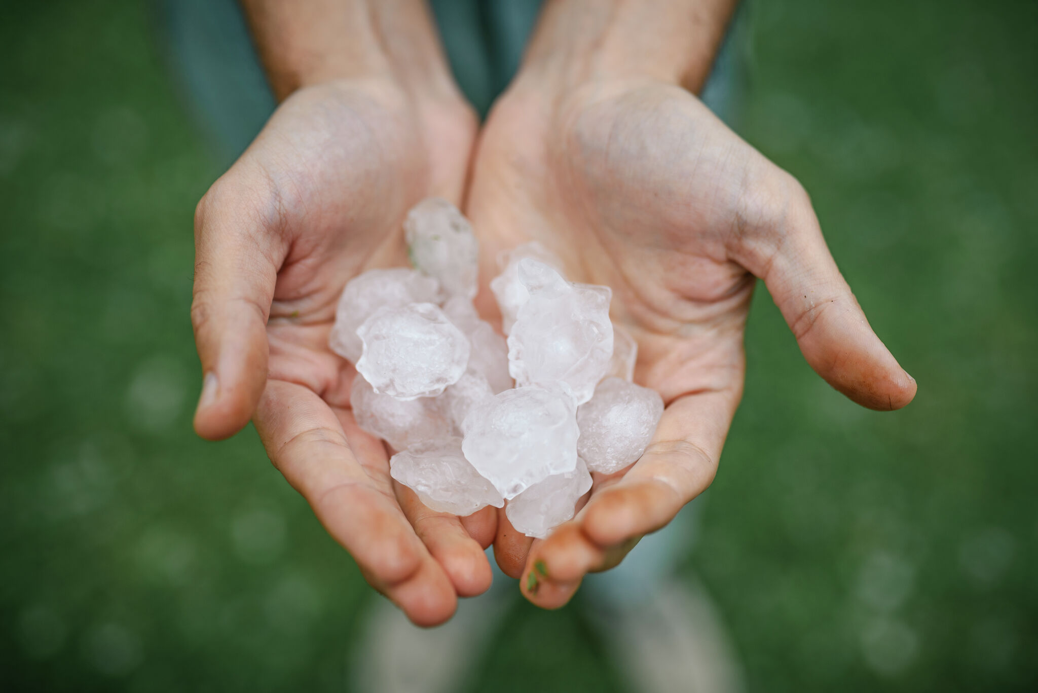 Hail, flooding and cold front headed for parts of Texas. Here's where.
Severe weather could bring large hail to West Texas. Parts of Texas could face several days of severe weather, with storms kicking off today and potentially lasting through the weekend. Scattered to numerous…
-
 Weather Warn Thursday/Friday for Heavy Rain & Strong Storms
EL PASO, Texas (KFOX14) — The KFOX14 Severe Weather Team has issued a Weather Warn for Thursday and Friday as heavy rain and strong storms could affect parts of the Borderland. A strong low pressure system moving in…
-
 ABC-7 First Alert: Storm chances on the rise!
EL PASO, Texas (KVIA) -- We are under an ABC-7 First Alert as storm chances continue to rise. Today we woke to temps in the 60s. By lunch El Paso is expected to reach a high of 87, Las Cruces 83. This will keep our…
-
 ABC-7 First Alert: Storm chances climb!
EL PASO, Texas (KVIA) -- We are under an ABC-7 First Alert as storm chances are set to climb over the next few days. We woke this morning to temps in the 50s. By afternoon El Paso is expected to reach a high of 84, Las…
-
 ABC-7 StormTrack Weather: Light rain chances tonight, average temps
EL PASO, Texas (KVIA) -- Monday's forecast will lean comfortable to start however rain chances will increase into midafternoon and early evening. We woke this morning to some wet roadways and chilly temps after…
-
 ABC-7 StormTrack Weather: Cooler temperatures Sunday and Monday as rain chances return
EL PASO, Texas (KVIA) -- Temperatures tracking to remain cool Sunday and Monday, then climb back above normal starting Tuesday. The warming trend will continue even as rain chances increase in the forecast. Rain chances…
- ABC-7 StormTrack Weather: Chilly Saturday before temperatures climb into the 80s
EL PASO, Texas (KVIA) -- Grab a jacket before heading out this Saturday morning! Cool October air is keeping temperatures well below normal across the Borderland, but a big warmup is on the way. Lowland highs tracking…
-
 ABC-7 First Alert Continues: Coldest Temperatures of the Season Arrive, Strong Winds and Blowing Dust Continue
EL PASO, Texas (ABC-7) — El Paso and the Borderland are in for a significant cooldown, with the coldest temperatures of the season so far arriving tonight. Temperatures will dip into the low 40s across much of the…
Air quality
Acceptable. Unusually sensitive people should consider limiting prolonged outdoor exertion.
Forecast
- FriGood
- SatGood
- SunGood
El Paso, TX reporting area · 1 hr ago. Data from AirNow (EPA and its state, local and tribal partners); preliminary and subject to change.
Sun & moon
Almanac
MonthlyEl Paso Area, records since 1887. Normals 1991–2020. Data from NOAA's Regional Climate Centers (ACIS).
Nearby
- Ciudad Juárez 15 km
- Socorro 4 km
- Socorro Mission Number 1 Colonia 7 km
- Horizon City 9 km
- Sunland Park 29 km
- Chaparral 37 km
- Anthony 45 km
- San Elizario 12 km
- Fort Bliss 17 km
- Fabens 25 km
- Homestead Meadows South 18 km
- Canutillo 37 km
Forecasters' discussion
From the National Weather Service office in EPZ, issued 4 hrs ago
Discussion
Issued at 1022 PM MDT Thu Oct 22 2026
WV imagery showing main upper low now over western Nevada. Low will continue lifting out northward as a secondary low eventually closes off over SoCal and Arizona. Leading trough from the low extends N-S along the AZ/NM state line with good drying behind it. This trough delineates the western edge of this evening's convection. A weakening surface front from western Arizona down across the Baja will continue east possibly near the AZ/NM before washing out. The upper trough will continue to slowly drifting east over central New Mexico Friday afternoon before washing out. This will usher drier air into the western CWA (PWs of around .6 inches compared to 1.0 inch in the east). Decent CAPE values will continue Friday, along with some speed shear. Thus expect scattered convection again from about Deming east, with more isolated storms to the west, though some severe storms still possible either side of this line.
Saturday and Sunday...upper low continues to slowly lift northward from Arizona up to southern Utah. This will push deeper layered moisture east of the RG Valley, where decent chances of storms will continue. Expect best storm coverage from the RG Valley, with just isolated showers/storms to the west. Lowering PWs all areas suggest less chance of heavy rain/flooding. Some severe storm potential will continue but should be limited mostly to the RG Valley east.
Monday and Tuesday...main upper low exits into the central Plains with drier air aloft (at least at upper levels). GFS shows mid-level winds (700mb) remaining southerly and keeping some shallower moisture in the eastern CWA, with a slight chance of showers Monday from El Paso east. Moisture clears out Tuesday as mid level winds briefly turn more southwest.
Wednesday and Thursday...GFS remains bullish in bringing up more moisture with the help of a Pacific short wave approaching the area. Thus GFS has west two days here while the ECMWF remains mostly dry.
Aviation
(06Z TAFS) Issued at 1022 PM MDT Thu Oct 22 2026
VFR conditions through the period with SCT080 BKN150 BKN250. Isolated OVC050 3-5SM TSRA, mainly west of the RG Valley, until around 08Z. A few storms could produce large hail and wind gusts to 35 knots. After 20Z...scattered thunderstorms developing, mostly from about Deming east. Some storms could become severe with large hail and wind gusts of 30-40 knots. Surface winds south/southeast 10- 15G25 knots until around 09Z, then variable AOB 7 knots.
Fire Weather
Issued at 1149 AM MDT Thu Oct 22 2026
Fire threat remains low will another round of widespread showers and thunderstorms through the weekend. Temperatures will be cooling to near normal with RH's remaining above 30%. Some thunderstorms will be severe over the coming days and wind gusts over 50mph will be possible with the strongest storms.
Preliminary Point Temps
El Paso 63 84 59 79 / 50 60 80 60 Sierra Blanca 59 81 55 77 / 10 40 50 40 Las Cruces 58 78 54 75 / 70 40 50 60 Alamogordo 60 80 55 75 / 30 50 60 50 Cloudcroft 46 65 42 60 / 20 50 60 70 Truth or Consequences 57 74 54 69 / 100 40 50 60 Silver City 52 69 49 65 / 90 50 30 50 Deming 56 78 54 75 / 80 40 30 30 Lordsburg 57 75 54 72 / 60 30 10 20 West El Paso Metro 65 83 61 78 / 60 60 80 60 Dell City 61 84 58 77 / 0 40 50 70 Fort Hancock 65 91 62 85 / 10 40 60 50 Loma Linda 58 78 55 73 / 20 60 70 70 Fabens 63 88 60 82 / 40 60 70 60 Santa Teresa 61 81 57 77 / 70 60 80 60 White Sands HQ 63 82 58 77 / 40 50 70 70 Jornada Range 59 79 54 75 / 60 50 70 60 Hatch 58 80 54 76 / 90 40 50 50 Columbus 60 81 57 78 / 60 20 30 20 Orogrande 59 81 55 75 / 20 50 60 70 Mayhill 51 75 48 66 / 10 50 60 80 Mescalero 50 74 46 69 / 20 60 60 80 Timberon 48 71 44 65 / 20 50 50 70 Winston 48 70 45 65 / 90 40 40 40 Hillsboro 54 74 51 70 / 100 40 50 50 Spaceport 56 76 52 72 / 80 50 60 50 Lake Roberts 51 71 48 67 / 100 60 30 40 Hurley 52 72 49 68 / 90 60 30 40 Cliff 56 75 53 72 / 80 50 20 50 Mule Creek 53 70 49 67 / 80 50 20 50 Faywood 54 71 51 68 / 90 60 40 40 Animas 57 78 54 74 / 30 10 0 20 Hachita 57 78 54 74 / 50 30 10 20 Antelope Wells 58 81 54 76 / 30 10 0 10 Cloverdale 55 73 51 69 / 40 10 0 10
Forecasts, observations and alerts in the United States come from the National Weather Service (NOAA); radar from NOAA's Multi-Radar Multi-Sensor system; satellite imagery from NASA's Global Imagery Browse Services (GIBS) and NOAA's GOES satellites; the map from the U.S. Geological Survey's National Map; air quality from AirNow (EPA and its partners); hurricane information from the National Hurricane Center; climate normals and records from NOAA's Regional Climate Centers (ACIS). Forecasts outside the United States and the UV index: MET Norway (CC BY 4.0); observations outside the U.S.: airport reports via NOAA's Aviation Weather Center. Place names: GeoNames (CC BY 4.0). Data are copied on a schedule and may lag the sources; for warnings that affect your safety, follow your local National Weather Service office and emergency officials. Weather news is drawn from the 4Search index and reflects what the press published. Terms of use.