Install
Springfield, MO 65803 Weather
Current conditions
Observed at Springfield-Branson National Airport · 21 min ago
Forecast
10-day-
Tonight
Partly cloudy. Low around 48, with temperatures rising to around 50 overnight. Wind chill values as low as 47. Southeast wind around 7 mph.
-
Wednesday
Mostly sunny, with a high near 74. Southwest wind 2 to 6 mph.
-
Wednesday Night
Mostly clear. Low around 49, with temperatures rising to around 51 overnight. Northeast wind around 2 mph.
National Weather Service forecast updated 2 hrs ago.
Hourly
Hourly forecast- Now52°
- 2 AM52°
- 3 AM51°
- 4 AM50°
- 5 AM50°
- 6 AM50°
- 7 AM48°
- 8 AM50°
- 9 AM54°
- 10 AM61°
- 11 AM65°
- 12 PM68°
- 1 PM71°
- 2 PM73°
- 3 PM74°
- 4 PM74°
- 5 PM73°
- 6 PM71°
- 7 PM66°
- 8 PM59°
- 9 PM57°
- 10 PM56°
- 11 PM55°
- Thu12 AM54°
10-day forecast
Details- TonightOct 20Partly Cloudy48°
- TodayOct 21Mostly Sunny49°74°
- ThuOct 22Sunny52°77°
- FriOct 23Sunny52°76°
- SatOct 24Mostly Sunny53°78°
- SunOct 25Partly Sunny53°76°
- MonOct 26Partly Sunny51°74°
- TueOct 27Mostly Sunny68°
- WedOct 28Rain0.19 in41°49°
- ThuOct 29Sunny36°56°
Days after the National Weather Service's seven are MET Norway's outlook, a computer model with no forecaster's review.
Radar
Full mapWeather news near Springfield
More weather news-
 Week Ahead in Washington: Week of October 18
KY3 Week Ahead in Washington: Week of October 18 Woman kills husband, 3-year-old son at Great Wolf Lodge, police say Firefighters warn carbon monoxide alarms save lives as cold weather increases heating use Missouri Fan…
-
 Warm weather slows Missouri early antlerless deer harvest
Missouri hunters harvested 6,524 deer during the firearms Early Antlerless Portion of the deer season held Oct. 9-11, with warm weather contributing to lower totals than a year ago. The harvest figures were released by…
-
 Springfield plant owners brace for over 50-degree temperature drop in the upcoming weekend
SPRINGFIELD, Mo. (KY3) - After a scorching stretch of 90-degree October heat, gardeners across the Ozarks are bracing for temperatures to drop to nearly freezing this weekend. Landscaper Supervisor Henry McCormick at…
-
 Springfield temperatures were hotter in September than July
Skip the blur: Unlock a full year of access for just $40, or join our monthly plan for $4! September 2026 was Missouri’s warmest September on record, along with being generally dry, according to the University of…
- FIRST ALERT WEATHER: Midday Showers Ahead of Sharp Evening Cold Front
Temperatures plunge into the 40s tonight with gusty winds and 50s for a raw Friday KY3 FIRST ALERT WEATHER: Midday Showers Ahead of Sharp Evening Cold Front Ozarks Unsolved: Southwest Missouri authorities seeking tips…
-
 FIRST ALERT WEATHER: A drastic change is on the way
Good morning, and happy Thursday! Cloudy skies and a bit of rain are kicking off the day, though much of the rain has stayed in western Missouri, as expected. Scattered showers and a few thunderstorms are likely this…
-
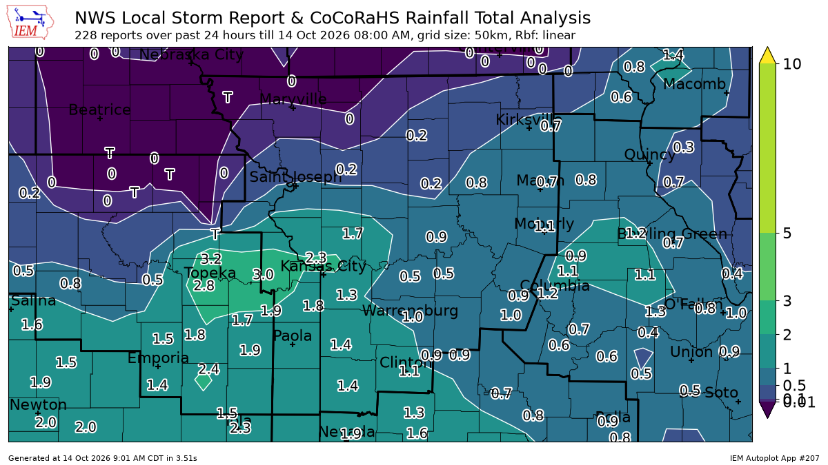 See Kansas City rainfall totals after overnight storms prompted tornado warning
Strong overnight storms brought heavy rain and damaging winds to the Kansas City area, leaving parts of the metro soaked with 1 to 2 inches of rain. Rainfall totals from automated weather stations show that several…
- Daily high-temperature records broken or tied on October 13 across parts of the central U.S.
Five daily high-temperature records were broken and one was tied at six sites across Kansas, Oklahoma, Missouri and Illinois on October 13, 2026. Temperatures at the sites reached 32.8–33.9°C (91–93°F), or 9.4–13.3°C…
-
 FIRST ALERT WEATHER: Hot again today before incoming midweek rain
After one more scorching Tuesday, a cold front will bring showers and thunderstorms to the Ozarks beginning Wednesday, with heavy rain posing the biggest threat to the region. Tuesday will be the calm before the storm…
-
 Freeze alerts stretch from Missouri to New York for Sunday
Temps drop for millions across the Central Plains, Midwest, Northeast The first real taste of fall is settling in for millions, including a few first frosts and freezes of the season for some in the Midwest and East…
Air quality
Air quality is satisfactory, and air pollution poses little or no risk.
Springfield, MO reporting area · 1 hr ago. Data from AirNow (EPA and its state, local and tribal partners); preliminary and subject to change.
Sun & moon
Almanac
MonthlySpringfield Area, records since 1888. Normals 1991–2020. Data from NOAA's Regional Climate Centers (ACIS).
Nearby
- Nixa 24 km
- Ozark 28 km
- Republic 23 km
- Bolivar 41 km
- Aurora 50 km
- Marshfield 35 km
- Battlefield 17 km
- Willard 13 km
- Mount Vernon 50 km
- Rogersville 26 km
- Buffalo 46 km
- Clever 30 km
Forecasters' discussion
From the National Weather Service office in SGF, issued 2 hrs ago
Key Messages
- Above normal temperatures with a warming trend into late week. Highs in the middle to upper 70s, near 80 are likely into the weekend. Mostly dry weather expected to persist.
- Medium to high confidence in above normal temperatures to persist through the end of October.
Short Term
Issued at 100 PM CDT Tue Oct 20 2026
Today-Tonight: A broad ridge continues to be prevalent across the Plains, with weak shortwave energy translating through the flow. Moisture availability remains limited, and thus any rain chances with each passing wave. KSGF 12Z RAOB depicts substantial dry air aloft through the mid levels. For the remainder of today through tonight, some isolated sprinkles/virga or a light shower are possible, though chances remain at 10-15%. Otherwise, another mild October day with highs near normal, around 70. Lows tonight fall into the middle to upper 40s, with the lowest temperatures focused across the valleys of the eastern Ozarks.
Wednesday: Weak energy continues to translate through the region into Wednesday, with additional low chances (10-15%) for sprinkles or a light shower. However, most areas remain dry once again with little to no measurable precipitation expected. Highs a bit warmer on Wednesday in the middle 70s.
Long Term
Issued at 100 PM CDT Tue Oct 20 2026
Thursday-Monday: The ridge and associated high pressure amplify into late week, supporting further warming across the area. Highs through the weekend approach upper 70s to near 80 in most locations as supported by 850mb temperatures around 13-16C. Additionally, less cloud cover is expected through the upcoming weekend as any shortwave energy becomes displaced well west of the region. This period of above normal temperatures (5 to 10 degrees) will be accompanied by dry weather through the weekend. Despite the warm and dry conditions, we are currently not expecting any elevated fire weather concerns through the weekend given the lack of a strong wind component. Nonetheless, potential fire weather will need to be monitored closely as we progress into mid-Fall with drought conditions persisting.
Ensemble guidance hint at a potential pattern change into next week, though confidence remains low given the variability. Further uncertainty exist in the temperatures into next week as NBM interquartile spreads increase to around 15 degrees. However, even the lower quartile would still support above normal temperatures. Thus, confidence remains medium to high on above normal temperatures through the end of October.
Aviation
Issued at 1056 PM CDT Tue Oct 20 2026
VFR conditions expected to prevail through the TAF period. Southeasterly winds <6 kts will be so light they're more variable than southeasterly at the surface. Scattered mid-level clouds may produce some sprinkles aloft across the region at times into the morning, but the expected sprinkles are not expected to reach the ground due to the dry low-level air mass in place.
Forecasts, observations and alerts in the United States come from the National Weather Service (NOAA); radar from NOAA's Multi-Radar Multi-Sensor system; satellite imagery from NASA's Global Imagery Browse Services (GIBS) and NOAA's GOES satellites; the map from the U.S. Geological Survey's National Map; air quality from AirNow (EPA and its partners); hurricane information from the National Hurricane Center; climate normals and records from NOAA's Regional Climate Centers (ACIS). Forecasts outside the United States and the UV index: MET Norway (CC BY 4.0); observations outside the U.S.: airport reports via NOAA's Aviation Weather Center. Place names: GeoNames (CC BY 4.0). Data are copied on a schedule and may lag the sources; for warnings that affect your safety, follow your local National Weather Service office and emergency officials. Weather news is drawn from the 4Search index and reflects what the press published. Terms of use.