Install
Atlantis, Western Cape, South Africa Weather
Current conditions
Forecast for this hour (no station report in the last two hours)
Forecast
10-day-
Wednesday
Rain. High 20°. Precipitation 1.1 mm for the day.
-
Wednesday Night
Light rain. Low 15°. Precipitation 1.1 mm for the day.
-
Thursday
Rain. High 19°. Precipitation 1.6 mm for the day.
MET Norway forecast updated 1 hr ago.
Hourly
Hourly forecast- Now15°0.7
- 10:0016°
- 11:0017°
- 12:0019°
- 13:0020°
- 14:0019°
- 15:0019°
- 16:0018°
- 17:0018°
- 18:0017°
- 19:0016°
- 20:0015°
- 21:0015°
- 22:0015°0.2
- 23:0015°
- Thu00:0014°0.4
- 01:0014°
- 02:0014°
- 03:0014°
- 04:0014°
- 05:0013°
- 06:0013°0.2
- 07:0014°0.3
- 08:0015°0.2
Daily forecast
DetailsRadar
Full mapWeather news near Atlantis
More weather news-
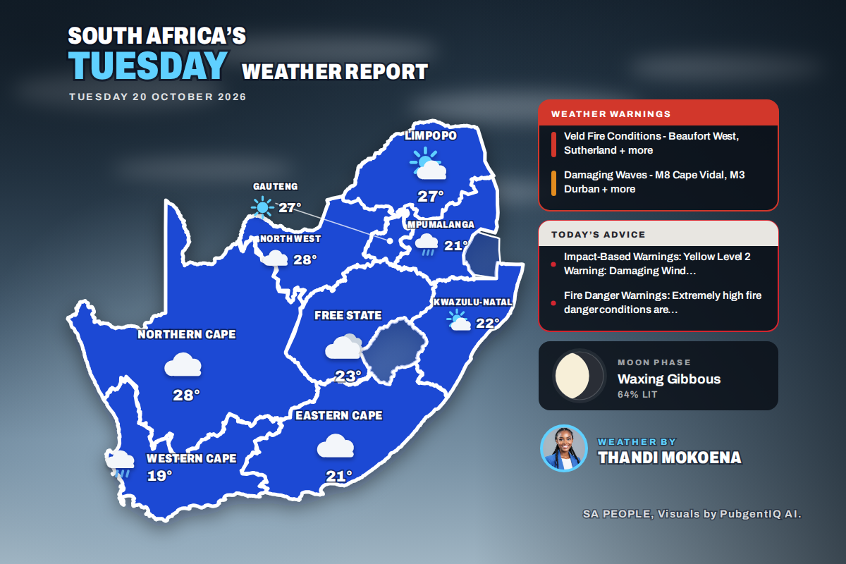 Here is today’s weather by province: Damaging waves expected along the KwaZulu-Natal coast today
Home » Here is today’s weather by province: Damaging waves expected along the KwaZulu-Natal coast today Mahikeng swings from a chilly 6°C at dawn to the country’s warmest reading of 28°C, while Cape Town tops out at…
- Why one part of South Africa is sweltering while another is freezing
This is why South Africa can be hot in one province and cold in another. As recent weather shows, South Africans can experience dramatically different weather conditions on the same day, with one province melting in hot…
-
 Weather: Brace for damaging winds and high fire danger
Home » News » Weather » Weather: Brace for damaging winds and high fire danger Wondering what the weather will be like this Tuesday– Here’s the outlook for KwaZulu-Natal, Free State and North West Here is what the…
-
 WEATHER TODAY: KZN thunderstorm warning, Ladysmith winds and 42°C in Musina
Home » News » Weather » WEATHER TODAY: KZN thunderstorm warning, Ladysmith winds and 42°C in Musina Weather for Monday: Rain showers soak the Eastern Cape, with an 80% chance in Gqeberha and East London, while Cape Town…
-
 Monday tides: Check coastal times as damaging winds and waves loom
Home » News » Weather » Monday tides: Check coastal times as damaging winds and waves loom Heading to the coast on Monday? Check tide times as damaging winds and waves threaten coastal activities. If you’re heading to…
-
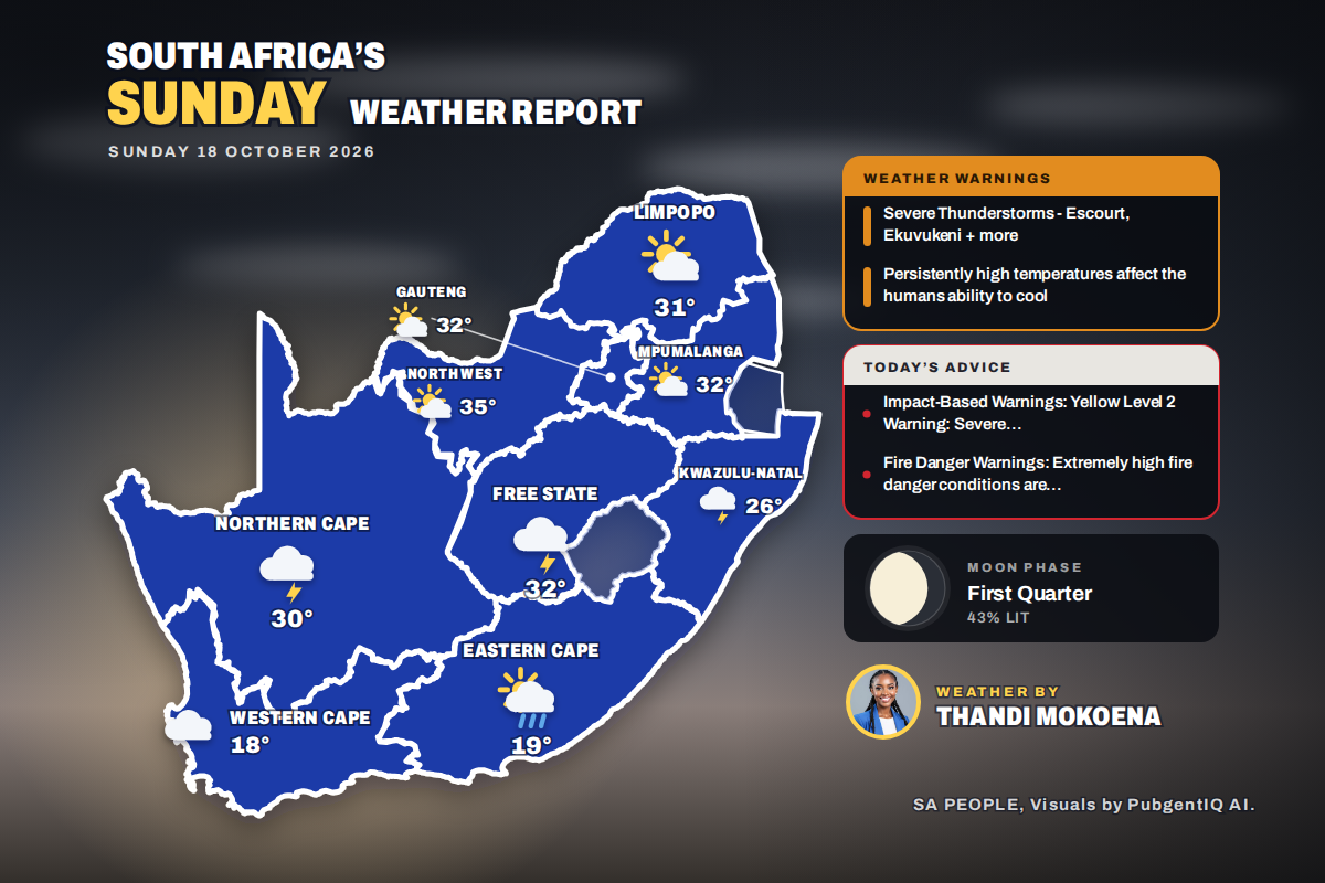 Here is today’s weather by province: Severe thunderstorms threaten Ladysmith Escourt and Dannhauser today
Home » Here is today’s weather by province: Severe thunderstorms threaten Ladysmith Escourt and Dannhauser today Mahikeng is the hottest spot at 35°C, while Cape Town peaks at just 18°C beneath cloud and a fresh SSE…
-
 WEATHER TODAY: Damaging storms lash western KZN, heat wave on Mpumalanga Highveld
Home » News » Weather » WEATHER TODAY: Damaging storms lash western KZN, heat wave on Mpumalanga Highveld Weather for Sunday: Musina peaks at 38°C and Pretoria at 35°C under dry skies, while Gqeberha has an 80% chance…
-
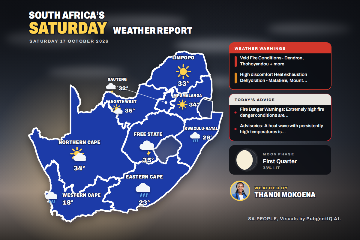 Here is today’s weather by province: Weather advisory issued for Queenstown and surrounding Eastern Cape towns
Home » Here is today’s weather by province: Weather advisory issued for Queenstown and surrounding Eastern Cape towns Kimberley takes the heat crown at 36°C, while Cape Town only reaches 18°C under a fresh SSE breeze…
-
 South Africa Weather Today: Saturday, 17 October 2026
It is Saturday, 17 October 2026, and Johannesburg wakes up to drizzle, with the mercury climbing from 18°C to a high of 30°C. Rain is the story of the day, with 4 of the nine provinces expecting showers or drizzle…
-
 Cape Town braces for rain as thousands head to weekend events
Home » News » Weather » Cape Town braces for rain as thousands head to weekend events Cape Town expects 100 000 people at weekend events, while a 60% chance of rain could affect outdoor plans and travel. Cape Town is…
Sun & moon
Nearby
- Cape Town 40 km
- Paarl 49 km
- Stellenbosch 54 km
- Kraaifontein 38 km
- Wellington 50 km
- Durbanville 33 km
- Kuils River 47 km
- Malmesbury 25 km
- Muizenberg 59 km
- Retreat 54 km
- Moorreesburg 49 km
- Rondebosch 44 km
Forecasts, observations and alerts in the United States come from the National Weather Service (NOAA); radar from NOAA's Multi-Radar Multi-Sensor system; satellite imagery from NASA's Global Imagery Browse Services (GIBS) and NOAA's GOES satellites; the map from the U.S. Geological Survey's National Map; air quality from AirNow (EPA and its partners); hurricane information from the National Hurricane Center; climate normals and records from NOAA's Regional Climate Centers (ACIS). Forecasts outside the United States and the UV index: MET Norway (CC BY 4.0); observations outside the U.S.: airport reports via NOAA's Aviation Weather Center. Place names: GeoNames (CC BY 4.0). Data are copied on a schedule and may lag the sources; for warnings that affect your safety, follow your local National Weather Service office and emergency officials. Weather news is drawn from the 4Search index and reflects what the press published. Terms of use.