Install
Starksboro, VT Weather
Current conditions
Forecast for this hour (no station report in the last two hours)
Forecast
10-day-
Friday
Mostly sunny, with a high near 50. North wind around 12 mph.
-
Friday Night
Partly cloudy, with a low around 32. Northeast wind 1 to 7 mph.
-
Saturday
Sunny, with a high near 51. South wind around 5 mph.
National Weather Service forecast updated 3 days ago.
Hourly
Hourly forecast- Now35°
- 7 AM34°
- 8 AM34°
- 9 AM36°
- 10 AM39°
- 11 AM42°
- 12 PM45°
- 1 PM47°
- 2 PM48°
- 3 PM48°
- 4 PM47°
- 5 PM45°
- 6 PM43°
- 7 PM42°
- 8 PM38°
- 9 PM37°
- 10 PM36°
- 11 PM35°
- Sat12 AM34°
- 1 AM34°
- 2 AM34°
- 3 AM34°
- 4 AM34°
- 5 AM34°
Daily forecast
Details- TueOct 20Sunny34°57°
- WedOct 21Sunny36°57°
- ThuOct 22Mostly Sunny34°55°
- TodayOct 23Mostly Sunny32°50°
- SatOct 24Sunny36°51°
- SunOct 25Sunny41°58°
- MonOct 26Mostly Sunny15%39°59°
- TueOct 27Cloudy31°49°
- WedOct 28Sunny26°47°
Days after the National Weather Service's seven are MET Norway's outlook, a computer model with no forecaster's review.
Radar
Full mapWeather news in Vermont
More weather news-
 NOAA’s Winter Outlook Predicts Warmer Temperatures and Less Snow for Vermont
At SSBCrack News, our dedicated editorial team brings you the latest and most reliable updates on Defence, Geopolitics, Military Affairs, Science, and Technology. Driven by a passion for national security and strategic…
- Vermont Woolly Bear Points to Mild Winter in Predicting A Harsh Winter Using Wildlife
A Vermont woolly bear crossing a patch of pine needles on an access road this week is feeding the old habit of predicting a harsh winter using wildlife, and this one pointed toward a mild season. Its black ends and wide…
-
 PHOTOS: First snowflakes fly around Vermont
VTDigger Member-supported journalism. Informing and engaging Vermont. This year, VTDigger is teaming up with Henry’s Weather Channel to help answer the annual question of when and where peak foliage will make its…
-
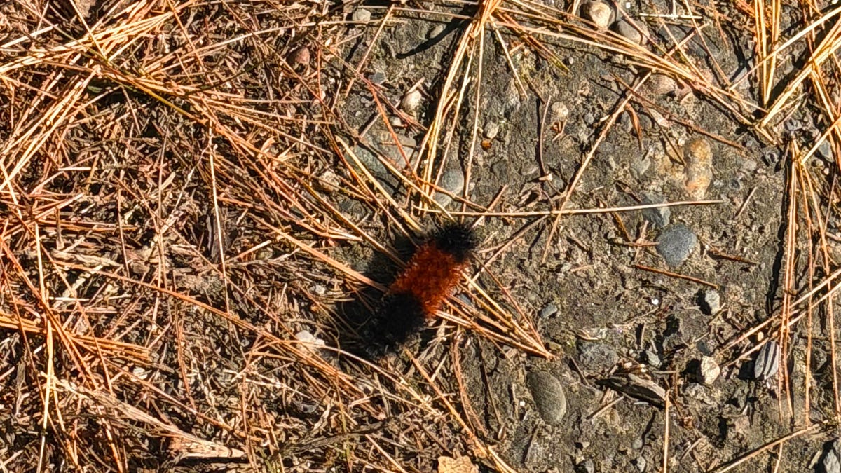 A Vermont Woolly Bear Calls for a Mild Winter. NOAA Mostly Agrees.
The federal government released its official winter forecast on Thursday. Compass Vermont got a second opinion from a caterpillar. We found him crossing a patch of pine needles on a Vermont access road this week. He’s a…
-
 Next Weather: WBZ morning forecast for Oct. 23, 2026
WBZ This Morning 5am CBS News Detroit 5am CBS News Miami 5am CBS News Philadelphia 5am KDKA-TV Morning News 5am
-
 Minnesota sees chances for rain and more seasonable temps soon | Next Weather 10 p.m. Oct. 22, 2026
CBS News Minnesota is a local news organization that is part of CBS News and Stations. Also referred to as WCCO-TV and channel 4, CBS News Minnesota offers local breaking news, weather coverage and investigative…
-
 Slaughden Quay
Tides for Slaughden Quay, East of England - BBC Weather BBC Right now, the tide in Slaughden Quay is Tide tables for the next 7 days For more information, please see FAQs. © Crown copyright and database right
-
 Cold Halloween night expected in New Hampshire. See full holiday forecast
AccuWeather just released its Halloween weekend forecast, predicting "a spooky mix of chilly temperatures, gusty winds, rain and even mountain snow" across the country. While the weather service predicts New England…
-
 Pensacola's Halloween weather forecast calls for warm, dry night
Pensacola's weather forecast for Halloween night is expected to be fairly normal, if not slightly warmer than usual, according to the latest forecasts. Halloween temperatures in the Florida Panhandle usually jump…
-
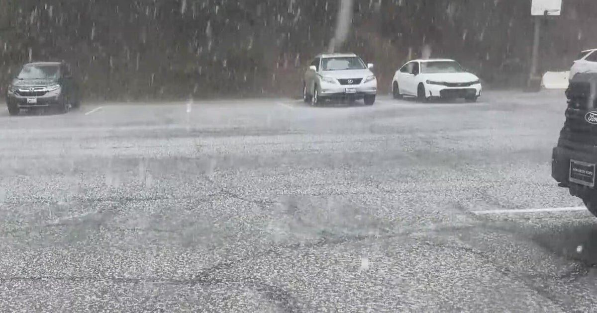 Inland Empire extreme weather for the day included hail in Crestline
October 22, 2026 / 6:05 PM PDT / CBS LA Severe weather, including hail and heavy rain, impacted the Inland Empire, prompting emergency response efforts on Thursday. Intermittent hail, rain, lightning, and wind hit the…
Air quality
Air quality is satisfactory, and air pollution poses little or no risk.
Forecast
- FriGood (30)
Burlington, VT reporting area · 1 hr ago. Data from AirNow (EPA and its state, local and tribal partners); preliminary and subject to change.
Sun & moon
Almanac
MonthlyBurlington Area, records since 1883. Normals 1991–2020. Data from NOAA's Regional Climate Centers (ACIS).
Nearby
- Burlington 30 km
- South Burlington 28 km
- Colchester 36 km
- Essex Junction 30 km
- Barre 44 km
- Williston 23 km
- Montpelier 39 km
- Winooski 31 km
- Middlebury (village) 25 km
- Morristown 50 km
- Hinesburg 12 km
- Stowe 40 km
Forecasters' discussion
From the National Weather Service office in BTV, issued 10 hrs ago
What Has Changed
As of 305 PM EDT Thursday...
No significant changes have been made.
Key Messages
As of 305 PM EDT Thursday...
1. Localized gusty north winds this evening will taper off, then dry and seasonable weather with a warming trend will follow through the weekend.
2. Quiet and dry weather is expected to continue into early next week.
Discussion
As of 305 PM EDT Thursday...
KEY MESSAGE 1: Sensible weather will continue to be quite agreeable for outdoor activities. Aside from a ribbon of clouds moving through from north to south this evening, a return to sunny days is expected as high pressure slowly builds in through the weekend. Main impacts for this period will be related to winds this evening on Lake Champlain, and then possible fire weather concerns over the weekend with critically low relative humidity values likely in parts of the region.
A moisture-starved cold front passed through the region today, detached from a ribbon of higher moisture behind it. Satellite imagery shows this cloud cover is tied to a corridor of higher relative humidity in the 925-850 millibar layer, with the air mass above that layer very dry. Hence, north of this region there are just some diurnally driven clouds and we can expect skies in our region to trend clear overnight.
A period of relatively fast pressure rises this evening is expected with accelerated northerly flow through the Champlain Valley as skies clear out again. Roughly between 7 PM and 10 PM we expect the strongest northerly winds in the 20 to 30 knot range on Lake Champlain with similar gusts in the eastern Champlain Valley. Northerly, rather than a more common northwesterly, flow will continue into Friday with a general decay of wind speeds as high pressure builds in.
The lightening wind will lead to a chilly night and have leaned towards colder guidance. At perennial cool spot SLK/Adirondack Regional Airport, a daily minimum temperature is possible (14 degrees). Any passing high clouds should have little affect on surface temperatures during the period. Also, as temperatures moderate aloft, both Saturday and Sunday will feature the return of the typical cold season surface inversion with mountain summits relative mild. Generally Sunday morning looks a bit less cold than Saturday morning as light south winds will interfere with the nocturnal boundary layer.
Forecast soundings through the next three days show very dry air aloft and correspondingly anomalously low precipitable water. While localized low humidity is expected tomorrow, cool northerly advection doesn't favor particularly low surface humidity at the surface. Dew points in the 20s are expected over the next couple of days, and with milder temperatures on Saturday reaching the upper 50s in most locations, this is the day when most locations will likely see their lowest relative humidities. Slight improvement on Sunday is expected with regards to fire weather concerns as some modest moisture advection occurs. Light winds through the weekend should minimize fire spread, however.
Aviation
Through 00Z Saturday...Cloud cover is slowly thinning now that a cold front has shifted south of the region. The layer exists between 4000-7000 ft agl, and will dissipate over the coming 6-9 hours. North winds will remain 5-10 knots for locations unsheltered from winds out of the north, but a few areas like KRUT and KSLK should transition towards light and variable conditions. Flow aloft is somewhat fast, and there could be localized regions that meet LLWS criteria during the next 6 hours, but are not shown explicitly for any terminals. This could also prevent fog from developing, though a brief reduction in visibility towards sunrise is not impossible.
Outlook...
Friday Night: VFR. NO SIG WX. Saturday: VFR. NO SIG WX. Saturday Night: VFR. NO SIG WX. Sunday: VFR. NO SIG WX. Sunday Night: VFR. NO SIG WX. Monday: Mainly VFR, with local MVFR possible. NO SIG WX. Monday Night: VFR. NO SIG WX. Tuesday: VFR. NO SIG WX.
Forecasts, observations and alerts in the United States come from the National Weather Service (NOAA); radar from NOAA's Multi-Radar Multi-Sensor system; satellite imagery from NASA's Global Imagery Browse Services (GIBS) and NOAA's GOES satellites; the map from the U.S. Geological Survey's National Map; air quality from AirNow (EPA and its partners); hurricane information from the National Hurricane Center; climate normals and records from NOAA's Regional Climate Centers (ACIS). Forecasts outside the United States and the UV index: MET Norway (CC BY 4.0); observations outside the U.S.: airport reports via NOAA's Aviation Weather Center. Place names: GeoNames (CC BY 4.0). Data are copied on a schedule and may lag the sources; for warnings that affect your safety, follow your local National Weather Service office and emergency officials. Weather news is drawn from the 4Search index and reflects what the press published. Terms of use.