Install
Wichita Falls, TX Weather
Current conditions
Forecast for this hour (no station report in the last two hours)
Forecast
10-day-
Sunday Night
Mostly cloudy, with a low around 58. Southeast wind 5 to 10 mph, with gusts as high as 20 mph.
-
Monday
Mostly sunny, with a high near 79. South southeast wind 5 to 8 mph.
-
Monday Night
Mostly cloudy, with a low around 60. South southeast wind around 7 mph.
National Weather Service forecast updated 19 hrs ago.
Hourly
Hourly forecast- Now73°
- 9 PM69°
- 10 PM67°
- 11 PM66°
- Mon12 AM65°
- 1 AM64°
- 2 AM63°
- 3 AM62°
- 4 AM61°
- 5 AM60°
- 6 AM59°
- 7 AM58°
- 8 AM58°
- 9 AM61°
- 10 AM66°
- 11 AM70°
- 12 PM74°
- 1 PM76°
- 2 PM77°
- 3 PM77°
- 4 PM79°
- 5 PM77°
- 6 PM77°
- 7 PM74°
10-day forecast
Details- TonightOct 24Mostly Cloudy62°
- TodayOct 25Mostly Cloudy58°81°
- MonOct 26Mostly Sunny60°79°
- TueOct 27Slight Chance Rain Showers20%60°80°
- WedOct 28Sunny62°82°
- ThuOct 29Mostly Sunny then Slight Chance Showers And Thunderstorms26%62°82°
- FriOct 30Chance Showers And Thunderstorms50%60°75°
- SatOct 31Chance Showers And Thunderstorms44%79°
- SunNov 1Cloudy68°81°
- MonNov 2Cloudy68°86°
Days after the National Weather Service's seven are MET Norway's outlook, a computer model with no forecaster's review.
Radar
Full mapWeather news near Wichita Falls
More weather news-
 Milder and cloudier
WICHITA FALLS, Texas (KAUZ) - Good morning, Texoma! We are off to a very comfortable start this morning with temperatures in the lower-50s. Skies are mostly clear. We had another round of very nice weather yesterday…
-
 Great weather ahead for the next few days
News Channel 6 | Wichita Falls, TX WICHITA FALLS, Texas (KAUZ) - Well it was another great day today with highs in the upper 70s with nothing but sunshine and a few high clouds. Temperatures are expected to cooldown…
-
 Another very nice day
News Channel 6 | Wichita Falls, TX WICHITA FALLS, Texas (KAUZ) - Good morning, Texoma! We had a really nice seasonal weather yesterday. I expect to see similar conditions today. Highs this afternoon should climb into…
-
 Another cold night tonight with warmer weather ahead
WICHITA FALLS, Texas (KAUZ) - Well, it was another chilly start to the morning across Texoma, with temperatures in the lower 40s. However, once we got into the afternoon, those numbers climbed into the upper 60s, making…
-
 Another cold night tonight with a warmer afternoon tomorrow
News Channel 6 | Wichita Falls, TX WICHITA FALLS, Texas (KAUZ) - Temperatures this afternoon were well below the normal for this time of year in the low 60s. Those numbers as we head into tonight will cool down into the…
-
 First Freeze of the Season Tonight in the Texas Panhandle
The first freeze of the fall season hits the Texas Panhandle and South Plains tonight, with 28 in Dalhart. Crashy the Cold Front has arrived, bringing gusty north winds and Extreme fire danger to East Texas today. Texas…
-
 A Very Fall Feeling Weekend
Expect sunshine both Saturday and Sunday with highs in the 60s and overnight lows in the 30s and 40s. WICHITA FALLS, Texas (KAUZ) - A large Arctic high-pressure system will move over us this weekend, keeping it cool!…
-
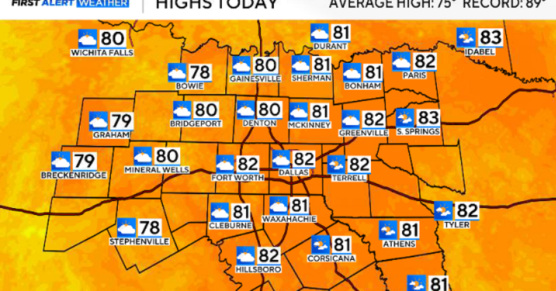 North Texas gets a warm, mild Sunday ahead of clouds and wind this week
October 25, 2026 / 6:51 AM CDT / CBS Texas Expect a warm and dry stretch of weather in North Texas over the next few days, with highs staying in the 80s, but we will see a pattern change as rain chances move in around…
-
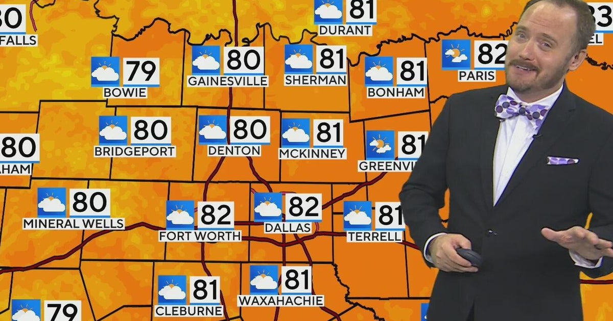 Warm, mild Sunday ahead for North Texas
CBS News Bay Area Morning Edition Weekend 6am WBZ This Morning 8am CBS Colorado Mornings Weekend CBS News Los Angeles Weekend 6am CBS Miami News Sunday Morning CBS News New York Sunday 8am KDKA News This Morning Sunday…
-
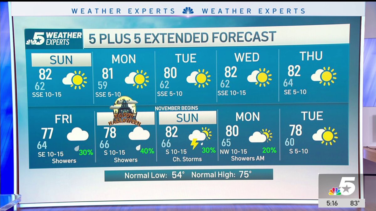 NBC 5 Forecast: A quiet weather pattern continues for North Texas
NBC 5 Dallas-Fort Worth NBC 5 Forecast: A quiet weather pattern continues for North Texas NBC 5 Forecast: Above normal temps, but still nice NBC 5 Forecast: Cool mornings and pleasant afternoons for North Texas
Sun & moon
Almanac
MonthlyWichita Falls Area, records since 1908. Normals 1991–2020. Data from NOAA's Regional Climate Centers (ACIS).
Nearby
- Burkburnett 22 km
- Iowa Park 17 km
- Henrietta 30 km
- Electra 41 km
- Walters 52 km
Forecasters' discussion
From the National Weather Service office in OUN, issued 4 hrs ago
Key Messages
Updated at 443 PM CDT Sun Oct 25 2026
- First wave of rainfall potential will primarily stay west of the area.
- The next chances of rain will be across the northwest half of the area Monday Night/Tuesday, and areawide late Thursday through the end of the week.
- Above normal temperatures through the upcoming week.
Update
Issued at 443 PM CDT Sun Oct 25 2026
Light to moderate rainfall is ongoing across far northwest Oklahoma this afternoon ahead of an embedded shortwave. Have increased POPs through tonight over northwest Oklahoma with the approach of another shortwave embedded within mid-level southwest flow.
Thompson
Near Term
(Rest of today and tonight) Issued at 126 PM CDT Sun Oct 25 2026
Stubborn upper ridge continues to control the weather across Oklahoma and much of the eastern half of Texas. It is also keeping the upper low to our west from pushing east, thus the rain remains west of the area. By later today the closed low will begin to open up and then lift northeast out of the four corners area into the central Plains. This will keep any precip confined to far northwest Oklahoma today and tonight.
In addition, the upper ridge will allow temperatures once again today to rise well above normal in spite of the extensive high and increasing mid clouds spreading east and northeast in advance of the upper low. Afternoon highs will climb into the upper 70s and lower 80s.
For tonight the upper low will continue to lift north and northeast across Colorado and into the northern Plains. Skies will remain cloudy however and with the south winds temperatures will only fall back into the mid/upper 50s to near 60.
Short Term
(Monday through Tuesday night) Issued at 126 PM CDT Sun Oct 25 2026
By Monday another southern stream shortwave moves north out of north central Mexico into southwest Texas. This will initially provide widespread cloud cover, but Gulf moisture will be rather meager as off-shore winds have limited northward transport. The cloud cover will keep temperatures a few degrees cooler during the day, but still well above normal. We could see a few stray showers across western Oklahoma, but most locations will remain dry Monday.
Although surface moisture will be slow to respond, deeper moisture above the surface will move north into the area as the shortwave approaches Monday night and Tuesday. This should provide an opportunity for rainfall(amounts remain light) further east into the body of the state, although the higher rain chances will be across western third of the state including western north Texas. Highest rainfall amounts would likely remain across western and northwestern Oklahoma and those would likely be around a quarter to half an inch.
Even with the potential for precip and extensive cloud cover, temperatures will again climb into the middle 70s to lower 80s Tuesday afternoon.
Forecasts, observations and alerts in the United States come from the National Weather Service (NOAA); radar from NOAA's Multi-Radar Multi-Sensor system; satellite imagery from NASA's Global Imagery Browse Services (GIBS) and NOAA's GOES satellites; the map from the U.S. Geological Survey's National Map; air quality from AirNow (EPA and its partners); hurricane information from the National Hurricane Center; climate normals and records from NOAA's Regional Climate Centers (ACIS). Forecasts outside the United States and the UV index: MET Norway (CC BY 4.0); observations outside the U.S.: airport reports via NOAA's Aviation Weather Center. Place names: GeoNames (CC BY 4.0). Data are copied on a schedule and may lag the sources; for warnings that affect your safety, follow your local National Weather Service office and emergency officials. Weather news is drawn from the 4Search index and reflects what the press published. Terms of use. How to use Weather