Install
Seminole, TX Weather
Current conditions
Observed at Seminole, Gaines County Airport · 1 hr ago
Forecast
10-day-
Friday
Partly sunny, with a high near 77.
-
Friday Night
A chance of showers and thunderstorms after 7pm. Mostly cloudy, with a low around 58.
-
Saturday
A chance of rain showers before 7am, then a chance of showers and thunderstorms. Partly sunny, with a high near 73.
National Weather Service forecast updated 3 days ago.
Hourly
Hourly forecast- Now62°
- 10 AM65°
- 11 AM67°
- 12 PM70°
- 1 PM73°
- 2 PM75°
- 3 PM76°
- 4 PM77°
- 5 PM76°
- 6 PM75°
- 7 PM72°22%
- 8 PM69°22%
- 9 PM67°22%
- 10 PM65°22%
- 11 PM64°22%
- Sat12 AM63°22%
- 1 AM62°28%
- 2 AM61°28%
- 3 AM61°28%
- 4 AM60°28%
- 5 AM59°28%
- 6 AM58°28%
- 7 AM58°32%
- 8 AM59°32%
10-day forecast
Details- TueOct 20Sunny55°76°
- WedOct 21Mostly Sunny55°79°
- ThuOct 22Mostly Sunny58°79°
- TodayOct 23Partly Sunny28%58°77°
- SatOct 24Chance Showers And Thunderstorms52%58°73°
- SunOct 25Chance Rain Showers52%57°67°
- MonOct 26Chance Rain Showers42%52°66°
- TueOct 27Heavy rain2.16 in54°59°
- WedOct 28Rain0.07 in50°60°
- ThuOct 29Cloudy47°66°
Days after the National Weather Service's seven are MET Norway's outlook, a computer model with no forecaster's review.
Radar
Full mapWeather news near Seminole
More weather news-
 Low Humidity, High Winds, Major Sunshine
SARASOTA, Fla. (WWSB) - Saturday’s rain was mixed on the Suncoast. SRQ received a half inch (0.51) Our total for the month is 9.74”. Other areas received a quarter inch (0.22”) at Lakewood Ranch and Venice Airport…
-
 Fall weather is finally here, and it looks to stay!
WALB.com SUNDAY: Temperatures will warm up, but not by much. Sunny skies with a breeze keep temperatures mainly in the 60s, occasionally peaking around 70°. This will be the coolest afternoon since May 9th. MONDAY…
-
 Will the Florida State-Miami Game be Delayed Saturday? Latest Weather, Kickoff
Will the Florida State-Miami football game be delayed by thunderstorms or lightning? The Seminoles and Hurricanes are scheduled to meet Saturday, October 17, at Hard Rock Stadium in Miami Gardens, Florida, but a…
-
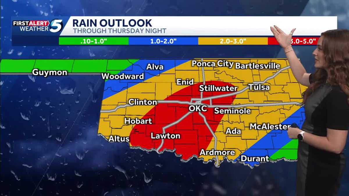 FORECAST: More rain and flooding risk for the rest of Thursday in Oklahoma
Oklahoma has already seen heavy rain and flooding, and we're not done just yet heading into the back half of Thursday. A flood watch remains in effect until 7 p.m. Thursday due to the expected rain. KOCO 5 Meteorologist…
-
 Cold Front Alert: A weekend cold front will bring cool and breezy conditions to Central Florida.
WKMG Cold Front Alert: A weekend cold front will bring cool and breezy conditions to Central Florida. Ex-US Sen. Mel Martinez, a Republican, endorses Democrat Bale Dalton in House District 7 race MICHELLE PARKER CASE…
-
 Severe Weather Is Possible Through Friday
KOKH Fox 25 provides, news, sports, weather and local event coverage in Oklahoma City and surrounding areas, including McLoud, Shawnee, Tecumseh, Seminole, Wewoka, Maud, Asher, Wanetted, Goldsby, Norman, Blanchard…
-
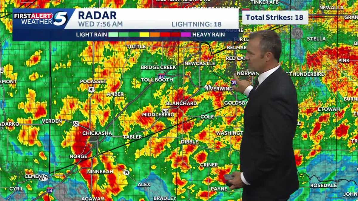 UPDATES: Storms continue into morning commute, bringing flooding risk to Oklahoma
It's another alert day in Oklahoma, as people are waking up in the OKC metro and statewide to heavy rainfall, storms, and a flash flooding risk. The heavy rain has caused dangerous road conditions as Oklahomans start…
- Forecasters warn of big change in Miami weather. ‘Nice while it lasted.’
Don’t get too used to sunny skies and lower humidity. The weather is changing in South Florida. Expect the relief to continue most of Wednesday, but rain chances will increase through the week and weekend, according to…
-
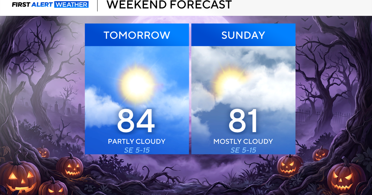 Clouds build in over the weekend as temperatures stay above average in the 80s across North Texas
October 23, 2026 / 8:00 AM CDT / CBS Texas North Texans are waking up to temperatures mainly in the 50s and 60s on Friday morning, with some clouds across portions of the area. In the afternoon and into the weekend…
-
 Josephine in Atlantic drifts away, but Pacific moisture might spoil Halloween for Texas
Subtropical Storm Josephine in the North Atlantic is racing away from the United States, while moisture from a strengthening eastern Pacific storm could bring rain to Texas around Halloween next week. Josephine's center…
Air quality
Air quality is satisfactory, and air pollution poses little or no risk.
Hobbs, NM reporting area · 1 hr ago. Data from AirNow (EPA and its state, local and tribal partners); preliminary and subject to change.
Sun & moon
Almanac
MonthlyDenver City, records since 1986. Normals 1991–2020. Data from NOAA's Regional Climate Centers (ACIS).
Nearby
- Hobbs 46 km
- Andrews 45 km
- Denver City 32 km
- Eunice 57 km
- Seagraves 26 km
Forecasters' discussion
From the National Weather Service office in MAF, issued 14 hrs ago
Key Messages
Updated at 628 PM CDT Thu Oct 22 2026
- Rain chances increase from west to east late Friday through the weekend, with highest rain chances over our western areas Saturday and Sunday. Occasionally heavy rainfall may lead to localized flash flooding over SE NM, especially on Saturday.
- Above normal temperatures and dry conditions continue through most of tomorrow. Southeasterly winds become breezy each afternoon this weekend.
- Temperatures trend cooler this weekend into early next week.
Short Term
(This afternoon through Friday night) Issued at 226 PM CDT Thu Oct 22 2026
Mid to upper level ridging currently resides over Texas, centered near the Texas/Coahuila border. Below the ridge, conditions remain dry, and highs top out in the 70s in the higher terrain and portions of the Lower Trans Pecos, and 80s for most. Tomorrow's highs will be roughly similar, give or take a few degrees. Temperatures tonight and tomorrow night settle in the mid 50s to mid 60s.
Through the Short Term period, an upper level trough begins to traverse the Desert Southwest. As it crawls toward our region southwesterly flow and moisture increases aloft, and heights gradually decrease. Meanwhile, a developing lee trough in the Plains brings breezy southeasterly winds to the Permian Basin, the Trans Pecos, and SE NM tomorrow afternoon and evening. Dry conditions are ahead for most tomorrow, but isolated (10-20% chance) showers and storms may develop over portions of SE NM during the late afternoon. Rain chances trend upward (10-40%) across SE NM and far west Texas tomorrow night. More active weather awaits us in the Long Term period. Details below...
Long Term
(Saturday through Wednesday) Issued at 226 PM CDT Thu Oct 22 2026
An upper level shortwave translates over the Desert Southwest through the weekend, gradually lifting from SoCal/AZ toward the central Plains. As this system nears, disturbances within southwesterly flow aloft pair with increased moisture to bring increasing rain chances and a potential for flash flooding over SE NM. Isolated to scattered (20-60% chance) showers/storms are forecast over the western half of our region Saturday. Rain chances increase and spread nearly areawide Saturday evening into Sunday, when coverage becomes scattered to numerous. The best rain chances will tend to favor SE NM and our westernmost counties over the weekend. Rounds of occasionally heavy rainfall over portions of SE NM may result in localized flash flooding, especially on Saturday. We will refrain from issuing a Flash Flood Watch for SE NM on Saturday with this forecast package, but may reconsider within the next few issuances. Stay tuned for any updates! Given the proximity of an upper ridge to our east, rainfall over eastern portions of our area look to be relatively lighter. The main shortwave lifts into the central and northern Plains Monday into Tuesday, sending a cold front southward in its wake. Upper troughing remains in place early next week, before subtle ridging builds back in around mid week. Thus, additional disturbances keep at least low rain chances in the forecast through Tuesday.
Aside from active weather, the Long Term period features a gradual cooling trend due to lowering heights, cloudier skies, and wetter conditions. Highs Saturday are forecast to reach the 70s to mid 80s (primarily in/near the river valleys). Highs in the 70s become more prevalent Sunday onward, with upper 60s creeping into our northern counties.
Aviation
(00Z TAFS) Issued at 628 PM CDT Thu Oct 22 2026
VFR conditions and breezy southeasterly winds are expected through the next six hours. MVFR to IFR CIGs look to develop between 08Z-16Z timeframe across most terminals. Low confidence of MVFR/IFR CIGs are prevalent at CNM and PEQ sites, though further amendments may be necessary.
Forecasts, observations and alerts in the United States come from the National Weather Service (NOAA); radar from NOAA's Multi-Radar Multi-Sensor system; satellite imagery from NASA's Global Imagery Browse Services (GIBS) and NOAA's GOES satellites; the map from the U.S. Geological Survey's National Map; air quality from AirNow (EPA and its partners); hurricane information from the National Hurricane Center; climate normals and records from NOAA's Regional Climate Centers (ACIS). Forecasts outside the United States and the UV index: MET Norway (CC BY 4.0); observations outside the U.S.: airport reports via NOAA's Aviation Weather Center. Place names: GeoNames (CC BY 4.0). Data are copied on a schedule and may lag the sources; for warnings that affect your safety, follow your local National Weather Service office and emergency officials. Weather news is drawn from the 4Search index and reflects what the press published. Terms of use.