Install
East Grand Forks, MN Weather
Current conditions
Observed at Grand Forks, Grand Forks International Airport · 1 hr ago
Forecast
10-day-
Monday
Mostly sunny, with a high near 45. Northeast wind 5 to 9 mph.
-
Monday Night
A chance of rain between 1am and 3am, then a chance of rain and snow. Mostly cloudy, with a low around 34. East northeast wind around 7 mph. Chance of precipitation is 40%. New rainfall amounts less than a tenth of an inch possible.
-
Tuesday
A chance of rain and snow before 10am. Cloudy, with a high near 48. East southeast wind around 9 mph. Chance of precipitation is 30%. New rainfall amounts less than a tenth of an inch possible.
National Weather Service forecast updated 4 hrs ago.
Hourly
Hourly forecast- Now28°
- 10 AM32°
- 11 AM36°
- 12 PM40°
- 1 PM43°
- 2 PM44°
- 3 PM45°
- 4 PM45°
- 5 PM45°
- 6 PM43°
- 7 PM39°
- 8 PM38°
- 9 PM37°
- 10 PM36°
- 11 PM35°
- Tue12 AM35°12%
- 1 AM34°17%
- 2 AM35°25%
- 3 AM35°33%
- 4 AM34°41%
- 5 AM34°29%
- 6 AM35°34%
- 7 AM35°30%
- 8 AM35°27%
Daily forecast
Details- TonightOct 25Partly Cloudy21°
- TodayOct 26Mostly Sunny41%34°45°
- TueOct 27Chance Rain And Snow then Cloudy34%33°48°
- WedOct 28Mostly Sunny28°56°
- ThuOct 29Sunny28°54°
- FriOct 30Mostly Sunny20%32°50°
- SatOct 31Chance Light Rain32%35°54°
- SunNov 1Slight Chance Light Rain20%55°
- MonNov 2Cloudy54°60°
Days after the National Weather Service's seven are MET Norway's outlook, a computer model with no forecaster's review.
Radar
Full mapWeather news in Minnesota
More weather news-
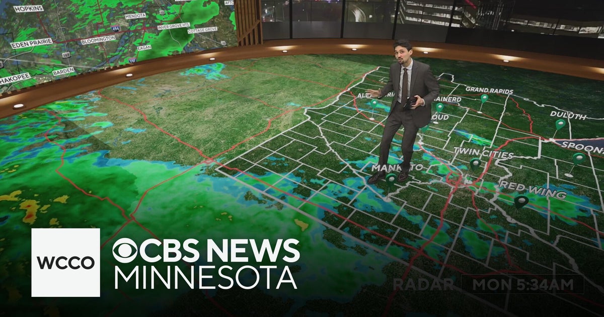 Widespread rainy weather in Minnesota | Oct. 26, 2026
CBS News Minnesota is a local news organization that is part of CBS News and Stations. Also referred to as WCCO-TV and channel 4, CBS News Minnesota offers local breaking news, weather coverage and investigative…
-
 Widespread rain in Minnesota Monday; milder air returns Tuesday
Updated on: October 26, 2026 / 6:42 AM CDT / CBS Minnesota Minnesota will see widespread rain Monday, with the heaviest amounts across the western and central parts of the state. Some areas could see more than an inch…
-
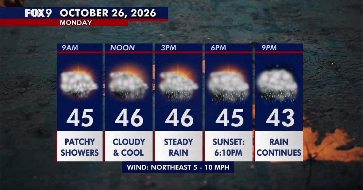 Minnesota weather: Wet, cloudy and cool Monday
Monday stays cloudy and chilly, with scattered morning showers turning into steadier afternoon rain across much of Minnesota. Temperatures remain mainly in the 40s before rain clears Tuesday and warmer weather returns…
-
 Cloudy Sunday with scattered showers as cooler air returns to Minnesota
October 25, 2026 / 12:39 PM CDT / CBS Minnesota A cold front has brought some cooler, more seasonal air to Minnesota. There will be lots of clouds Sunday, keeping highs in the mid-50s. There could be a few showers in…
-
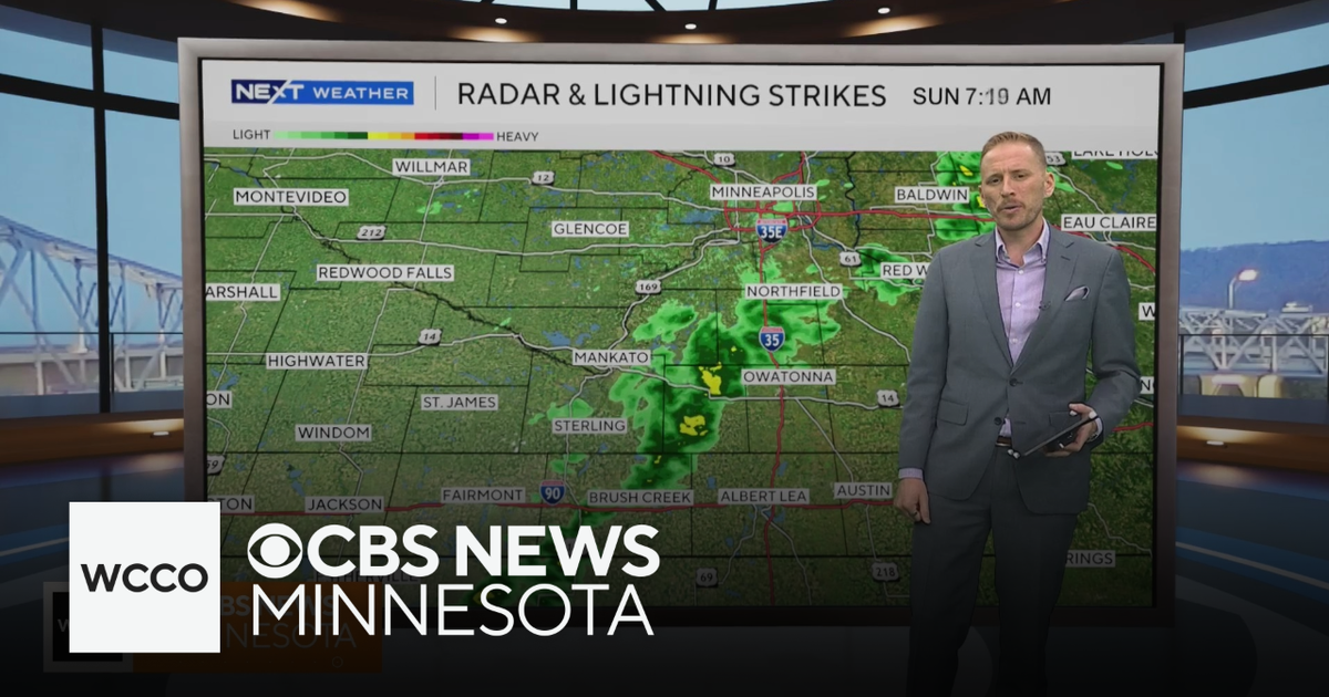 Cooler air returns to Minnesota, along with scattered showers | Oct. 25, 2026
CBS News Minnesota is a local news organization that is part of CBS News and Stations. Also referred to as WCCO-TV and channel 4, CBS News Minnesota offers local breaking news, weather coverage and investigative…
-
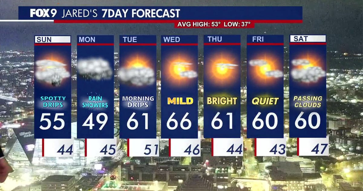 Minnesota weather: Cloudy skies and cooler air ahead after overnight rain
Expect a cool and cloudy Sunday with scattered, passing showers later in the evening. FOX 9 meteorologist Jared Piepenburg has the full forecast. MINNEAPOLIS (FOX 9) - Cooler air, clouds and scattered rain are set to…
-
 When Does Daylight Saving Time End in Minnesota?
I like bright sunny summer days, so the transition to fall is always a downer for me. The part I like the least is how short the days get. You've probably already noticed the sun going down earlier each day, and it…
-
 Another round of wind and showers Saturday in Minnesota | Oct. 24, 2026
CBS News Bay Area Morning Edition Weekend 6am WBZ This Morning 8am CBS News Chicago Saturday 8am CBS Colorado Mornings Weekend CBS News Los Angeles Weekend 6am CBS News Miami This Morning 9am WCCO News Saturday Morning…
-
 Minnesota weather to feature warm temps Saturday before cooldown | Oct. 23, 2026
CBS News Minnesota is a local news organization that is part of CBS News and Stations. Also referred to as WCCO-TV and channel 4, CBS News Minnesota offers local breaking news, weather coverage and investigative…
-
 Minnesota weather: one last warm day, then a damp, cool change | Oct. 23, 2026
CBS News Minnesota is a local news organization that is part of CBS News and Stations. Also referred to as WCCO-TV and channel 4, CBS News Minnesota offers local breaking news, weather coverage and investigative…
Air quality
Air quality is satisfactory, and air pollution poses little or no risk.
Forecast
- MonGood
- TueGood
- WedGood
Red River Valley North, MN reporting area · 1 hr ago. Data from AirNow (EPA and its state, local and tribal partners); preliminary and subject to change.
Sun & moon
Almanac
MonthlyGrand Forks Area, records since 1941. Normals 1991–2020. Data from NOAA's Regional Climate Centers (ACIS).
Nearby
- Grand Forks 1 km
- Crookston 36 km
- Grand Forks Air Force Base 27 km
Forecasters' discussion
From the National Weather Service office in FGF, issued 2 hrs ago
Key Messages
- Period of rain late today into Tuesday morning southeast half of North Dakota into Minnesota. Overall forecast rainfall amounts have been lowered.
- Mix with or change to wet snow overnight parts of the area east and west of the valley, but light precipitation rates and warm ground inhibit much accumulation.
- Seasonable high temperatures in the 40s and 50s through early next week, with slightly above average highs by late week.
Update
Issued at 541 AM CDT Mon Oct 26 2026
The rainfall from earlier in the night has indeed dissipated over far southeast ND and southern parts of west central MN. This was as forecast. Next wave to generate rain in central SD with a mix of rain/snow in north central SD into parts of southern ND east of Bismarck as we get into late afternoon and evening. This batch of rain does spread farther north than the one Sunday but overall precipitation amounts are less than it was showing 24-48 hours ago as the 1+ inch amounts of rain are more from east central SD into central MN. Soundings and 925 mb temp progs show a favored area of where below 0C 925 mb temps and precipitation overlap in an area from in between Mobridge and Aberdeen SD into North Dakota in between Bismarck and Jamestown into tonight. Also a smaller area where mix may occur is north central MN. But in the north central into south central ND area probs for 1 inch of snow remain greater than 50 pct particularly in that area near Eureka SD to near Wishek, Ashley to west of Edgeley ND. Also compared to past forecasts, it does look like the rain area will exit the forecast area sooner with pops for rain moving out of eastern fcst area midday Tuesday.
UPDATE Issued at 1128 PM CDT Sun Oct 25 2026
Rain can be noted across southeast North Dakota and west central Minnesota on radar however dry air is still evident and preventing much of it from reaching the ground currently. Soundings continue to support a gradual moistening trend in the low levels allowing for perhaps a couple hundredths to a tenth of an inch to fall over the next several hours before forcing wanes by sunrise.
Discussion
Issued at 238 PM CDT Sun Oct 25 2026
...Synopsis...
A deep trough is in place across the Great Basin, with southeast flow building across the central High Plains. Our CWA is still under the influence of westerly flow aloft, with an embedded shortwave in SW flow to the south of the region. Surface ridging is in place and drier north and eventually northeast BL flow is undercutting the northern edge of this initial precipitation and while a few sprinkles may sneak into the south tonight, most locations are expected to remain dry through midday Monday. After the more organized system moves through the region Monday afternoon through Tuesday, southwest flow develops and persists at least through the end of the week and potentially beyond the weekend (some variance in clusters between ridging and SW by this weekend). The general trend should be for seasonal temperatures to warm slightly from seasonal highs in the 40s/lower 50s to slightly above average highs in the mid 50s/near 60. SW flow aloft inherently brings the potential for additional chances for precipitation, however due to the weak nature of the upper flow in the Plains and variance in guidance resolving any embedded waves confidence in measurable precipitation/impacts is low beyond Tuesday.
...Rain Monday into Tuesday...
A stronger mid level wave organizes into a hybrid type system Monday with large scale ascent increasing across our CWA south to north late Monday afternoon through Tuesday. Initially drier air in northeast BL flow may delay measurable rainfall, however the surge of deeper moisture with WAA and at least some 700MB deformation banding will help saturate the low levels and periods of moderate (locally heavy) rainfall would be expected. As is usually the case with dominant WAA patterns, stronger areas of frontogenesis will tend to be more transient making coverage of higher totals 1"+ harder to anticipate. Better coverage of rain will tend to initially be along and south of US Highway 2, though the track of the mid/upper low will eventually allow rain to overspread northwest/north central MN. High 24hr probabilities (60-80%) for 0.25" or more rainfall are shown by NBM across southeast ND and west central MN, with a 30-50% chance in similar areas for greater than 1" of rainfall.
Regarding snowfall: As with previous rounds of guidance the temperature profiles may at times be cold enough to support a mix or change over to snow, particularly in higher terrain areas west of the Red River Valley late Monday night/early Tuesday morning. However, as HREF/REFS/NBM all show a very weak signal, with lighter rates the chance for any snow to accumulate will be diminished due to warmer ground temperatures. Still, a few novelty snowflakes or a light dusting on grassy/elevated surfaces may occur (best chance west of the Red River Valley (no impacts).
Aviation
Issued at 724 AM CDT Mon Oct 26 2026
Increase in high clouds today...scattered coverage north half this morning. Will look for the rain to spread north this evening and tonight and as it does likely an area of low level saturation and low cloud formation with ceilings dropping below 1k ft agl overnight in the rain area. Not DVL though as they will remain in the drier airmass. Winds today starting out near calm then mostly easterly under 10 kts.
Forecasts, observations and alerts in the United States come from the National Weather Service (NOAA); radar from NOAA's Multi-Radar Multi-Sensor system; satellite imagery from NASA's Global Imagery Browse Services (GIBS) and NOAA's GOES satellites; the map from the U.S. Geological Survey's National Map; air quality from AirNow (EPA and its partners); hurricane information from the National Hurricane Center; climate normals and records from NOAA's Regional Climate Centers (ACIS). Forecasts outside the United States and the UV index: MET Norway (CC BY 4.0); observations outside the U.S.: airport reports via NOAA's Aviation Weather Center. Place names: GeoNames (CC BY 4.0). Data are copied on a schedule and may lag the sources; for warnings that affect your safety, follow your local National Weather Service office and emergency officials. Weather news is drawn from the 4Search index and reflects what the press published. Terms of use. How to use Weather