Install
Port Huron, MI Weather
Current conditions
Observed at St Clair County International Airport · 1 hr ago
Forecast
10-day-
Today
Sunny, with a high near 66. East northeast wind around 6 mph.
-
Tonight
Mostly clear, with a low around 40. East wind around 6 mph.
-
Wednesday
Sunny, with a high near 64. Southeast wind around 3 mph.
National Weather Service forecast updated 3 hrs ago.
Hourly
Hourly forecast- Now46°
- 8 AM46°
- 9 AM49°
- 10 AM53°
- 11 AM57°
- 12 PM60°
- 1 PM62°
- 2 PM64°
- 3 PM66°
- 4 PM66°
- 5 PM66°
- 6 PM63°
- 7 PM59°
- 8 PM56°
- 9 PM55°
- 10 PM53°
- 11 PM51°
- Wed12 AM49°
- 1 AM46°
- 2 AM44°
- 3 AM43°
- 4 AM42°
- 5 AM40°
- 6 AM40°
Daily forecast
Details- TodayOct 20Sunny40°66°
- WedOct 21Sunny45°64°
- ThuOct 22Sunny41°66°
- FriOct 23Sunny40°59°
- SatOct 24Sunny45°62°
- SunOct 25Mostly Sunny48°66°
- MonOct 26Mostly Sunny13%45°63°
- TueOct 27Light rain0.09 in45°53°
- WedOct 28Cloudy39°48°
Days after the National Weather Service's seven are MET Norway's outlook, a computer model with no forecaster's review.
Radar
Full mapWeather news in Michigan
More weather news-
 Sunshine and Mild Temperatures Continue Across Southeast Michigan
ClickOnDetroit | WDIV Local 4 Trader Joe’s is expanding nationwide, including new Metro Detroit store Sunshine and Mild Temperatures Continue Across Southeast Michigan Oakland County Little League umpire shared child…
-
 How El Niño could impact the coming Michigan winter
The National Oceanic and Atmospheric Administration's seasonal weather outlook for winter 2026-27 is here, and it suggests the current El Niño could have a significant impact on Michigan. The NOAA predicts…
-
 Your WTOL 11 weather impact forecast: What to expect in northwest Ohio, southeast Michigan
WTOL Your WTOL 11 weather impact forecast: What to expect in northwest Ohio, southeast Michigan To stream WTOL on your phone, you need the WTOL app. Download the WTOL app Next up in 5 Example video title will go here…
-
 Powerful Fall Storm Expected to Bring Heavy Winds and Waterspouts to Lake Michigan
At SSBCrack News, our dedicated editorial team brings you the latest and most reliable updates on Defence, Geopolitics, Military Affairs, Science, and Technology. Driven by a passion for national security and strategic…
- NOAA: El Niño will bring milder, drier late fall, winter for Michigan
Subfreezing morning temperatures and gusty conditions gave way to a calm, quiet weekend across Lower Michigan, while long-range forecasters point to a warmer and drier late autumn and winter ahead across the Great Lakes…
-
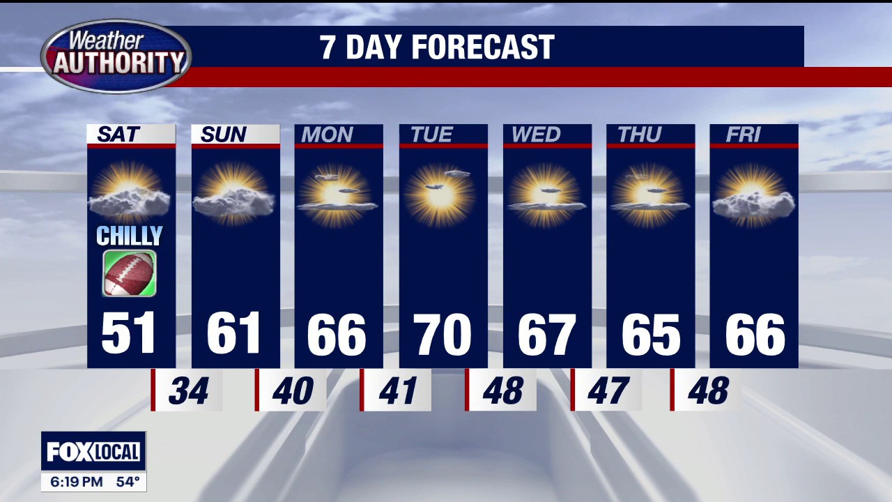 Frost advisory in Southeast Michigan
FOX 2 Detroit Temps could dip as low as 33 degrees from 3 a.m. - 8 a.m. on Saturday, with the potential to result in frost formation in the early morning hours of Saturday, Oct. 17.
-
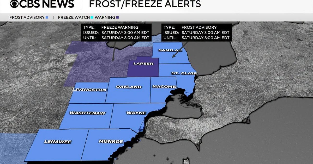 Frost advisory issued for Southeast Michigan early Saturday morning
October 16, 2026 / 3:30 PM EDT / CBS Detroit If you are holding onto the last of your outdoor plants, it is time to take action on Friday night. The National Weather Service has issued a combination of freeze warnings…
-
 Dangerous Freeze Watch for Parts of Indiana and Michigan as Temperatures Drop
A Freeze Watch is in effect for northern, east central and southeast Indiana from late Saturday night through Sunday morning, with lows as cold as 31 degrees possible. A Frost Advisory comes first, for parts of northern…
-
 Justin Liles: After a good freeze, warmer weather returns to Wisconsin, Minnesota, and Michigan this weekend
Scattered light showers across north-central Wisconsin will quickly fade this afternoon, with winds diminishing as high pressure moves overhead tonight. A hard freeze is expected across northwest Wisconsin, where lows…
- Blustery Blast Hits Milwaukee: Lake Michigan Winds, Saturday Frost Possible
Milwaukee is facing chilly temperatures and a blustery Friday, with showers expected mainly before noon. The high is expected to reach about 53 degrees, with blustery winds and peak gusts of 35 to 40 mph. The National…
Sun & moon
Almanac
MonthlyPort Huron, records since 1931. Normals 1991–2020. Data from NOAA's Regional Climate Centers (ACIS).
Nearby
- Clinton Township 59 km
- Shelby 60 km
- Sarnia 2 km
- Mount Clemens 56 km
- New Baltimore 41 km
- Lambton Shores 46 km
- Wallaceburg 42 km
- Marysville 8 km
- Camlachie 23 km
- Richmond 32 km
- Corunna 10 km
- Petrolia 24 km
Forecasters' discussion
From the National Weather Service office in DTX, issued 3 hrs ago
Key Messages
- Dry weather with mild afternoon highs and cool morning lows will persist into the weekend.
Dtw Threshold Probabilities
* None.
Prev Discussion
Issued at 300 AM EDT Tue Oct 20 2026
DISCUSSION...
An elongated sfc to mid level ridge axis extending across the Great Lakes region today through Wednesday will maintain the persistent dry pattern across the forecast area. A northern stream short wave forecast to track across northern Ontario Wednesday will drive a weakening sfc cold front into the Great Lakes region Wed night. This frontal boundary will essentially wash out as long wave ridge amplification takes hold across the central US Thurs into Friday, resulting in rebounding mid level heights across Lower Mi. This will strengthen the large low-mid level anticyclone across much of the eastern US, the influence of which will affect Se Mi through Saturday sustaining dry conditions with relatively little cloud cover.
The dry ambient airmass will continue to support relatively cool nights with ample afternoon sunshine today through Saturday. Forecast mixing depths and thermal profiles remain supportive of afternoon highs from the mid 60s to lower 70s today through Thursday. Sfc high pressure is forecast to strengthen to 1035mb across Quebec by Friday. This may drive a slightly cooler airmass across the eastern Great Lakes, warranting a little lower forecast highs on Friday. With the center of the sfc high pressure already centered across NE Ontario and Quebec, light easterly winds off the lakes will contribute to some enhanced fog potential. There are some indications in the hi res suite for some degree of fog expansion across the thumb this morning. A more notable moisture push tonight into Wed morning may allow a more expansive advective fog event off Lake Erie, with the stronger easterly flow possibly supporting the better fog chances farther west toward Adrian and Ann Arbor.
There is indication in Ecwmf and GFS ensemble members that a forecast deeper upper wave tracking across central Canada Sunday into early next week will break down the ridging across the Great Lakes, suggesting a possible pattern change for next week.
MARINE...
Dtx Watches
MI...None. Lake Huron...None. Lake St Clair...None. Michigan waters of Lake Erie...None.
Forecasts, observations and alerts in the United States come from the National Weather Service (NOAA); radar from NOAA's Multi-Radar Multi-Sensor system; satellite imagery from NASA's Global Imagery Browse Services (GIBS) and NOAA's GOES satellites; the map from the U.S. Geological Survey's National Map; air quality from AirNow (EPA and its partners); hurricane information from the National Hurricane Center; climate normals and records from NOAA's Regional Climate Centers (ACIS). Forecasts outside the United States and the UV index: MET Norway (CC BY 4.0); observations outside the U.S.: airport reports via NOAA's Aviation Weather Center. Place names: GeoNames (CC BY 4.0). Data are copied on a schedule and may lag the sources; for warnings that affect your safety, follow your local National Weather Service office and emergency officials. Weather news is drawn from the 4Search index and reflects what the press published. Terms of use.