Install
Yorkville, IL Weather
Current conditions
Observed at Aurora Municipal Airport · 1 hr ago
Forecast
10-day-
Sunday
Mostly sunny, with a high near 76. South wind 0 to 5 mph.
-
Sunday Night
Mostly cloudy, with a low around 48. South wind 0 to 5 mph.
-
Monday
Mostly cloudy, with a high near 68.
National Weather Service forecast updated 1 day ago.
Hourly
Hourly forecast- Now46°
- 8 AM47°
- 9 AM52°
- 10 AM59°
- 11 AM65°
- 12 PM69°
- 1 PM72°
- 2 PM74°
- 3 PM76°
- 4 PM75°
- 5 PM72°
- 6 PM68°
- 7 PM64°
- 8 PM60°
- 9 PM58°
- 10 PM57°
- 11 PM56°
- Mon12 AM54°
- 1 AM53°
- 2 AM52°
- 3 AM52°
- 4 AM50°
- 5 AM49°
- 6 AM48°
10-day forecast
Details- TonightOct 23Partly Cloudy then Patchy Fog46°
- SatOct 24Patchy Fog then Mostly Sunny46°73°
- TodayOct 25Mostly Sunny48°76°
- MonOct 26Mostly Cloudy49°68°
- TueOct 27Mostly Cloudy49°68°
- WedOct 28Partly Sunny10%50°72°
- ThuOct 29Mostly Sunny15%44°69°
- FriOct 30Slight Chance Rain Showers19%65°
- SatOct 31Partly cloudy34°57°
- SunNov 1Partly cloudy53°68°
Days after the National Weather Service's seven are MET Norway's outlook, a computer model with no forecaster's review.
Radar
Full mapWeather news near Yorkville
More weather news-
 Community leaders say foiled Illinois mass shooting was result of surge in anti-Hindu hate online
Mostly cloudy with scattered thunderstorms (some with damaging wind gust potential) through early evening, then brisk and drier as it turns much cooler the rest of the night. . Bulletin: SEVERE THUNDERSTORM WATCH 686…
- Capitol Fax.com - Your Illinois News Radar » Good morning!
Thursday, Oct 22, 2026 - Posted by Isabel Miller DOMi & JD BECK, Herbie Hancock… - Barton - Thursday, Oct 22, 26 @ 8:53 am: Oh yeah, and you have to monitor comments between it all. Thank you for the lessons…
-
 Strong El Niño likely means a milder winter for northern Illinois, climatologist says
After a record tornado year, northern Illinois may get a break: forecasters favor a warmer-than-average winter as El Niño strengthens in the Pacific. El Niño refers to a warming of the Pacific Ocean’s surface that…
-
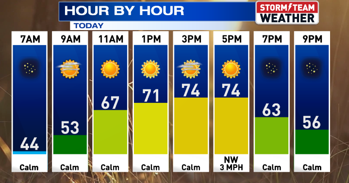 Gorgeous weather continues for Central Illinois
WEDNESDAY: Warming up with sunny skies and calm conditions. High: 75 Low: 47 THURSDAY: Above average with sunny skies. High: 76 Low: 47 FRIDAY: Nice weather continues with sunny skies. High: 76 Low: 46 SATURDAY: Some…
-
 Another beautiful day ahead for Central Illinois
DECATUR, Ill. (WAND) – If you’re looking for a reason to get outside, Tuesday is your day. A high-pressure system settling over the Midwest is bringing abundant sunshine and calm winds to Central Illinois, with…
- Central Illinois Winter Weather Outlook
The winter weather outlook for central and southeast Illinois has been released, and a detailed summary is available at this link. Some of the highlights: Current Conditions Latest Observations Daily Climate Maps…
-
 One of the year’s most pleasant weather stretches arrives in Central Illinois
DECATUR, Ill. (WAND) – A beautiful stretch of sunshine and mild temperatures is settling into the region, and it’s the perfect time to get outside and enjoy it. High pressure is taking control of the Midwest, locking in…
-
 A great week ahead for Central Illinois
WAND DECATUR, Ill. (WAND) – A wonderful weekend across Central Illinois carries into the start of the workweek. Overnight lows dip back into the upper 30s tonight with a small risk for patchy frost, though coverage will…
-
 Winter outlook calling for 'less active storm track' in Illinois
It’s not too early to start talking about the winter outlook for Illinois. “We’re looking at warmer temperatures and a less active storm track,” said DTN Agriculture Meteorologist John Baranick during a Tuesday visit on…
Air quality
Acceptable. Unusually sensitive people should consider limiting prolonged outdoor exertion.
Forecast
- SunModerate
- MonModerate
Aurora and Elgin, IL reporting area · 2 hrs ago. Data from AirNow (EPA and its state, local and tribal partners); preliminary and subject to change.
Sun & moon
Almanac
MonthlyAurora Water, records since 1887. Normals 1991–2020. Data from NOAA's Regional Climate Centers (ACIS).
Nearby
- Aurora 17 km
- Joliet 33 km
- Naperville 30 km
- Elgin 46 km
- Schaumburg 53 km
- Bolingbrook 32 km
- Orland Park 49 km
- Tinley Park 56 km
- Oak Lawn 58 km
- Berwyn 59 km
- Wheaton 38 km
- Hoffman Estates 54 km
Forecasters' discussion
From the National Weather Service office in LOT, issued 1 hr ago
Key Messages
- Generally well above normal temperatures will continue, albeit with a modest cool-down on Monday near and north of I-80, and particularly near Lake Michigan.
- There are periodic low/uncertain rain chances in the mid to late workweek period, with the best chance of any meaningful rainfall not until next Saturday (Halloween) night.
Discussion
Issued at 250 AM CDT Sun Oct 25 2026
Conditions are again nice and quiet as we welcome the new week. Temperatures early this morning are in the 40s and lower 50s with some high clouds passing overhead. Some light rain showers and sprinkles developed over southern and central WI last evening associated with a low-mid level jet max downstream of a surface cold front. The precip has stayed safely to our north thus far and that will remain true as it now starts to move over central Lake Michigan. Today will be very similar to yesterday with afternoon temperatures in the lower and middle 70s and sunshine filtered by scattered high cloud cover.
That aforementioned cold front currently stretching from central IA, up across far SE MN and into northern WI won't make a ton of eastward progress during the day. But it will pivot to become more zonally-oriented across central WI before dropping south across our area overnight tonight through tomorrow morning. Weak forcing for ascent, both along the front and from neighboring synoptic features, and a lack of layer moisture will keep any mentionable rain chances out of the forecast with this frontal passage. It will, however, have a noticeable influence on temperatures as the timing is diurnally favorable for a good gradient in afternoon temps tomorrow. High temperatures are forecast in the lower and middle 60s in our north where the front will have passed by early morning, while lower and middle 70s are expected near and south of the Kankakee and Illinois river valleys where the front won't make it across until later in the morning.
Upper 60s to lower 70s are expected on Tuesday with 70s forecast areawide on Wednesday. Another weak cold front looks to drop into northern IL Thursday night and is then favored to stall nearby into the weekend. The latest NBM came in with slight chance and low-end chance PoPs in our north and northwest ahead of the front Wednesday night into Thursday. However, forecast soundings suggest that may be difficult to achieve until some better layer moisture works in closer to the end of the week. Chances are seemingly better toward the weekend near the stalled baroclinicity. There is uncertainty in the exact evolution of this front/baroclinic zone which lowers confidence in temperature trends late in the week. Generally warmer- than- normal conditions are favored to continue through the end of the week, but a consistent signal among ensembles is for more seasonable temperatures for the early part of November.
Doom
Aviation
Issued at 557 AM CDT Sun Oct 25 2026
Quiet weather continues with VFR conditions persisting into tonight. South-southwesterly will prevail today, but speeds will generally remain under 10 kt. Winds will ease to 5 kt or less this evening in advance of an approaching cold front. This cold front will shift across the terminal airspace during the predawn hours of Monday morning, resulting in a north- northeasterly wind shift. We will also have to keep an eye on the potential for a period of IFR CIGs with the passage of this front early Monday morning. For the 12Z TAFs we maintained the northerly wind shift mention after 10Z Monday morning (slightly early at RFD). I also hinted at the possibility of some lower clouds (SCT008) around in the wake of this frontal passage. Any lower CIGs that develop should improve by mid to late morning.
KJB
Lot Watches
IL...None. IN...None. LM...None.
Forecasts, observations and alerts in the United States come from the National Weather Service (NOAA); radar from NOAA's Multi-Radar Multi-Sensor system; satellite imagery from NASA's Global Imagery Browse Services (GIBS) and NOAA's GOES satellites; the map from the U.S. Geological Survey's National Map; air quality from AirNow (EPA and its partners); hurricane information from the National Hurricane Center; climate normals and records from NOAA's Regional Climate Centers (ACIS). Forecasts outside the United States and the UV index: MET Norway (CC BY 4.0); observations outside the U.S.: airport reports via NOAA's Aviation Weather Center. Place names: GeoNames (CC BY 4.0). Data are copied on a schedule and may lag the sources; for warnings that affect your safety, follow your local National Weather Service office and emergency officials. Weather news is drawn from the 4Search index and reflects what the press published. Terms of use.