Install
Panama City, FL Weather
Current conditions
Observed at Tyndall Air Force Base · 48 min ago
Forecast
10-day-
Tonight
Clear, with a low around 65. Northeast wind around 15 mph, with gusts as high as 25 mph.
-
Sunday
Sunny, with a high near 78. Northeast wind 15 to 20 mph.
-
Sunday Night
Clear, with a low around 64. Northeast wind around 15 mph, with gusts as high as 25 mph.
National Weather Service forecast updated 1 hr ago.
Hourly
Hourly forecast- Now74°
- 7 PM73°
- 8 PM71°
- 9 PM71°
- 10 PM70°
- 11 PM69°
- Sun12 AM68°
- 1 AM67°
- 2 AM67°
- 3 AM67°
- 4 AM66°
- 5 AM65°
- 6 AM65°
- 7 AM66°
- 8 AM68°
- 9 AM70°
- 10 AM72°
- 11 AM73°
- 12 PM75°
- 1 PM77°
- 2 PM77°
- 3 PM78°
- 4 PM78°
- 5 PM77°
10-day forecast
Details- TodayOct 24Sunny65°76°
- SunOct 25Sunny64°78°
- MonOct 26Sunny61°78°
- TueOct 27Sunny57°78°
- WedOct 28Mostly Sunny60°79°
- ThuOct 29Sunny60°79°
- FriOct 30Sunny62°81°
- SatOct 31Showers0.08 in69°83°
- SunNov 1Light rain0.03 in71°82°
- MonNov 2Cloudy0.02 in70°82°
Days after the National Weather Service's seven are MET Norway's outlook, a computer model with no forecaster's review.
Radar
Full mapWeather news near Panama City
More weather news-
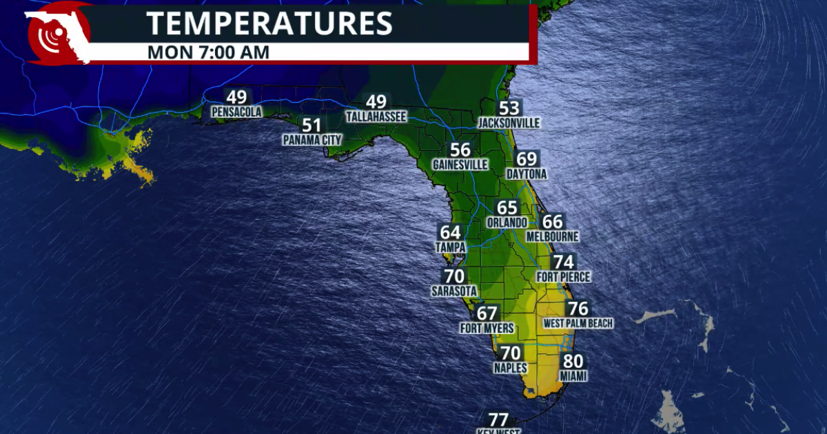 Fall arrives in Florida this weekend
www.fpren.org Update your Zip Code Fall arrives in Florida this weekend The cold front marks the leading edge of a cooler and drier air mass moving southward across the eastern United States. Behind the boundary, winds…
-
 First Alert| Warm afternoons before temperatures drop this weekend
WJHG PANAMA CITY, Fla. (WJHG/WECP) - TODAY: After a comfortable start, afternoon highs will reach the upper 80s. Skies will be sunny, with winds shifting to the south around 5 mph. LOOKING AHEAD: A cold front will be…
-
 FIRST ALERT| Sunny skies stick around
WJHG PANAMA CITY, Fla. (WJHG/WECP) - TODAY: The sunshine sticks around! Afternoon highs are expected to climb into the upper 80s, with feels-like temperatures into the low 90s. These quiet and sunny conditions are…
-
 All stocked up and nowhere to blow
Ashley Trice — All stocked up and nowhere to blow Lagniappe Daily Mother Nature has a pretty good sense of humor She didnât bother to send us any Atlantic hurricanes this year until we had already traded our supply…
-
 Low-pressure center brings strong winds and rain to central Florida
The wind today could gust to more than 30 mph across central Florida and up to 45 mph along the coast. These numbers will only increase on Sunday and Monday, when Orlando could have winds around 45 mph, and we could see…
-
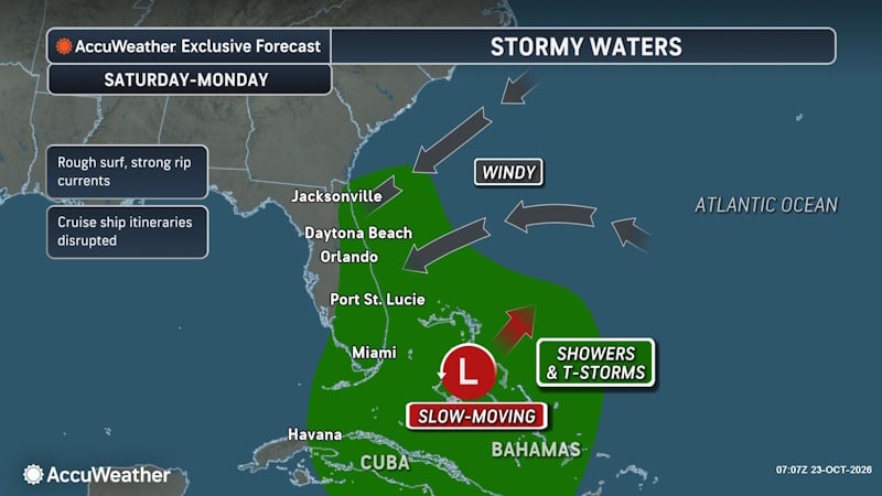 Rough Seas and Tropical Threats Loom Over Florida’s Atlantic Coast
Florida’s East Coast is already dealing with coastal flooding, gusty winds and dangerous surf, and a new area of potential tropical development could prolong or worsen those conditions early next week. Higher tides…
- Rain, strong winds and high surf ahead for Central Florida this weekend
ORLANDO, Fla. — Central Florida’s quiet weather will give way to increasing rain chances and gusty winds this weekend, with hazardous conditions developing along the coast. A trough of low pressure is expected to…
- A trough of low pressure will bring rain and wind to Central Florida
CENTRAL FLA. — After a quiet Friday, we are tracking Weather On the Way for the weekend. A trough of low pressure will develop over the Bahamas, increasing rain chances and wind over Central Florida. Tonight will be…
- Daily reference and potential evapotranspiration, and supporting meteorological data from weather stations, solar insolation data from the GOES satellite, and blue-sky albedo data from the MODIS satellite, Florida, 2023
Potential evapotranspiration (PET), and reference evapotranspiration (ETo) are estimated at an approximately 2-kilometer (approximately 0.019 degrees longitude and 0.018 degrees latitude) spatial grid and daily…
-
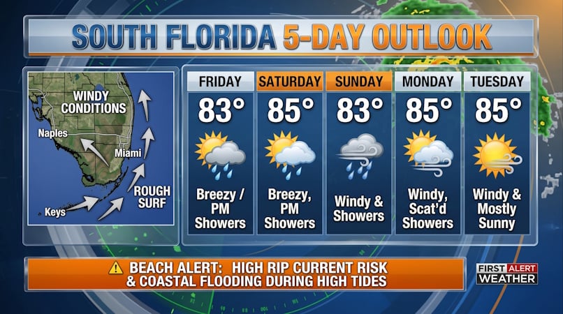 South Florida Forecast: Breezy Conditions, Persistent Beach Hazards, and Rising High Tides
Donna Thomas has studied hurricanes for two decades. She holds a PhD in history when her experience with Hurricane Andrew ultimately led her to earn a degree in broadcast meteorology from Mississippi State University…
Air quality
Air quality is satisfactory, and air pollution poses little or no risk.
Forecast
- SatGood
- SunGood
- MonGood
Bay and Gulf Counties, FL reporting area · 1 hr ago. Data from AirNow (EPA and its state, local and tribal partners); preliminary and subject to change.
Sun & moon
Almanac
MonthlyTyndall Afb, records since 1949. Normals 1991–2020. Data from NOAA's Regional Climate Centers (ACIS).
Nearby
- Lynn Haven 10 km
- Callaway 9 km
- Upper Grand Lagoon 8 km
- Panama City Beach 14 km
- Springfield 5 km
- Parker 6 km
- Youngstown 31 km
- Laguna Beach 27 km
- Lower Grand Lagoon 9 km
- Port Saint Joe 52 km
- Cedar Grove 4 km
- Pretty Bayou 5 km
Forecasters' discussion
From the National Weather Service office in TAE, issued 6 hrs ago
Key Messages
Updated at 126 PM EDT Sat Oct 24 2026
- Northeast winds will increase today, then increase further on Sunday, becoming windy. Northeast wind gusts will peak in the 25-35 mph range during the day on Sunday.
- Hazardous marine conditions are expected today through early next week with fresh to strong northeast winds. The windiest conditions will be tonight through Sunday morning, when brief gusts to gale-force are expected. Small Craft Advisories are in effect for all the open Gulf waters.
Update
Issued at 959 AM EDT Sat Oct 24 2026
Current forecast remains on track, including dew points. Some sprinkles are possible in the FL Suwanee Valley this afternoon.
Aviation
(18Z TAFS) Issued at 126 PM EDT Sat Oct 24 2026
VFR conditions are expected to prevail through the period with clear skies. Northeast winds will decrease around sunset, then increase late Sunday morning, with gusts of 15 to 20 knots.
Marine
Issued at 224 AM EDT Sat Oct 24 2026
A prolonged period of hazardous marine conditions continues through early next week with fresh to strong northeasterly breezes of 20-25 kt and gusts to 30 kt. Small Craft Advisories continue for the Gulf waters through Tuesday afternoon, but could be extended further into next week. Rough seas will also continue with wave heights of 5 to 8 feet expected.
Forecasts, observations and alerts in the United States come from the National Weather Service (NOAA); radar from NOAA's Multi-Radar Multi-Sensor system; satellite imagery from NASA's Global Imagery Browse Services (GIBS) and NOAA's GOES satellites; the map from the U.S. Geological Survey's National Map; air quality from AirNow (EPA and its partners); hurricane information from the National Hurricane Center; climate normals and records from NOAA's Regional Climate Centers (ACIS). Forecasts outside the United States and the UV index: MET Norway (CC BY 4.0); observations outside the U.S.: airport reports via NOAA's Aviation Weather Center. Place names: GeoNames (CC BY 4.0). Data are copied on a schedule and may lag the sources; for warnings that affect your safety, follow your local National Weather Service office and emergency officials. Weather news is drawn from the 4Search index and reflects what the press published. Terms of use.