Install
Taylor, AZ Weather
Current conditions
Forecast for this hour (no station report in the last two hours)
Forecast
10-day-
Tuesday
Patchy fog before 8am, then a slight chance of showers and thunderstorms. Mostly sunny. High near 73, with temperatures falling to around 71 in the afternoon. South wind 1 to 16 mph, with gusts as high as 26 mph.
-
Tuesday Night
A slight chance of showers and thunderstorms before 11pm, then a chance of showers and thunderstorms. Mostly cloudy. Low around 52, with temperatures rising to around 54 overnight. South wind 2 to 9 mph. Chance of precipitation is 50%.
-
Wednesday
Showers and thunderstorms. Mostly cloudy, with a high near 72. South wind 2 to 17 mph, with gusts as high as 28 mph. Chance of precipitation is 80%.
National Weather Service forecast updated 14 hrs ago.
Hourly
Hourly forecast- Now71°10%
- 6 PM67°10%
- 7 PM63°10%
- 8 PM61°10%
- 9 PM60°10%
- 10 PM58°10%
- 11 PM58°37%
- Wed12 AM56°37%
- 1 AM55°37%
- 2 AM55°37%
- 3 AM54°37%
- 4 AM54°37%
- 5 AM54°45%
- 6 AM53°45%
- 7 AM52°45%
- 8 AM57°45%
- 9 AM62°45%
- 10 AM67°45%
- 11 AM70°65%
- 12 PM71°65%
- 1 PM72°65%
- 2 PM72°65%
- 3 PM72°65%
- 4 PM70°65%
10-day forecast
Details- TonightOct 19Patchy Fog46°
- TodayOct 20Patchy Fog then Slight Chance Showers And Thunderstorms45%52°73°
- WedOct 21Showers And Thunderstorms94%52°72°
- ThuOct 22Showers And Thunderstorms98%47°66°
- FriOct 23Sunny11%39°63°
- SatOct 24Sunny11%38°59°
- SunOct 25Sunny41°62°
- MonOct 26Mostly Sunny63°
- TueOct 27Sunny40°64°
- WedOct 28Sunny40°63°
Days after the National Weather Service's seven are MET Norway's outlook, a computer model with no forecaster's review.
Radar
Full mapWeather news in Arizona
More weather news-
 Strong storm system headed to Arizona — here's when it'll hit
AZ Family Strong storm system headed to Arizona — here's when it'll hit How much rain could Phoenix get? Here’s the latest forecast Heavy rain, strong storms across Phoenix area expected later this week Sunny, warm…
-
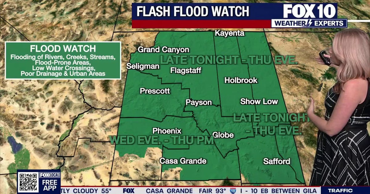 Arizona weather forecast: Heavy rain and severe storms approaching
The National Weather Service has issued flood watches across Arizona as heavy rain and severe storms are set to move into the region. PHOENIX - Plenty of change is expected over the next several days. What to Expect…
-
 Timing rain chances across Arizona this week
AZ Family Timing rain chances across Arizona this week Heavy rain, strong storms across Phoenix area expected later this week Sunny, warm conditions in Arizona followed by rain this week Rain in forecast over the next…
-
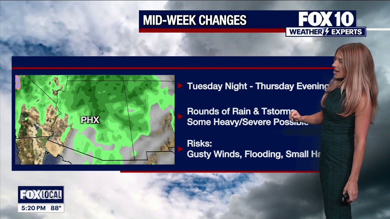 Rain is on the way to Arizona this week
FOX 10 Phoenix FOX 10's Erica Horvatin has the details on a storm that's headed our way this week. She has where it's expected to hit and when.
-
 Another storm system on the way to Arizona this week
ABC15 Arizona Another storm system on the way to Arizona this week
-
 Unsettled weather pattern keeps rain chances alive through Thursday across southern Arizona
KOLD Unsettled weather pattern keeps rain chances alive through Thursday across southern Arizona Tucson eyes active pattern with cooling temperatures ahead Wind Advisory until this afternoon, rain chances return…
-
 Fall system to bring heavy rain, strong storms to Arizona
PHOENIX (AZFamily) — A big weather change is ahead with a strong fall storm system headed toward the Desert Southwest. Wednesday and Thursday are First Alert Weather Days as several rounds of showers and thunderstorms…
-
 Unsettled weather pattern keeps rain chance alive through Thursday for southern Arizona
TUCSON, Ariz. (13 News) - Tonight: Partly cloudy, with a low around 65. East wind around 6 mph. Tuesday: A 20 percent chance of showers and thunderstorms after 11am. Mostly sunny, with a high near 89. East northeast…
-
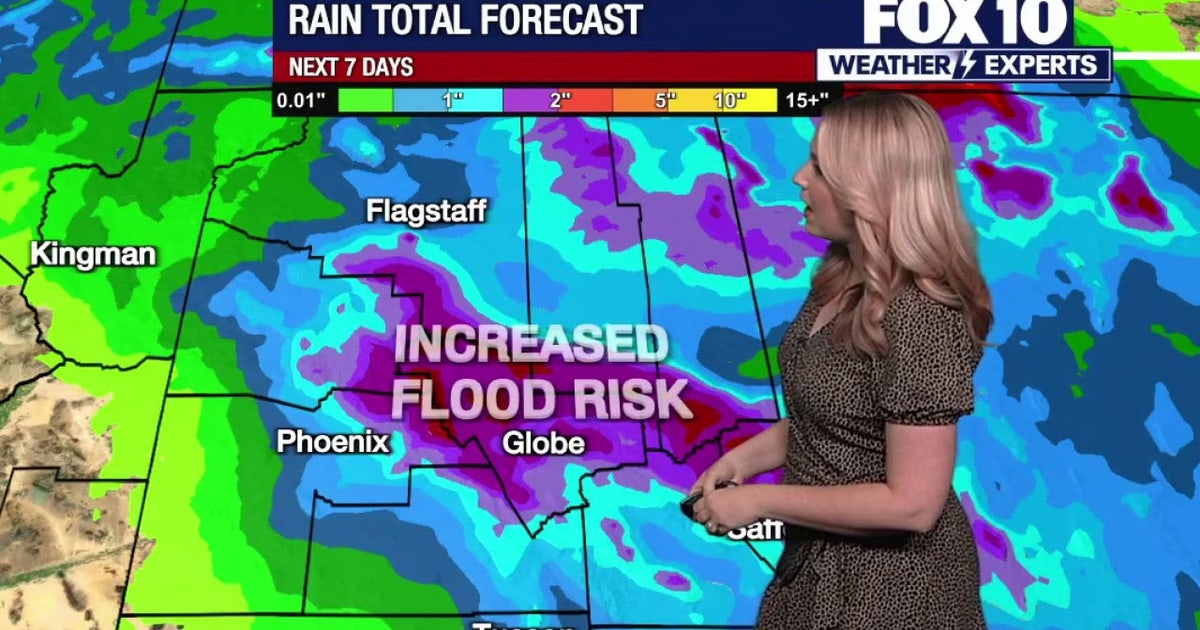 Arizona weather forecast: Phoenix hits the 90s before rain and severe storm chances arrive
Phoenix will hit 91 degrees before rain chances and severe storms return to Arizona mid-week. PHOENIX - Arizona is in for another week of changing weather. While high pressure whirls to the southeast, a trough and…
-
 Why storm chances are increasing across Arizona this week
After a warm start to the week, Arizona is in for a noticeable weather change. Valley highs climb back into the low 90s Tuesday before rain and thunderstorm chances increase Wednesday and Thursday, bringing temperatures…
Sun & moon
Almanac
MonthlyShow Low Airport, records since 1984. Normals 1991–2020. Data from NOAA's Regional Climate Centers (ACIS).
Nearby
- Show Low 24 km
- Snowflake 6 km
- Holbrook 49 km
- Pinetop-Lakeside 38 km
- Lake of the Woods 35 km
- Heber-Overgaard 44 km
- Linden 21 km
- White Mountain Lake 16 km
Forecasters' discussion
From the National Weather Service office in FGZ, issued 13 hrs ago
Synopsis
Northern Arizona will remain in an active weather pattern through the week. A few isolated showers and thunderstorms are possible on Tuesday, then a strong weather system will bring high chances for showers and thunderstorms beginning Wednesday morning and continuing through Thursday. The primary concerns are flooding and flash flooding, especially across eastern Arizona. There is a secondary concern for severe thunderstorms, though there is lower confidence in this hazard.
Discussion
Today...Current mesoanalysis and satellite imagery reveals a subtle shortwave and a weak 40kt jet at 500mb over eastern Arizona. This has combined with marginal instability (100 J/kg of MUCAPE) to allow for very isolated and weakly rotating thunderstorms across the White Mountains as of 2 AM MST this morning. This is expected to end within a few hours as the mid- level pattern shifts northeastward. Into today, a deep upper-level low will continue to rapidly dive southward along the West Coast while ridging over the central CONUS amplifies. This will help lift the weak shortwave fully out of Arizona, and brief subsidence aloft will lead to suppressed daytime shower activity. Still a few weak showers or even thunderstorms will remain possible especially towards the Kaibab and the White Mountains.
Late tonight through Thursday...Beginning late tonight, the West Coast low will begin to push eastward and carry a deep surge of subtropical and tropical moisture to northern Arizona. This moisture surge is somewhat enhanced due to continued active tropical cyclone activity across the Eastern Pacific. PWAT values (a measure of atmospheric moisture) are forecast to rise up to 0.8-1.1 inches, well above normal for mid-October. As a result, there will widespread showers and thunderstorms bringing a primary hazard of Flooding/Flash Flooding through the period. The current forecast calls for the heaviest rainfall accumulations along/south of the Mogollon Rim, with a 1.0-3.0 inches expected. Another area of concern will be the Navajo Nation, where widespread rainfall accumulations of 1.0-2.0 inches are forecast. Localized heavy rainfall will remain possible even outside of the regions. As a result, a Flood Watch has been issued for all of Northern and Central Arizona from 5 AM MST Wednesday-11 PM MST Thursday (6 AM MDT Wednesday-12 AM MDT Friday). Have a way to receive Flash Flood Warnings and be prepared to take action should warnings be issued.
There also remains a Severe Thunderstorm threat. A strong 500mb jet streak moves overhead through the period, and 50+ kts of shear are likely. There still is a degree of uncertainty in the available instability, however mesoscale models remain adamant that we will see CAPE values 500-1500 J/kg from high surface dewpoints and steepening mid-level lapse rates. If the higher instability manifests, there will be severe hail and wind threats. The shear profile also suggests potential for rotating storms, and even an isolated tornado threat. The SPC maintains a Marginal risk (category 1 out of 5) of severe weather across all of Northern and Central AZ on Wednesday and Thursday, and even a Slight risk (2 out of 5) for severe storms across the Eastern Mogollon Rim and White Mountains on Wednesday. Besides heavy rain and thunderstorms, expect gusty daytime winds up to 30-40 mph on Thursday, though likely remaining below Advisory criteria.
Friday and onward...Activity is expected to trend downward by Friday into after the main trough axis pushes past Northern AZ and drier air moves in. Some slight chances for showers look to linger each day, but there is low confidence during this period. Expect lighter winds and temperatures remaining below normal otherwise.
Aviation
Tuesday 20/12Z through Wednesday 21/12Z...Primarily VFR, periods of MVFR/IFR in heavier showers and storms. Isolated showers and thunderstorms possible over the White Mountains and Kaibab Plateau after 18Z. Numerous to widespread showers and thunderstorms begin moving in from the south after 06Z Wednesday. Winds S-SW 5-15kts gusts to 20kts daytime Tuesday, light and VRB overnight. Gusty and erratic winds expected near storms.
OUTLOOK...Wednesday 21/12Z through Friday 23/12Z...Widespread shower and thunderstorm activity bringing periods of MVFR/IFR conditions. Activity diminishes from west to east late Thursday evening/night. Winds S 10-15kts with gusts to 25kts Wednesday, S-SW 10-20kts with gusts to 30kts Thursday.
Fire Weather
Today through Wednesday...Isolated showers and thunderstorms are possible during the daytime today, then activity will increase in coverage late Tuesday and become widespread on Wednesday. Some storms may produce very heavy rainfall leading to flooding or flash flooding on Wednesday. Winds are south 10-15 mph with gusts to 25 mph on Tuesday, then 10-20 mph with gusts 25-35 mph on Wednesday. Daytime temperatures near to below normal.
Thursday through Saturday...Widespread showers and thunderstorms continue on Thursday, becoming isolated for Friday and Saturday. Some storms may produce very heavy rainfall leading to flooding or flash flooding on Thursday. South through southwest winds 15-25 mph with gusts 30-40 mph on Thursday, becoming southwest through west 10- 15 mph with gusts to 25 mph on Friday, then light northerly winds 5- 15 mph on Saturday.
Forecasts, observations and alerts in the United States come from the National Weather Service (NOAA); radar from NOAA's Multi-Radar Multi-Sensor system; satellite imagery from NASA's Global Imagery Browse Services (GIBS) and NOAA's GOES satellites; the map from the U.S. Geological Survey's National Map; air quality from AirNow (EPA and its partners); hurricane information from the National Hurricane Center; climate normals and records from NOAA's Regional Climate Centers (ACIS). Forecasts outside the United States and the UV index: MET Norway (CC BY 4.0); observations outside the U.S.: airport reports via NOAA's Aviation Weather Center. Place names: GeoNames (CC BY 4.0). Data are copied on a schedule and may lag the sources; for warnings that affect your safety, follow your local National Weather Service office and emergency officials. Weather news is drawn from the 4Search index and reflects what the press published. Terms of use.