Install
Livingston, CA 95334 Weather
Current conditions
Forecast for this hour (no station report in the last two hours)
Forecast
10-day-
Today
Partly sunny, with a high near 74. Northwest wind around 5 mph.
-
Tonight
A slight chance of rain after 5am. Mostly cloudy. Low around 51, with temperatures rising to around 53 overnight. Northwest wind 0 to 5 mph.
-
Wednesday
A chance of rain. Partly sunny. High near 71, with temperatures falling to around 69 in the afternoon. West northwest wind 0 to 5 mph. Chance of precipitation is 40%. New rainfall amounts less than a tenth of an inch possible.
National Weather Service forecast updated 2 hrs ago.
Hourly
Hourly forecast- Now66°
- 1 PM70°
- 2 PM72°
- 3 PM72°
- 4 PM74°
- 5 PM73°
- 6 PM72°
- 7 PM68°
- 8 PM63°
- 9 PM61°
- 10 PM59°
- 11 PM59°
- Wed12 AM57°
- 1 AM57°
- 2 AM56°
- 3 AM56°
- 4 AM53°
- 5 AM53°
- 6 AM53°
- 7 AM52°
- 8 AM54°
- 9 AM58°
- 10 AM63°
- 11 AM65°19%
Daily forecast
Details- TodayOct 20Partly Sunny51°74°
- WedOct 21Chance Light Rain51%50°71°
- ThuOct 22Chance Showers And Thunderstorms40%46°71°
- FriOct 23Sunny45°73°
- SatOct 24Sunny46°76°
- SunOct 25Mostly Sunny46°76°
- MonOct 26Sunny45°74°
- TueOct 27Cloudy49°81°
- WedOct 28Cloudy54°82°
Days after the National Weather Service's seven are MET Norway's outlook, a computer model with no forecaster's review.
Radar
Full mapWeather news near Livingston
More weather news-
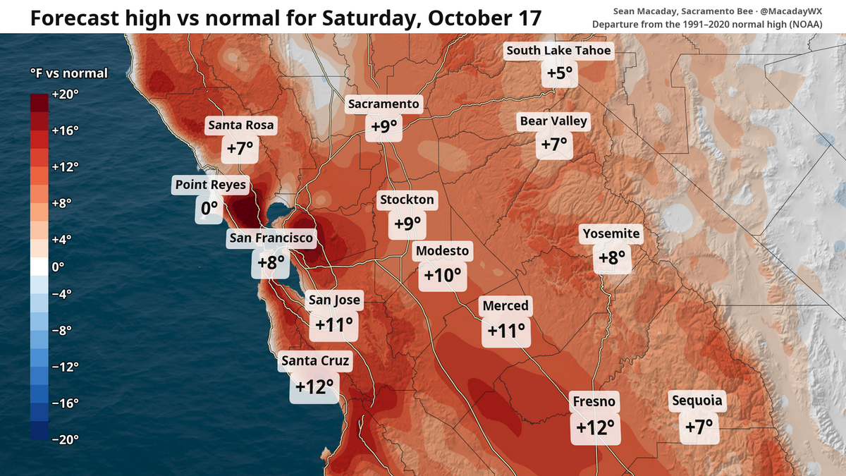 High temps in Fresno to fall 20 degrees this week. What to expect in Central Valley and state
Despite chilly weekend mornings, the high temperature in Fresno is expected to touch 90 Saturday and then fall to 70 by Wednesday. The topsy-turvy weather and winds can be a calling card of mid-October. After a brief…
- Wind, cooldown and rain? What to expect this weekend and beyond in NorCal weather
Despite a breeze, this weekend is set to be the warmest stretch for the foreseeable future. Those factors will provide some fire risk before temperatures tumble and a window for rain opens next week. It’s a great…
-
 Mid-October Santa Ana winds rapidly spread wildfires in Southern California
Several fires have erupted recently amid strong, dry winds known as the Santa Anas. The name is commonly linked way back in the 1800s to Santa Ana Canyon in Orange County, through which these warm winds were known to…
-
 California Will Turn Clocks Back on November 1
California residents will turn their clocks back one hour on Sunday, November 1, 2026, when daylight saving time ends across most of the United States. The change will provide an additional hour overnight but bring…
-
 Pacific Storm Brings Rain and High Elevation Snow to Northern California
SuaraGarut.ID A Pacific storm moving south along the West Coast is bringing cooler temperatures, breezy winds, and scattered precipitation to Northern California this week According to KCRA meteorologists, rain chances…
-
 Rain — and potentially lots of it — heading to Southern California
Widespread rain and possible thunderstorms are headed for Southern California this week, with forecasters on Monday warning that some areas could receive up to 2 inches of rain. The National Weather Service said a…
-
 Cooler temperatures, possible rain headed for Southern California
It’s time to grab those jackets and pull out the umbrellas because cooler temperatures and a chance of rain is on tap for Southern California by the middle of this week, forecasters say. The region could see widespread…
-
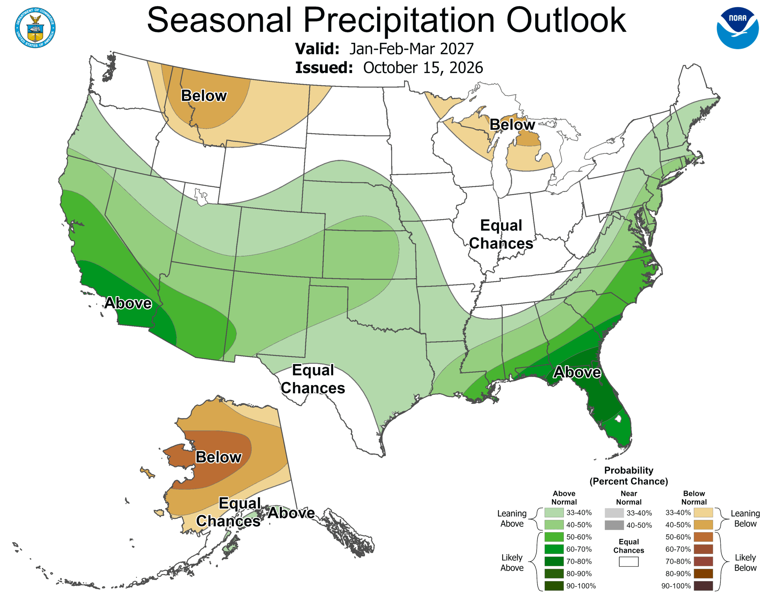 ‘Weather Whiplash’ Bringing Back Rain and Snow to California
A “weather whiplash” will continue taking Californians for a ride this week, as last week’s high temperatures and blustery winds give way to clouds, rain and snow in the mountains. This week, the stormy weather returns…
- Deep Pacific storm targets Central California, raising rain chances by Wednesday
by Ilya Neyman, Chief Meteorologist Tonight, there is a potent mid-latitude cyclone developing over the North Pacific, just west of Washington state. A very robust jet stream, with winds of close to 200 mph, is…
-
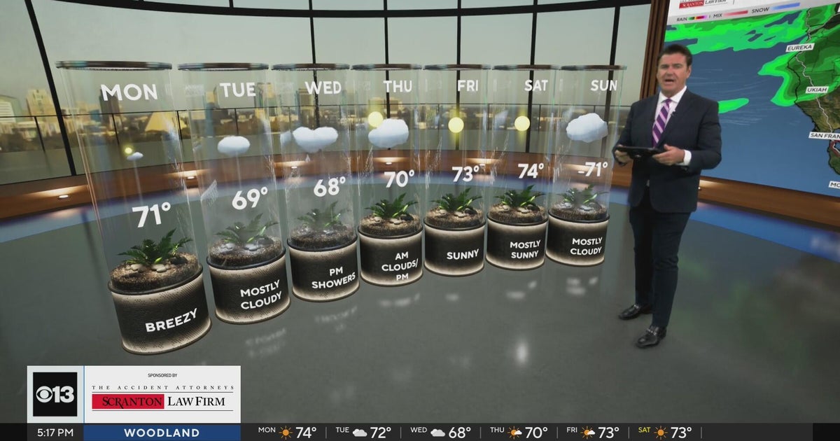 Sunday evening Northern California weather forecast - October 18, 2026
CBS News Bay Area Evening Edition Weekend 5pm CBS News Detroit Weekend 6:30pm CBS News Miami 6:30pm CBS Philadelphia at 6:30pm What's in Season with Michael Marks CBS News Texas 5:30pm
Air quality
Air quality is satisfactory, and air pollution poses little or no risk.
Forecast
- TueGood (47)
Merced, CA reporting area · 1 hr ago. Data from AirNow (EPA and its state, local and tribal partners); preliminary and subject to change.
Sun & moon
Almanac
MonthlyMerced Area, records since 1899. Normals 1991–2020. Data from NOAA's Regional Climate Centers (ACIS).
Nearby
Forecasters' discussion
From the National Weather Service office in HNX, issued 7 hrs ago
Update
Updated Aviation Section.
Key Messages
1. High confidence in a change in the weather pattern over the next several days with below average temperatures likely after today and precipitation mid-week.
2. This is likely to be the first wetting rainfall in the Central Valley this fall with a 75-85% chance of at least a quarter inch of rain in 24 hours by around mid-day Thursday.
3. Snowfall is likely above 8,000 feet in elevation with a 60-70% chance of at least 4 inches of snow (probabilities increase further at higher elevations).
Discussion
Today's highs were in the upper 70s to mid 80s at the warmest locations, including in the Central Valley and Mojave Desert portions of eastern Kern County. While maximum temperatures were around five degrees lower than yesterday's, highs remained several degrees above seasonal averages today, mainly from Fresno southward. Expect temperatures to continue on the downward trend on Tuesday and even more on Wednesday when highs reach below average. Precipitation chances begin late Tuesday in the Sierra Nevada and spread to much of the forecast area by Wednesday. The bulk of the precipitation is now for Wednesday evening until Thursday morning, although additional showers will develop on Thursday afternoon. A slight chance of thunderstorms exists for both Wednesday and Thursday, mainly in the afternoons. In terms of precipitation amounts, we're seeing a high probability (75-85% chance) of at least 0.25 inch for the San Joaquin Valley on Wednesday into Thursday. There is a 70-80 percent chance for at least 0.50 inch of precipitation for the Sierra Nevada and foothills for a 24 hour period ending Thursday afternoon. As for snowfall, at least a 60-70 percent chance for at least 4 inches of snow is shown for the higher elevations of the Sierra Nevada, mainly above 8,000 feet. The heaviest snow amounts will occur above 10,000 feet; the latest Winter Storm Severity Index from the Weather Prediction Center shows minor to moderate impacts for portions of the Sierra crest due to snow loading.
From Friday onward, cooler temperatures prevail (highs mainly in the 70s in the lower elevations), although precipitation is no longer forecast through early next week. Nonetheless, the latest outlooks from the Climate Prediction Center continue to show the odds tilted towards above average precipitation out to 8-14 days. Temperatures show a tilt towards above average (40-50% chance) for the 6-10 day period, but revert to below average (similar probability) on the 8-14 day outlook.
Aviation
VFR conditions will prevail for the next 24 hours.
Forecasts, observations and alerts in the United States come from the National Weather Service (NOAA); radar from NOAA's Multi-Radar Multi-Sensor system; satellite imagery from NASA's Global Imagery Browse Services (GIBS) and NOAA's GOES satellites; the map from the U.S. Geological Survey's National Map; air quality from AirNow (EPA and its partners); hurricane information from the National Hurricane Center; climate normals and records from NOAA's Regional Climate Centers (ACIS). Forecasts outside the United States and the UV index: MET Norway (CC BY 4.0); observations outside the U.S.: airport reports via NOAA's Aviation Weather Center. Place names: GeoNames (CC BY 4.0). Data are copied on a schedule and may lag the sources; for warnings that affect your safety, follow your local National Weather Service office and emergency officials. Weather news is drawn from the 4Search index and reflects what the press published. Terms of use.