Install
Ripon, CA Weather
Current conditions
Observed at Stockton, Stockton Metropolitan Airport · 35 min ago
Forecast
10-day-
Tuesday
Partly sunny, with a high near 73. North northwest wind around 5 mph.
-
Tuesday Night
Mostly cloudy. Low around 52, with temperatures rising to around 54 overnight. Northwest wind around 5 mph.
-
Wednesday
A chance of showers and thunderstorms after 5pm. Partly sunny, with a high near 72. Northwest wind around 3 mph. Chance of precipitation is 40%.
National Weather Service forecast updated 4 hrs ago.
Hourly
Hourly forecast- Now49°
- 7 AM48°
- 8 AM50°
- 9 AM54°
- 10 AM60°
- 11 AM63°
- 12 PM67°
- 1 PM70°
- 2 PM71°
- 3 PM72°
- 4 PM73°
- 5 PM72°
- 6 PM71°
- 7 PM67°
- 8 PM63°
- 9 PM61°
- 10 PM60°
- 11 PM59°
- Wed12 AM57°
- 1 AM57°
- 2 AM56°
- 3 AM56°
- 4 AM55°
- 5 AM54°
10-day forecast
Details- TonightOct 19Mostly Cloudy48°
- TodayOct 20Partly Sunny52°73°
- WedOct 21Partly Sunny then Chance Showers And Thunderstorms47%52°72°
- ThuOct 22Chance Showers And Thunderstorms45%48°70°
- FriOct 23Sunny47°73°
- SatOct 24Sunny48°75°
- SunOct 25Sunny48°75°
- MonOct 26Sunny74°
- TueOct 27Cloudy55°83°
- WedOct 28Cloudy57°81°
Days after the National Weather Service's seven are MET Norway's outlook, a computer model with no forecaster's review.
Radar
Full mapWeather news near Ripon
More weather news-
 Rain is on the way to Merced area as 'unsettled weather arrives.’ What to expect
After a warm weekend with temperatures climbing into the 80s, cooler fall weather is finally moving into the Merced area, bringing lower temperatures, cloudy skies and a chance of rain. "A pattern change is on the way…
- Heavy overnight rain batters Chennai as Northeast monsoon gets active in Tamil Nadu
Published - October 18, 2026 09:01 pm IST - CHENNAI As the Northeast monsoon intensified in its first week itself, Chennai was battered by extremely heavy rainfall on Saturday night, with many areas receiving more than…
-
 Rain-battered Chennai braces for more heavy showers, CM Vijay reviews preparations
On Sunday, Chief Minister Vijay inspected the Greater Chennai Corporation headquarters at Ripon Building to review preparations for the northeast monsoon and stormwater drainage measures. The RMC has forecast heavy…
- Wet in the Modesto region this week? Here’s what the weather service forecasts
After a few days of fall-like weather, temperatures in the Modesto region heated up a bit last week. But it looks like fall will return, according the upcoming week’s forecast by the National Weather Service. Following…
-
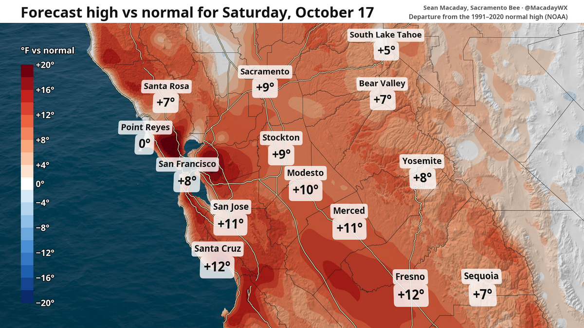 High temps in Fresno to fall 20 degrees this week. What to expect in Central Valley and state
Despite chilly weekend mornings, the high temperature in Fresno is expected to touch 90 Saturday and then fall to 70 by Wednesday. The topsy-turvy weather and winds can be a calling card of mid-October. After a brief…
-
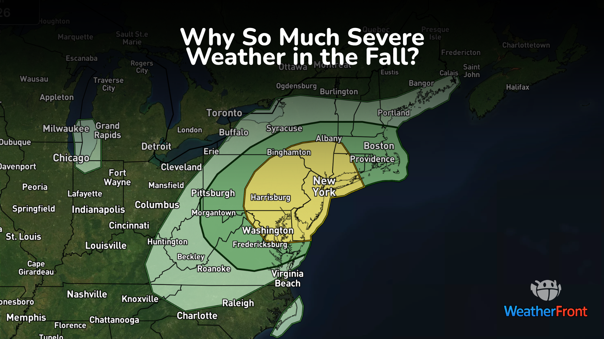 Why Fall Has a Second Severe Weather Season
Tornado warnings probably weren’t what people in Fort Stockton, Texas, had in mind for an October afternoon. But on October 14, storms produced two confirmed tornadoes in the area. No injuries or deaths were reported…
- Wind, cooldown and rain? What to expect this weekend and beyond in NorCal weather
Despite a breeze, this weekend is set to be the warmest stretch for the foreseeable future. Those factors will provide some fire risk before temperatures tumble and a window for rain opens next week. It’s a great…
-
 FIRST ALERT WEATHER: A drastic change is on the way
Good morning, and happy Thursday! Cloudy skies and a bit of rain are kicking off the day, though much of the rain has stayed in western Missouri, as expected. Scattered showers and a few thunderstorms are likely this…
-
 Severe Tornado and Thunderstorm Warnings Issued in Texas as Conditions Intensify
A Tornado Warning is in effect until 3:15 p.m. CDT Wednesday for north central Pecos County near Fort Stockton, Texas, as severe thunderstorms with wind gusts up to 70 mph and quarter-size hail move across West Texas…
-
 FIRST ALERT WEATHER DAY: Heavy rainfall and severe weather threat continues Wednesday
CBS7 FIRST ALERT WEATHER DAY: Heavy rainfall and severe weather threat continues Wednesday Cleanup underway after microburst storm causes major flooding, building damage in Odessa Confirmed tornado moves through Pecos…
Air quality
Acceptable. Unusually sensitive people should consider limiting prolonged outdoor exertion.
Forecast
- TueGood (50)
Modesto, CA reporting area · 40 min ago. Data from AirNow (EPA and its state, local and tribal partners); preliminary and subject to change.
Sun & moon
Almanac
MonthlyStockton Area, records since 1893. Normals 1991–2020. Data from NOAA's Regional Climate Centers (ACIS).
Nearby
Forecasters' discussion
From the National Weather Service office in STO, issued 16 hrs ago
Key Messages
- Chance for a shower over the Coastal Range this afternoon/evening.
- Widespread precipitation Tuesday through Thursday, with below normal temperatures, thunderstorm chances, and high elevation snow showers.
- Dry conditions return end of the week and into the weekend, followed by the potential for further unsettled weather.
Discussion
...Today through Thursday...
Current satellite and radar has an area of light showers over the Coastal Range this afternoon as a trough sits off the coast. This trough will continue to deepen and move onshore through Thursday. Today we will continue to see clouds move into the region with a broken cloud deck overnight. Temperatures will be in the upper 60s to lower 70s today and through the remainder of the week.
The main push of precipitation comes Tuesday evening as moisture from the south pushes through California. Snow levels will be above 9000 feet on Tuesday and drop to 8000-9000 feet Wednesday. Tuesday evening, we will see instability increase across the mountains and foothills, with up to 500 J/kg of CAPE and strong speed and directional shear. This fuels the chances for an isolated thunderstorms within the mountains and foothills. A few storms may be on the stronger side with small hail, gusty winds, and frequent lightning possible. As we move through Tuesday night into Wednesday precipitation chances becomes widespread across the forecast area, with increased chances for thunderstorms by Wednesday afternoon in parts of the southern Sacramento Valley, northern San Joaquin Valley, foothills, and mountains. Shear, instability, moisture, and lift are in better positions to initiate and sustain thunderstorms Wednesday afternoon/evening. A few storms may be on the stronger side Wednesday, with small hail, gusty winds, brief heavy rain, and frequently lightning being the main hazards. There is a low chance for a low top supercell to develop within the foothills and/or northern San Joaquin Valley where shear is more elongated and sustainable for supercellular development. We will continue to monitor the latest for thunderstorms Tuesday and Wednesday.
Snow levels start to drop to the 8000-9000 feet Wednesday, and a few inches are possible within the higher peaks of the Sierra predominantly south of Highway 50. Minor impacts are possible in eastern Tuolumne and Alpine counties Wednesday and potentially into Thursday as the system lingers across the area. Thunderstorm chances will again be possible Thursday, but remain in the foothills and Sierra where lift is more sustainable for the growth and development.
...Friday and onward...
The system moves out of the southwestern United States Friday and Saturday, with a return to dry conditions for the area. This doesn't last long as ensemble guidance continues to show an unsettled pattern redeveloping across the western United States bringing the potential for more precipitation to parts of California. Temperatures during this time remain below average for this time of year. Uncertainty arises with the development, timing, and strength of any precipitation end of the weekend and into next week.
Aviation
VFR conditions prevail across the region through the TAF period. There are some brief low clouds around the RBL site this morning, which will continue off and on through 19z. Otherwise, winds will be breezy at times, with a few gusts near the Sacramento sites to 20kts this afternoon/evening. Overnight clouds move in for all sites from the west as a system moves into the region.
Sto Watches
None.
Forecasts, observations and alerts in the United States come from the National Weather Service (NOAA); radar from NOAA's Multi-Radar Multi-Sensor system; satellite imagery from NASA's Global Imagery Browse Services (GIBS) and NOAA's GOES satellites; the map from the U.S. Geological Survey's National Map; air quality from AirNow (EPA and its partners); hurricane information from the National Hurricane Center; climate normals and records from NOAA's Regional Climate Centers (ACIS). Forecasts outside the United States and the UV index: MET Norway (CC BY 4.0); observations outside the U.S.: airport reports via NOAA's Aviation Weather Center. Place names: GeoNames (CC BY 4.0). Data are copied on a schedule and may lag the sources; for warnings that affect your safety, follow your local National Weather Service office and emergency officials. Weather news is drawn from the 4Search index and reflects what the press published. Terms of use.