Install
Teague, TX 75860 Weather
Current conditions
Observed at Mexia Limestone County Airport · 1 hr ago
Forecast
10-day-
Wednesday
Sunny, with a high near 80. East northeast wind 0 to 5 mph.
-
Wednesday Night
Mostly clear, with a low around 54. Northeast wind around 0 mph.
-
Thursday
Sunny, with a high near 82. Northeast wind around 0 mph.
National Weather Service forecast updated 11 hrs ago.
Hourly
Hourly forecast- Now80°
- 5 PM79°
- 6 PM77°
- 7 PM73°
- 8 PM66°
- 9 PM64°
- 10 PM62°
- 11 PM61°
- Thu12 AM59°
- 1 AM58°
- 2 AM57°
- 3 AM56°
- 4 AM55°
- 5 AM55°
- 6 AM54°
- 7 AM54°
- 8 AM54°
- 9 AM59°
- 10 AM68°
- 11 AM73°
- 12 PM77°
- 1 PM80°
- 2 PM81°
- 3 PM81°
10-day forecast
Details- TonightOct 20Clear51°
- TodayOct 21Sunny54°80°
- ThuOct 22Sunny53°82°
- FriOct 23Mostly Sunny54°82°
- SatOct 24Mostly Sunny54°82°
- SunOct 25Partly Sunny53°78°
- MonOct 26Mostly Sunny20%56°79°
- TueOct 27Chance Rain Showers38%76°
- WedOct 28Partly cloudy52°66°
- ThuOct 29Cloudy47°64°
Days after the National Weather Service's seven are MET Norway's outlook, a computer model with no forecaster's review.
Radar
Full mapWeather news near Teague
More weather news-
 Doug Iverson's Storm Tracker Forecast | Monday, October 19
KPVI Warmer-than-usual temperatures continue, but sunshine takes a step back. STUDENT'S ALLEGED GUN THREAT AFFECTS LOCAL SCHOOLS Low Water Levels Reveal Original American Falls Town Site Local Man Was Arrested in Bar…
-
 Doug Iverson's Storm Tracker Weather | Thursday, October 15
KPVI A warming trend heading into the weekend. Local Woman Sentenced to Prison One of Colorado's Most Wanted Sex Offenders Was Found in Wyoming Rooster Makes an Appearance on Tail-Wagger Wednesday Friends of Blackfoot…
-
 Matt Davenport's Storm Tracker Forecast for Thursday, October 15
KPVI Warmer weather is on the way for the weekend. Local Woman Sentenced to Prison One of Colorado's Most Wanted Sex Offenders Was Found in Wyoming Rooster Makes an Appearance on Tail-Wagger Wednesday Friends of…
-
 Doug Iverson's Storm Tracker Forecast | Tuesday, October 13
KPVI Finally, our first storm of the month is winding down. American Falls Police Seeking Information on Missing Person Rain Didn't Stop the Community from Coming Out for ISU Homecoming Parade The City of Idaho Falls is…
-
 KPVI Storm Tracker Alert
KPVI WIDESPREAD FREEZE is likely in the Snake River Plain late Tuesday Night into Wednesday Morning. The National Weather Service has issued a Freeze Warning from 3 to 9 a.m. on Wednesday. American Falls Police Seeking…
-
 Matt Davenport's Storm Tracker Forecast for Tuesday, October 13
KPVI One more day of rainy weather before things begin to warm up. American Falls Police Seeking Information on Missing Person Rain Didn't Stop the Community from Coming Out for ISU Homecoming Parade The City of Idaho…
-
 Warming trend will continue for East Texas this week
KLTV.com 2 accused of trafficking and prostitution at Smith County spa Child dies following wreck on W. Loop 281 in Longview Tyler man indicted on numerous tax fraud charges East Texas Democratic official says she was…
-
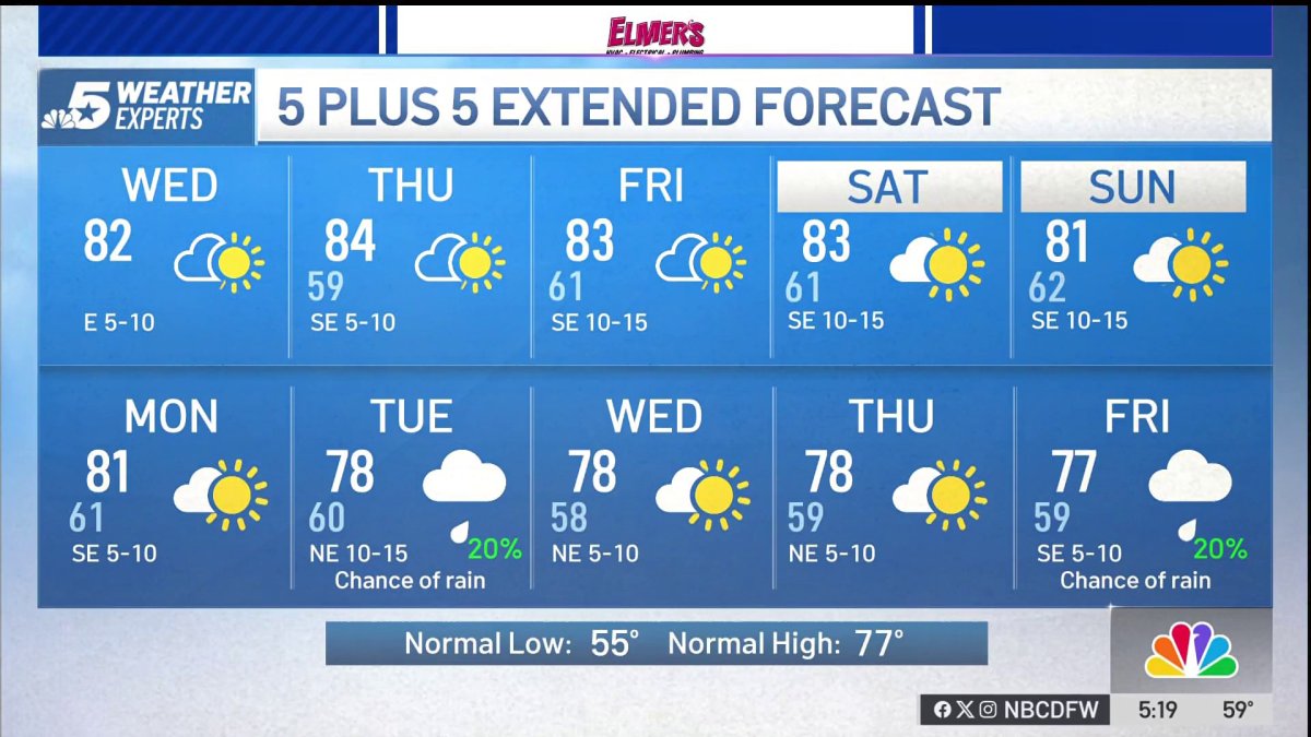 NBC 5 Forecast: A quiet weather pattern continues for North Texas
NBC 5 Dallas-Fort Worth NBC 5 Forecast: A quiet weather pattern continues for North Texas
-
 Storms, flooding possible in parts of Texas. Here's where
The National Weather Service Amarillo says a slight risk for excessive rainfall and flooding is possible on Friday and Saturday, October 23-24, 2026. If you feel like you need a break from all the ups and downs of Texas…
-
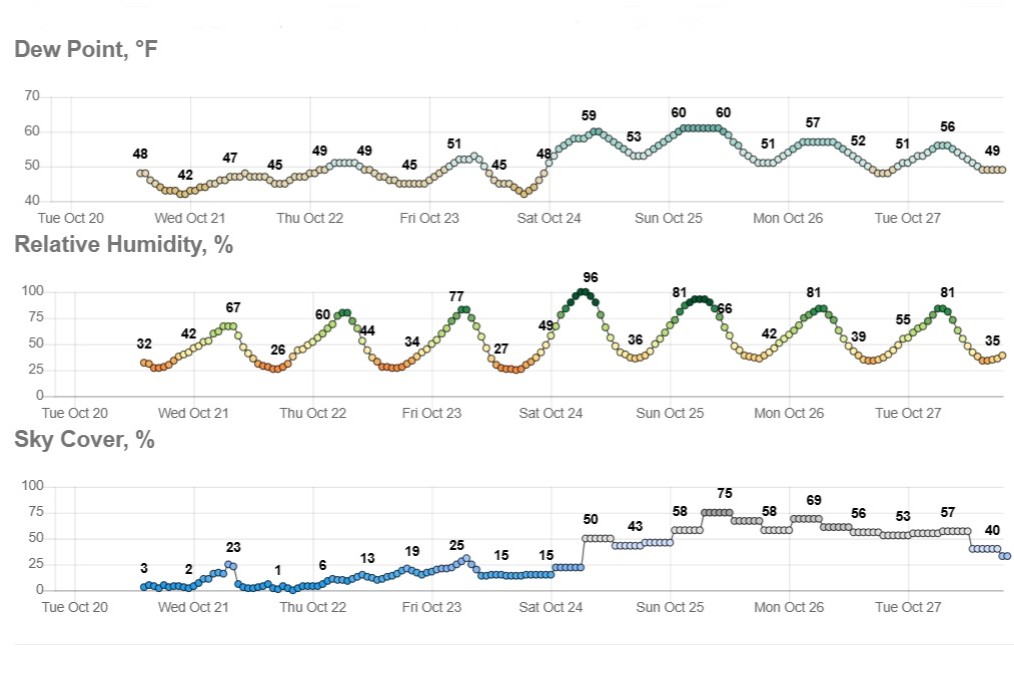 Sunny and dry in Texas, but wild weather across U.S. hits both coasts
Temperatures in Austin will climb to just a few degrees above our mid-October average of 82 degrees. Early-rising Texans might notice temperatures beginning to warm up over the next few mornings. Predawn temps will…
Sun & moon
Nearby
Forecasters' discussion
From the National Weather Service office in FWD, issued 3 hrs ago
Key Messages
- Quiet weather will continue with steadily warming temperatures through the end of the week.
- An unsettled pattern is beginning to come into view for early to mid next week, with cooler and wetter weather possible.
Short Term
(This afternoon through Friday) Issued at 1245 PM CDT Wed Oct 21 2026
"High and dry" is the phrase of the day, as peaceful weather will continue for the rest of this week. North and Central Texas remains under a stout upper-level ridge that continues to drive our subsident and rain-free pattern. Temperatures will remain pleasant and seasonal as light easterly winds and very dry dewpoints keep highs in the in the upper 70s to lower 80s. With a lack of overnight cloud cover, radiational cooling should allow for some brisk and crisp nights, with overnight lows in the 55-60 degree range across the region. Friday, while pleasant conditions will continue for North and Central Texas, the upper-level closed low that has been bringing rain and severe weather to Arizona today will begin to join the broad trough pattern and shift east. This will set the stage for our next eventful weather going into next week.
Long Term
(Saturday through Wednesday) Issued at 1245 PM CDT Wed Oct 21 2026
Saturday, an upper-level closed low will slide northeast into the CONUS via Baja California and integrate into the larger trough pattern. This will intensify the already digging trough, and will be the focus for the upcoming pattern shift. While long-range guidance is coming into agreement on a cold front FROPA into North and Central Texas on or around Tuesday of next week, there is still much uncertainty on timing, intensity, and any rain chances in the area. While there is a most likely outcome, some long-range ensemble members still highlight a potential second, less likely scenario. While both patterns will be discussed here, the bottom line is that it will likely be a cooler, more unsettled week leading up to and on Halloween day, which may impact any planned outdoor activities.
In the most likely scenario, mid to long-range deterministic models (GFS, ECMWF) quickly lift the now integrated upper-level low up and into the Central and Northern Plains. This will flatten the ridge that has been dominating the local pattern, as a new trough begins digging in the Pacific Northwest. The lifting upper- level low will be able to send shortwave disturbances around the base of the trough and into the Southern Plains, priming our area for a pattern shift. Given the quickly lifting trough, this scenario would favor a later, more slow moving cold front that sags south across the Red River from OK and into NTX by mid-next week. This would also favor a dryer pattern through the start of the week, with more isolated precip mainly confined to Northwest Texas.
Some of the ensembles have picked up on the possibility of another, less likely scenario (20-30% chance of occurrence), which would bring a more progressive cold front, as well as more widespread rain chances for North and Central Texas. LREF cluster guidance and GEFS ensembles continue to be bullish on a scenario that involves the upper-level trough shifting northeast much more slowly, and continuing to dig through the Central Plains, instead of lifting quickly north. With the slower pattern, a weak ridge would be likely to develop across the Mountain West, and would help intensify a progressive FROPA from late next Monday into Tuesday. Rain chances along this front would be more widespread with stronger upslope flow ahead of FROPA, with a low (less than 30%) chance for an isolated thunderstorm or two. Again, this scenario is the less likely of the two, and fall climatology for NTX/CTX tends to favor a quickly lifting trough with a weaker, sagging cold front behind in its wake.
Regardless of either scenario playing out, a more unstable and cooler pattern will be on tap going into mid-week and leading up to Halloween, as highs area wide will be in the lower 70s, with lows in the 50s. More details and specifics will become clearer as short to mid-range guidance begins to come in over the next few days, so make sure to stay updated with the forecast!
Aviation
(18Z TAFS) Issued at 1245 PM CDT Wed Oct 21 2026
VFR conditions will prevail at all TAF sites through the period. Winds will continue to remain very calm (less than 6 KTS) and VRB at times, with the prevailing flow still E-ESE (090-120). While some high clouds (FEW250) may overspread D10 after 18Z Thursday, there will be no operational impacts. Winds overnight will continue to stay calm and E-ESE.
Forecasts, observations and alerts in the United States come from the National Weather Service (NOAA); radar from NOAA's Multi-Radar Multi-Sensor system; satellite imagery from NASA's Global Imagery Browse Services (GIBS) and NOAA's GOES satellites; the map from the U.S. Geological Survey's National Map; air quality from AirNow (EPA and its partners); hurricane information from the National Hurricane Center; climate normals and records from NOAA's Regional Climate Centers (ACIS). Forecasts outside the United States and the UV index: MET Norway (CC BY 4.0); observations outside the U.S.: airport reports via NOAA's Aviation Weather Center. Place names: GeoNames (CC BY 4.0). Data are copied on a schedule and may lag the sources; for warnings that affect your safety, follow your local National Weather Service office and emergency officials. Weather news is drawn from the 4Search index and reflects what the press published. Terms of use.