Install
Center, TX Weather
Current conditions
Forecast for this hour (no station report in the last two hours)
Forecast
10-day-
Thursday
Sunny. High near 82, with temperatures falling to around 79 in the afternoon. East wind 0 to 5 mph.
-
Thursday Night
Mostly clear, with a low around 53. Northeast wind around 0 mph.
-
Friday
Sunny, with a high near 83. East southeast wind 0 to 5 mph.
National Weather Service forecast updated 2 days ago.
Hourly
Hourly forecast- Now66°
- 11 AM71°
- 12 PM75°
- 1 PM79°
- 2 PM80°
- 3 PM81°
- 4 PM82°
- 5 PM79°
- 6 PM77°
- 7 PM75°
- 8 PM72°
- 9 PM68°
- 10 PM65°
- 11 PM64°
- Fri12 AM62°
- 1 AM61°
- 2 AM59°
- 3 AM58°
- 4 AM56°
- 5 AM55°
- 6 AM54°
- 7 AM53°
- 8 AM58°
- 9 AM63°
10-day forecast
Details- TonightOct 19Partly Cloudy52°
- TueOct 20Sunny50°80°
- WedOct 21Sunny51°81°
- TodayOct 22Sunny53°82°
- FriOct 23Sunny52°83°
- SatOct 24Mostly Sunny56°83°
- SunOct 25Partly Sunny56°82°
- MonOct 26Partly Sunny81°
- TueOct 27Cloudy63°78°
- WedOct 28Sunny53°73°
Days after the National Weather Service's seven are MET Norway's outlook, a computer model with no forecaster's review.
Radar
Full mapWeather news near Center
More weather news-
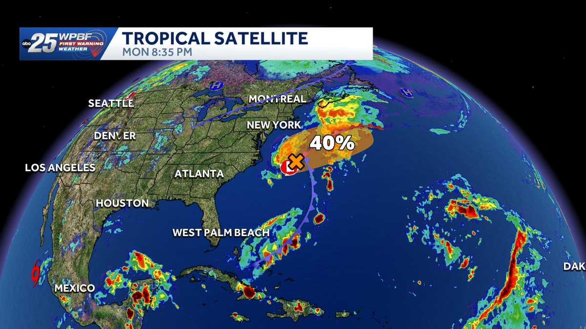 National Hurricane Center tracks Invest 93-L off U.S. East Coast
The National Hurricane Center is monitoring Invest 93-L off the coast of the United States. The NHC said in its Tropical Weather Outlook on Monday night that a storm-force non-tropical low-pressure area is attached to…
-
 National Hurricane Center eyes subtropical development near Carolinas, off SWFL coast
WINK News A new outlook was just released from the National Hurricane Center tonight, not only increasing potential tropical formation chances but giving us our latest area of investigation This spin is present near due…
-
 Hurricane center continues to track system off US East Coast
The National Hurricane Center continued Monday to keep an eye on a system off the U.S. East Coast with the potential to develop into a more dangerous storm. As of the NHC’s 8 a.m. tropical outlook, a nontropical area of…
-
 Hurricane center tracks system off East Coast
ORLANDO, Fla. — The National Hurricane Center continued Monday to keep an eye on a system off the U.S. East Coast with the potential to develop into a more dangerous storm. ORLANDO, Fla. — The National Hurricane Center…
-
 Texas Warms Back Up, West Texas Rain Chances Return by Friday | Texas Weather Roundup
Crashy the Cold Front is long gone, and Texas is warming back up. South winds and a little more humidity are back this week. Most of the state stays dry, but rain chances creep back into West Texas by Thursday and…
-
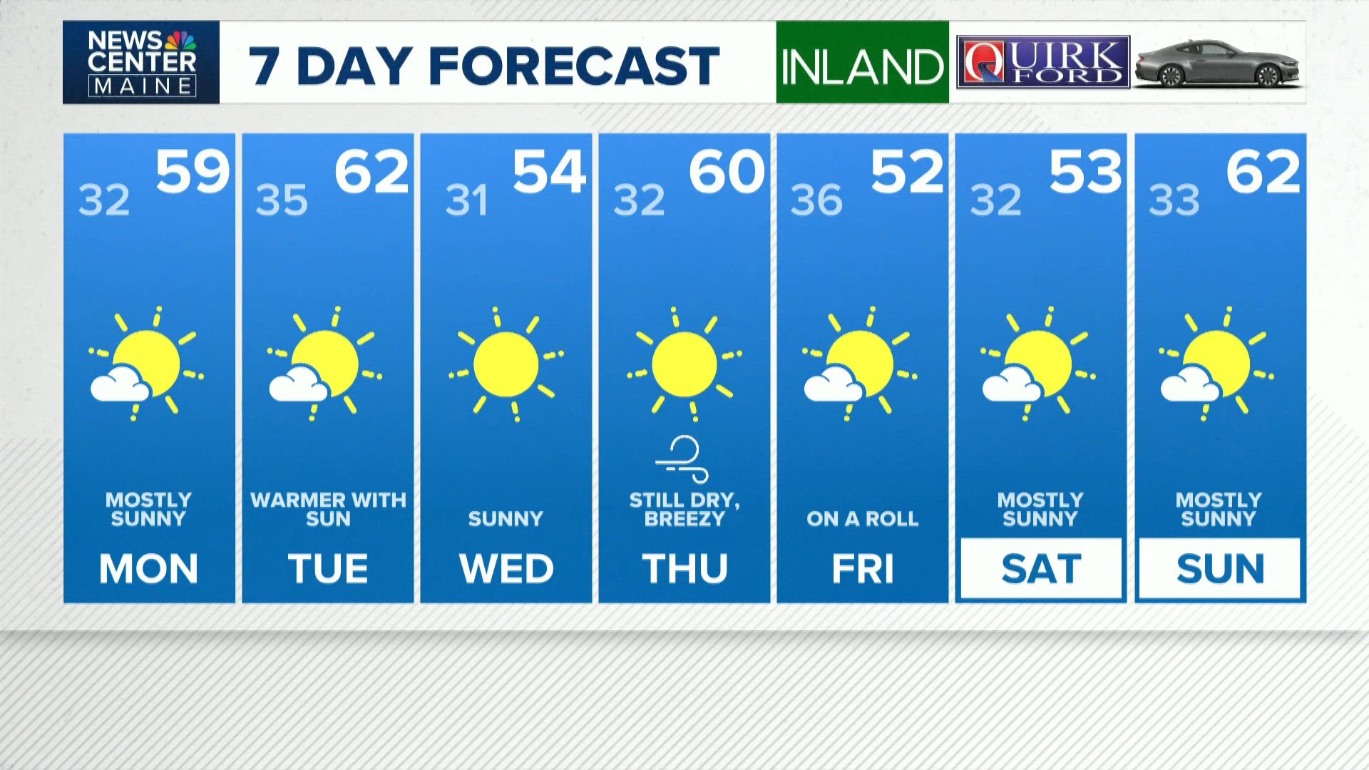 NEWS CENTER Maine Weather Video Forecast
newscentermaine.com NEWS CENTER Maine Weather Video Forecast To stream NCM on your phone, you need the NCM app. Download the NCM app Next up in 5 Example video title will go here for this video Before You Leave, Check…
-
 Mainly sunny days ahead, dry pattern holds through the week
High temperatures this week will be in the 70s and 80s, generally near or slightly above normal for mid-to-late October. No rain is expected in East Texas through the end of the week. Sunny to mostly sunny skies are in…
-
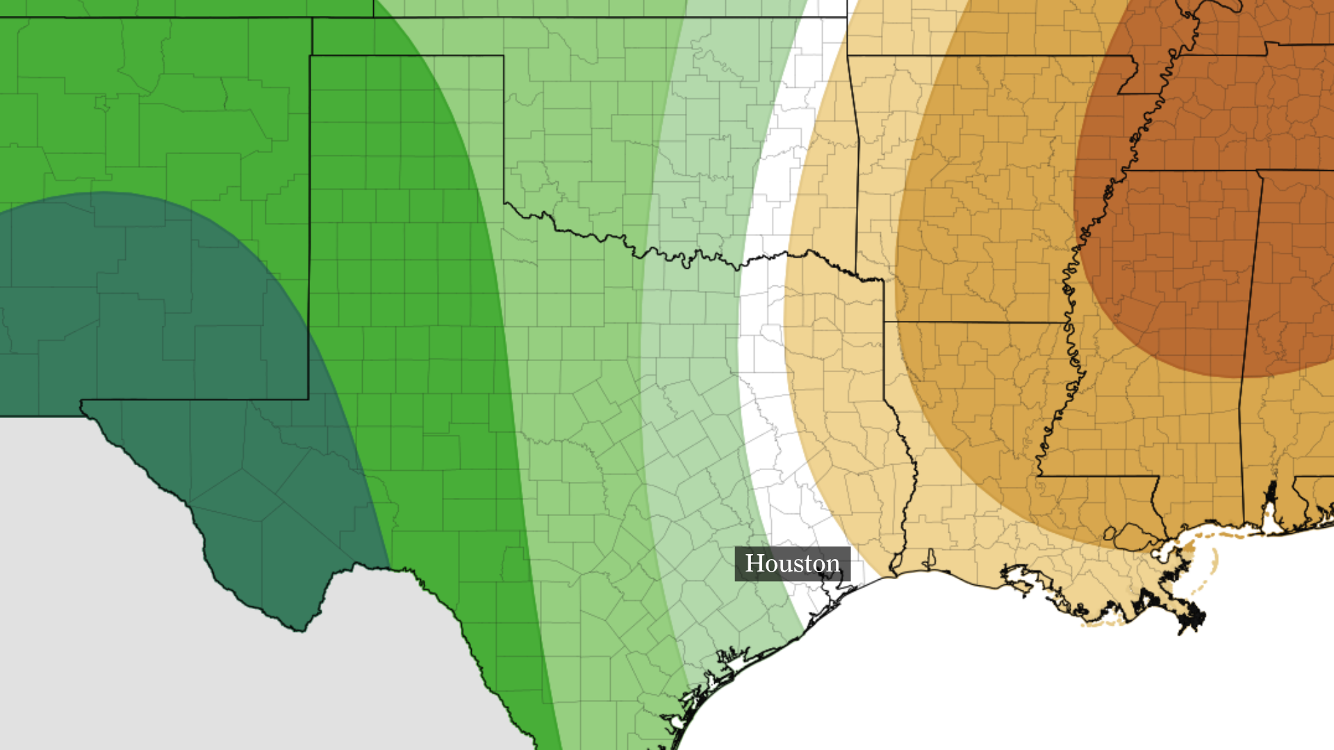 Houston drought deepens as rain chances remain slim this week
The precipitation outlook from NOAA’s Climate Prediction Center for Oct. 24-28 shows below-normal rainfall is expected near and east of Houston, with above-normal precipitation across much of the state. The Houston…
-
 Mainly Sunny Days Ahead: Dry Pattern Holds Through the Week | October 19, 2026
High temperatures this week will be in the 70s and 80s, generally near or slightly above normal for mid-to-late October. No rain is expected in East Texas through the end of the week. Sunny to mostly sunny skies are in…
-
 Dog gets the zoomies among peak New England foliage
Adorable dog gets the zoomies among colorful New England leaves The Weather Channel Adorable dog gets the zoomies among colorful New England leaves Adorable footage shows a dog bounding through piles of vibrant leaves…
Air quality
Acceptable. Unusually sensitive people should consider limiting prolonged outdoor exertion.
Forecast
- ThuModerate
- FriModerate
- SatModerate
Waco-Killeen, TX reporting area · 1 hr ago. Data from AirNow (EPA and its state, local and tribal partners); preliminary and subject to change.
Sun & moon
Nearby
Forecasters' discussion
From the National Weather Service office in FWD, issued 9 hrs ago
Key Messages
- Quiet weather will continue through the end of the week.
- A pattern shift looks to occur early to mid next week, which may result in cooler conditions and low rain chances.
Short Term
(Today and tonight) Issued at 125 AM CDT Thu Oct 22 2026
The short term is very rinse-wash-repeat, as the upper level ridge remains planted over the Southern Plains heading into the weekend. East to southeast light winds will prevail the next couple days, keeping our temperatures quite moderate with overnight lows in the 50s and highs in the 80s. A closed low spinning off the coast of California will eventually move onshore, with broad-scale troughing becoming established over the western CONUS to kick off the weekend. This will set the stage for our early next week pattern shift as the movement of the trough will displace the aforementioned ridge further east into the Gulf states. Overall, largely a tranquil and simple way to ease into the last week and a half of October.
Long Term
(Friday through Wednesday) Issued at 125 AM CDT Thu Oct 22 2026
While the northern stream of the broad trough will be more progressive and eject to the northeast, a lagging upper low will meander towards the Four Corners through the weekend. Ample moisture advection will begin across West Texas in response to the approaching disturbance, leading to increasing rain chances. Unfortunately for North and Central Texas, this activity is expected to remain displaced to our west, leaving the weekend forecast dry. We may observe some increased cloud cover and slightly lower temperatures out west in the Big Country thanks to the eastern periphery of the moisture plume, but this is largely a nothing- burger at this time.
The upper low will eventually become influenced by additional upstream disturbances, and eject northeastward into the Central Plains early next week. This will effectively flatten the ridge and shunt it even further south into the Gulf. As the disturbance moves across the Plains towards the Midwest/Great Lakes, overspreading mid- and upper-level moisture atop North and Central Texas. This increase in cloud cover would aid in keeping conditions a few degrees cooler as we head into the new work week. The movement of the disturbance would also welcome the returning potential for low rain chances to portions of the region. Latest guidance keeps better moisture generally near the Big Country and out towards West Texas, which would confine any accompanying showers and storms to those areas.
On top of the slightly cooler conditions, there remains potential for a cold front to push towards North and Central Texas early- mid week. While slightly under 50% of this morning's 12Z ensemble members had a deeper disturbance and FROPA pushing completely through on Tuesday, the rest were a bit lagging and weaker/non- existent in signal. This is where the forecast becomes much more uncertain as latest guidance is looking a bit more bearish with the frontal passage. The latest 00Z runs of the GFS and ECMWF essentially nix any FROPA. We'll need to keep an eye on the 00Z ensembles as they come in overnight to see if there is any more backing off. All this being said, there is still considerable uncertainty regarding the timing and intensity of FROPA as well as the magnitude and location of any rain chances this far out in the forecast period. Continue to keep updated with the forecast and more specific details will become clearer as we get closer in time.
Aviation
(06Z TAFS) Issued at 125 AM CDT Thu Oct 22 2026
Light east to east-southeast winds with speeds AOB 5-6 KT will prevail at all TAF sites through the next 24-30 hours. Through mid- morning (generally around 15Z), winds may become calm or variable in direction, though speeds will remain light enough to preclude any flow change or terminal impact. Occasional high-based cirrus will stream overhead. No impacts to the airports are anticipated.
Forecasts, observations and alerts in the United States come from the National Weather Service (NOAA); radar from NOAA's Multi-Radar Multi-Sensor system; satellite imagery from NASA's Global Imagery Browse Services (GIBS) and NOAA's GOES satellites; the map from the U.S. Geological Survey's National Map; air quality from AirNow (EPA and its partners); hurricane information from the National Hurricane Center; climate normals and records from NOAA's Regional Climate Centers (ACIS). Forecasts outside the United States and the UV index: MET Norway (CC BY 4.0); observations outside the U.S.: airport reports via NOAA's Aviation Weather Center. Place names: GeoNames (CC BY 4.0). Data are copied on a schedule and may lag the sources; for warnings that affect your safety, follow your local National Weather Service office and emergency officials. Weather news is drawn from the 4Search index and reflects what the press published. Terms of use.