Install
Silvis, IL 61282 Weather
Current conditions
Forecast for this hour (no station report in the last two hours)
Forecast
10-day-
Tonight
Partly cloudy, with a low around 54. Southeast wind around 5 mph.
-
Saturday
Mostly sunny. High near 76, with temperatures falling to around 74 in the afternoon. South wind 5 to 10 mph.
-
Saturday Night
Partly cloudy. Low around 53, with temperatures rising to around 55 overnight. South wind around 5 mph.
National Weather Service forecast updated 4 hrs ago.
Hourly
Hourly forecast- Now57°
- 3 AM57°
- 4 AM55°
- 5 AM55°
- 6 AM54°
- 7 AM54°
- 8 AM55°
- 9 AM57°
- 10 AM62°
- 11 AM66°
- 12 PM70°
- 1 PM73°
- 2 PM74°
- 3 PM74°
- 4 PM75°
- 5 PM74°
- 6 PM71°
- 7 PM68°
- 8 PM63°
- 9 PM62°
- 10 PM60°
- 11 PM60°
- Sun12 AM59°
- 1 AM58°
10-day forecast
Details- TonightOct 23Partly Cloudy54°
- TodayOct 24Mostly Sunny53°76°
- SunOct 25Mostly Sunny53°77°
- MonOct 26Partly Sunny50°72°
- TueOct 27Mostly Cloudy10%52°69°
- WedOct 28Mostly Sunny15%51°73°
- ThuOct 29Slight Chance Rain Showers18%45°69°
- FriOct 30Slight Chance Rain Showers22%65°
- SatOct 31Cloudy59°74°
- SunNov 1Heavy rain0.83 in55°66°
Days after the National Weather Service's seven are MET Norway's outlook, a computer model with no forecaster's review.
Radar
Full mapWeather news near Silvis
More weather news-
 Cold and Frost Tonight; Sunshine this Weekend
KWQC Cold and Frost Tonight; Sunshine this Weekend Drive-thru 7 Brew to open store in Silvis Man arrested in California waives extradition back to Iowa Hall of Famer returns to hometown for stadium dedication in his…
- Capitol Fax.com - Your Illinois News Radar » Good morning!
Thursday, Oct 22, 2026 - Posted by Isabel Miller DOMi & JD BECK, Herbie Hancock… - Barton - Thursday, Oct 22, 26 @ 8:53 am: Oh yeah, and you have to monitor comments between it all. Thank you for the lessons…
-
 Strong El Niño likely means a milder winter for northern Illinois, climatologist says
After a record tornado year, northern Illinois may get a break: forecasters favor a warmer-than-average winter as El Niño strengthens in the Pacific. El Niño refers to a warming of the Pacific Ocean’s surface that…
-
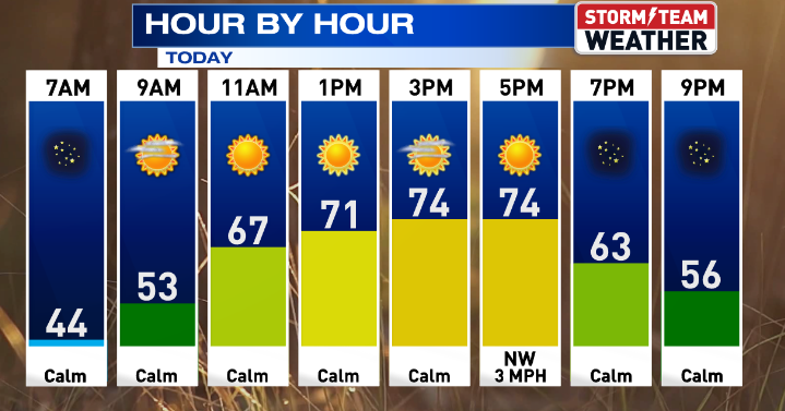 Gorgeous weather continues for Central Illinois
WEDNESDAY: Warming up with sunny skies and calm conditions. High: 75 Low: 47 THURSDAY: Above average with sunny skies. High: 76 Low: 47 FRIDAY: Nice weather continues with sunny skies. High: 76 Low: 46 SATURDAY: Some…
-
 Another beautiful day ahead for Central Illinois
DECATUR, Ill. (WAND) – If you’re looking for a reason to get outside, Tuesday is your day. A high-pressure system settling over the Midwest is bringing abundant sunshine and calm winds to Central Illinois, with…
- Central Illinois Winter Weather Outlook
The winter weather outlook for central and southeast Illinois has been released, and a detailed summary is available at this link. Some of the highlights: Current Conditions Latest Observations Daily Climate Maps…
-
 One of the year’s most pleasant weather stretches arrives in Central Illinois
DECATUR, Ill. (WAND) – A beautiful stretch of sunshine and mild temperatures is settling into the region, and it’s the perfect time to get outside and enjoy it. High pressure is taking control of the Midwest, locking in…
-
 A great week ahead for Central Illinois
WAND DECATUR, Ill. (WAND) – A wonderful weekend across Central Illinois carries into the start of the workweek. Overnight lows dip back into the upper 30s tonight with a small risk for patchy frost, though coverage will…
-
 Sunshine, chilly mornings and a big warm-up ahead for central Illinois
CENTRAL ILLINOIS (25News Now) - Fall is making an appearance across central Illinois this weekend, but don’t get too comfortable with the chilly temperatures. After a cold start on Sunday morning, sunshine will help…
-
 Overnight Frost Advisory for parts of Illinois, NW Indiana
CBS News Colorado 10pm Saturday CBS News Detroit Weekend 11pm CBS News Los Angeles Weekend 9pm CBS News Philadelphia Weekend 11pm KDKA News Weekend 11pm CBS News Texas Weekend 10pm
Air quality
Air quality is satisfactory, and air pollution poses little or no risk.
Forecast
- SatModerate
- SunModerate
- MonModerate
Rock Island-Moline, IL reporting area · 2 hrs ago. Data from AirNow (EPA and its state, local and tribal partners); preliminary and subject to change.
Sun & moon
Almanac
MonthlyMoline Area, records since 1874. Normals 1991–2020. Data from NOAA's Regional Climate Centers (ACIS).
Nearby
- Davenport 14 km
- Moline 9 km
- Rock Island 14 km
- Bettendorf 9 km
- Clinton 43 km
- Muscatine 53 km
- East Moline 3 km
- Kewanee 50 km
- Geneseo 22 km
- Eldridge 23 km
- De Witt 37 km
- Colona 5 km
Forecasters' discussion
From the National Weather Service office in DVN, issued 7 hrs ago
Key Messages
- Above normal temperatures and mostly dry conditions are forecast into early next week, with slightly cooler temperatures possible toward the middle to end of the week.
Short Term
Issued at 215 PM CDT Fri Oct 23 2026
The pleasant late October weather will continue into Saturday with well above normal temperatures and dry conditions.
A 500mb ridge axis will remain situated over the Southern Plains to Mid/Upper Mississippi Valley region, bringing partly sunny skies (passing mid to high clouds) and warm temperatures with highs in the 70s; lows tonight and Sat. night will be in the 50s. Otherwise, expect steady south-southeast winds 5-15 mph, with higher gusts at times during the afternoon hours.
Long Term
Issued at 215 PM CDT Fri Oct 23 2026
By Sunday, a strong low over Hudson Bay will dislodge high pressure from the Great Lakes, pushing it eastward. A diffuse frontal boundary from this system will sag southeastward from the northern Plains, eventually reaching the CWA by Monday and bringing a cooldown to at least part of the CWA. However, model timing still remains quite poor with regard to the front, resulting in a near 10 degree spread across the northwestern half. With this slight cooldown, highs are expected to fall into the mid 60s to mid 70s but remain above the normal highs for late October.
Looking ahead to next week, while guidance has a wide spread regarding that pattern aloft, an eventual return to a more active pattern is expected. Some models, such as the ECMWF, favor a west CONUS trough and eastern CONUS ridge, while the GFS favors a more shallow, near- zonal flow with embedded waves. While the pattern aloft remains unclear this far out, a continuation of our above-normal temperature streak appears likely through the end of October with highs generally in the 60s to 70s.
Additionally, while guidance continues to trend drier along the boundary on Monday, precipitation chances trend higher toward the end of the week. However, there is plenty of uncertainty on placement and timing of systems this far out and the transition to an active pattern may hold off until next weekend. What will favor more widespread precipitation, in addition to a more active pattern, is an increasingly moist airmass with PWATs near 0.8-1.0 inches, or around the 75-90th percentiles.
Aviation
Issued at 604 PM CDT Fri Oct 23 2026
Winds under 10 knots and from the east southeast to southeast through 14z/24. After 14z/24 deeper mixing will begin turnings winds more southerly around 10 knots with gusts up to 20 knots.
Forecasts, observations and alerts in the United States come from the National Weather Service (NOAA); radar from NOAA's Multi-Radar Multi-Sensor system; satellite imagery from NASA's Global Imagery Browse Services (GIBS) and NOAA's GOES satellites; the map from the U.S. Geological Survey's National Map; air quality from AirNow (EPA and its partners); hurricane information from the National Hurricane Center; climate normals and records from NOAA's Regional Climate Centers (ACIS). Forecasts outside the United States and the UV index: MET Norway (CC BY 4.0); observations outside the U.S.: airport reports via NOAA's Aviation Weather Center. Place names: GeoNames (CC BY 4.0). Data are copied on a schedule and may lag the sources; for warnings that affect your safety, follow your local National Weather Service office and emergency officials. Weather news is drawn from the 4Search index and reflects what the press published. Terms of use.