Install
West Liberty, KY 41472 Weather
Current conditions
Forecast for this hour (no station report in the last two hours)
Forecast
10-day-
Tonight
Patchy fog after midnight. Clear. Low around 38, with temperatures rising to around 40 overnight. Northeast wind around 1 mph.
-
Saturday
Patchy fog before 10am. Sunny, with a high near 70. East southeast wind around 1 mph.
-
Saturday Night
Areas of fog after midnight. Mostly clear. Low around 37, with temperatures rising to around 39 overnight. Northeast wind around 1 mph.
National Weather Service forecast updated 9 hrs ago.
Hourly
Hourly forecast- Now41°
- 5 AM40°
- 6 AM40°
- 7 AM39°
- 8 AM38°
- 9 AM42°
- 10 AM49°
- 11 AM57°
- 12 PM63°
- 1 PM66°
- 2 PM69°
- 3 PM70°
- 4 PM70°
- 5 PM70°
- 6 PM66°
- 7 PM61°
- 8 PM55°
- 9 PM51°
- 10 PM49°
- 11 PM46°
- Sun12 AM45°
- 1 AM44°
- 2 AM43°
- 3 AM42°
10-day forecast
Details- TonightOct 23Clear then Patchy Fog38°
- TodayOct 24Patchy Fog then Sunny37°70°
- SunOct 25Areas Of Fog then Sunny33°70°
- MonOct 26Areas Of Fog then Sunny42°71°
- TueOct 27Mostly Sunny45°70°
- WedOct 28Partly Sunny46°72°
- ThuOct 29Mostly Sunny45°73°
- FriOct 30Mostly Sunny70°
- SatOct 31Cloudy47°78°
- SunNov 1Rain0.12 in57°75°
Days after the National Weather Service's seven are MET Norway's outlook, a computer model with no forecaster's review.
Radar
Full mapWeather news in Kentucky
More weather news-
 Calm, quiet conditions persist in South-Central Kentucky
Pleasant conditions for the region continue for the weekend and the start of next week, but a disturbance is beginning to show up in forecast models... This weather pattern will remain unchanged for the weekend and next…
-
 Wonderful weather continues for South-Central Kentucky
BOWLING GREEN, Ky. (WBKO) - We’ll see another spectacular day for your Thursday, with lots of sunshine and comfortable conditions. This surface high will stick around for the next week or so, meaning this fair weather…
- A meteor shower from Halley’s Comet peaks over Kentucky tonight. When to see it
A full “hunter’s moon” will soon peak over Kentucky, along with an upcoming meteor shower from Halley’s Comet. The Orionid meteor shower will peak Wednesday night into Thursday morning, according to NASA. “The Orionids…
- Here’s what the Super El Niño has in store for Kentucky this winter
Lexington Herald Leader Forecasters are pointing to a colder-than-normal winter for Kentucky, with a strengthening El Niño potentially sharpening the chill. Here’s a quick look at what Lexington and the broader region…
-
 Farmer’s Almanac Drops Thanksgiving Forecast and If It’s Correct, Folks in Indiana & Kentucky Should Get Their Snow Shovels Ready
In the past several years, Thanksgiving weather has been pretty warm. I don't recall the last time I saw snow on Thanksgiving in the Tri-State. We even spent Thanksgiving outside like a picnic a few years ago because it…
- Kentucky Winter 2026-27: Louisville, 13.89-Inch Snow History
NOAA's historical El Niño snowfall analysis from 1950–2009 shows mixed snowfall departures across Kentucky and neighboring states, without establishing a consistent statewide increase or decrease. Why El Niño Doesn't…
-
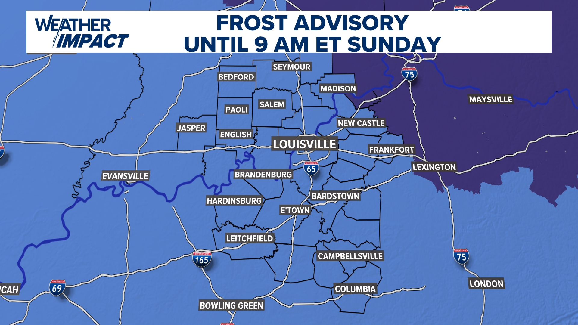 Frost Advisory Saturday night for Kentucky, southern Indiana
WHAS11 Frost Advisory Saturday night for Kentucky, southern Indiana Cover any sensitive vegetation in a cloth and bring in potted plants. The last time Louisville has a freeze was March 18, 2026. The normal first frost…
Air quality
Acceptable. Unusually sensitive people should consider limiting prolonged outdoor exertion.
Hazard, KY reporting area · 1 hr ago. Data from AirNow (EPA and its state, local and tribal partners); preliminary and subject to change.
Sun & moon
Almanac
MonthlyCave Run Lake, records since 1904. Normals 1991–2020. Data from NOAA's Regional Climate Centers (ACIS).
Nearby
- Morehead 33 km
- Paintsville 41 km
- Grayson 53 km
- Prestonsburg 51 km
- Stanton 53 km
- Jackson 42 km
Forecasters' discussion
From the National Weather Service office in JKL, issued 30 min ago
Key Messages
- Dry weather persists into next week, with mostly clear skies, mild days, and chilly nights expected.
- Light, patchy frost may develop late tonight and again on Sunday and Monday nights in sheltered valleys away from lakes, rivers, and larger creeks. Fog is more likely near those bodies of water.
Long Term
(Sunday night through Friday) Issued at 420 AM EDT SAT OCT 24 2026
The long-term period opens Sunday evening with the stubborn 500 hPa ridge of recent days still anchored over the region, its positively-tilted axis stretching from the Ark-La-Tex northeastward to over southern Quebec. Subsidence on the eastern side of the ridge continues to maintain expansive surface high pressure (with an ~1032 mb center over the Delmarva) from the Mid/Lower Mississippi Valley northeastward to over the Atlantic south of the Maritime Provinces. Well to our north, a trough is passing over the Hudson Bay region, supporting an ~985 mb surface low over the northern tip of Quebec. The low's cold front trails south across the province to near Ottawa and then southwest across the Upper Great Lakes and Central Plains to another weaker low along the lee of the Colorado/New Mexico Rockies. That second surface low is associated with a shortwave ejecting out of mean 500 hPa troughing found along and west of the Rockies, anchored by a vertically stacked parent low just off the Pacific Northwest coast.
The ridge aloft will flatten appreciably on Monday and Tuesday as the aforementioned cold front sags southeast and eventually stalls north of the Ohio River. Meanwhile, the upstream shortwave and surface low eject northeastward, pulling the boundary back to the north by Wednesday. That shortwave as well as the lingering ridge over the eastern CONUS will flatten and fill on Wednesday and Thursday. A small minority of the 24/00Z LREF members maintain a strong enough shortwave trough to sensibly impact the Lower Ohio Valley. However, a vast majority of solutions maintain resilient ridging as the 500 hPa axis shifts east of the Commonwealth, which would preclude anything more than periods of passing mid and high-level cloud cover. The number of ensemble members favoring 500 hPa troughing developing over the Ohio Valley grows on Friday, though ~61/100 LREF members still cluster towards lingering ridging. Materially, this suggests that upper-level ridging is still favored to remain intact and keep dry weather in place over eastern Kentucky through the long-term period, but forecast confidence does decrease noticeably by Friday. There are still no rain chances in the long-term forecast at this time.
Aside from increased cloud cover midweek, the pattern should continue to favor fair weather with sunny, mild days, and cool, clear nights. Frost will be possible again in the colder sheltered hollows on Sunday and Monday nights. Fog will also continue to be a nightly phenomenon for the typical favored valley locations. Otherwise, look for high temperatures to range in the lower to middle 70s while sharp ridge-valley splits develop each night, with minimum temperatures in the mid to upper 30s in the coldest hollows to the mid to upper 40s on thermal belt ridges. The exception could be Tuesday and Wednesday nights when more extensive cloud cover could keep nighttime temperatures a tad milder.
Aviation
(For the 06Z TAFS through 06Z Saturday night) ISSUED AT 158 AM EDT SAT OCT 24 2026
VFR conditions are currently in place at all TAF sites, but recent satellite imagery reveals radiation fog developing in the valleys of Eastern Kentucky. This fog should deepen in the coming hours, especially in places closer to the area's lakes, rivers, and streams. KSYM and KSME are the TAF sites most likely to see vsby reductions from this fog. The former has experienced fog- driven MVFR reductions around dawn for the past few days, and the same weather pattern remains in place across the area. Persistence forecasting suggests that a TEMPO group around dawn will sufficiently capture these potential vsby reductions. KSME's proximity to Lake Cumberland could bolster the fog potential there, so a TEMPO group has also been introduced there with the 06z TAF package. Once the fog mixes out by mid-morning, all terminals are forecast to return to and/or remain in VFR conditions through the end of the forecast period. A passing disturbance aloft could introduce a few high clouds in the latter half of the period, but these will not be enough to produce meaningful ceilings. Expect light and variable surface winds to persist through the end of the period.
Jkl Watches
None.
Forecasts, observations and alerts in the United States come from the National Weather Service (NOAA); radar from NOAA's Multi-Radar Multi-Sensor system; satellite imagery from NASA's Global Imagery Browse Services (GIBS) and NOAA's GOES satellites; the map from the U.S. Geological Survey's National Map; air quality from AirNow (EPA and its partners); hurricane information from the National Hurricane Center; climate normals and records from NOAA's Regional Climate Centers (ACIS). Forecasts outside the United States and the UV index: MET Norway (CC BY 4.0); observations outside the U.S.: airport reports via NOAA's Aviation Weather Center. Place names: GeoNames (CC BY 4.0). Data are copied on a schedule and may lag the sources; for warnings that affect your safety, follow your local National Weather Service office and emergency officials. Weather news is drawn from the 4Search index and reflects what the press published. Terms of use.