Install
Dickson, TN 37055 Weather
Current conditions
Observed at Dickson Municipal Airport · 53 min ago
Forecast
10-day-
Overnight
Clear, with a low around 47. North northeast wind around 0 mph.
-
Thursday
Sunny, with a high near 75. North northeast wind 0 to 5 mph.
-
Thursday Night
Clear, with a low around 45. Northeast wind around 5 mph.
National Weather Service forecast updated 4 hrs ago.
Hourly
Hourly forecast- Now48°
- 6 AM47°
- 7 AM47°
- 8 AM49°
- 9 AM55°
- 10 AM63°
- 11 AM67°
- 12 PM70°
- 1 PM73°
- 2 PM74°
- 3 PM74°
- 4 PM75°
- 5 PM73°
- 6 PM68°
- 7 PM64°
- 8 PM58°
- 9 PM56°
- 10 PM55°
- 11 PM53°
- Fri12 AM52°
- 1 AM51°
- 2 AM50°
- 3 AM48°
- 4 AM47°
10-day forecast
Details- TonightOct 21Clear47°
- TodayOct 22Sunny45°75°
- FriOct 23Sunny46°73°
- SatOct 24Sunny46°75°
- SunOct 25Sunny47°74°
- MonOct 26Mostly Sunny47°73°
- TueOct 27Partly Sunny49°73°
- WedOct 28Mostly Sunny72°
- ThuOct 29Mostly sunny46°70°
- FriOct 30Sunny48°75°
Days after the National Weather Service's seven are MET Norway's outlook, a computer model with no forecaster's review.
Radar
Full mapWeather news near Dickson
More weather news-
 10/19/26: Clear Skies and 61.3 – High of 70.7, Low of 41.5, Winds Up to 11.2, No Precipitation
Weather Today in Dickson County: Clear sky, high 71°F, low 42°F. Winds 5 mph. 7-day outlook inside. Current conditions in Dickson County at 7:00 PM show a temperature of 61.3°F with a light wind from the southeast at…
-
 10/17/26: Clear Skies Tonight and a High of 62; Temp Now 54 with Light Winds
Dickson County Source At 7:00 PM in Dickson County, the current temperature is 54.3°F with a light wind from the southeast at 5.7 mph. Conditions are clear, and there has been no recorded precipitation. Earlier today…
-
 10/17/26: Clear Skies and Mild Temperatures with a High of 60.8, Low of 46.6; Winds Up to 13.5 mph
Weather Today in Dickson County: Overcast, high 61°F, low 47°F. Winds 20 mph. 7-day outlook inside. Currently, in Dickson County at 2:50 PM, the temperature is 60.8°F with a wind speed of 12.3 mph from the northwest…
-
 Thunderstorms and heavy rain forecast for 13 states, KL and Putrajaya until 5pm
PETALING JAYA: The Malaysian Meteorological Department (MetMalaysia) has issued a warning of thunderstorms, heavy rain and strong winds across 13 states and two Federal Territories, effective until 5pm on Saturday (Oct…
-
 Alert Level 3 in parts of South-East Asia
PETALING JAYA: The Asean Specialised Meteorological Centre (ASMC) has issued Alert Level 3 for southern South-East Asia, signalling a high risk of severe transboundary haze as dry weather and widespread hotspots…
-
 10/17/26: Mainly Clear with a High of 60 and Winds Up to 16 MPH; Morning Temp at 48
Weather Today in Dickson County: Overcast, high 60°F, low 46°F. Winds 18 mph. 7-day outlook inside. Current conditions in Dickson County are 47.7°F with winds at 11 mph. The skies are mainly clear, and there has been no…
-
 10/16/26: Partly Cloudy, High 75, Low 48, Current Temp 52, Winds 7, Precip Chance 11%
Weather Today in Dickson County: Overcast, high 75°F, low 48°F. Winds 12 mph. 7-day outlook inside. At 7:01 PM in Dickson County, the current temperature is 52.2°F with a light wind speed of 7.3 mph. There has been no…
-
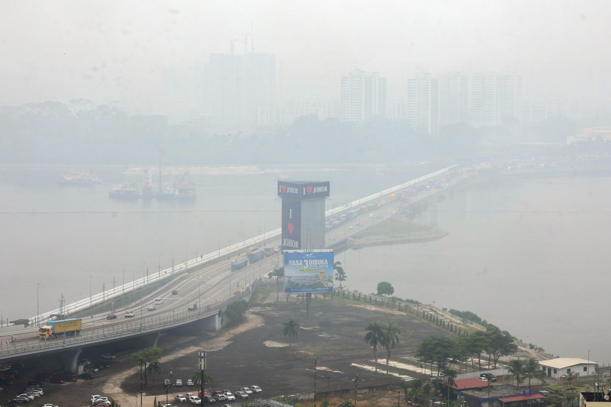 Haze: Pasir Gudang, Larkin hit 'very unhealthy' API reading, 27 other areas in 'unhealthy' range as at 4pm
According to APIMS, six other areas in Johor are in the unhealthy API range: Pengerang with a reading of 181, Batu Pahat and Kota Tinggi (both 171), Kluang (168), Tangkak (159) and Segamat (156). In Selangor, six areas…
- 10/15/26: Clear Skies Tonight with Low of 75 and Wind at 7.7 mph Following a Sunny Day High of 90.3
Dickson County Source In Dickson County, the current temperature is 81.3°F with a light wind from the east at 5.8 mph. The sky is clear, and there has been no precipitation recorded. Earlier today, temperatures reached…
-
 10/15/26: Clear Skies and a High of 90; Tonight’s Low Near 74 with Light Winds
Weather Today in Dickson County: Partly cloudy, high 90°F, low 70°F. Winds 17 mph. 7-day outlook inside. At 2:50 PM in Dickson County, the temperature is 89.6°F with a wind speed of 10.7 mph. There is currently no…
Air quality
Air quality is satisfactory, and air pollution poses little or no risk.
Forecast
- ThuGood (50)
- FriModerate (51)
Nashville, TN reporting area · 1 hr ago. Data from AirNow (EPA and its state, local and tribal partners); preliminary and subject to change.
Sun & moon
Almanac
MonthlyDickson, records since 1900. Normals 1991–2020. Data from NOAA's Regional Climate Centers (ACIS).
Nearby
- Nashville 56 km
- Clarksville 51 km
- Franklin 51 km
- Brentwood 56 km
- Spring Hill 56 km
- Fairview 27 km
- Forest Hills 50 km
- Oak Hill 55 km
- Ashland City 37 km
- Coopertown 56 km
- Pleasant View 48 km
- Waverly 36 km
Forecasters' discussion
From the National Weather Service office in OHX, issued 18 hrs ago
Key Messages
Updated at 1107 AM CDT Wed Oct 21 2026
- Mild, sunny days and cool, clear nights will continue for the foreseeable future.
- No rain is expected for at least the next 7 days, and likely longer.
- Drought conditions are going to worsen.
Short Term
(Rest of today through Thursday) Issued at 1107 AM CDT Wed Oct 21 2026
Ridging continues to be the dominant feature of our forecast period, with sunny and warm conditions persisting into the weekend. For the next few mornings, patchy dense fog will be possible across Middle Tennessee. It looks like Thursday morning has the most potential to be more widespread than localized, so use caution on your morning commutes. Otherwise, enjoy the sunshine and milder (yet still above- average) temperatures for the next few days.
Long Term
(Thursday Night through next Wednesday) Issued at 1107 AM CDT Wed Oct 21 2026
Dry and sunny conditions continue into mid-week next week as surface high pressure holds its ground in the eastern US. Stable temperatures in the 70s for highs and 40s for morning lows will persist through the end of the forecast period. No notable chances for precipitation either, which means the drought is only going to get worse across the mid-state.
Aviation
(12Z TAFS) Issued at 625 AM CDT Wed Oct 21 2026
Patchy fog possible at CSV and SRB through ~13z. Otherwise, another clear/VFR day with winds becoming NNE at 5-7 kts.
Forecasts, observations and alerts in the United States come from the National Weather Service (NOAA); radar from NOAA's Multi-Radar Multi-Sensor system; satellite imagery from NASA's Global Imagery Browse Services (GIBS) and NOAA's GOES satellites; the map from the U.S. Geological Survey's National Map; air quality from AirNow (EPA and its partners); hurricane information from the National Hurricane Center; climate normals and records from NOAA's Regional Climate Centers (ACIS). Forecasts outside the United States and the UV index: MET Norway (CC BY 4.0); observations outside the U.S.: airport reports via NOAA's Aviation Weather Center. Place names: GeoNames (CC BY 4.0). Data are copied on a schedule and may lag the sources; for warnings that affect your safety, follow your local National Weather Service office and emergency officials. Weather news is drawn from the 4Search index and reflects what the press published. Terms of use.