Install
Ashland City, TN Weather
Current conditions
Observed at Nashville, Nashville International Airport · 39 min ago
Forecast
10-day-
Monday
Patchy fog before 10am. Mostly sunny, with a high near 75. West southwest wind around 0 mph.
-
Monday Night
Areas of fog after 1am. Partly cloudy, with a low around 47. Wind around 0 mph.
-
Tuesday
Areas of fog before 9am. Mostly sunny, with a high near 77. East southeast wind around 0 mph.
National Weather Service forecast updated 21 hrs ago.
Hourly
Hourly forecast- Now63°
- 11 AM68°
- 12 PM71°
- 1 PM73°
- 2 PM74°
- 3 PM74°
- 4 PM75°
- 5 PM73°
- 6 PM70°
- 7 PM66°
- 8 PM60°
- 9 PM57°
- 10 PM56°
- 11 PM54°
- Tue12 AM52°
- 1 AM51°
- 2 AM49°
- 3 AM49°
- 4 AM48°
- 5 AM48°
- 6 AM47°
- 7 AM47°
- 8 AM49°
- 9 AM55°
10-day forecast
Details- TonightOct 25Areas Of Fog47°
- TodayOct 26Patchy Fog then Mostly Sunny47°75°
- TueOct 27Areas Of Fog then Mostly Sunny49°77°
- WedOct 28Partly Sunny48°76°
- ThuOct 29Sunny49°78°
- FriOct 30Mostly Sunny57°79°
- SatOct 31Slight Chance Rain Showers74%61°77°
- SunNov 1Rain Showers Likely71%75°
- MonNov 2Cloudy0.03 in61°73°
- TueNov 3Cloudy0.15 in59°75°
Days after the National Weather Service's seven are MET Norway's outlook, a computer model with no forecaster's review.
Radar
Full mapWeather news near Ashland City
More weather news-
 Halloween weekend forecast for Middle Tennessee
NASHVILLE, Tenn. (WSMV) - Clouds will begin increasing on Friday in the Midstate. Our next rain system will arrive Halloween weekend. Sure, the timing isn’t great as plenty of little ones and their parents will be going…
-
 First Alert Forecast: Super looking week of weather, then rain
NASHVILLE, Tenn. (WSMV) - Badly needed rain will arrive late Saturday. Clear, cool weather is expected overnight. We’ll have temperatures in the 40s by sunrise, Monday. Monday afternoon will be sunny and warm once…
-
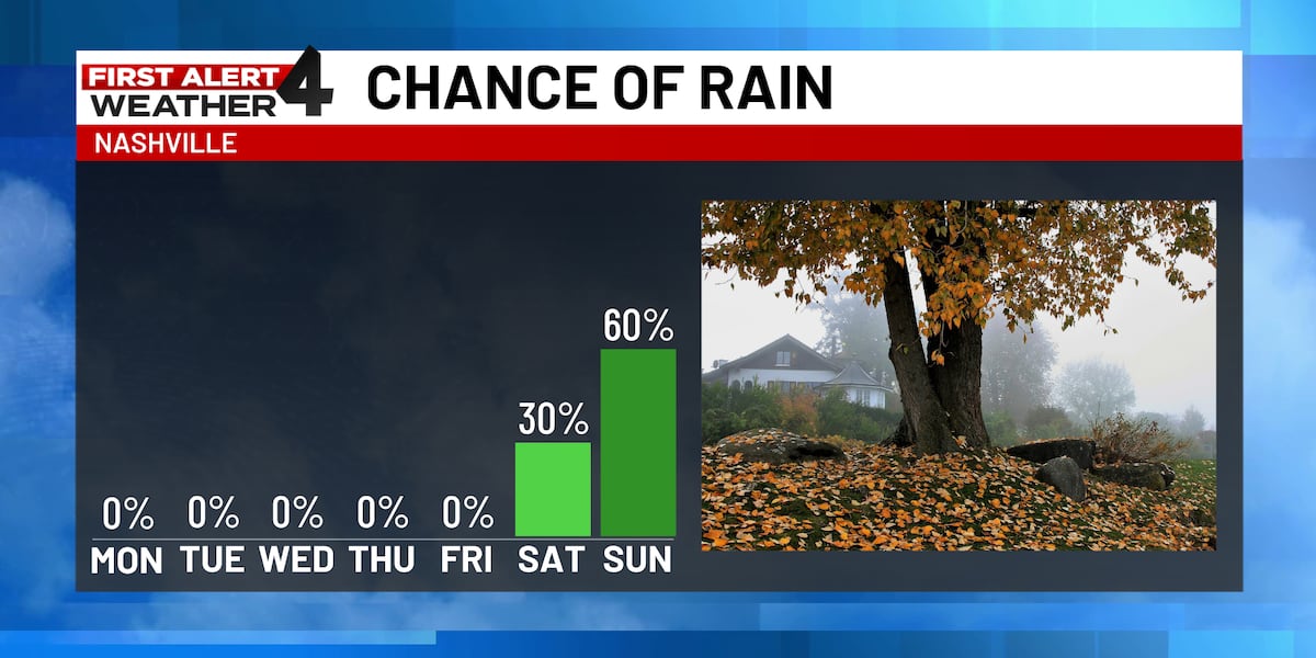 First Alert Forecast: Dry, sunny weather continues; rain returns Halloween weekend
The warm and sunny weather will stick around through the rest of this week. Much needed rain looks to return Halloween weekend, but will it impact trick-or-treating? NASHVILLE, Tenn. (WSMV) - The warm and sunny weather…
- Dallas Weather Forecast Sunny 86-Degree Saturday
Sunshine should push the city toward a high near 86, with southeast winds between 0 and 10 mph and no rain expected. The National Weather Service expects another quiet night, with partly cloudy skies and a low near 62…
-
 First Alert Forecast: Staying dry this weekend
NASHVILLE, Tenn. (WSMV) - We’re locked in a stagnant pattern that won’t budge, and it’s keeping our weather mild and dry. There’s little to no changes in our weather over the next several days. Plan for another clear…
-
 First Alert Forecast: Fantastic weekend weather on tap for Midstate
NASHVILLE, Tenn. (WSMV) - Outdoor plans look great for the entire weekend across the Midstate. Another easy night with temperatures gradually dipping into the upper 60 through the early evening with morning lows…
-
 First Alert Forecast: Beautiful weather will give way to a significant rain system
NASHVILLE, Tenn. (WSMV) - Slightly warmer weather develops on Saturday. Clear and pleasant this evening with temperatures in the 60s. After a chilly start, Friday afternoon will warm nicely through the 70s. Low, 47…
-
 First Alert Forecast: Dry, warm afternoons continue across Middle Tennessee
NASHVILLE, Tenn. (WSMV) - More of the same as the seasonal, dry weather continues across the Midstate. For life-saving weather alerts, customized messages on conditions and forecasts, and videos detailing upcoming…
-
 2026 has been one of the driest years ever for Middle Tennessee
WSMV 2026 has been one of the driest years ever for Middle Tennessee First Alert Weather Plus PMC, JamJuice launch $5 per day parking for musicians in Nashville Driver, Franklin County deputy injured in crash while…
-
 First Alert Forecast: Sunny days as temperatures inch upward
NASHVILLE, Tenn. (WSMV) - Watch for isolated patches of fog overnight. Mainly clear and pleasant this evening with temperatures falling from the 60s back into the 50s. Thursday will bring a few clouds and more beautiful…
Air quality
Acceptable. Unusually sensitive people should consider limiting prolonged outdoor exertion.
Forecast
- MonModerate (51)
- TueModerate (52)
Nashville, TN reporting area · 1 hr ago. Data from AirNow (EPA and its state, local and tribal partners); preliminary and subject to change.
Sun & moon
Almanac
MonthlySpringfield Experiment Station, records since 1942. Normals 1991–2020. Data from NOAA's Regional Climate Centers (ACIS).
Nearby
- Nashville 28 km
- Clarksville 39 km
- Franklin 43 km
- Hendersonville 40 km
- Smyrna 59 km
- Brentwood 37 km
- Hermitage 41 km
- Spring Hill 59 km
- La Vergne 52 km
- Gallatin 57 km
- Mount Juliet 50 km
- Goodlettsville 32 km
Forecasters' discussion
From the National Weather Service office in OHX, issued 5 hrs ago
Key Messages
Updated at 545 AM CDT Mon Oct 26 2026
- Warm, sunny days and cool, clear nights will continue through the work week.
- No rain is expected through at least Friday night, but the weather pattern will begin to shift next weekend.
- Drought conditions will continue to worsen in the near-term.
Short Term
(Tonight through Tuesday Night) Issued at 1024 PM CDT Sun Oct 25 2026
A surface ridge bisects Middle Tennessee this evening, with winds having gone light or calm across the region. This means our evening temperatures are dropping quickly given the perfect radiation cooling conditions. Once again, widespread fog is expected overnight as dew point spreads shrink to near zero. And tomorrow looks to be a carbon copy of today. Afternoon RH values will remain quite low, so there is some concern about an elevated fire danger given that available fuels continue to dry out, but surface winds will remain light throughout the week, so this will prevent the danger from become anything more than marginal.
Long Term
(Wednesday through next Monday) Issued at 1024 PM CDT Sun Oct 25 2026
Temperatures will gradually warm throughout the week as high pressure maintains its dominance across Middle Tennessee. By week's end, the upper ridge will flatten out, and this will enable us to transition a more unsettled weather pattern by the weekend. At this time, it appears that our next rain chances will arrive on Halloween, but better rain chances will develop Saturday night and Sunday and continue into at least the early part of next week. So while we expect drought continues to worsen even more this week, perhaps the increased probability of meaningful rainfall can at least put the breaks on any additional worsening after this week.
Aviation
(12Z TAFS) Issued at 545 AM CDT Mon Oct 26 2026
VFR conditions will continue to prevail for the taf period. Winds will be less than 5 kts and variable in direction.
Forecasts, observations and alerts in the United States come from the National Weather Service (NOAA); radar from NOAA's Multi-Radar Multi-Sensor system; satellite imagery from NASA's Global Imagery Browse Services (GIBS) and NOAA's GOES satellites; the map from the U.S. Geological Survey's National Map; air quality from AirNow (EPA and its partners); hurricane information from the National Hurricane Center; climate normals and records from NOAA's Regional Climate Centers (ACIS). Forecasts outside the United States and the UV index: MET Norway (CC BY 4.0); observations outside the U.S.: airport reports via NOAA's Aviation Weather Center. Place names: GeoNames (CC BY 4.0). Data are copied on a schedule and may lag the sources; for warnings that affect your safety, follow your local National Weather Service office and emergency officials. Weather news is drawn from the 4Search index and reflects what the press published. Terms of use. How to use Weather