Install
Ozark, AL 36361 Weather
Current conditions
Forecast for this hour (no station report in the last two hours)
Forecast
10-day-
Friday
Sunny, with a high near 77. East northeast wind 5 to 10 mph.
-
Friday Night
Clear, with a low around 48. Northeast wind around 5 mph.
-
Saturday
Sunny, with a high near 74. Northeast wind 5 to 15 mph.
National Weather Service forecast updated 8 hrs ago.
Hourly
Hourly forecast- Now74°
- 1 PM76°
- 2 PM77°
- 3 PM77°
- 4 PM76°
- 5 PM75°
- 6 PM71°
- 7 PM63°
- 8 PM61°
- 9 PM59°
- 10 PM57°
- 11 PM55°
- Sat12 AM54°
- 1 AM53°
- 2 AM51°
- 3 AM50°
- 4 AM50°
- 5 AM49°
- 6 AM48°
- 7 AM48°
- 8 AM51°
- 9 AM58°
- 10 AM63°
- 11 AM67°
10-day forecast
Details- TonightOct 22Clear50°
- TodayOct 23Sunny48°77°
- SatOct 24Sunny52°74°
- SunOct 25Sunny52°74°
- MonOct 26Sunny46°76°
- TueOct 27Sunny47°76°
- WedOct 28Mostly Sunny47°75°
- ThuOct 29Sunny77°
- FriOct 30Cloudy64°77°
- SatOct 31Rain0.19 in64°77°
Days after the National Weather Service's seven are MET Norway's outlook, a computer model with no forecaster's review.
Radar
Full mapWeather news near Ozark
More weather news-
 News4 First Alert Weather Extra: Mid-Late October Record Lows
WTVY News4 First Alert Weather Extra: Mid-Late October Record Lows ‘It was like there had been a war out here’: Ozark lake closed after Hurricane Isaias News4 First Alert Weather Extra | Weather In Words: Favoring the…
-
 FIRST ALERT WEATHER: Mild Tuesday despite clouds around
The Ozarks will continue its mild pattern through the rest of the week. That applies for today despite plenty of clouds and a chance for some sprinkles this afternoon and evening. An upper-level low pressure system…
-
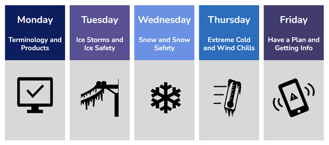 NWS Asks Public to Prepare for Winter November 2nd
Ozark Radio News Springfield, MO. – The National Weather Service is coming up on their annual observance of Winter Weather Preparedness Week, taking place November 2nd through the 6th. This week, as the name implies, is…
-
 FIRST ALERT WEATHER: Cloudy start, low-mid 70s Tuesday
KY3 FIRST ALERT WEATHER: Cloudy start, low-mid 70s Tuesday Looking at the City of Springfield’s ‘Help Starts Here’ panhandling sign campaign Ozarks Unsolved: 19 years later, Hollister, Mo., Police reopen search for…
-
 FIRST ALERT WEATHER: Mild Monday followed by a gradual warming trend
A weak upper-level wave moving out of Denver will influence our weather through Tuesday, but the Ozarks can expect mainly dry conditions and mild temperatures for the next several days. After a cool start this morning…
-
 FIRST ALERT WEATHER: Cool Sunday night & mild for Monday
Sunday delivered what Mother Nature promised: cold morning lows in the middle 30s to lower 40s, followed by a mild and sunny afternoon with highs in the middle to upper 60s. That pattern is about to shift into something…
-
 FIRST ALERT WEATHER: Sunday starts cold & ends mild
After a chilly Saturday morning in the 30s and lower 40s, the Ozarks enjoyed a pleasant afternoon with highs climbing into the upper 50s to middle 60s. The nice weather is sticking around for one more night — but with a…
-
 Frost flowers: how to find ice ribbons on plants at dawn
The Weather Channel Look down this weekend: frost flowers could bloom at your feet A hard freeze after a warm week could grow frost flowers, thin curling ribbons of ice, on plant stems across the Ozarks and the Ohio and…
-
 FIRST ALERT WEATHER: Blustery, Chilly Friday as Clouds Linger Behind Cold Front
KY3 FIRST ALERT WEATHER: Blustery, Chilly Friday as Clouds Linger Behind Cold Front KY3 Digital Extra: What's next for former Missouri Attorney General Andrew Bailey Show-Me-State Politics: Good news for farmers…
- Could Alabama see perfect Thanksgiving weather? Almanac says yes
Alabama families planning to gather around the Thanksgiving table may have one less thing to worry about this year: the weather. If the Farmers' Almanac's latest forecast holds, the holiday week could bring a welcome…
Air quality
Acceptable. Unusually sensitive people should consider limiting prolonged outdoor exertion.
Forecast
- FriGood
- SatGood
- SunGood
Holmes, Jackson, and Washington Counties, FL reporting area · 2 hrs ago. Data from AirNow (EPA and its state, local and tribal partners); preliminary and subject to change.
Sun & moon
Almanac
MonthlyCairns Field Fort Rucker, records since 1954. Normals 1991–2020. Data from NOAA's Regional Climate Centers (ACIS).
Nearby
Forecasters' discussion
From the National Weather Service office in TAE, issued 4 hrs ago
Key Messages
Updated at 839 AM EDT Fri Oct 23 2026
- Elevated fire danger across southeast Alabama and southwest Georgia due to low relative humidity and increasing winds this afternoon.
- Windy conditions are expected this weekend, following passage of a dry back door front late Friday. Northeast wind gusts will peak in the 25-35 mph range, possibly higher, during the day on Sunday.
- Hazardous marine conditions are expected from Friday evening through Monday due to strong and near-gale northeast winds. The windiest conditions will be on Saturday night and Sunday morning, when frequent gusts around gale-force are expected. Small Craft Advisories are in effect beginning tonight for all the open Gulf waters.
Update
Issued at 839 AM EDT Fri Oct 23 2026
No changes are planned at this time from the discussion below.
Aviation
(12Z TAFS) Issued at 634 AM EDT Fri Oct 23 2026
VFR conditions are expected to prevail through the period with clear skies. Northeast winds will increase to around 10 knots during the day on Friday with occasional 15 knot gusts.
Marine
Issued at 220 AM EDT Fri Oct 23 2026
Hazardous marine conditions begin tonight as a backdoor cold front clears the marine area. Moderate northeasterly breezes today will freshen tonight then become strong Saturday as the pressure gradient tightens between a high over the mid-Atlantic and a low over the Bahamas. These strong northeasterly breezes will persist through Sunday with some gusts near gale-force possible, especially far offshore, before relaxing to fresh breezes Monday into Tuesday. A Small Craft Advisory goes into effect for all open Gulf waters beginning this evening and continues through at least Monday evening. Seas will become rough, building to 5 to 8 feet over the weekend into early next week.
Forecasts, observations and alerts in the United States come from the National Weather Service (NOAA); radar from NOAA's Multi-Radar Multi-Sensor system; satellite imagery from NASA's Global Imagery Browse Services (GIBS) and NOAA's GOES satellites; the map from the U.S. Geological Survey's National Map; air quality from AirNow (EPA and its partners); hurricane information from the National Hurricane Center; climate normals and records from NOAA's Regional Climate Centers (ACIS). Forecasts outside the United States and the UV index: MET Norway (CC BY 4.0); observations outside the U.S.: airport reports via NOAA's Aviation Weather Center. Place names: GeoNames (CC BY 4.0). Data are copied on a schedule and may lag the sources; for warnings that affect your safety, follow your local National Weather Service office and emergency officials. Weather news is drawn from the 4Search index and reflects what the press published. Terms of use.