Install
Abbeville, AL 36310 Weather
Current conditions
Observed at Dothan, Dothan Regional Airport · 16 min ago
Forecast
10-day-
Tonight
Clear, with a low around 45. North northeast wind 0 to 5 mph.
-
Wednesday
Sunny. High near 77, with temperatures falling to around 73 in the afternoon. Northeast wind around 5 mph.
-
Wednesday Night
Clear, with a low around 46. Northeast wind 0 to 5 mph.
National Weather Service forecast updated 40 min ago.
Hourly
Hourly forecast- Now53°
- Wed12 AM52°
- 1 AM51°
- 2 AM49°
- 3 AM47°
- 4 AM46°
- 5 AM46°
- 6 AM45°
- 7 AM45°
- 8 AM52°
- 9 AM59°
- 10 AM64°
- 11 AM68°
- 12 PM72°
- 1 PM74°
- 2 PM76°
- 3 PM76°
- 4 PM77°
- 5 PM73°
- 6 PM69°
- 7 PM66°
- 8 PM60°
- 9 PM58°
- 10 PM56°
10-day forecast
Details- TonightOct 20Clear45°
- WedOct 21Sunny46°77°
- ThuOct 22Sunny48°79°
- FriOct 23Sunny48°76°
- SatOct 24Sunny48°73°
- SunOct 25Sunny47°74°
- MonOct 26Sunny48°76°
- TueOct 27Sunny78°
- WedOct 28Sunny52°77°
- ThuOct 29Mostly sunny54°77°
Days after the National Weather Service's seven are MET Norway's outlook, a computer model with no forecaster's review.
Radar
Full mapWeather news in Alabama
More weather news-
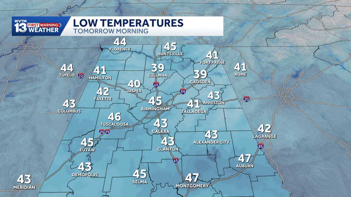 Chilly mornings and sunny, warm days in Alabama's weather forecast this week
MONDAY: Chilly morning lows down in the 40s. Warming up to the 70s with full sunshine in the afternoon. Rain chance: 0%. TUESDAY: Another chilly start in the 40s. Warming to the mid-70s in the afternoon with a light…
-
 Alabama stays rain-free all week as fall warmth builds with low humidity and clear skies
ALABAMA 7 DAY FORECAST Another pleasant fall day is on tap in Alabama as cool and dry conditions persist for another day. An upper-level ridge to our west and a building upper-level trough to our east will keep up in…
-
 Alabama’s first freeze dates: When to expect cold weather in north, central and south Alabama
A few cool fall mornings are usually enough to get Alabama gardeners thinking about their tomatoes, the flowers still blooming, and the potted plants on the porch. How much longer can they stay outside? Across Alabama…
- Colder Air Rolls Into Alabama ...
Published on: October 16, 2026 at 2:26 PM The coolest air so far this season will settle into Alabama for the weekend. Expect highs in the 60s, lows mostly in the 40s, and a sun filled sky both days. NEXT WEEK: Dry…
- Colder air arrives on a north wind making for Alabama's coolest weekend weather forecast in months
SATURDAY: Blustery and cool. Morning lows drop to the upper 40s and lower 50s, and the temperature slowly recovers to the lower and middle 60s in the afternoon with a brisk north wind around 15 to 25 miles per hour with…
-
 Preview of WSFA's weather special: 'Alabama's Second Severe Season'
WSFA Preview of WSFA's weather special: 'Alabama's Second Severe Season' It's Friday Night! Here is a look at your Friday Night Football Fever forecast! It's still warm for now, but cooler air and gusty winds are not…
-
 Fall Temperatures Headed to West Alabama This Weekend
This is the weekend all of Alabama has been waiting for. We’re finally getting a taste of that fall-like weather we’ve been dreaming about. According to the National Service in Birmingham, a “cold front Friday afternoon…
-
 Cold front brings windy, chilly weather to Alabama; sunny weekend ahead
FRIDAY FRONT: A cold front will pass through Alabama later today, and it will set up a big thermal contrast. By mid to late afternoon, temperatures will range from the upper 60s across the Tennessee Valley to the upper…
-
 More record highs in Alabama on Thursday but change coming this weekend
A few Alabama cities again added to the weather record books on Thursday, according to the National Weather Service. It’s the fourth day in a row that there has been a record high in the state. Here are Thursday’s…
-
 The Latest: Isaias drops heavy rain on Alabama as Mexico's Pacific coast prepares for Simon
Bluefield Daily Telegraph
Air quality
Air quality is satisfactory, and air pollution poses little or no risk.
Forecast
- TueGood (33)
- WedGood (50)
Columbus-Phenix City - GA and AL, AL reporting area · 56 min ago. Data from AirNow (EPA and its state, local and tribal partners); preliminary and subject to change.
Sun & moon
Almanac
MonthlyDothan Regional Ap, records since 1965. Normals 1991–2020. Data from NOAA's Regional Climate Centers (ACIS).
Nearby
Forecasters' discussion
From the National Weather Service office in TAE, issued 3 hrs ago
Key Messages
Updated at 947 PM EDT Tue Oct 20 2026
- Windy conditions are expected during daytime hours from Friday through Sunday, following passage of a dry back door cold front. Gusts of 25-35 mph are forecast this weekend.
- Hazardous marine conditions are expected from Friday through Sunday, as northeast winds increase to near-gale force at times following a back door cold frontal passage on Friday. Peak winds are expected Saturday night, when gales are possible.
- Breezy and gusty conditions from Friday through Sunday, along with the recent lack of rainfall, will bring elevated fire weather conditions this weekend.
Update
Issued at 947 PM EDT Tue Oct 20 2026
The forecast is on track, updates don't appear necessary.
Short Term
(This Evening through Wednesday) Issued at 327 PM EDT Tue Oct 20 2026
The air mass is dry and stable. North to northwest flow aloft prevails, while northeasterly low-level flow is reinforcing the dry air. Satellite- derived PW imagery shows values of 0.4 to 0.5 inches this afternoon. This morning's 12z Urban Sky UA sounding from Madison County showed a pronounced stable layer between 940 mb and 820 mb. Little change in sensible weather and the air mass at large are expected through Wednesday, though lighter wind and a small increase in low-level thickness suggest an upward trend of a few degrees in the high temperature for tomorrow.
Long Term
(Wednesday night through next Tuesday) Issued at 327 PM EDT Tue Oct 20 2026
No rain is in the forecast through next Tuesday. The main story will be breezy to windy conditions this weekend.
A persistent pattern and little change in sensible conditions are expected through Thursday night.
The pattern starts to evolve from Friday through the weekend. At 500 mb, the southern end of a longwave trough currently off the U.S. East Coast will cut off and start to retrograde toward the FL Peninsula on Friday. Over the weekend, the cut-off low will pivot southward and reach an unusually low latitude over the Straits of Florida, Cuba, or the northwest Caribbean, spawning a broad and fairly deep surface trough across central Cuba to the southeast Bahamas and beyond into the Atlantic.
North of all that action, a strong surface high will set up over the U.S. Mid- Atlantic region over the course of Friday and Friday night. At first, this will push a back-door cold front through our region on Friday, followed by an increase in northeasterly low- level flow. By this weekend, there will be an impressive MSLP gradient of 25 mb between the surface high over New Jersey and low pressure in the Southeast Bahamas. The tightest part of this gradient will set up near our latitude. E-NE 925 mb winds will peak on Saturday night in the 35-40 knot range over south-central GA and the FL Big Bend, supporting gusty conditions this weekend. Surface wind gusts of 25-35 mph are expected areawide during the day on Saturday and Sunday.
In the fast and well-mixed flow, Atlantic-sourced maritime moisture may be sufficiently deep for a few low-topped showers to get as far west as the Suwannee Valley this weekend. For now, the forecast is dry, but we may need to eventually add low PoPs over that way. Elsewhere across our region, the forecast will remain rain-free.
Forecasts, observations and alerts in the United States come from the National Weather Service (NOAA); radar from NOAA's Multi-Radar Multi-Sensor system; satellite imagery from NASA's Global Imagery Browse Services (GIBS) and NOAA's GOES satellites; the map from the U.S. Geological Survey's National Map; air quality from AirNow (EPA and its partners); hurricane information from the National Hurricane Center; climate normals and records from NOAA's Regional Climate Centers (ACIS). Forecasts outside the United States and the UV index: MET Norway (CC BY 4.0); observations outside the U.S.: airport reports via NOAA's Aviation Weather Center. Place names: GeoNames (CC BY 4.0). Data are copied on a schedule and may lag the sources; for warnings that affect your safety, follow your local National Weather Service office and emergency officials. Weather news is drawn from the 4Search index and reflects what the press published. Terms of use.