Install
Quincy, FL 32353 Weather
Current conditions
Forecast for this hour (no station report in the last two hours)
Forecast
10-day-
Tonight
Clear, with a low around 51. North northeast wind 0 to 5 mph.
-
Friday
Sunny, with a high near 79. Northeast wind 0 to 10 mph.
-
Friday Night
Clear, with a low around 51. Northeast wind 5 to 10 mph, with gusts as high as 25 mph.
National Weather Service forecast updated 5 hrs ago.
Hourly
Hourly forecast- Now76°
- 7 PM71°
- 8 PM66°
- 9 PM64°
- 10 PM61°
- 11 PM59°
- Fri12 AM58°
- 1 AM57°
- 2 AM56°
- 3 AM55°
- 4 AM54°
- 5 AM53°
- 6 AM52°
- 7 AM52°
- 8 AM51°
- 9 AM58°
- 10 AM64°
- 11 AM71°
- 12 PM73°
- 1 PM76°
- 2 PM78°
- 3 PM78°
- 4 PM78°
- 5 PM78°
10-day forecast
Details- TodayOct 22Sunny51°82°
- FriOct 23Sunny51°79°
- SatOct 24Sunny56°78°
- SunOct 25Sunny56°77°
- MonOct 26Sunny54°78°
- TueOct 27Sunny53°79°
- WedOct 28Mostly Sunny54°79°
- ThuOct 29Mostly sunny61°80°
- FriOct 30Mostly sunny60°79°
- SatOct 31Mostly sunny57°81°
Days after the National Weather Service's seven are MET Norway's outlook, a computer model with no forecaster's review.
Radar
Full mapWeather news near Quincy
More weather news- Florida has that fall feeling this week. Check how cool it will get and when
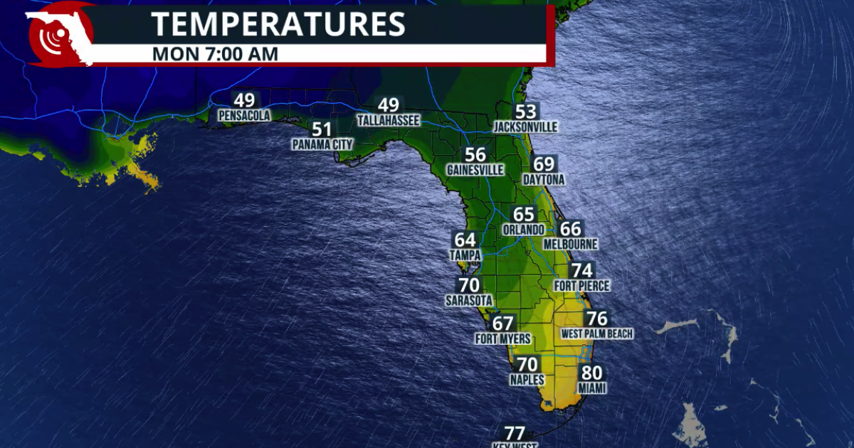
Florida people can tell you when fall has arrived. It’s that time of year when the humidity and temperature drop just enough for us to walk the dog without the sauna feel. The time has come. This week, South Florida is…
-
 Fall arrives in Florida this weekend
WUSF Fall arrives in Florida this weekend The cold front marks the leading edge of a cooler and drier air mass moving southward across the eastern United States. Behind the boundary, winds shift more northerly, helping…
-
 🚍Bus Stop Forecast: Austin is eyeing BIG changes for your weekend
TALLAHASSEE, Fla. (WCTV) - Finally, it is Friday. Another cool morning as you get the kids ready for school or you prepare for work. Expect another toasty afternoon once again today, before the weekend shocks your…
-
 Cooler temps and gusty winds on the way by the weekend 🍃💨
WCTV TALLAHASSEE, Fla. (WCTV) - A cold front will arrive late Friday night, with only one or two stray showers ahead of it, but also a slight chance for a stray shower or two behind it, mainly over our eastern areas for…
-
 Super El Niño fueled winter could unleash more storms, driving more active pattern into the South
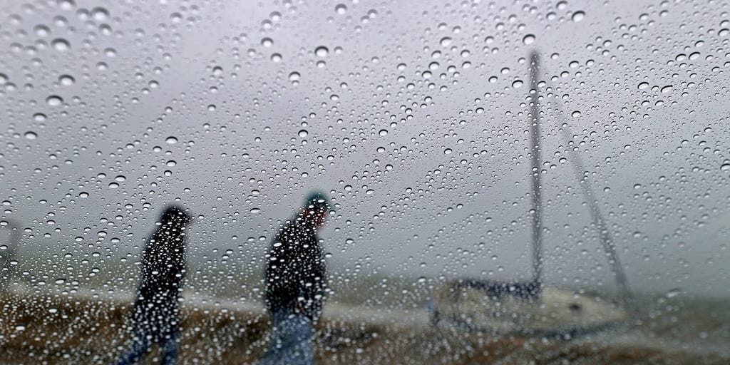
NOAA's Winter 2026-27 outlook is out, and it shows the El Niño will have a major effect on the season ahead. FOX Weather Meteorologists Stephen Morgan, Melanie Black, Michael Estime and Bob Van Dillen bring us the…
-
 🚍Bus Stop Forecast: Austin is tracking a cool morning, near-record warm afternoon
TALLAHASSEE, Fla. (WCTV) - I have a little bit of weather for everyone over the next few days. Feeling like summer to end your workweek in the afternoon, then fall takes over this weekend! A nice start to the day will…
-
 South Florida sees spotty showers ahead of weekend flooding, strong wind threats
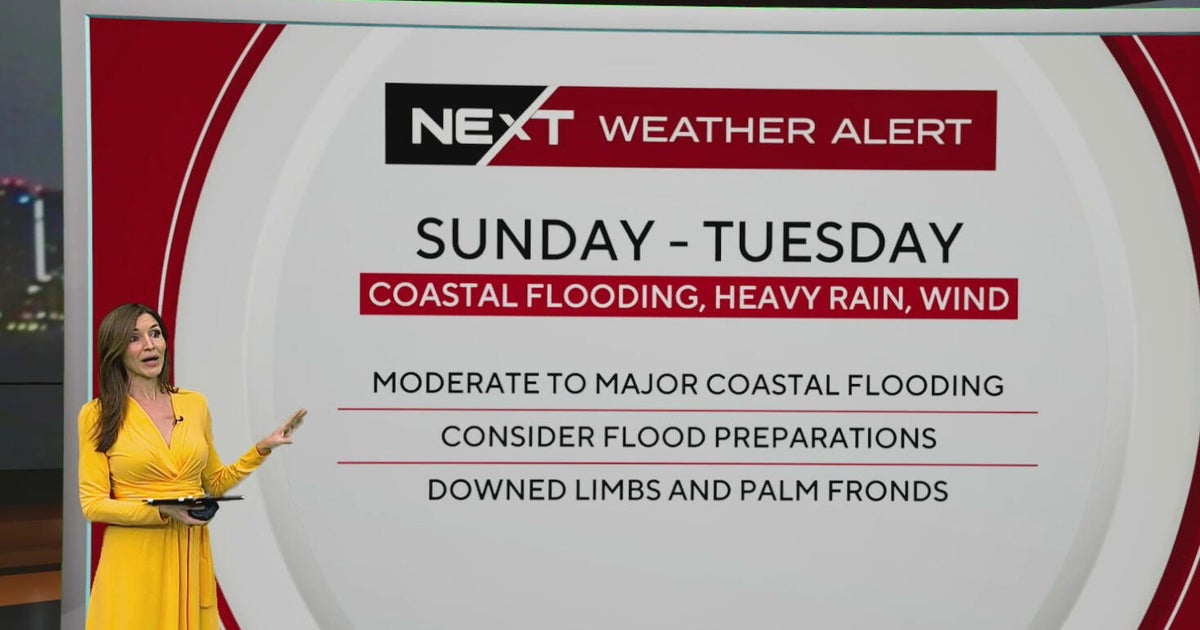
October 22, 2026 / 7:30 AM EDT / CBS Miami South Florida will see warmer temperatures and spotty afternoon showers Thursday as the region prepares for a stretch of wet and windy weather that could bring heavy downpours…
-
 Rough Seas, Dangerous Rip Currents Threaten Florida Coast Ahead Of Possible Tropical Development
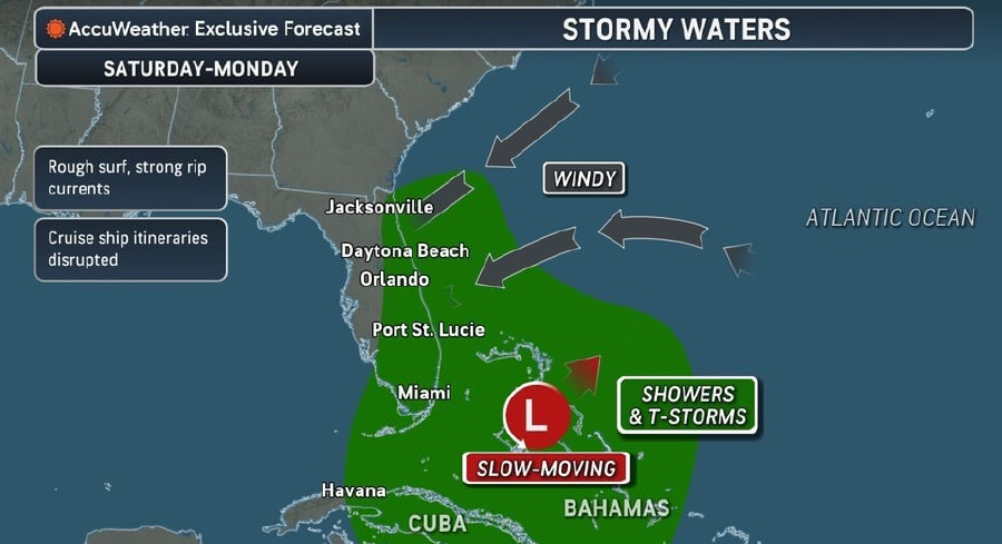
Persistent onshore winds and a slow-moving area of low pressure near the Bahamas are expected to bring hazardous surf, strong rip currents, and marine travel disruptions along Florida’s Atlantic coast starting this…
-
 Atlantic storms churn up dangerous, rough seas from Florida coast to Northeast
Subtropical Storm Josephine is expected to become a strong extratropical cyclone with hurricane-force winds as it churns in the mid-Atlantic off the U.S. East Coast, forecasters said. Josephine is bringing high winds…
-
 Another beautiful day Thursday before a big weather change arrives in Central Florida
ORLANDO, Fla. — Central Florida is in for another beautiful day, with cool temperatures to start the morning and warm, mostly sunny conditions expected this afternoon. However, changes are on the way as windy weather…
Air quality
Air quality is satisfactory, and air pollution poses little or no risk.
Forecast
- ThuModerate
- FriModerate
- SatModerate
Liberty County, FL reporting area · 2 hrs ago. Data from AirNow (EPA and its state, local and tribal partners); preliminary and subject to change.
Sun & moon
Almanac
MonthlyTallahassee Area, records since 1892. Normals 1991–2020. Data from NOAA's Regional Climate Centers (ACIS).
Nearby
- Tallahassee 34 km
- Bainbridge 39 km
- Cairo 53 km
- Crawfordville 47 km
- Midway 16 km
- Chattahoochee 29 km
- Woodville 43 km
- Blountstown 44 km
Forecasts, observations and alerts in the United States come from the National Weather Service (NOAA); radar from NOAA's Multi-Radar Multi-Sensor system; satellite imagery from NASA's Global Imagery Browse Services (GIBS) and NOAA's GOES satellites; the map from the U.S. Geological Survey's National Map; air quality from AirNow (EPA and its partners); hurricane information from the National Hurricane Center; climate normals and records from NOAA's Regional Climate Centers (ACIS). Forecasts outside the United States and the UV index: MET Norway (CC BY 4.0); observations outside the U.S.: airport reports via NOAA's Aviation Weather Center. Place names: GeoNames (CC BY 4.0). Data are copied on a schedule and may lag the sources; for warnings that affect your safety, follow your local National Weather Service office and emergency officials. Weather news is drawn from the 4Search index and reflects what the press published. Terms of use.