Install
New Ellenton, SC 29809 Weather
Current conditions
Forecast for this hour (no station report in the last two hours)
Forecast
10-day-
Today
Sunny, with a high near 75. North wind 1 to 5 mph.
-
Tonight
Clear, with a low around 46. North wind 3 to 7 mph.
-
Friday
Sunny, with a high near 71. Northeast wind 7 to 12 mph.
National Weather Service forecast updated 9 hrs ago.
Hourly
Hourly forecast- Now63°
- 12 PM67°
- 1 PM71°
- 2 PM73°
- 3 PM74°
- 4 PM75°
- 5 PM74°
- 6 PM72°
- 7 PM66°
- 8 PM60°
- 9 PM57°
- 10 PM55°
- 11 PM53°
- Fri12 AM52°
- 1 AM51°
- 2 AM50°
- 3 AM49°
- 4 AM48°
- 5 AM47°
- 6 AM47°
- 7 AM46°
- 8 AM46°
- 9 AM50°
- 10 AM57°
10-day forecast
Details- TodayOct 22Sunny46°75°
- FriOct 23Sunny47°71°
- SatOct 24Sunny46°71°
- SunOct 25Sunny46°72°
- MonOct 26Sunny44°73°
- TueOct 27Sunny47°75°
- WedOct 28Mostly Sunny49°75°
- ThuOct 29Rain0.09 in61°75°
- FriOct 30Partly cloudy58°77°
- SatOct 31Mostly sunny54°71°
Days after the National Weather Service's seven are MET Norway's outlook, a computer model with no forecaster's review.
Radar
Full mapWeather news in South Carolina
More weather news-
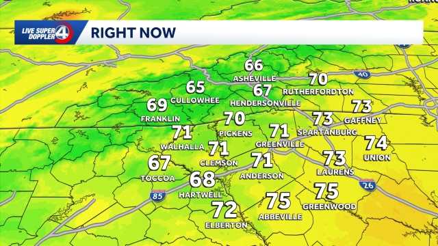 Staying sunny, seasonable in South Carolina: October 22 forecast
Sunshine lingers with highs in the 60s and 70s Thursday will feature sunny and seasonable weather in the Upstate of South Carolina, Western North Carolina and Northeast Georgia. After a cool to chilly start, highs will…
- Cold Mornings with Warmer Afternoons in South Carolina: October 20 forecast
Cooler mornings with warm afternoons ahead. Sunshine and comfortable temperatures expected this week in the Upstate. The forecast remains quiet this week as a high pressure keeps the area dry. Highs sit in the 70s with…
- Quiet weather ahead this week in South Carolina: October 19 forecast
Sunshine and comfortable temperatures expected this week in the Upstate. The forecast remains quiet this week as a high pressure keeps the area dry. Highs sit in the 70s with lows in the 40s. The temperatures will be…
- Cold start to Sunday in South Carolina: October 18 forecast
Frost and Freeze across the area this morning, warming up through the week. Afternoon highs will warm into the low to mid-60s by Sunday afternoon. Frost and freeze conditions remain possible Monday and Tuesday mornings…
-
 Storm Warnings Issued Off the North and South Carolina Coast as Conditions Intensify
Storm Warnings are in effect for offshore waters from Oregon Inlet, North Carolina, to Little River Inlet, South Carolina, with north winds of 35 to 40 knots, gusts to 50 knots and seas up to 18 feet. A nor’easter is…
- Cold and Breezy Saturday in South Carolina: Oct 17 forecast
Colder start this morning with breezy conditions through the afternoon. Highs plummet into the 50s and 60s and lows tumble into the 30s and 40s. Frost and freeze conditions are possible in the mountains Sunday, Monday…
-
 South Carolina's Drought Conditions Improve
PUBLISHED ON October 16, 2026 After reviewing drought indicators statewide, the DRC voted to reduce drought severity in 27 counties. The maps attached illustrate changes in drought status between the DRC’s September 8…
- Be ready for dense fog in South Carolina Friday morning
A report was issued from the NWS Columbia SC on Friday at 7:22 a.m. for dense fog until 9:30 a.m. The alert is for Central Orangeburg and Southeastern Orangeburg as well as Barnwell, Calhoun, Clarendon and Bamberg…
- Temperatures plummet this weekend in South Carolina: October 16 forecast
A weekend cold front drops temperatures this weekend in the Upstate Near-record heat is likely once again on Friday as highs warm to the 80s. Big changes arrive for the weekend after a cold front arrives. Strong winds…
Air quality
Air quality is satisfactory, and air pollution poses little or no risk.
Aiken-Augusta - SC and GA, SC reporting area · 1 hr ago. Data from AirNow (EPA and its state, local and tribal partners); preliminary and subject to change.
Sun & moon
Almanac
MonthlyAugusta Area, records since 1874. Normals 1991–2020. Data from NOAA's Regional Climate Centers (ACIS).
Nearby
- Augusta 27 km
- Martinez 38 km
- Aiken 17 km
- Evans 43 km
- North Augusta 27 km
- Grovetown 47 km
- Belvedere 27 km
- Waynesboro 47 km
- Batesburg-Leesville 57 km
- Boiling Springs 39 km
- Edgefield 47 km
- Barnwell 36 km
Forecasters' discussion
From the National Weather Service office in CAE, issued 4 hrs ago
What Has Changed
The forecast remains on track. Aviation discussion updated for 12z TAFs.
Key Messages
- 1. Dry weather continues the remainder of this week and into this weekend with temperatures near to just below normal.
Discussion
Key Message 1: Dry weather continues the remainder of this week and into this weekend with temperatures near to just below normal.
As has been advertised over the past few days, dry weather is expected to continue through the remainder of this week, this weekend, and into early next week. The previously discussed trough out west should continue into the Four Corners region over the next 72 hours, amplifying downstream features, being the ridge in the central CONUS and troughing across the east. The only change this should bring compared to previous days is slightly lower temperatures Friday and this weekend, in the upper 60s to lower 70s. At the surface this weekend, high pressure should ridge down from New England with a tightening pressure gradient so breezy winds could be possible Saturday and Sunday. Heading into next week, surface high pressure is expected to become centered across the Carolinas during the early week, bringing continued dry weather and temperatures just below normal. A bit more uncertainty in the upper pattern into the middle of next week is seen across deterministic/AI guidance, but overall, any chance for rain remains low.
Aviation
VFR conditions expected through the next 24 hours.
High pressure continues to reside over the area with generally calm winds across the region. Some lake/river fog developed over the warmer water but is not expected to impact terminals this morning. Winds should pick up after 15-16z from the north around 5 to 6 knots before diminishing again at sunset with mostly clear skies through this forecast period.
EXTENDED AVIATION OUTLOOK...Moisture increases back into the area this weekend. Some patchy fog will be possible late in the extended.
Forecasts, observations and alerts in the United States come from the National Weather Service (NOAA); radar from NOAA's Multi-Radar Multi-Sensor system; satellite imagery from NASA's Global Imagery Browse Services (GIBS) and NOAA's GOES satellites; the map from the U.S. Geological Survey's National Map; air quality from AirNow (EPA and its partners); hurricane information from the National Hurricane Center; climate normals and records from NOAA's Regional Climate Centers (ACIS). Forecasts outside the United States and the UV index: MET Norway (CC BY 4.0); observations outside the U.S.: airport reports via NOAA's Aviation Weather Center. Place names: GeoNames (CC BY 4.0). Data are copied on a schedule and may lag the sources; for warnings that affect your safety, follow your local National Weather Service office and emergency officials. Weather news is drawn from the 4Search index and reflects what the press published. Terms of use.