Install
Brentwood, NY 11717 Weather
Current conditions
Forecast for this hour (no station report in the last two hours)
Forecast
10-day-
Friday
Sunny, with a high near 56. North wind 6 to 10 mph.
-
Friday Night
Mostly clear, with a low around 39. Northeast wind around 3 mph.
-
Saturday
Sunny, with a high near 58. Northwest wind around 5 mph.
National Weather Service forecast updated 1 day ago.
Hourly
Hourly forecast- Now56°
- 5 PM55°
- 6 PM54°
- 7 PM50°
- 8 PM46°
- 9 PM45°
- 10 PM44°
- 11 PM43°
- Sat12 AM42°
- 1 AM41°
- 2 AM40°
- 3 AM40°
- 4 AM39°
- 5 AM39°
- 6 AM39°
- 7 AM39°
- 8 AM40°
- 9 AM44°
- 10 AM49°
- 11 AM53°
- 12 PM55°
- 1 PM57°
- 2 PM57°
- 3 PM58°
10-day forecast
Details- ThuOct 22Sunny41°63°
- TodayOct 23Sunny39°56°
- SatOct 24Sunny39°58°
- SunOct 25Sunny42°61°
- MonOct 26Sunny48°65°
- TueOct 27Sunny46°62°
- WedOct 28Partly Sunny47°60°
- ThuOct 29Mostly sunny45°61°
- FriOct 30Partly cloudy52°66°
- SatOct 31Mostly sunny49°58°
Days after the National Weather Service's seven are MET Norway's outlook, a computer model with no forecaster's review.
Radar
Full mapWeather news in New York
More weather news-
 Dangerous Storm and Gale Warnings Issued for New York, Massachusetts, and the Rest of New England
The nor’easter’s strongest winds are shifting north, with Storm Warnings for waters south of New England, Gale Warnings for Massachusetts and Rhode Island waters, and coastal flooding on Long Island. The storm stays…
-
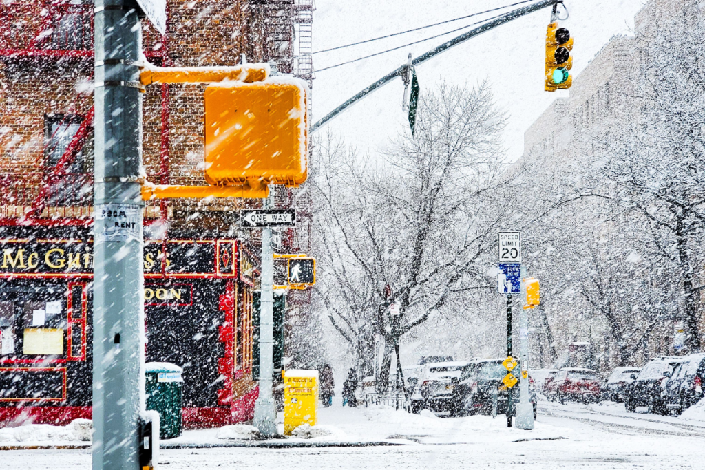 Here’s when New York City could see its first snowflakes of the season
As autumn chill settles over New York City, National Weather Service and NOAA climate data reveal when the five boroughs can expect their first flurries of the 2026 season. After a mild start to fall, recent temperature…
-
 Enjoy beautiful autumn weather in New York with sunny skies and temperatures up to 17°C
The Times of India New York, October 21, 2026 Today's weather is characterized by a mostly sunny and breezy day, marking a pleasant autumn shift in climate The temperature is expected to reach a high of 17°C, while…
-
 Freeze alerts stretch from Missouri to New York for Sunday
Temps drop for millions across the Central Plains, Midwest, Northeast The first real taste of fall is settling in for millions, including a few first frosts and freezes of the season for some in the Midwest and East…
-
 Good Morning, Buffalo: What a super El Niño could mean for Western New York
Oct. 18, 2026 Javascript is required to use this website. Golfers make their way to the next tee in the course at Delaware Park last week. In past El Ãino years, Western New York received much less snow than normal and…
-
 First Alert Weather: Bright sunshine, crisp air for Sunday in New York - 10/17/26
CBS News Detroit Weekend 11pm CBS News Los Angeles Weekend 8pm CBS News Philadelphia Weekend KDKA News Weekend 11pm CBS News Texas Weekend 10pm
-
 First Alert Weather: Clear skies with chilly temps Sunday in New York - 10/17/26
CBS News Bay Area Evening Edition Weekend 6pm CBS News Detroit Weekend 6pm CBS News Los Angeles Weekend 6pm CBS News Philadelphia 7:30pm Health Watch on CBS News Sacramento CBS News Texas Saturday 5pm
-
 Dangerous Freeze Warnings for 7 Counties in New York as Temperatures Plummet
Freeze Warnings take effect tonight across parts of New York, with lows in the upper 20s to around 30 expected from the Hudson Valley to Buffalo. The warnings run into 9 a.m. EDT Sunday. Frost and freeze conditions…
-
 First Alert Weather: Feels like November Saturday in New York - 10/17/26
CBS News Bay Area Morning Edition Weekend 6am WBZ This Morning 8am CBS News Chicago Saturday 8am CBS Colorado Mornings Weekend CBS News Los Angeles Weekend 6am CBS News Miami This Morning 9am WCCO News Saturday Morning…
-
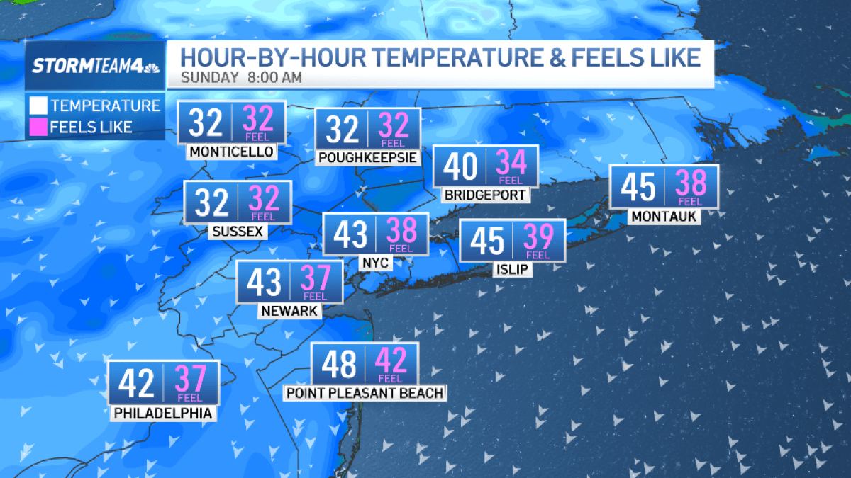 Bundle up! Cold snap hits New York City this weekend
The Friday night severe thunderstorm threat may have passed, but our weekend weather woes are not over quite yet. A surge of much colder air now sweeps across the region. Saturday is forecast to be windy and noticeably…
Air quality
Air quality is satisfactory, and air pollution poses little or no risk.
Forecast
- FriGood (27)
- SatGood (32)
- SunModerate (51)
Long Island Region, NY reporting area · 1 hr ago. Data from AirNow (EPA and its state, local and tribal partners); preliminary and subject to change.
Sun & moon
Almanac
MonthlyIslip Area, records since 1963. Normals 1991–2020. Data from NOAA's Regional Climate Centers (ACIS).
Nearby
- Queens 51 km
- The Bronx 52 km
- Bridgeport 45 km
- Stamford 39 km
- North Stamford 47 km
- Norwalk 40 km
- East Norwalk 38 km
- New Rochelle 47 km
- Mount Vernon 51 km
- Fairfield 40 km
- White Plains 51 km
- Hempstead 32 km
Forecasters' discussion
From the National Weather Service office in OKX, issued 14 hrs ago
What Has Changed
Small craft advisories have expanded in area and have been extended in time into tonight, Friday and Friday night. Coastal flood statement for Southern Nassau for early Friday morning with brief minor coastal flooding.
Key Messages
1) Dry conditions and gradually warming daytime temperatures are expected Friday through Monday. Dry conditions continue through much of next week.
2) For Friday night into the weekend, locations within our region (mainly across interior NE NJ, the Lower Hudson Valley, Southern CT, parts of Eastern Suffolk NY) there will be frost potential for late night and early morning.
3) Minor coastal flooding possible in back bays of Nassau County NY for the morning high tide. For subsequent high tide cycles through early Saturday, additional minor coastal flooding possible for the same location.
Key Message 1
Daytime high temperatures trend from below normal Friday to near normal Saturday and then more above normal Sunday and Monday. Dry conditions are forecast to prevail.
Mid levels from numerical weather prediction models indicate rising heights into the weekend. Trough exits east of the Canadian Maritimes with ridge moving in from the west. The ridging weakens late this weekend into early next week. At the surface, the low pressure associated with Josephine moves well out into the Northern Atlantic and east of Canadian Maritimes through Friday as high pressure builds in from the north across our local region.
Strong surface high pressure will be the main feature heading into the weekend with prevailing dry conditions. The pressure gradient will gradually weaken allowing for lighter winds. This will further allow for greater daytime insolation and greater nighttime radiational cooling with a more vast range in temperature between max and min.
Surface high pressure weakens and shifts farther south and west Sunday night into early next week. Dry conditions prevail through this weekend and into next week despite a cold front moving across late Monday into Monday night. Temperatures warm up for daytime highs this weekend and into early next week. Warmest day looks to be Monday with models showing relatively highest 850mb temperatures near 11 to 13 degrees C. Some locations are forecast to reach near 70 degrees Fahrenheit for Monday's highs. That is the warmest day of the forecast period through next week.
.KEY MESSAGE 2... With more radiational cooling each night, temperatures in outlying areas and rural sections will drop further.
Frost is expected to develop in these areas, mainly across the northern half of the forecast area. For tonight, patchy frost is forecast across parts of the interior and will be limited in spatial extent due to winds staying up in the boundary layer. Lows tonight range from mid 30s to upper 40s for much of the area.
Outlook For 06z Saturday Through Tuesday
Friday night through Tuesday: VFR.
Detailed information, including hourly TAF wind component forecasts, can be found at: https:/www.weather.gov/zny/n90
Forecasts, observations and alerts in the United States come from the National Weather Service (NOAA); radar from NOAA's Multi-Radar Multi-Sensor system; satellite imagery from NASA's Global Imagery Browse Services (GIBS) and NOAA's GOES satellites; the map from the U.S. Geological Survey's National Map; air quality from AirNow (EPA and its partners); hurricane information from the National Hurricane Center; climate normals and records from NOAA's Regional Climate Centers (ACIS). Forecasts outside the United States and the UV index: MET Norway (CC BY 4.0); observations outside the U.S.: airport reports via NOAA's Aviation Weather Center. Place names: GeoNames (CC BY 4.0). Data are copied on a schedule and may lag the sources; for warnings that affect your safety, follow your local National Weather Service office and emergency officials. Weather news is drawn from the 4Search index and reflects what the press published. Terms of use.