Install
Dannhauser, KwaZulu-Natal, South Africa Weather
Current conditions
Forecast for this hour (no station report in the last two hours)
Forecast
10-day-
Wednesday
Partly cloudy. High 29°.
-
Wednesday Night
Partly cloudy. Low 13°.
-
Thursday
Partly cloudy. High 29°.
MET Norway forecast updated 10 hrs ago.
Hourly
Hourly forecast- Now28°
- 14:0029°
- 15:0028°
- 16:0028°
- 17:0027°
- 18:0024°
- 19:0022°
- 20:0022°
- 21:0021°
- 22:0020°
- 23:0019°
- Thu00:0018°
- 01:0017°
- 02:0017°
- 03:0016°
- 04:0015°
- 05:0015°
- 06:0016°
- 07:0019°
- 08:0023°
- 09:0025°
- 10:0026°
- 11:0027°
- 12:0028°
Daily forecast
DetailsRadar
Full mapWeather news near Dannhauser
More weather news-
 Tuesday Weather: Damaging Wave Warning Issued for KwaZulu-Natal Coast as Cape Town Braces for Rain
South Africa wakes up to a mixed bag of conditions this Tuesday, 20 October 2026, with warm sunshine in some provinces and grey, wet skies in others. Here is a full breakdown of what to expect, province by province…
-
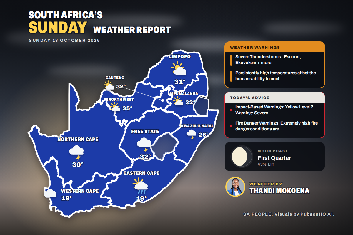 Here is today’s weather by province: Severe thunderstorms threaten Ladysmith Escourt and Dannhauser today
Home » Here is today’s weather by province: Severe thunderstorms threaten Ladysmith Escourt and Dannhauser today Mahikeng is the hottest spot at 35°C, while Cape Town peaks at just 18°C beneath cloud and a fresh SSE…
-
 Newcastle weather forecast for October 18, 2026: Pleasant sunny intervals with a high of 12°C
The Times of India With maximum temperatures peaking at 12°C and minimums settling around 9°C, the atmosphere remains relatively cool and comfortable Residents can expect sunny intervals throughout the day…
-
 SAWS Issues Yellow Level 2 Thunderstorm Warning for Newcastle and Parts of KZN
Search our reporting by place, person, company, topic or keyword. Residents across Newcastle and several other parts of KwaZulu-Natal are being urged to prepare for potentially severe weather on Sunday, 18 October 2026…
-
 Don Day's Wyoming Weather Forecast: Sunday, October 18, 2026
Sunny in Wyoming on Sunday and partly cloudy to mostly clear overnight. Highs from the upper 50s to low 70s. Lows from the mid 20s to low 40s. Riverton: Sunny today with a high near 61 and mostly clear overnight with a…
-
 Rapid City forecast: Breezy warmth, fire concerns before rain chances
RAPID CITY, S.D. (KOTA) -A cold front will bring a cooler, breezy Sunday to KOTA Territory, but temperatures will remain above average as a mostly dry stretch raises fire concerns ahead of possible late-week rain. Rapid…
-
 Don Day's Wyoming Weather Forecast: Saturday, October 17, 2026
Sunny in Wyoming on Saturday and mostly clear overnight. Highs from near 60 to the upper 70s. Lows from the mid 20s to mid 40s. Jeffrey City: Sunny and windy today with a high near 65 and wind gusts as high as 40 mph…
-
 Newcastle weather forecast for October 16, 2026: Sunny intervals and mild temperatures
The Times of India Newcastle, 16 October 2026 Today, residents can expect mainly sunny intervals with a pleasant high of 13°C and a relatively mild low of 8°C The humidity sits at a comfortable 83%, but no rain is…
-
 Rainfall amounts for Oct. 16, 2026
Listed below is the 24-hour rainfall in inches as of 7 a.m. Atkinson 0.22 Roger Brink Beemer 0.45 Jake Ott Belden 0.50 Chuck Arduser Coleridge (2 miles north) 0.38 Sheryl Kalin Creighton 0.11 Norman Doerr Elgin 0.43 NWS…
-
 South Africa’s Hottest Summer Yet? What A Very Strong El Niño Means For Heatwaves In Gauteng, And How To Stay Safe
South Africans are being told to prepare for a hot, possibly dry summer. The South African Weather Service (SAWS) says above-normal temperatures are “very likely” across the country from now until at least January 2027…
Forecasts, observations and alerts in the United States come from the National Weather Service (NOAA); radar from NOAA's Multi-Radar Multi-Sensor system; satellite imagery from NASA's Global Imagery Browse Services (GIBS) and NOAA's GOES satellites; the map from the U.S. Geological Survey's National Map; air quality from AirNow (EPA and its partners); hurricane information from the National Hurricane Center; climate normals and records from NOAA's Regional Climate Centers (ACIS). Forecasts outside the United States and the UV index: MET Norway (CC BY 4.0); observations outside the U.S.: airport reports via NOAA's Aviation Weather Center. Place names: GeoNames (CC BY 4.0). Data are copied on a schedule and may lag the sources; for warnings that affect your safety, follow your local National Weather Service office and emergency officials. Weather news is drawn from the 4Search index and reflects what the press published. Terms of use.