Install
Solosolo, Atua, Samoa Weather
Current conditions
Observed at Apia/Faleolo Intl · 1 hr ago
Forecast
10-day-
Thursday
Rain. High 26°. Precipitation 1.2 mm for the day.
-
Thursday Night
Cloudy. Low 22°. Precipitation 1.2 mm for the day.
-
Friday
Rain. High 28°. Precipitation 1.9 mm for the day.
MET Norway forecast updated 1 day ago.
Hourly
Hourly forecast- Now22°
- 03:0022°
- 04:0022°
- 05:0023°
- 06:0022°
- 07:0023°
- 08:0024°
- 09:0025°
- 10:0025°0.2
- 11:0026°0.5
- 12:0026°0.2
- 13:0025°
- 14:0025°
- 15:0026°
- 16:0025°
- 17:0025°
- 18:0024°
- 19:0024°
- 20:0024°
- 21:0024°
- 22:0023°
- 23:0023°
- Fri00:0023°
- 01:0024°
Daily forecast
DetailsRadar
Full mapWeather news in Samoa
More weather news-
 Daylight Saving Time Fast Facts
(CNN) — Here’s a look at Daylight Saving Time, a system to reduce electricity usage by extending daylight hours. Sunday, March 8, 2026 – Daylight Saving Time begins at 2am. Set clocks ahead one hour. Sunday, November 1…
-
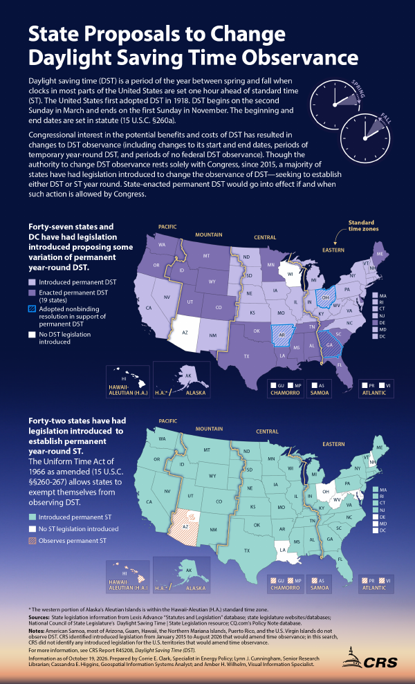 State Proposals to Change Daylight Saving Time Observance
October 19, 2026 IG10102 State Proposals to Change Daylight Saving Time Observance Daylight saving time (DST) is a period of the year between spring and fall when clocks in most parts of the United States are set one…
-
 Fall Back, Daylight Saving Time Ends Sunday November 1, 2026
It’s that time of the year, and a sign that winter is just around the corner, as Daylight Saving Time ends at 2 am Sunday, November 1, 2026. According to timeanddate.com, “In the U.S., Daylight Saving Time – or “fast…
-
 Everything you need to know about the clocks changing in 2026
As we figure out how to change the time on our cars and appliances, it's only natural to question the purpose of daylight savings time - and when it might come to an end. When do the clocks change in 2026? In Ireland…
-
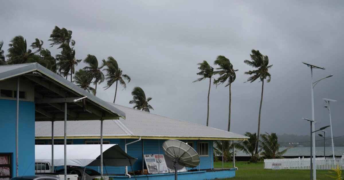 Developed near Samoa, Cyclone Wati is heading for the Cook Islands
Cyclone Wati, which developed east of Samoa on Saturday, is heading south-east directly through the Cook Islands. There is a low chance that the country will be directly affected, the Samoa Meteorological Service said…
-
 NOT Tonight! Daylight Saving Time 2026: Clocks Fall Back Nov. 1 as Congress Weighs Permanent Change
Daylight saving time 2026 officially ends Sunday, Nov. 1, when most Americans will gain an extra hour as clocks return to standard time. The annual change happens at 2 a.m., when clocks move backward to 1 a.m. That…
-
 When do clocks fall back? 2026 daylight saving time start and end
Daylight saving time will end at 2 a.m. Sunday, Nov. 1, 2026, when clocks turn back one hour. The annual “fall back” means an extra hour of sleep and a return to standard time. It also means an earlier sunset, with…
- California and National Drought Summary for October 13, 2026, 10 Day Weather Outlook, and California Drought Statistics: 72% of State Abnormally Dry, A 0% Increase Week-Over-Week
In the Republic of Palau, rainfall amounts this past week were light, with an even half-inch reported at WSO Palau (Airai) and 0.06-inch at Koror. Despite being a “dry” week (rainfall did not reach the required 2-inch…
-
 Forecast warns central Pacific countries such as Samoa are vulnerable to cyclones
English translation of a Samoan story, reviewed by Ayesha on 15 October 2026. Faitau i le gagana Samoa → Earth Sciences New Zealand, the agency that monitors scientific research, has released an outlook showing how…
- Kiwi holidaymakers urged to plan ahead as Pacific cyclone season looms
RNZ / News / Pacific Pacific travel agents are warning Kiwi travellers to stay alert in the coming months amid warnings of heightened cyclone activity in the region. Earth Sciences New Zealand (ESNZ) said between seven…
Sun & moon
Nearby
Forecasts, observations and alerts in the United States come from the National Weather Service (NOAA); radar from NOAA's Multi-Radar Multi-Sensor system; satellite imagery from NASA's Global Imagery Browse Services (GIBS) and NOAA's GOES satellites; the map from the U.S. Geological Survey's National Map; air quality from AirNow (EPA and its partners); hurricane information from the National Hurricane Center; climate normals and records from NOAA's Regional Climate Centers (ACIS). Forecasts outside the United States and the UV index: MET Norway (CC BY 4.0); observations outside the U.S.: airport reports via NOAA's Aviation Weather Center. Place names: GeoNames (CC BY 4.0). Data are copied on a schedule and may lag the sources; for warnings that affect your safety, follow your local National Weather Service office and emergency officials. Weather news is drawn from the 4Search index and reflects what the press published. Terms of use.