Install
Santa Teresa del Tuy, Miranda, Venezuela Weather
Current conditions
Forecast for this hour (no station report in the last two hours)
Forecast
10-day-
Tuesday
Heavy rain. High 33°. Precipitation 13.7 mm for the day.
-
Tuesday Night
Light rain. Low 23°. Precipitation 13.7 mm for the day.
-
Wednesday
Heavy showers. High 31°. Precipitation 3.3 mm for the day.
MET Norway forecast updated 9 hrs ago.
Hourly
Hourly forecast- Now30°
- 11:0032°
- 12:0033°
- 13:0033°2.6
- 14:0031°7.5
- 15:0025°2.9
- 16:0025°0.4
- 17:0025°
- 18:0025°
- 19:0025°
- 20:0024°
- 21:0024°0.2
- 22:0024°
- 23:0024°
- Wed00:0024°
- 01:0024°
- 02:0024°
- 03:0024°
- 04:0024°
- 05:0024°
- 06:0023°
- 07:0024°
- 08:0025°
- 09:0026°
Daily forecast
DetailsRadar
Full mapWeather news in Venezuela
More weather news-
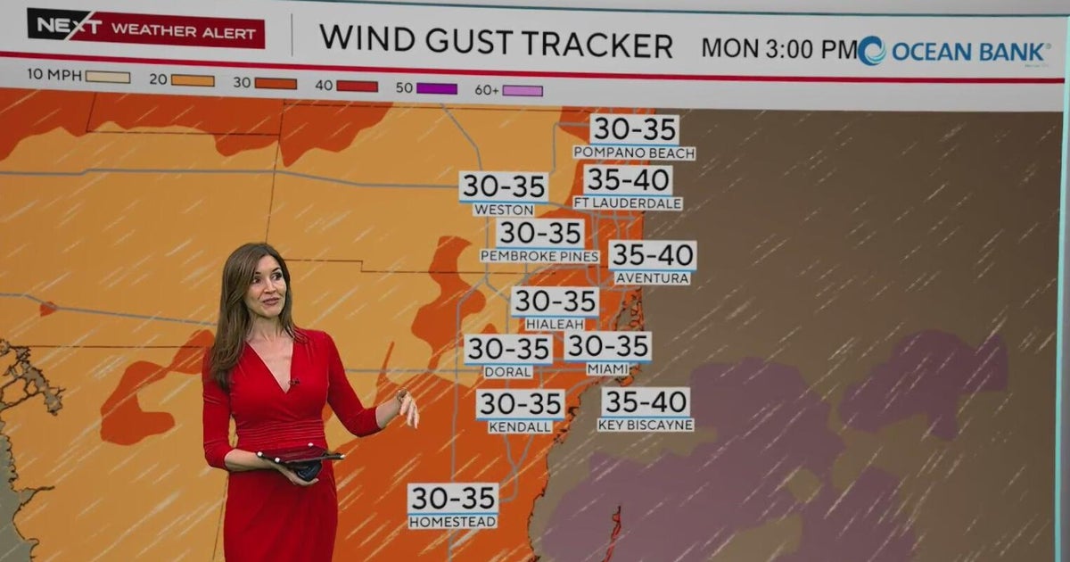 NEXT Weather Alert in effect across South Florida due to king tides, strong winds, heavy downpours
A CBS News Miami NEXT Weather Alert is in effect across South Florida through at least Tuesday due to the combination of king tides, strong onshore winds and heavy downpours. CBS News Miami NEXT Weather meteorologist…
-
 Tampa weather: Breezy winds and marine advisories continue
Gusty winds and a persistent Small Craft Advisory will continue across the region for several days. Rain chances remain low at 10% to 20% along the west coast as isolated showers move statewide. Quiet conditions persist…
-
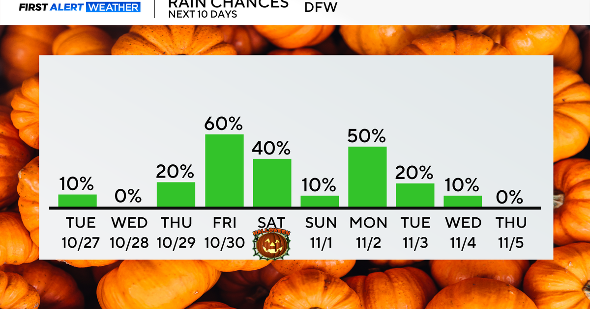 Rain chances return end of the week as temperatures remain in 70s, low 80s
Updated on: October 27, 2026 / 8:27 AM CDT / CBS Texas North Texans are waking up to mainly dry conditions Tuesday morning, with very isolated showers lingering across parts of the area. Expect a mix of clouds and sun…
-
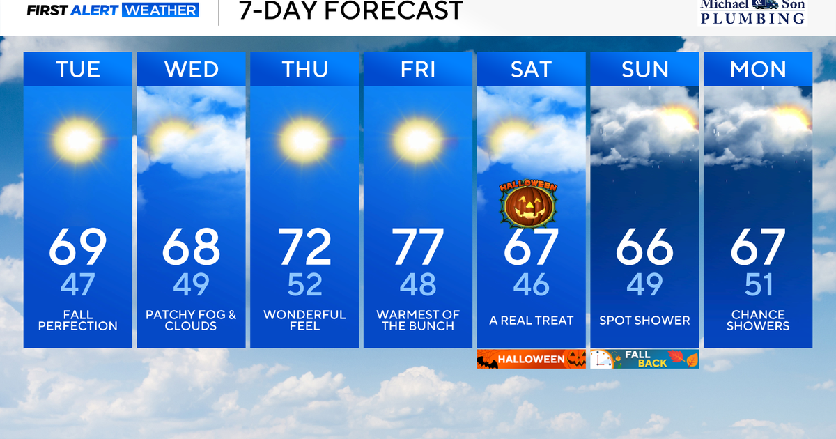 Beautiful weather continues right into Halloween for Maryland
Updated on: October 27, 2026 / 8:34 AM EDT / CBS Baltimore Several more days of sunshine, dry, and comfortable weather are in the forecast. Looking ahead, a pattern change brings our next chance of needed rain heading…
-
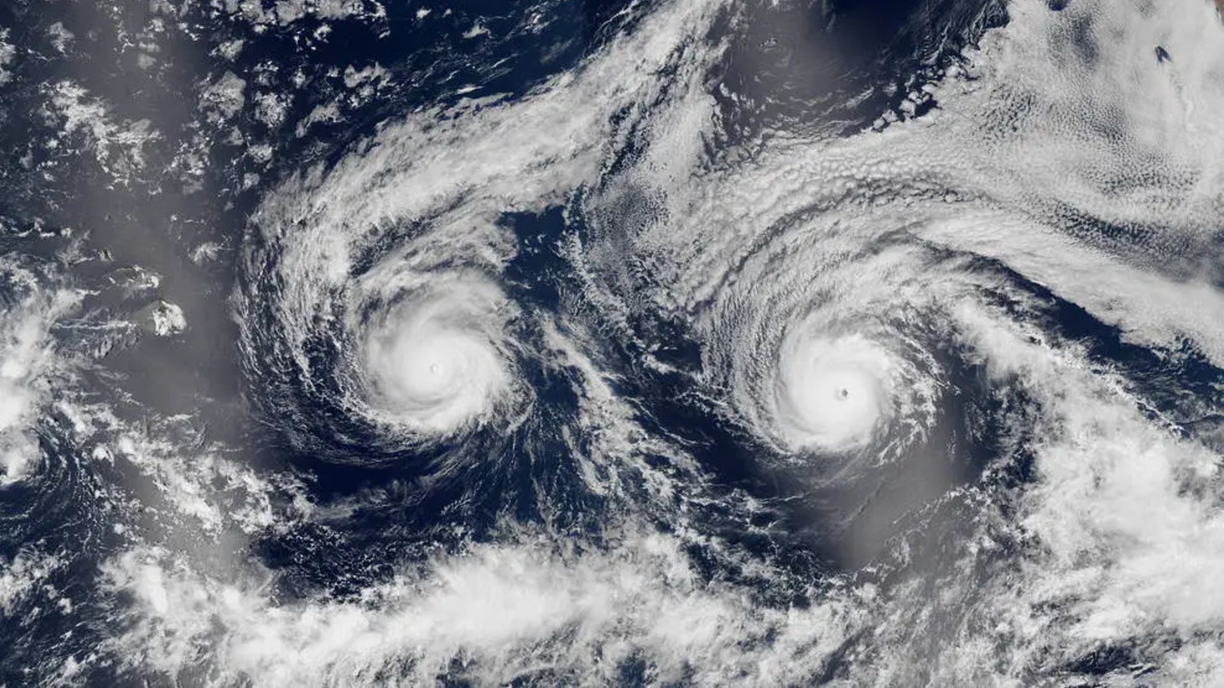 Twin hurricanes stare out to space as they barrel toward Hawaii — Earth from space
Not ready for Pro? Join live science pro Want more Life's Little Mysteries? Where is it? Pacific Ocean When was it taken? Aug. 29, 2016 This eye-catching satellite snap from a decade ago shows a pair of hurricanes…
-
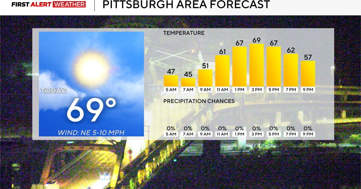 Rain chances could return to the Pittsburgh-area forecast early next week
October 27, 2026 / 7:54 AM EDT / CBS Pittsburgh Rain chances could return to the forecast for the Pittsburgh area next week. Any alert days ahead? Nope. Aware: Yesterday was the tenth day in a row with no measurable…
-
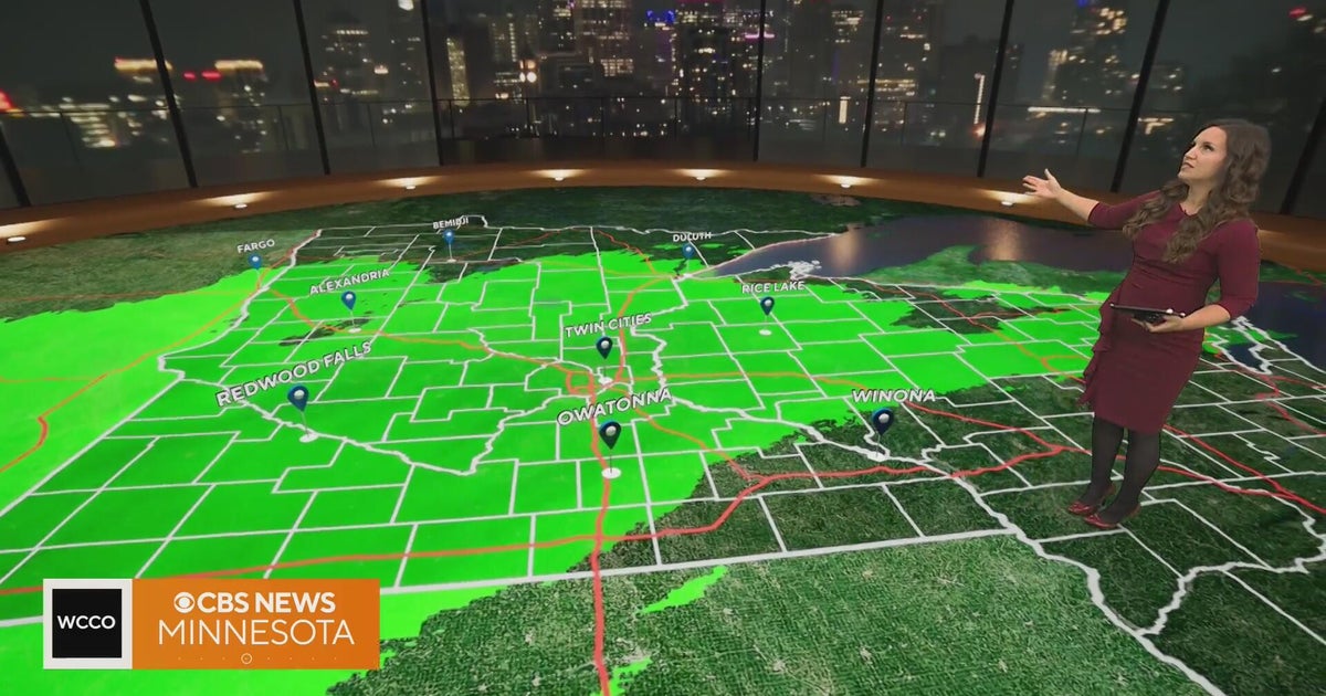 Rain to taper off after Minnesota's morning commute | Oct. 27, 2026
CBS News Minnesota is a local news organization that is part of CBS News and Stations. Also referred to as WCCO-TV and channel 4, CBS News Minnesota offers local breaking news, weather coverage and investigative…
-
 Rain tapering off across Minnesota, with storms possible Wednesday
October 27, 2026 / 6:44 AM CDT / CBS Minnesota Rain is expected to taper off after Tuesday morning's commute in Minnesota. It will be about 10 degrees warmer than Monday, and Wednesday will be warmer still, with…
-
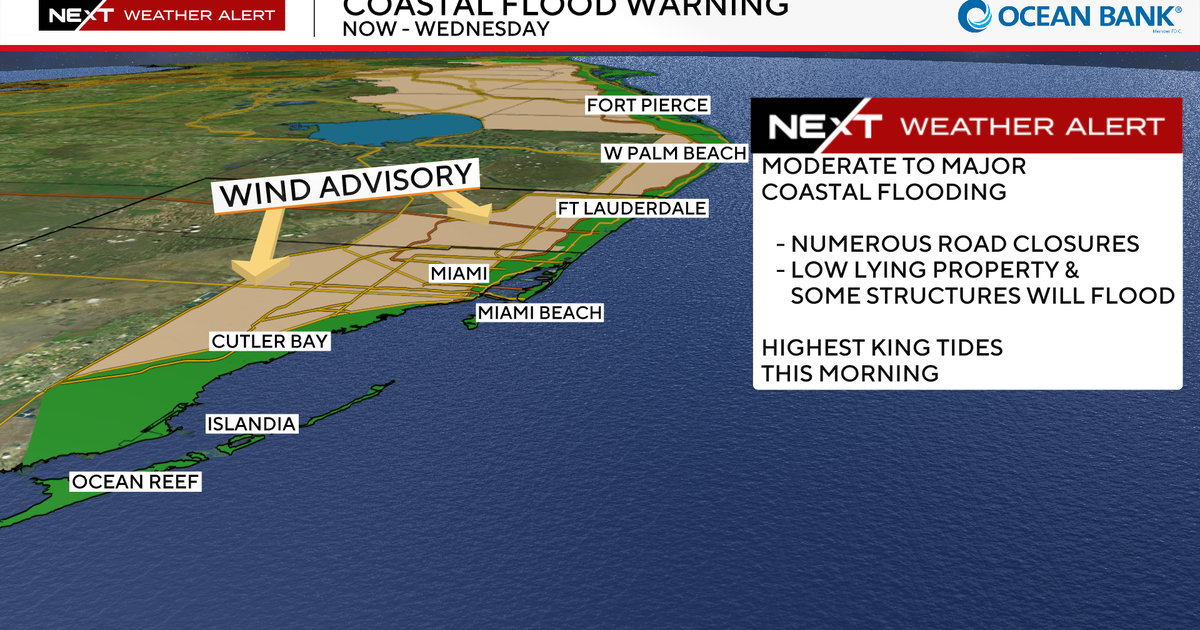 South Florida king tides peak Tuesday continuing risk of coastal flooding from Fort Lauderdale to Miami
October 27, 2026 / 7:20 AM EDT / CBS Miami A CBS News Miami NEXT Weather Alert remains in effect across South Florida through Wednesday due to a combination of king tides, strong onshore winds and periods of heavy rain…
-
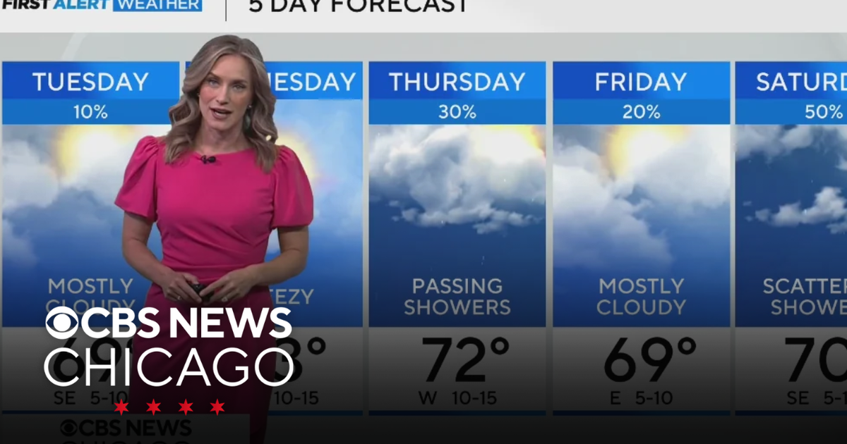 Highs near 70 degrees on Tuesday in Chicago
WBZ This Morning 6am CBS News Chicago 5am CBS News Detroit 6am CBS News Miami 6am CBS News Philadelphia 6am KDKA-TV Morning News 6am CBS News Texas 5am
Sun & moon
Nearby
- Caracas 37 km
- Petare 31 km
- Los Teques 43 km
- Guarenas 27 km
- Baruta 32 km
- Guatire 30 km
- Cúa 25 km
- Lander 7 km
- Ocumare del Tuy 18 km
- Charallave 21 km
- Catia La Mar 58 km
- Altagracia de Orituco 52 km
Forecasts, observations and alerts in the United States come from the National Weather Service (NOAA); radar from NOAA's Multi-Radar Multi-Sensor system; satellite imagery from NASA's Global Imagery Browse Services (GIBS) and NOAA's GOES satellites; the map from the U.S. Geological Survey's National Map; air quality from AirNow (EPA and its partners); hurricane information from the National Hurricane Center; climate normals and records from NOAA's Regional Climate Centers (ACIS). Forecasts outside the United States and the UV index: MET Norway (CC BY 4.0); observations outside the U.S.: airport reports via NOAA's Aviation Weather Center. Place names: GeoNames (CC BY 4.0). Data are copied on a schedule and may lag the sources; for warnings that affect your safety, follow your local National Weather Service office and emergency officials. Weather news is drawn from the 4Search index and reflects what the press published. Terms of use. How to use Weather