Install
Silverdale, WA Weather
Current conditions
Forecast for this hour (no station report in the last two hours)
Forecast
10-day-
Saturday Night
Rain likely. Mostly cloudy, with a low around 44. North wind 1 to 6 mph. Chance of precipitation is 70%. New rainfall amounts between a tenth and quarter of an inch possible.
-
Sunday
Rain likely. Mostly cloudy, with a high near 56. Northwest wind around 2 mph. Chance of precipitation is 70%. New rainfall amounts between a tenth and quarter of an inch possible.
-
Sunday Night
Rain likely. Mostly cloudy, with a low around 46. Chance of precipitation is 60%. New rainfall amounts less than a tenth of an inch possible.
National Weather Service forecast updated 2 days ago.
Hourly
Hourly forecast- Now47°57%
- 4 AM47°57%
- 5 AM47°70%
- 6 AM47°70%
- 7 AM46°70%
- 8 AM46°70%
- 9 AM47°70%
- 10 AM48°70%
- 11 AM49°68%
- 12 PM51°68%
- 1 PM53°68%
- 2 PM54°68%
- 3 PM55°68%
- 4 PM55°68%
- 5 PM54°60%
- 6 PM53°60%
- 7 PM51°60%
- 8 PM50°60%
- 9 PM49°60%
- 10 PM49°60%
- 11 PM49°59%
- Mon12 AM49°59%
- 1 AM48°59%
- 2 AM48°59%
Daily forecast
Details- FriOct 23Sunny41°58°
- SatOct 24Mostly Cloudy then Slight Chance Light Rain70%44°55°
- TodayOct 25Light Rain Likely70%46°56°
- MonOct 26Chance Light Rain28%45°57°
- TueOct 27Partly Sunny32%44°57°
- WedOct 28Chance Light Rain32%43°56°
- ThuOct 29Slight Chance Light Rain then Mostly Sunny16%41°56°
- FriOct 30Partly cloudy45°62°
- SatOct 31Partly cloudy45°62°
Days after the National Weather Service's seven are MET Norway's outlook, a computer model with no forecaster's review.
Radar
Full mapWeather news near Silverdale
More weather news-
 Friday continues the trend of sunny October afternoons, rain threatens the weekend
Friday skies are gradually clearing to sunny, with high temperatures warming into the mid to upper 50s and a few low 60s around the South Sound. Friday continues the trend of sunny October afternoons, rain threatens the…
-
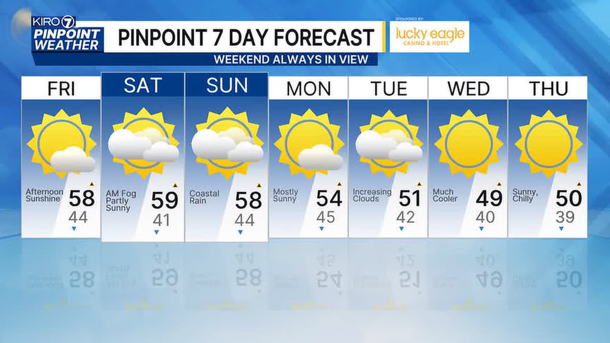 Sunny October Afternoons Continue, but Rain Threatens the Weekend
Friday brings another sunny October afternoon to the Seattle area, extending a stretch of pleasant fall weather. Forecasters, however, are tracking a shift as rain moves in and threatens to dampen plans for the weekend…
-
 The spooky secret hiding inside Pacific Northwest Glaciers | CNN
Glacier ice worms look like monsters from a horror movie. But they could reveal clues to how life survives in extremes — if they survive human-made warming. An astronaut aboard SpaceX Dragon and a videographer beside a…
-
 Will We Still Get Japow During Super El Niño?
El Niño has has officially reached uncharted territory. Water in the equatorial Pacific has now been measured at 3.3°C (5.9°F) above average, surpassing the previous record set in November 2015. Even Japan, famous for…
-
 Fire whirl flares during French protests | CNN
A fire whirl was spotted briefly during anti-government protests in Clermont-Ferrand, a city in central France. An astronaut aboard SpaceX Dragon and a videographer beside a lake in Canada share two amazing views of…
-
 TRAFFIC, TRANSIT, WEATHER: Wednesday watch
6:02 AM: Good morning! Welcome to Wednesday, October 21, 2026. Sunny, high in the low 60s. Sunrise will be at 7:37 am today, with sunset at 6:09 pm. SDOT is scheduled to close the low bridge to drivers from 7 am…
-
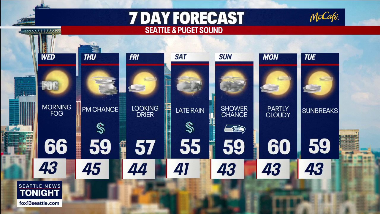 Seattle weather: More sunny fall days ahead
FOX 13 Seattle FOX 13 Seattle Meteorologist Claire Anderson has your latest western Washington weather forecast.
-
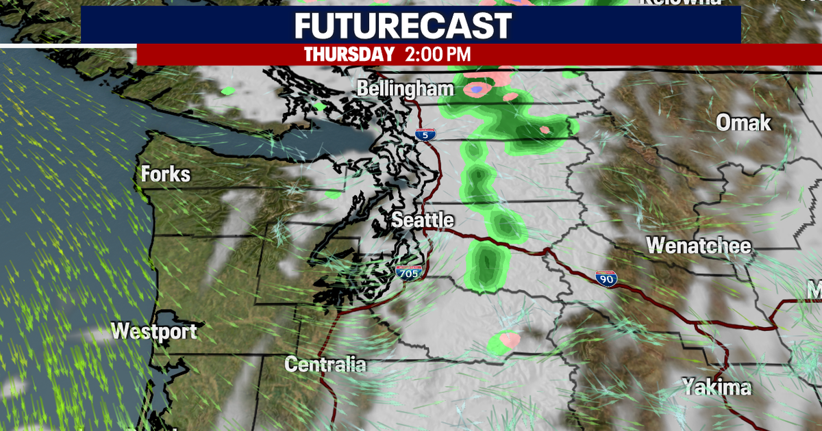 Seattle weather: Mild Wednesday, cooler later this week
Seattle weather: Morning fog, low 60s Tuesday Seattle - Western Washington’s weather will continue to stay quiet through Friday, though some could see a few light showers on Thursday. Light offshore flow won't be strong…
-
 Violent storms drench Corsica and southern France | CNN
On Tuesday, “unprecedented” precipitation hit Corsica, a French island in the Mediterranean. Over four months of rain (21 inches) fell in six hours, setting a new record for France. An astronaut aboard SpaceX Dragon and…
-
 TRAFFIC, WEATHER, TRANSIT: Tuesday notes
6:03 AM: Good morning! Welcome to Tuesday, October 20, 2026. Sunny, high near 60. Sunrise will be at 7:35 am today, with sunset at 6:11 pm. Washington State Ferries – The Triangle Route is now on the two-boat schedule…
Air quality
Acceptable. Unusually sensitive people should consider limiting prolonged outdoor exertion.
Forecast
- SunGood (33)
- MonGood (33)
- TueGood (33)
Kitsap County, WA reporting area · 1 hr ago. Data from AirNow (EPA and its state, local and tribal partners); preliminary and subject to change.
Sun & moon
Almanac
MonthlyBremerton, records since 1899. Normals 1991–2020. Data from NOAA's Regional Climate Centers (ACIS).
Nearby
Forecasters' discussion
From the National Weather Service office in SEW, issued 7 hrs ago
Synopsis
An offshore storm system moving into area today will very gradually shift south and east through Monday morning. This will bring widespread rain and breezy conditions through Sunday morning followed by showery unsettled weather into the start of the week. The pattern looks to remain very seasonal for the last week of the month - cooler with a series of systems bringing periods of unsettled weather nearly every day.
Short Term
Rain remains on track this evening with a minor update to the short-term below, and aviation section. -HPR
The offshore system that has been sliding down the British Columbia coast continues to move off the Washington coast, with light warm frontal precipitation spreading into the north Olympic Peninsula, and into British Columbia this evening. REFS guidance showing the cold front slowly moving onshore overnight as the parent system takes it's time moving south and east. Precipitation with the cold front will be heavier that the lighter rain Saturday. While this ultimately is a fairly typical October storm system, it is the first fall-like system to move into the area, and will definitely feel different as such. Heavier precipitation amounts are expected along the coast and Olympic Peninsula with 24 hour amounts through Sunday evening in the neighborhood of 1-2 inches, and 0.50 to 1 inch along the I-5 corridor eastward. In addition to the rainfall, increasing south winds along the coast this evening will spread inland ahead of and with the front, remaining breezy through Sunday. Peak wind gusts of 20 to 35 mph are possible for many areas.
The parent upper level system is expected to continue its slow south-southeast track through the day Sunday into Monday. Ensembles showing more agreement in the track of the upper level low than the surface low. The higher resolution REFS ensemble hinting at a more northerly track with the ensemble mean showing the surface low moving into Grays Harbor late Monday morning, while many of the other higher resolution ensembles like the HREF and UW ensemble systems show a much more southerly track. In any case, with the upper level low over the area Sunday into Monday morning, scattered, but widespread showers will linger well into Monday before shifting east with the upper level support late Monday afternoon.
High temperatures will trend near normal in the mid to upper 50s, while overnight lows will trend cooler than normal in the in the low 30s to low 40s.
Long Term
The grand ensemble remains generally consistent early in the week with the upper level trough associated with the weekend system shifting into the northern Intermountain area Tuesday morning. Ensembles all hint at a trailing shortwave sliding down the British Columbia coast, with variability in the strength and timing. The consistent message is that the bulk of the relatively light precipitation looks to be focused mainly south of western Washington Tuesday. Ensembles very consistently showing a more consolidated upper level low sliding down the BC coast Tuesday night and into western Washington Wednesday. This looks scenario very similar in many ways to this weekend's system, with cooler temperatures and widespread rain over much of the Pacific Northwest. The pattern looks to remain unsettled Thursday into Saturday with a broad positively tilted upper level trough along the Western US. Some scenarios showing a more consolidate upper level low over California. For the Pacific Northwest the pattern looks to remain unsettled - but seasonal - through the last few days of the month.
Aviation
Southwest flow aloft increases into Sunday, becoming more southerly by Sunday afternoon as an upper trough digs offshore. Widespread VFR mid and high clouds this evening across western Washington ahead of a frontal system. However, MVFR has been observed along the coast and BLI as rain continues to slowly spread eastwards. Low-end VFR to high-end MVFR cigs expected for most southern and central Puget Sound terminals by early Sunday. Lower VFR cigs for interior, with continued MVFR for portions of the Olympic Peninsula on Sunday afternoon. Vsby reductions possible in areas of steadier rain into Sunday, dropping to 3 to 6SM, lowest along the coast. Increasing S/SE winds for the coast, and E/NE winds for BLI into tonight, remaining light for KPAE to KTCM into Sunday.
KSEA...VFR continues through tonight with mid and high clouds. Cigs slowly lowering towards MVFR by Sunday AM. At this time, the probability for MVFR cigs peaks between 13 to 18z Sunday as rain arrives, with probabilities around 25 to 30%. Rain at times into Sunday PM, with brief reductions to vsbys possible. VFR for Sunday afternoon with continued OVC mid clouds. Light west winds this afternoon, with a light E/NE component tonight into Sunday.
Forecasts, observations and alerts in the United States come from the National Weather Service (NOAA); radar from NOAA's Multi-Radar Multi-Sensor system; satellite imagery from NASA's Global Imagery Browse Services (GIBS) and NOAA's GOES satellites; the map from the U.S. Geological Survey's National Map; air quality from AirNow (EPA and its partners); hurricane information from the National Hurricane Center; climate normals and records from NOAA's Regional Climate Centers (ACIS). Forecasts outside the United States and the UV index: MET Norway (CC BY 4.0); observations outside the U.S.: airport reports via NOAA's Aviation Weather Center. Place names: GeoNames (CC BY 4.0). Data are copied on a schedule and may lag the sources; for warnings that affect your safety, follow your local National Weather Service office and emergency officials. Weather news is drawn from the 4Search index and reflects what the press published. Terms of use.