Install
Richland, WA Weather
Current conditions
Forecast for this hour (no station report in the last two hours)
Forecast
10-day-
Tonight
Mostly cloudy. Low around 35, with temperatures rising to around 37 overnight. Northwest wind around 2 mph.
-
Sunday
Patchy frost between 8am and 11am. Mostly cloudy. High near 58, with temperatures falling to around 56 in the afternoon. North wind 1 to 5 mph.
-
Sunday Night
Patchy fog between 2am and 5am, then patchy fog and a slight chance of rain showers. Mostly cloudy, with a low around 39. Northwest wind around 3 mph. Chance of precipitation is 20%.
National Weather Service forecast updated 17 hrs ago.
Hourly
Hourly forecast- Now46°
- 10 PM44°
- 11 PM42°
- Sun12 AM42°
- 1 AM41°
- 2 AM40°
- 3 AM39°
- 4 AM37°
- 5 AM37°
- 6 AM37°
- 7 AM35°
- 8 AM36°
- 9 AM39°
- 10 AM44°
- 11 AM47°
- 12 PM50°
- 1 PM54°
- 2 PM56°
- 3 PM56°
- 4 PM58°
- 5 PM56°
- 6 PM55°
- 7 PM52°
- 8 PM49°
Daily forecast
Details- TodayOct 24Areas Of Frost then Mostly Sunny35°59°
- SunOct 25Patchy Frost then Mostly Cloudy18%39°58°
- MonOct 26Patchy Fog then Partly Sunny18%38°59°
- TueOct 27Partly Sunny23%38°61°
- WedOct 28Slight Chance Rain Showers29%35°58°
- ThuOct 29Slight Chance Rain Showers then Partly Sunny21%33°55°
- FriOct 30Mostly Sunny10%32°54°
- SatOct 31Rain0.20 in35°45°
- SunNov 1Partly cloudy33°50°
Days after the National Weather Service's seven are MET Norway's outlook, a computer model with no forecaster's review.
Radar
Full mapWeather news near Richland
More weather news-
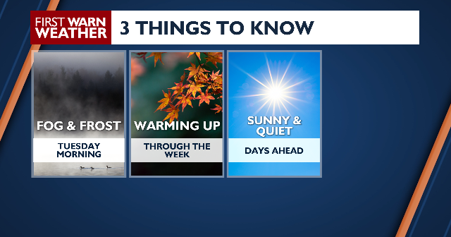 Warming up through the week
âCOPYRIGHT 2026 BY NEWS 8 NOW/NEWS 8000. ALL RIGHTS RESERVED. THIS MATERIAL MAY NOT BE PUBLISHED, BROADCAST, REWRITTEN OR REDISTRIBUTED. News 8+ 24/7 Live Stream Behind The Counter October 2026 Powerball Jackpot Jumps…
- Fall colors coming soon to Tri-Cities region, ETSU experts say
Johnson City Press Fall colors are reaching their peak in areas across the Southern Appalachians Vibrant oranges and yellows will cascade through lower elevations this weekend and into next week, according to East…
-
 Returning to more seasonal temperatures Sunday; warmer days ahead next week
LINCOLN, Neb. (KOLN) - A cold start to Saturday morning gave way to a brisk fall afternoon, but warmer weather is on the way for the coming week. High pressure continues to dominate the region, keeping skies clear and…
-
 FIRST ALERT: Watching the potential of subtropical development off the East Coast
The National Hurricane Center is watching the potential of formation off the East Coast. Watch our 2026 hurricane special, “The 5th Season” in the video above this story. A non-tropical area of low pressure is forecast…
- UPDATE: Lake wind advisory for Midlands until Sunday evening - gusts to hit 35 mph
An updated lake wind advisory was issued by the NWS Columbia SC on Saturday at 12:28 p.m. in effect until Sunday at 8 p.m. The advisory is for Northern Lancaster, Southern Lancaster, Northwestern Orangeburg, Central…
-
 Freeze warning issued for Northern Ohio Sunday Morning
The National Weather Service has issued a freeze warning for Sunday from 1 a.m. to 9 a.m. across northern Ohio and northwest Pennsylvania, with temperatures dropping as low as 30 degrees. CLEVELAND, OH (MARION COUNTY…
-
 First frost of the season arrives this weekend
by WCYB (Kit Alexander) Get ready for a rollercoaster ride of temperatures from the record heat this week to frost and near-freezing conditions early Sunday morning. Freeze watches are in effect for some in Southwest…
-
 Fall color report: Highest peaks fade as color moves down
Fall color is on the move across the Southern Appalachians. The highest peaks have largely passed peak, but elevations just below them are entering some of their best color of the season, according to East Tennessee…
-
 Pleasant weekend taking shape as temperatures feel like autumn
WNEM SAGINAW, Mich. (WNEM) - A freeze warning is in effect Friday night through 8 a.m. Saturday for the Tri-Cities, along Interstate 69 and along U.S. 127. A frost advisory is in effect until 8 a.m. Saturday for the…
-
 Dangerous Freeze Warnings Issued for Iowa, Wisconsin, Minnesota and Illinois as Temperatures Drop
Freeze Warnings take effect early Saturday across much of Iowa, Wisconsin, southeast and central Minnesota and northern Illinois, with lows as cold as 26 degrees expected. Seven National Weather Service offices issued…
Air quality
Air quality is satisfactory, and air pollution poses little or no risk.
Forecast
- SatGood
- SunGood
Kennewick, WA reporting area · 2 hrs ago. Data from AirNow (EPA and its state, local and tribal partners); preliminary and subject to change.
Sun & moon
Almanac
MonthlyTri-Cities Area, records since 1894. Normals 1991–2020. Data from NOAA's Regional Climate Centers (ACIS).
Nearby
- Tri-Cities 8 km
- Kennewick 14 km
- Pasco 15 km
- Hermiston 50 km
- Sunnyside 56 km
- West Richland 6 km
- Grandview 48 km
- Umatilla 41 km
- Finley 24 km
- Prosser 38 km
- Connell 53 km
- West Pasco 9 km
Forecasters' discussion
From the National Weather Service office in PDT, issued 23 hrs ago
Key Messages
- Dry conditions will persist into the weekend as a ridge of high pressure moves overhead.
- Near- to sub-freezing low temperatures tonight into Saturday morning. Freeze Warnings in effect.
- High confidence (70-90%) in cooler conditions and periods of showery weather early next week, followed by medium confidence (40-60%) in periods of active weather middle to late week.
Discussion
Water vapor imagery shows broad troughing over the western CONUS, moving out of our forecast area. Meanwhile, precipitation has tapered off across the Blue Mountains as a very dry northerly to northwesterly flow aloft replaces the previous air mass and a low-amplitude upper-level ridge moves overhead. Morning soundings (12Z or 18Z) at SLE, OTX, MFR, and UIL all show low PWATs of 0.25-0.35" and 12Z HREF model guidance suggests values ranging from 0.15" to 0.45" across the forecast area today into tonight. Lingering breezy conditions will taper off this evening into tonight. Moreover, the combination of clear to mostly clear skies and the dry air mass has set the stage for near- to sub-freezing temperatures tonight into Saturday morning. While most public forecast zones have observed a season-ending freeze, a widespread freeze has not yet occurred in the lowest elevations of our forecast area. Confidence is medium-high (50-95%) that a season-ending freeze will be observed in the lower Columbia Basin, eastern Columbia River Gorge, Yakima Valley, and the foothills of the northern Blue Mountains. Lowest confidence in a widespread freeze is for the eastern Columbia River Gorge; highest confidence in a freeze is for cold-prone locations along the Blue Mountain foothills and lower Columbia Basin. That said, opted to upgrade all Freeze Watches to Freeze Warnings.
Uncertainty in the 500-hPa height field burgeons Sunday through the remainder of the forecast period due to continued ensemble spread in solutions regarding the evolution of a closed low that is currently developing in the Gulf of Alaska. While ensemble solutions have begun to cluster around a closed low entering, then tracking inland, across the Pacific Northwest region later Sunday through Tuesday of next week, significant uncertainty remains with regard to the track of the low, the depth of the low, and how quickly it will move inland. Based on 12Z ensemble guidance, the best chances of precipitation will be Monday and Tuesday. Even then, chances of a wetting rain (0.10" or greater) are low (40% or less) for the lower elevations, Washington Cascades, and Ochoco-John Day Highlands. Higher chances (40-70%) of a wetting rain are forecast for the Oregon Cascades and northeast Blue Mountains.
Ensemble solutions are roughly split (50/50) Wednesday through the remainder of the week on whether another trough/closed low or ridge will be present over the Pacific Northwest. Continued cool, showery weather would accompany the closed low or troughing scenario, while dry conditions would result from the ridge.
Aviation
High pressure will create light and variable winds overnight (under 5 knots). More consistency in wind direction will develop on Saturday (under 10 knots). Clear sky or cirrus and VFR conditions at all terminals.
Pdt Watches
WA...Freeze Warning until 10 AM PDT Saturday for WAZ024-027>029. OR...Freeze Warning until 10 AM PDT Saturday for ORZ041-044-507.
Forecasts, observations and alerts in the United States come from the National Weather Service (NOAA); radar from NOAA's Multi-Radar Multi-Sensor system; satellite imagery from NASA's Global Imagery Browse Services (GIBS) and NOAA's GOES satellites; the map from the U.S. Geological Survey's National Map; air quality from AirNow (EPA and its partners); hurricane information from the National Hurricane Center; climate normals and records from NOAA's Regional Climate Centers (ACIS). Forecasts outside the United States and the UV index: MET Norway (CC BY 4.0); observations outside the U.S.: airport reports via NOAA's Aviation Weather Center. Place names: GeoNames (CC BY 4.0). Data are copied on a schedule and may lag the sources; for warnings that affect your safety, follow your local National Weather Service office and emergency officials. Weather news is drawn from the 4Search index and reflects what the press published. Terms of use.