Install
Burlington, WA Weather
Current conditions
Forecast for this hour (no station report in the last two hours)
Forecast
10-day-
Saturday
A chance of rain after 11am. Mostly cloudy, with a high near 54.
-
Saturday Night
A chance of rain. Mostly cloudy, with a low around 37.
-
Sunday
A slight chance of rain before 5pm. Partly sunny, with a high near 59.
National Weather Service forecast updated 3 days ago.
Hourly
Hourly forecast- Now53°28%
- 5 PM52°38%
- 6 PM50°38%
- 7 PM48°38%
- 8 PM46°38%
- 9 PM44°38%
- 10 PM43°38%
- 11 PM42°36%
- Sun12 AM41°36%
- 1 AM40°36%
- 2 AM40°36%
- 3 AM40°36%
- 4 AM39°36%
- 5 AM39°20%
- 6 AM38°20%
- 7 AM37°20%
- 8 AM38°20%
- 9 AM42°20%
- 10 AM47°20%
- 11 AM52°15%
- 12 PM55°15%
- 1 PM56°15%
- 2 PM57°15%
- 3 PM58°15%
Daily forecast
Details- WedOct 21Patchy Fog then Sunny41°64°
- ThuOct 22Mostly Cloudy37°57°
- FriOct 23Mostly Sunny11%36°56°
- TodayOct 24Chance Light Rain38%37°54°
- SunOct 25Slight Chance Light Rain20%37°59°
- MonOct 26Mostly Sunny18%37°58°
- TueOct 27Slight Chance Light Rain20%36°57°
- WedOct 28Mostly sunny39°56°
- ThuOct 29Cloudy0.03 in38°52°
Days after the National Weather Service's seven are MET Norway's outlook, a computer model with no forecaster's review.
Radar
Full mapWeather news near Burlington
More weather news-
 Top wind gusts Friday before cold air filters into the region this evening
BURLINGTON, Vt. (WCAX) - A strong cold front swept through northern New York and Vermont Friday morning into early afternoon, bringing the strongest wind gusts of the fall so far. Our crews found storm damage across…
-
 Region prepares for first taste of winter
JEFFERSONVILLE, Vt. (WCAX) - As temperatures dip this weekend, heralding the change in seasons, Vermont ski resorts, road crews, state parks, and nonprofits are preparing for the challenges ahead. “Ready for the snow to…
-
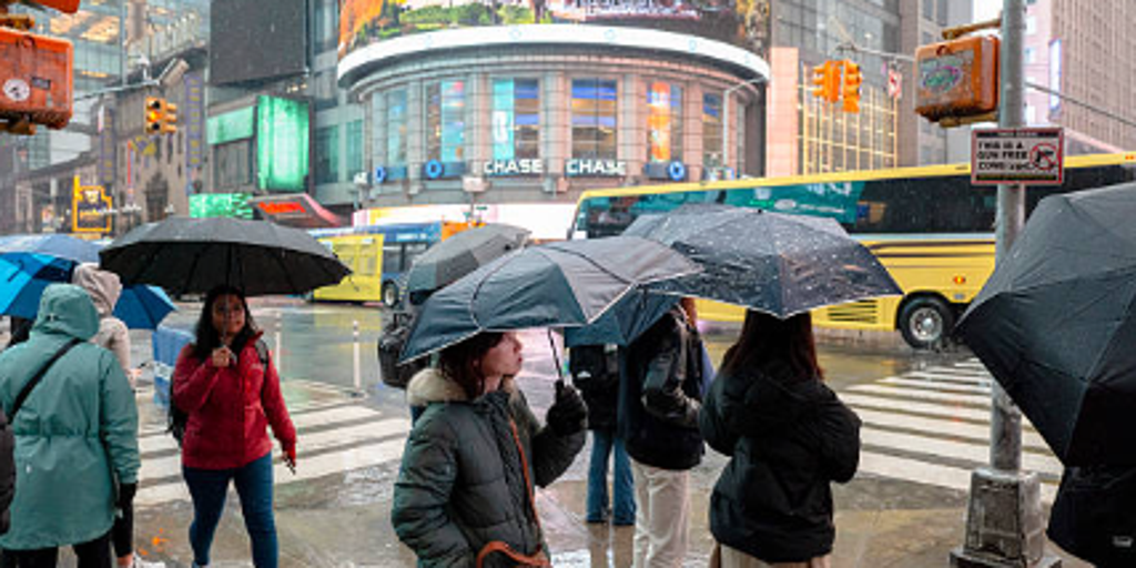 Severe storms threaten Northeast this weekend — where will the heaviest rain fall?
A week of pleasant fall weather will come to a screeching halt this weekend for people in the Northeast U.S. as severe storms bring nasty rain and strong winds. A surge in rainfall and dropping temperatures will arrive…
-
 Near-record cold with wintry conditions across Vermont Friday into Saturday
BURLINGTON, Vt. (WCAX) - This upcoming weekend will be our first widespread taste of winter across northern New York and Vermont. Mount Mansfield picked up the season’s first flakes last week, but accumulating snow has…
-
 Washington DC weather forecast: Sunny autumn day with highs of 19°C and low of 3°C on October 23, 2026
Washington DC, October 23, 2026. Today brings a lovely autumn day to the capital. Residents can expect mostly sunny skies with a welcoming high temperature of 19°C and a notable low of 3°C. With just ... Washington DC…
-
 First Serious Freeze and Frost Possible Tonight, Friday for Oregon, Washington
Published 10/22/2026 at 8:55 p.m. By Oregon Coast Beach Connection Staff The National Weather Service (NWS) in both states have issued a bundle of advisories that involve “brrrrr” as the operative word. Not all of it is…
- What 'behemoth' El Niño could mean for Washington DC's winter weather
A powerful l El Niño is taking shape in the Pacific Ocean, and it could influence everything from temperatures to precipitation this winter thousands of miles away in Washington DC. The developing weather phenomenon has…
-
 Dangerous Frost Warning Issued for 30+ Counties in Washington and Oregon as Temperatures Drop Fast
NWS Portland has issued Frost Advisories for two straight nights, Thursday night and Friday night, across northwest Oregon and southwest Washington. A Freeze Watch is also in effect Friday night for the Willamette…
-
 Washington DC weather forecast: Sunny autumn day with highs of 22°C and no rain
Washington DC, October 22, 2026. Today, residents can expect a delightful day characterized by plenty of sunshine, with maximum temperatures reaching around 22°C and a comfortable minimum of 9°C. Washington DC, October…
- UPDATE: Eastern Washington under a wind advisory Friday - gusts up to 45 mph
On Thursday at 11:09 p.m. an updated wind advisory was issued by the NWS Spokane WA valid for Friday between midnight and 3 p.m. The advisory is for Upper Columbia Basin, Okanogan Valley and Waterville Plateau. The…
Air quality
Air quality is satisfactory, and air pollution poses little or no risk.
Forecast
- SatModerate
- SunGood
- MonGood
Mount Vernon, WA reporting area · 1 hr ago. Data from AirNow (EPA and its state, local and tribal partners); preliminary and subject to change.
Sun & moon
Almanac
MonthlyWhidbey Island Nas, records since 1945. Normals 1991–2020. Data from NOAA's Regional Climate Centers (ACIS).
Nearby
- Everett 56 km
- Bellingham 34 km
- Marysville 48 km
- Mount Vernon 6 km
- Lake Stevens 55 km
- Oak Harbor 31 km
- Mukilteo 59 km
- West Lake Stevens 56 km
- Arlington 34 km
- Anacortes 22 km
- Camano 37 km
- Lynden 53 km
Forecasters' discussion
From the National Weather Service office in SEW, issued 13 hrs ago
Synopsis
A low pressure system will descend from British Columbia tonight into Sunday, bringing precipitation to Western Washington. Conditions look to remain cooler and unsettled next week as additional systems move through the area.
Short Term
High clouds starting to stream overhead across Western Washington early this morning. Temperatures continue to drop as well, with the latest observations showing temperatures in the low 30s to low 40s. A frontal system associated associated with a low pressure system just off the coast of British Columbia will move south into Western Washington this evening. Light precipitation is expected with this system, with rain reaching the coastline this evening and then filling into the interior by Sunday morning. The bulk of the precipitation is expected along the coast and the Olympics. The parent upper level low is expected to continue its southward track Sunday into Monday. The majority of models favor the center of the low pressure system moving into Oregon, which should render drier conditions for the region. However, shall center of the low track more towards the Oregon/Washington border, it may keep light showers in the forecast for Monday.
High temperatures in the mid to upper 50s. Low temperatures in the in the low 30s to low 40s increasing to the upper 30s to mid 40s by Monday.
29
Long Term
Conditions look to remain generally unsettled into Friday. There is general agreement among ensemble guidance a broad upper level trough will remain situated over the region Tuesday with a low pressure system to the north. Models are now trending wetter on Wednesday and Thursday, as the low pressure system moves southward. Cooler temperatures expected next week, with the coldest temperatures expected late in the week; high temperatures in the low to mid 50s and low temperatures in the low 30s to low 40s.
29
Aviation
Westerly flow aloft will shift southwesterly and increase today as an upper trough digs southward into the Washington offshore waters. Areas of LIFR low clouds and surface visibilities below 3SM along the coast and across the Southwest Interior will dissipate by around 18Z as high and mid level moisture increases areawide ahead of the incoming system. Ceilings will lower to MVFR in light rain at times along the coast and across the far North Interior by around 00Z. After low clouds dissipate this morning, ceilings are expected to remain VFR across the interior from around KPAE southward into this evening.
KSEA...Confidence in VFR conditions this morning remains fairly high as temp/dew point trend and arrival of high clouds with incoming system limit any low cloud development. High and mid level clouds will lower and thicken through the day, but are expected to remain well within VFR thresholds. Surface winds southeasterly generally 7 knots or less this morning are expected to back to a more E/NE direction later this afternoon and evening as offshore system gets a little closer to the region.
27
Forecasts, observations and alerts in the United States come from the National Weather Service (NOAA); radar from NOAA's Multi-Radar Multi-Sensor system; satellite imagery from NASA's Global Imagery Browse Services (GIBS) and NOAA's GOES satellites; the map from the U.S. Geological Survey's National Map; air quality from AirNow (EPA and its partners); hurricane information from the National Hurricane Center; climate normals and records from NOAA's Regional Climate Centers (ACIS). Forecasts outside the United States and the UV index: MET Norway (CC BY 4.0); observations outside the U.S.: airport reports via NOAA's Aviation Weather Center. Place names: GeoNames (CC BY 4.0). Data are copied on a schedule and may lag the sources; for warnings that affect your safety, follow your local National Weather Service office and emergency officials. Weather news is drawn from the 4Search index and reflects what the press published. Terms of use.