Install
West Brattleboro, VT Weather
Current conditions
Forecast for this hour (no station report in the last two hours)
Forecast
10-day-
Sunday
Sunny, with a high near 64.
-
Sunday Night
Mostly clear, with a low around 33.
-
Monday
Sunny, with a high near 67.
National Weather Service forecast updated 2 days ago.
Hourly
Hourly forecast- Now29°
- 8 AM33°
- 9 AM38°
- 10 AM44°
- 11 AM52°
- 12 PM57°
- 1 PM61°
- 2 PM62°
- 3 PM63°
- 4 PM64°
- 5 PM59°
- 6 PM54°
- 7 PM49°
- 8 PM48°
- 9 PM44°
- 10 PM41°
- 11 PM38°
- Mon12 AM37°
- 1 AM36°
- 2 AM36°
- 3 AM36°
- 4 AM35°
- 5 AM35°
- 6 AM34°
Daily forecast
Details- ThuOct 22Sunny34°62°
- FriOct 23Sunny24°56°
- SatOct 24Sunny27°59°
- TodayOct 25Sunny33°64°
- MonOct 26Sunny37°67°
- TueOct 27Mostly Sunny29°56°
- WedOct 28Mostly Sunny34°55°
- ThuOct 29Cloudy0.02 in41°59°
Days after the National Weather Service's seven are MET Norway's outlook, a computer model with no forecaster's review.
Radar
Full mapWeather news in Vermont
More weather news-
 NOAA’s Winter Outlook Predicts Warmer Temperatures and Less Snow for Vermont
At SSBCrack News, our dedicated editorial team brings you the latest and most reliable updates on Defence, Geopolitics, Military Affairs, Science, and Technology. Driven by a passion for national security and strategic…
- Vermont Woolly Bear Points to Mild Winter in Predicting A Harsh Winter Using Wildlife
A Vermont woolly bear crossing a patch of pine needles on an access road this week is feeding the old habit of predicting a harsh winter using wildlife, and this one pointed toward a mild season. Its black ends and wide…
-
 PHOTOS: First snowflakes fly around Vermont
VTDigger Member-supported journalism. Informing and engaging Vermont. This year, VTDigger is teaming up with Henry’s Weather Channel to help answer the annual question of when and where peak foliage will make its…
-
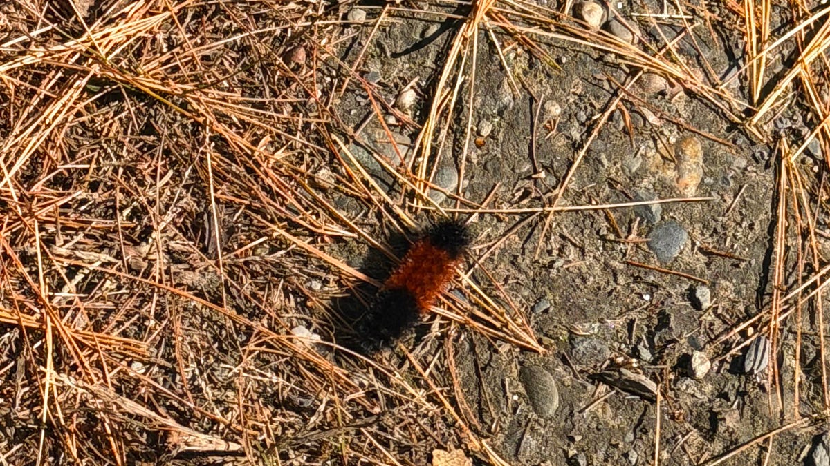 A Vermont Woolly Bear Calls for a Mild Winter. NOAA Mostly Agrees.
The federal government released its official winter forecast on Thursday. Compass Vermont got a second opinion from a caterpillar. We found him crossing a patch of pine needles on a Vermont access road this week. He’s a…
-
 More wet and windy weather to follow stormy weekend
Choppy seas and large waves crashing up onshore in Aberystwyth, Ceredigion Storm Boelo will continue to batter parts of the UK on Sunday but the fierce autumn weather shows no sign of clearing quickly. After two named…
-
 Storm Boelo: warnings in place in Scotland, Northern Ireland and north of England as high winds batter UK
Met Office reports gusts of 80mph in exposed coastal spots and advises people in affected areas to stay indoors Strong winds have battered Scotland, Northern Ireland and northern England overnight, as Storm Boelo hit…
-
 Rain on Halloween? L.A. could have its first wet Halloween in a decade
The reprieve from rain is expected to last just a few more days as forecasters warn of another storm system that could bring Los Angeles its first rainy Halloween since 2014. It’s still too far out to know the exact…
-
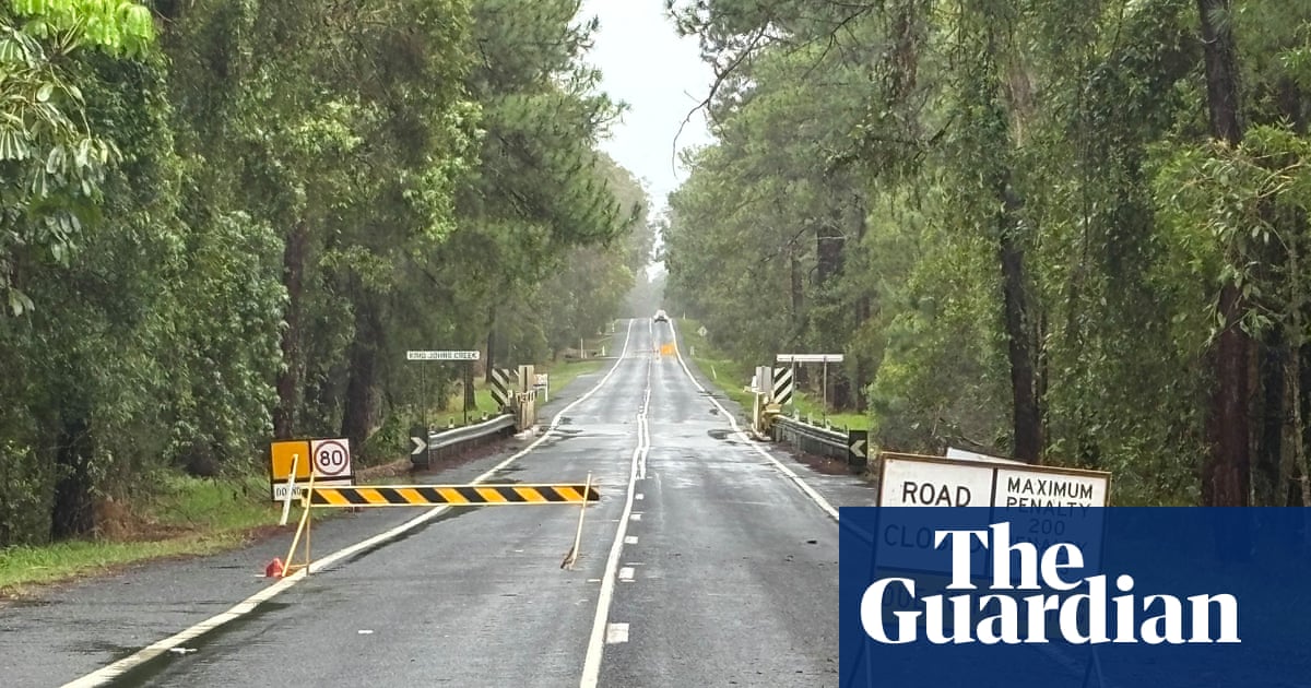 ‘Unusually large’ multi-state storm causing severe weather for Australia’s east – with more on the way
BoM predicts hail, damaging winds, flash flooding and power outages across southern Queensland, western NSW, the ACT and eastern Victoria on Sunday afternoon Large parts of eastern Australia were put on alert for severe…
-
 First Alert Weather: Freezing temps overnight for some parts of New York - 10/24/26
CBS News - The 5:33 | Legacy of the LIRR Massacre - On The Dot with David Schechter: Wildfires & Climate Change First Alert Weather: Freezing temps overnight for some parts of New York - 10/24/26 Trump, Obama make…
-
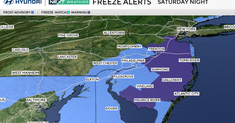 Frosty start to Sunday in Philadelphia region; fabulous fall weather for Eagles-Cowboys Monday
October 24, 2026 / 11:38 PM EDT / CBS Philadelphia Sunday will be a beautiful fall day in the Philadelphia region with plenty of sunshine, light winds and temperatures beginning to moderate after another frosty start…
Air quality
Acceptable. Unusually sensitive people should consider limiting prolonged outdoor exertion.
Forecast
- SunGood
- MonGood
Cheshire County, NH reporting area · 1 hr ago. Data from AirNow (EPA and its state, local and tribal partners); preliminary and subject to change.
Sun & moon
Almanac
MonthlyKeene, records since 1893. Normals 1991–2020. Data from NOAA's Regional Climate Centers (ACIS).
Nearby
- Amherst 55 km
- Northampton 59 km
- Keene 28 km
- Gardner 58 km
- Greenfield 30 km
- Amherst Center 54 km
- North Adams 45 km
- Bennington 48 km
- Montague 36 km
- Athol 42 km
- Brattleboro 4 km
- Swanzey 26 km
Forecasts, observations and alerts in the United States come from the National Weather Service (NOAA); radar from NOAA's Multi-Radar Multi-Sensor system; satellite imagery from NASA's Global Imagery Browse Services (GIBS) and NOAA's GOES satellites; the map from the U.S. Geological Survey's National Map; air quality from AirNow (EPA and its partners); hurricane information from the National Hurricane Center; climate normals and records from NOAA's Regional Climate Centers (ACIS). Forecasts outside the United States and the UV index: MET Norway (CC BY 4.0); observations outside the U.S.: airport reports via NOAA's Aviation Weather Center. Place names: GeoNames (CC BY 4.0). Data are copied on a schedule and may lag the sources; for warnings that affect your safety, follow your local National Weather Service office and emergency officials. Weather news is drawn from the 4Search index and reflects what the press published. Terms of use.