Install
Fairlawn, VA Weather
Current conditions
Forecast for this hour (no station report in the last two hours)
Forecast
10-day-
Tuesday
Patchy fog before 10am. Sunny, with a high near 70. Northeast wind 0 to 3 mph.
-
Tuesday Night
Partly cloudy, with a low around 42. East wind around 2 mph.
-
Wednesday
Mostly cloudy, with a high near 66. Southeast wind 0 to 3 mph.
National Weather Service forecast updated 2 hrs ago.
Hourly
Hourly forecast- Now40°
- 7 AM39°
- 8 AM39°
- 9 AM41°
- 10 AM50°
- 11 AM58°
- 12 PM64°
- 1 PM67°
- 2 PM69°
- 3 PM70°
- 4 PM69°
- 5 PM68°
- 6 PM65°
- 7 PM59°
- 8 PM57°
- 9 PM54°
- 10 PM52°
- 11 PM50°
- Wed12 AM49°
- 1 AM48°
- 2 AM47°
- 3 AM46°
- 4 AM46°
- 5 AM45°
Daily forecast
Details- TonightOct 26Patchy Fog38°
- TodayOct 27Patchy Fog then Sunny42°70°
- WedOct 28Mostly Cloudy42°66°
- ThuOct 29Sunny40°73°
- FriOct 30Sunny46°77°
- SatOct 31Mostly Cloudy21%47°69°
- SunNov 1Chance Rain Showers56%52°64°
- MonNov 2Chance Rain Showers53%68°
- TueNov 3Rain0.12 in57°66°
Days after the National Weather Service's seven are MET Norway's outlook, a computer model with no forecaster's review.
Radar
Full mapWeather news in Virginia
More weather news-
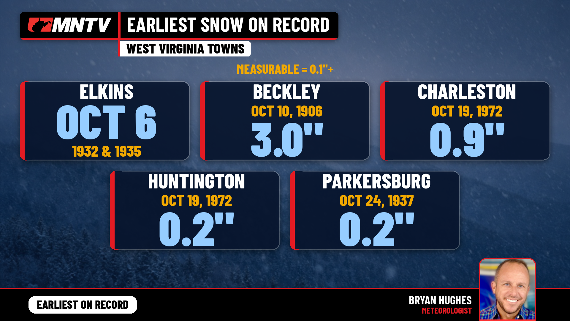 When does West Virginia usually see its first snow? Earlier than you might think
Every fall somebody asks the same question: when does the first snow usually show up in West Virginia? It’s a fair one. Leaves are still hanging on in a lot of places, football season is in full swing, and Halloween…
-
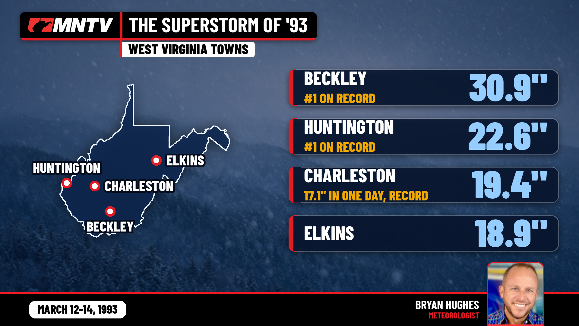 The Storm of the Century: When West Virginia Disappeared Under Feet of Snow
I’ve been forecasting West Virginia weather for 27 years, and there’s one storm folks still bring up at the grocery store, at ballgames, and in my Facebook comments: March 12-14, 1993. You might know it as the…
-
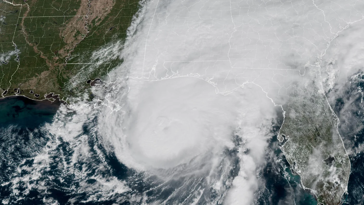 How AI is transforming hurricane forecasts
A satellite image provided by the National Oceanic and Atmospheric Administration (NOAA) shows Hurricane Isaias approaching the Gulf Coast of Alabama and Florida on Friday, Oct. 9 2026. NOAA/NOAA hide caption Hurricane…
-
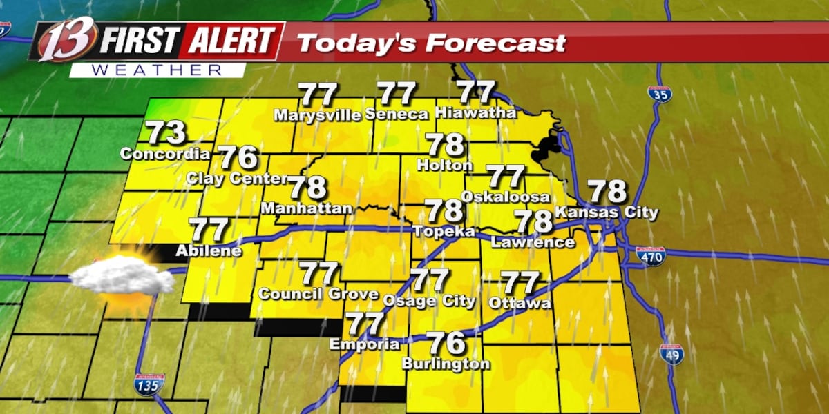 Monday forecast: Staying mild
TOPEKA, Kan. (WIBW) - The unseasonably warm weather continues all week with several opportunities for rain. The chance of rain remain low overall to begin the week with most of the rain staying in north-central KS today…
- Warmth Continues With Scattered Rain Chances, Better Odds Late Week
TOPEKA, Kan. (WIBW) - Above-normal temperatures continue through the forecast, so enjoy the warm stretch! Low rain chances move into north-central Kansas tonight into Monday, spreading east Tuesday, with greater chances…
-
 Seasonable temperatures for October's final weekend
RICHMOND, Va. -- Sunshine will mix with more clouds this afternoon, especially east and south of Richmond. Highs will be in the low to mid 60s in most areas, with some upper 60s to the southwest. Minor coastal flooding…
- Dry and Warm Through Sunday, Low-End Rain Chances Continue Through Thursday
TOPEKA, Kan. (WIBW) - A quiet, warm weekend is ahead, before low-end chances continue off and on through Thursday, but most of the area stays dry. - Low-End Rain Chances Continue Through Thursday: Low-end chances for…
-
 Drought advisory in Hampton Roads escalates
Southeast Virginia, including Hampton Roads, has moved from a drought watch to a warning as of Thursday, according to the Virginia Department of Environmental Quality. This escalation was recommended by the Drought…
-
 VDOT lists Fredericksburg District lane closures for Oct. 25–31
VDOT listed scheduled lane closures for road work in the Fredericksburg District for Oct. 25–31, weather permitting, the agency said. On I-95, mobile single lane closures to clean and wash bridges run Monday–Friday, 7…
-
 Winds and Rain Chances on the Rise, Temps Plummet
RAPID CITY, S.D. (KOTA) - The end of the week is finally here. After talking about the shake up all week, we’ve made it to the mythical cold front day. Rain is expected to pass through the western side of SD tonight…
Air quality
Air quality is satisfactory, and air pollution poses little or no risk.
Forecast
- TueGood (44)
Roanoke, VA reporting area · 1 hr ago. Data from AirNow (EPA and its state, local and tribal partners); preliminary and subject to change.
Sun & moon
Almanac
MonthlyHot Springs, records since 1893. Normals 1991–2020. Data from NOAA's Regional Climate Centers (ACIS).
Nearby
- Roanoke 56 km
- Salem 54 km
- Hollins 48 km
- Vinton 56 km
- Lexington 47 km
- Buena Vista 55 km
- Covington 2 km
- Lewisburg 41 km
- Clifton Forge 15 km
- Cloverdale 46 km
- Blue Ridge 47 km
- Daleville 41 km
Forecasters' discussion
From the National Weather Service office in RNK, issued 3 hrs ago
What Has Changed
Did not go as pessimistic with respect to fog in the aviation forecasts. Still think there will be some along the immediate rivers, but coverage is expected to be less this morning compared to yesterday morning.
No significant changes to the overall forecast. Guidance maintains dry forecast through the week in spite of some periodic cloud cover.
Key Messages
1) Dry and seasonable weather continues through the week. The first day of November is the next opportunity for rain.
Discussion
KEY MESSAGE 1: Dry and seasonable weather continues through the week. The first day of November is the next opportunity for rain.
High pressure remains over the Mid-Atlantic and Southeast states through the end of the month. This high amplitude anticyclone will flatten in response to short wave energy moving through the faster flow to our north. Mid and upper level moisture will increase Wednesday, remnants of the storm system which plagued the Southwest, but is weakening as it moves northeast. Its passage will bring a veil of cirrus but nothing more. We may actually end of with some marine strato-cu as the surface winds become easterly late tonight into Wednesday...the HREF the most bullish with respect to this cloud layer. Depending on cloud thickness, this may impact temperatures with lower high temps Wednesday and higher low temps Wednesday night.
Aside from the passage of the shortwave trough Wednesday the overall ridge of high pressure will remain in place for the remainder of the week and into the weekend. Temperatures should remain seasonably mild through the end of the month as a result. Friday looks to be the warmest day with high temperatures 10 degrees above normal.
As for the next chance of rain. Models have been consistent with advertisement of a southern stream short wave to cross the country over the weekend, bringing moisture into the area beginning Sunday November 1st. Some rain may sneak in here late Halloween night, but all models still insist on dry conditions for the Trick-or-Treat crowd Saturday evening.
Strength of the initial wave Sunday appears weak, but models do indicate southeast upslope flow which should enhance the rain chance along the Blue Ridge. A series of disturbances are forecast to follow during the week, so it looks promising for additional rainfall, and this should help snuff the late October dry spell.
Aviation
Forecast remains dry. Aside for patchy fog this morning, expecting VFR conditions today.
Used tempo groups for LWB and BCB to account for fog off the rivers this morning. Maintained unrestricted vsby elsewhere.
Winds this morning were light and variable. After 14Z, expect a light northeast wind over the piedmont and an east wind across the mountains...generally under 6 kts but with a few gusts up to 15 kts between 14-19Z.
For tonight, high clouds will begin to increase after midnight. Will also be monitoring shallow easterly flow which may bring a shallow but thin layer of MVFR cigs to the area Wednesday morning. The HREF is the most bullish with respect to this low level cloud cover.
EXTENDED AVIATION OUTLOOK...
A period of low level clouds from the east may drop ceilings below 3000 ft...mainly MVFR, but there is a chance it could be as low as IFR Wednesday morning. Multiple cloud layers may persist through Wednesday night before clearing Thursday.
Forecasts, observations and alerts in the United States come from the National Weather Service (NOAA); radar from NOAA's Multi-Radar Multi-Sensor system; satellite imagery from NASA's Global Imagery Browse Services (GIBS) and NOAA's GOES satellites; the map from the U.S. Geological Survey's National Map; air quality from AirNow (EPA and its partners); hurricane information from the National Hurricane Center; climate normals and records from NOAA's Regional Climate Centers (ACIS). Forecasts outside the United States and the UV index: MET Norway (CC BY 4.0); observations outside the U.S.: airport reports via NOAA's Aviation Weather Center. Place names: GeoNames (CC BY 4.0). Data are copied on a schedule and may lag the sources; for warnings that affect your safety, follow your local National Weather Service office and emergency officials. Weather news is drawn from the 4Search index and reflects what the press published. Terms of use. How to use Weather