Install
Childress, TX Weather
Current conditions
Observed at Vernon, Wilbarger County Airport · 59 min ago
Forecast
10-day-
Saturday
Mostly sunny, with a high near 76. South southeast wind 10 to 15 mph.
-
Saturday Night
A chance of rain showers after 1am. Mostly cloudy, with a low around 59. South southeast wind around 10 mph, with gusts as high as 25 mph. Chance of precipitation is 30%.
-
Sunday
A chance of rain showers. Mostly cloudy, with a high near 71. Chance of precipitation is 40%.
National Weather Service forecast updated 3 days ago.
Hourly
Hourly forecast- Now75°
- 3 PM76°
- 4 PM76°
- 5 PM75°
- 6 PM73°
- 7 PM71°10%
- 8 PM69°10%
- 9 PM67°10%
- 10 PM65°10%
- 11 PM64°10%
- Sun12 AM63°10%
- 1 AM63°30%
- 2 AM62°30%
- 3 AM62°30%
- 4 AM61°30%
- 5 AM60°30%
- 6 AM60°30%
- 7 AM60°42%
- 8 AM61°42%
- 9 AM62°42%
- 10 AM63°42%
- 11 AM64°42%
- 12 PM66°42%
- 1 PM67°44%
10-day forecast
Details- TonightOct 20Mostly Clear55°
- WedOct 21Sunny57°81°
- ThuOct 22Mostly Sunny58°81°
- FriOct 23Mostly Sunny58°79°
- TodayOct 24Mostly Sunny30%59°76°
- SunOct 25Chance Rain Showers44%55°71°
- MonOct 26Chance Showers And Thunderstorms37%53°68°
- TueOct 27Chance Rain Showers35%64°
- WedOct 28Sunny41°58°
- ThuOct 29Sunny38°61°
Days after the National Weather Service's seven are MET Norway's outlook, a computer model with no forecaster's review.
Radar
Full mapWeather news near Childress
More weather news-
 More rain, severe storms expected to continue through Wednesday
LUBBOCK, Texas (KCBD) - Heavy rain is currently pushing northeast across the region with scattered showers expected to persist through mid-morning. Severe storms are unlikely during this early period, and there are no…
-
 Strong El Niño could bring more rain and improves drought conditions
AMARILLO, Texas (KFDA) - Recent rounds of rain are bringing relief after months of severe to exceptional drought across the Texas Panhandle and eastern New Mexico. NewsChannel 10 Chief Meteorologist Dave Oliver said…
-
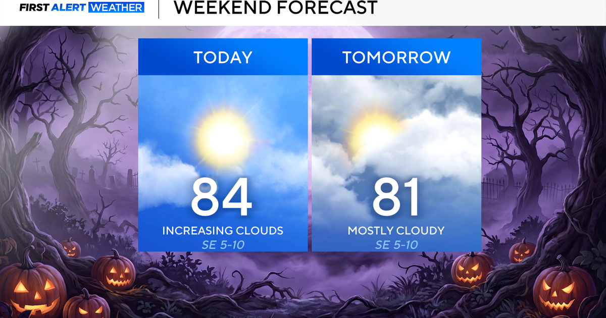 North Texas seeing rain chances return next week
October 24, 2026 / 7:21 AM CDT / CBS Texas North Texas was off to a seasonable start on Saturday morning, with temperatures mainly in the 50s. Temperatures will remain above average this weekend, with highs in the lower…
-
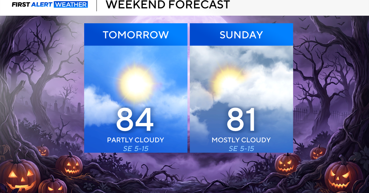 Clouds build in over the weekend as temperatures stay above average in the 80s across North Texas
October 23, 2026 / 8:00 AM CDT / CBS Texas North Texans are waking up to temperatures mainly in the 50s and 60s on Friday morning, with some clouds across portions of the area. In the afternoon and into the weekend…
- Video: What the Super El Niño Means for Texas This Winter
The Gilmer Mirror
-
 Josephine in Atlantic drifts away, but Pacific moisture might spoil Halloween for Texas
Subtropical Storm Josephine in the North Atlantic is racing away from the United States, while moisture from a strengthening eastern Pacific storm could bring rain to Texas around Halloween next week. Josephine's center…
-
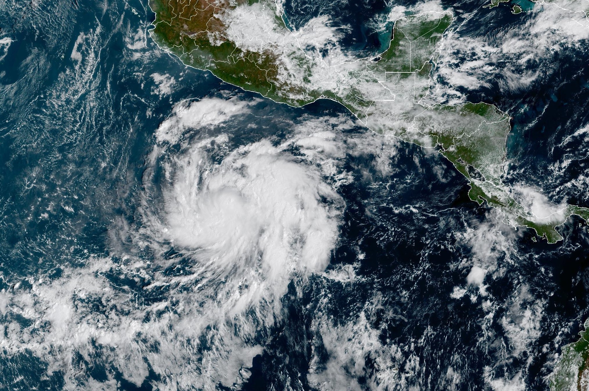 Tropical Storm Vance forms near Mexico. Will it affect Texas?
From there, some weather models show that moisture from Vance could move into parts of South Texas, bringing enhanced rain chances to places like the Rio Grande Valley, San Antonio, and Corpus Christi. Exactly when…
-
 Hometown Sizzle: Texas Chili For Chilly Weather
WDBJ7 Hometown Sizzle: Texas Chili For Chilly Weather STYLE & SAVINGS: Goodwill Offers Tips For Thrifting Halloween Costumes VDOT: Overhead Flashers In Franklin County Live on Rte. 220
-
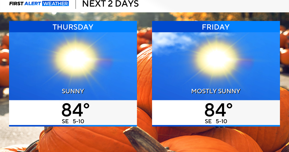 Temperatures to stay in 80s through weekend as clouds increase across North Texas
October 22, 2026 / 7:57 AM CDT / CBS Texas Temperatures are in the 50s and low 60s when you step outside to start your day. The forecast is almost identical to Wednesday, with sunshine and highs in the 80s in store for…
-
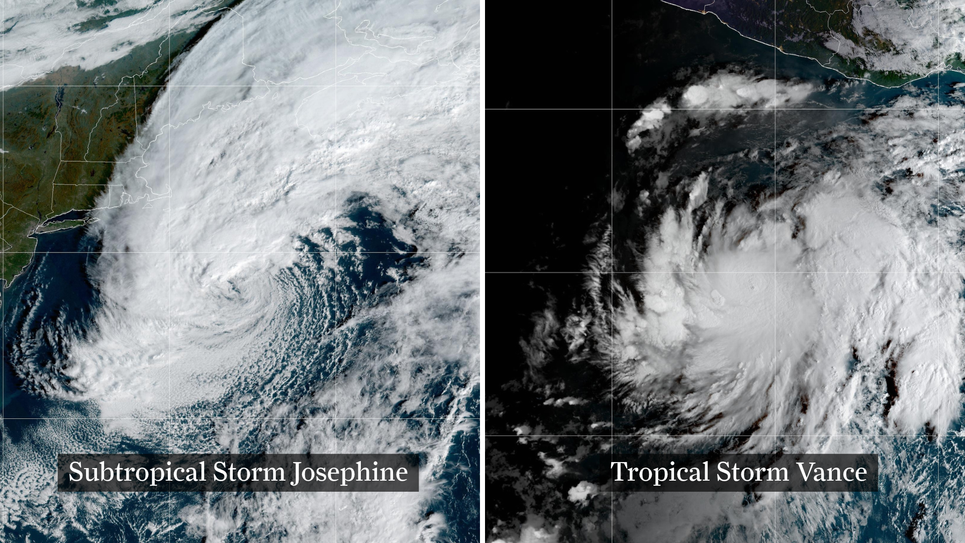 Josephine drifts away, Pacific moisture might spoil Halloween in Texas
From left, weather satellite images show Subtropical Storm Josephine in the North Atlantic and Tropical Storm Vance in the eastern Pacific. Josephine will continue strengthening off the coast of New England and the…
Sun & moon
Almanac
MonthlyChildress Area, records since 1893. Normals 1991–2020. Data from NOAA's Regional Climate Centers (ACIS).
Nearby
- Quanah 45 km
- Wellington 48 km
- Memphis 45 km
Forecasters' discussion
From the National Weather Service office in LUB, issued 8 hrs ago
Key Messages
Updated at 604 AM CDT Sat Oct 24 2026
- Showers and storms are possible Saturday through Tuesday, with the best chance being on the Caprock on Sunday (50-80% chance). The threat of flooding has diminished.
Short Term
(Tonight through Sunday) Issued at 1018 PM CDT Fri Oct 23 2026
A slow eastward progression of the synoptic pattern continues, with the upper ridge axis now focused from south Texas northward to Lake Superior. Meanwhile, the western US trough has begun to split into a closed low over the SW CONUS and another over Canada. Friday's forecast largely panned out as expected, including the morning stratus across the South Plains, and another round of stratus appears likely along and west of I-27 Saturday morning. While the SW US upper low slowly meanders east on Sat, a primarily meridional (southerly) mid-level flow component suggests limited eastward progression of any storms that develop across NM tomorrow. CAMs indicate precip is possible near, along, and perhaps just east of the NM/TX border tomorrow, but much of the forecast area stays dry through at least late Sat evening.
Shower and storm chances do increase late Sat night into Sun, especially on the Caprock (50-80% chance), but the flooding potential has lowered considerably from previous forecasts. As the upper low lifts northeast towards CO, the better upper forcing will be focused north of our area, and the sfc front never quite reaches our area either, so forcing is weaker and less persistent than earlier model runs suggested. In addition to weaker forcing on Sun, the lack of preceding rainfall on Fri-Sat will also minimize the flood threat, as current soil moisture values from NASA-SPoRT indicate dry soils that will be receptive to rain. The previous WPC Excessive Rainfall Outlook had a "Slight Risk" (level 2 of 4) across much of the Caprock on Sunday, but the updated outlook now has no categorical risk across most of the area (less than 5% chance of flooding). The potential of exceeding 1" of rain on Sunday is low, around 20% west of I-27, peaking at 40% in the far SW TX Panhandle.
The temps trend cooler into Sun as the cloud cover thickens and precip chances increase, with highs in the mid 60s on the Caprock Sun and mid 70s off the Caprock. Winds on Sat-Sun will be similar to what we experience on Fri, out of the southeast with gusts as high as 30 mph.
Long Term
(Sunday night through next Friday) Issued at 1018 PM CDT Fri Oct 23 2026
During the early part of next week, the upper low over CO continues to lift northeast, but precip chances linger across the forecast area, aided in part by another shortwave lifting across the Permian Basin. The highest precipitable water values (nearing 1.25") will shift to areas off the Caprock by Mon, but similar to areas on the Caprock on Sun these areas will have received little preceding rainfall and the dry soils should limit the flooding risk.
The polar jet remains active across the northern US next week, with multiple disturbances evolving over and emerging from the Pacific NW. Models have come into better agreement in showing a fast-moving wave ejecting onto the northern Plains late Tues, and the associated sfc pressure falls will keep southerly winds in place locally. Differences remain during the latter half of the week but a SW flow regime is favored over the SW CONUS and W TX. This would support occasional shortwaves and associated precip chances late next week into the Halloween weekend. The CPC 6 to 10 Day Outlook (valid Oct 29-Nov 2) has a 60-80% chance of above normal precip across west Texas. Beyond Tues, temps will generally be in the 60s/70s with lows in the upper 40s/50s.
Aviation
(12Z TAFS) Issued at 604 AM CDT Sat Oct 24 2026
VFR conditions will prevail. Low clouds are expected to fill in from the south impacting KLBB. However, these low clouds are not expected to impact flight category. Chances for showers and thunderstorms are possible at KLBB and KPVW towards the end of this TAF period, however as timing is still uncertain, have been left out of this TAF. Severe threat will be low with these storms.
Forecasts, observations and alerts in the United States come from the National Weather Service (NOAA); radar from NOAA's Multi-Radar Multi-Sensor system; satellite imagery from NASA's Global Imagery Browse Services (GIBS) and NOAA's GOES satellites; the map from the U.S. Geological Survey's National Map; air quality from AirNow (EPA and its partners); hurricane information from the National Hurricane Center; climate normals and records from NOAA's Regional Climate Centers (ACIS). Forecasts outside the United States and the UV index: MET Norway (CC BY 4.0); observations outside the U.S.: airport reports via NOAA's Aviation Weather Center. Place names: GeoNames (CC BY 4.0). Data are copied on a schedule and may lag the sources; for warnings that affect your safety, follow your local National Weather Service office and emergency officials. Weather news is drawn from the 4Search index and reflects what the press published. Terms of use.