Install
James Island, SC Weather
Current conditions
Observed at Charleston, Charleston Air Force Base · 50 min ago
Forecast
10-day-
Saturday Night
Mostly clear, with a low around 55. Northeast wind 13 to 18 mph, with gusts as high as 29 mph.
-
Sunday
Sunny, with a high near 72.
-
Sunday Night
Mostly clear, with a low around 54.
National Weather Service forecast updated 2 days ago.
Hourly
Hourly forecast- Now60°
- 1 AM59°
- 2 AM58°
- 3 AM58°
- 4 AM57°
- 5 AM56°
- 6 AM56°
- 7 AM55°
- 8 AM56°
- 9 AM59°
- 10 AM62°
- 11 AM65°
- 12 PM68°
- 1 PM70°
- 2 PM71°
- 3 PM72°
- 4 PM72°
- 5 PM71°
- 6 PM70°
- 7 PM67°
- 8 PM66°
- 9 PM64°
- 10 PM62°
- 11 PM61°
10-day forecast
Details- TonightOct 22Clear51°
- FriOct 23Sunny55°69°
- SatOct 24Mostly Sunny55°72°
- TodayOct 25Sunny54°72°
- MonOct 26Sunny51°72°
- TueOct 27Sunny54°72°
- WedOct 28Mostly Sunny then Slight Chance Rain Showers15%57°72°
- ThuOct 29Mostly Sunny13%72°
- FriOct 30Cloudy65°76°
- SatOct 31Rain0.21 in65°74°
Days after the National Weather Service's seven are MET Norway's outlook, a computer model with no forecaster's review.
Radar
Full mapWeather news near James Island
More weather news- Weather alert for winds in Lowcountry until Saturday evening
Hilton Head Island Packet The creation of this content included the use of AI based on templates created, reviewed and edited by journalists in the newsroom. Read more on our AI policy here. The NWS Charleston SC issued…
-
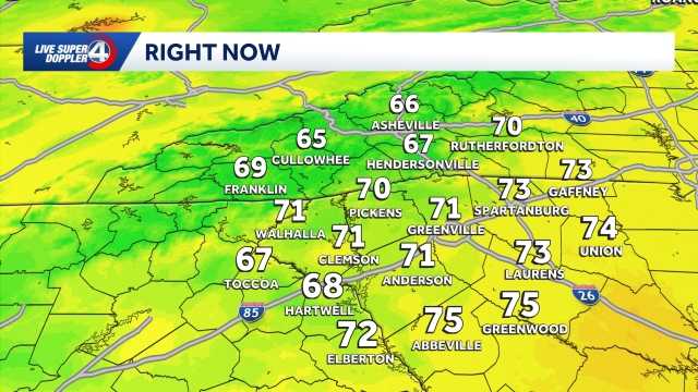 Staying cool and dry Saturday in South Carolina: October 24 forecast
Cool morning ahead, breezy at times with highs in the 70s. Staying dry this weekend. Sunshine lingers into the Sunday. Expect highs in the 60s and lows in the 30s and 40s. Clouds are expected to increase just a bit by…
- Cooler weekend ahead in South Carolina: October 23 forecast
Highs top out in the 60s Expect slightly cooler temperatures on Friday in the Upstate of South Carolina, Western North Carolina and Northeast Georgia. Highs will top out in the upper 60s to low 70s under plenty of…
- Staying sunny, seasonable in South Carolina: October 22 forecast
Sunshine lingers with highs in the 60s and 70s Thursday will feature sunny and seasonable weather in the Upstate of South Carolina, Western North Carolina and Northeast Georgia. After a cool to chilly start, highs will…
- Cold Mornings with Warmer Afternoons in South Carolina: October 20 forecast
Cooler mornings with warm afternoons ahead. Sunshine and comfortable temperatures expected this week in the Upstate. The forecast remains quiet this week as a high pressure keeps the area dry. Highs sit in the 70s with…
- Quiet weather ahead this week in South Carolina: October 19 forecast
Sunshine and comfortable temperatures expected this week in the Upstate. The forecast remains quiet this week as a high pressure keeps the area dry. Highs sit in the 70s with lows in the 40s. The temperatures will be…
- Cold start to Sunday in South Carolina: October 18 forecast
Frost and Freeze across the area this morning, warming up through the week. Afternoon highs will warm into the low to mid-60s by Sunday afternoon. Frost and freeze conditions remain possible Monday and Tuesday mornings…
Air quality
Air quality is satisfactory, and air pollution poses little or no risk.
Charleston, SC reporting area · 1 hr ago. Data from AirNow (EPA and its state, local and tribal partners); preliminary and subject to change.
Sun & moon
Almanac
MonthlyCharleston Area, records since 1937. Normals 1991–2020. Data from NOAA's Regional Climate Centers (ACIS).
Nearby
- Charleston 6 km
- North Charleston 15 km
- Mount Pleasant 12 km
- Summerville 38 km
- Goose Creek 29 km
- Hanahan 22 km
- Ladson 32 km
- Moncks Corner 53 km
- Sangaree 38 km
- Centerville 36 km
- Hollywood 26 km
- Isle of Palms 17 km
Forecasters' discussion
From the National Weather Service office in CHS, issued 2 hrs ago
What Has Changed
Minor changes to Key Message 1.
Key Messages
- 1) A significant, multi-day coastal flooding event is expected this weekend through at least the middle of next week.
- 2) Strong northeast flow this weekend and into early next week will result in several hazards including gusty lake winds, rip currents, high surf, and beach erosion.
- 3) Dry conditions and below normal temperatures will continue through early next week before gradually warming up by the end of the week.
Discussion
KEY MESSAGE 1: A significant multi-day coastal flooding event is expected this weekend through at least the middle of next week.
Astronomical tides will continue to rise through the remainder of the weekend and into next week due to the upcoming full moon (10/26) and the lunar perigee (10/28). Large tidal departures are already ongoing, and with an extended period of strong northeast flow this weekend and into next week, these departures will increase in magnitude. The combination of the highest astronomical tides of the year and persistent strong northeast flow will result in a multi-day moderate to major coastal flooding event for the entire southeast GA/SC coast.
Sunday Morning: Tide levels at the Charleston Harbor are forecast to reach 7.9-8.1 ft MLLW, resulting in a Coastal Flood Warning for Charleston and coastal Colleton. In addition, at these tide levels, up to half a foot of saltwater inundation will be possible for tidal Berkeley county, resulting in a Coastal Flood Advisory. Lastly, a Coastal Flood Advisory has been issued for Fort Pulaski as well, from Beaufort County in SC to McIntosh County in GA, with forecast values of 10.0-10.2 ft MLLW.
Sunday Evening: Tide levels at the Charleston Harbor are forecast to reach 7.4-7.6 ft MLLW, whereas at Fort Pulaski the tide is expected to reach 9.6-9.8 ft MLLW. Coastal flood advisories will most likely be needed.
Next Week: The highest water levels are expected to occur with the Monday, Tuesday, and Wednesday morning high tide cycles. During these cycles, confidence is increasing that Charleston will exceed major flood stage (8.0 ft MLLW) and Fort Pulaski will exceed moderate flood stage (10.0 ft MLLW). There is even concern that Fort Pulaski could reach or exceed its major flood stage (10.5 ft MLLW), which has never happened in its history (records begin in 1935) outside of a tropical system. Coastal flooding will likely occur with both the morning and evening high cycles for several days, though the evening tide will be the lower of the two. Coastal Flood Advisories will definitely be needed, and Coastal Flood Watches/Warnings are very likely for some or all of the coast from Sunday through Wednesday.
KEY MESSAGE 2: Strong northeast flow this weekend and into early next week will result in several hazards including gusty lake winds, rip currents, high surf, and beach erosion.
Aviation
Northeasterly winds will remain gusty into the overnight hours, increasing after sunrise to become breezy again. Areas well away from the coast are expected to see gusts of 20-25 knots, while those along the coast will be closer to 30 knots.
Extended Aviation Outlook: VFR conditions are expected at CHS/JZI/SAV through the middle of next week. However, breezy/gusty north-northeast winds are likely Sunday afternoon (up to 25-30 kt).
Forecasts, observations and alerts in the United States come from the National Weather Service (NOAA); radar from NOAA's Multi-Radar Multi-Sensor system; satellite imagery from NASA's Global Imagery Browse Services (GIBS) and NOAA's GOES satellites; the map from the U.S. Geological Survey's National Map; air quality from AirNow (EPA and its partners); hurricane information from the National Hurricane Center; climate normals and records from NOAA's Regional Climate Centers (ACIS). Forecasts outside the United States and the UV index: MET Norway (CC BY 4.0); observations outside the U.S.: airport reports via NOAA's Aviation Weather Center. Place names: GeoNames (CC BY 4.0). Data are copied on a schedule and may lag the sources; for warnings that affect your safety, follow your local National Weather Service office and emergency officials. Weather news is drawn from the 4Search index and reflects what the press published. Terms of use.