Install
Greenville, SC Weather
Current conditions
Forecast for this hour (no station report in the last two hours)
Forecast
10-day-
Saturday
Sunny, with a high near 66. Northeast wind 10 to 15 mph, with gusts as high as 22 mph.
-
Saturday Night
Clear, with a low around 44. Northeast wind around 12 mph, with gusts as high as 22 mph.
-
Sunday
Sunny, with a high near 67. Northeast wind 12 to 15 mph, with gusts as high as 22 mph.
National Weather Service forecast updated 1 day ago.
Hourly
Hourly forecast- Now63°
- 2 PM65°
- 3 PM66°
- 4 PM66°
- 5 PM66°
- 6 PM64°
- 7 PM60°
- 8 PM56°
- 9 PM54°
- 10 PM52°
- 11 PM51°
- Sun12 AM50°
- 1 AM49°
- 2 AM48°
- 3 AM47°
- 4 AM46°
- 5 AM46°
- 6 AM45°
- 7 AM44°
- 8 AM45°
- 9 AM49°
- 10 AM53°
- 11 AM58°
- 12 PM61°
Daily forecast
Details- FriOct 23Sunny46°69°
- TodayOct 24Sunny44°66°
- SunOct 25Sunny43°67°
- MonOct 26Sunny42°71°
- TueOct 27Sunny47°74°
- WedOct 28Mostly Sunny46°70°
- ThuOct 29Sunny48°72°
- FriOct 30Sunny53°74°
- SatOct 31Partly cloudy0.35 in56°76°
Days after the National Weather Service's seven are MET Norway's outlook, a computer model with no forecaster's review.
Radar
Full mapWeather news near Greenville
More weather news-
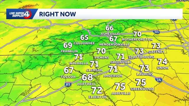 Quiet weather ahead this week in South Carolina: October 19 forecast
Sunshine and comfortable temperatures expected this week in the Upstate. The forecast remains quiet this week as a high pressure keeps the area dry. Highs sit in the 70s with lows in the 40s. The temperatures will be…
-
 First freeze of fall expected in western North Carolina mountains Sunday morning
A Frost Advisory is in effect Sunday morning from 1 AM to 9 AM for the southern NC mountains, eastern foothills, Upstate SC, and NE Georgia. A Freeze Warning is in effect Sunday morning from 1 AM to 9 AM for counties…
- Staying cool and dry Saturday in South Carolina: October 24 forecast
Cool morning ahead, breezy at times with highs in the 70s. Staying dry this weekend. Sunshine lingers into the Sunday. Expect highs in the 60s and lows in the 30s and 40s. Clouds are expected to increase just a bit by…
- Cooler weekend ahead in South Carolina: October 23 forecast
Highs top out in the 60s Expect slightly cooler temperatures on Friday in the Upstate of South Carolina, Western North Carolina and Northeast Georgia. Highs will top out in the upper 60s to low 70s under plenty of…
- Staying sunny, seasonable in South Carolina: October 22 forecast
Sunshine lingers with highs in the 60s and 70s Thursday will feature sunny and seasonable weather in the Upstate of South Carolina, Western North Carolina and Northeast Georgia. After a cool to chilly start, highs will…
- Cold Mornings with Warmer Afternoons in South Carolina: October 20 forecast
Cooler mornings with warm afternoons ahead. Sunshine and comfortable temperatures expected this week in the Upstate. The forecast remains quiet this week as a high pressure keeps the area dry. Highs sit in the 70s with…
- Cold start to Sunday in South Carolina: October 18 forecast
Frost and Freeze across the area this morning, warming up through the week. Afternoon highs will warm into the low to mid-60s by Sunday afternoon. Frost and freeze conditions remain possible Monday and Tuesday mornings…
-
 Storm Warnings Issued Off the North and South Carolina Coast as Conditions Intensify
Storm Warnings are in effect for offshore waters from Oregon Inlet, North Carolina, to Little River Inlet, South Carolina, with north winds of 35 to 40 knots, gusts to 50 knots and seas up to 18 feet. A nor’easter is…
Air quality
Air quality is satisfactory, and air pollution poses little or no risk.
Greenville-Spartanburg, SC reporting area · 1 hr ago. Data from AirNow (EPA and its state, local and tribal partners); preliminary and subject to change.
Sun & moon
Almanac
MonthlyGreenville-Spartanburg Area, records since 1884. Normals 1991–2020. Data from NOAA's Regional Climate Centers (ACIS).
Nearby
- Spartanburg 43 km
- Greer 18 km
- Anderson 45 km
- Mauldin 11 km
- Taylors 12 km
- Easley 19 km
- Simpsonville 18 km
- Wade Hampton 8 km
- Clemson 45 km
- Berea 7 km
- Gantt 6 km
- Five Forks 16 km
Forecasters' discussion
From the National Weather Service office in GSP, issued 11 hrs ago
What Has Changed
Low temperatures were nudged upward a few degrees for tonight.
Key Messages
1. Dry for the next seven days, with near to below normal highs through weekend before above normal highs return next week. Breezy northeast winds will develop east of the mountains over the weekend.
Discussion
Key message 1: Dry for the next seven days, with near to below normal highs through weekend before above normal highs return next week. Breezy northeast winds will develop east of the mountains over the weekend.
Overall, the weather continues to look benign across our region for the next seven days, with dry conditions persisting. The new guidance shows the upper level blocking pattern holding on longer into early next week, which is an interesting change, but ultimately just prolongs the quietness because we are in the favorable part of the block. The high-amplitude mid/upper ridge axis to our west supports a parent sfc high that drifts from the St. Lawrence valley this morning to the northern Mid-Atlantic region Sunday, resulting in a somewhat unusual cold air damming wedge with mostly clear sky. Thus, temps today in the area east of the mtns will be only five degrees below normal. The northeast wind will be the only clue that we are under a wedge. For tonight, there has been some concern about frost potential in the mtn valleys, but the trend in the fcst has low temps creeping upward a bit as we maintain a northeast wind, so only patchy frost is indicated in the headwaters of the French Broad River. Temps modify upward a degree or two for Sunday and continue on a warming trend through Tuesday when we end up a category above normal. If there's going to be any low-RH problems, it will probably be Tuesday. Another northern stream sfc high begins to influence our region by Wednesday with another dry wedge, so temps cool back down briefly before climbing above normal again for the end of the week.
Aviation
At KCLT and elsewhere: Strengthening East Coast high pressure will maintain primarily NE winds over the region through the period, picking up to 10-12 KT most of today. The exception is KAVL, where periods of SE may develop though with light enough speeds to prevail VRB. A shallow moist layer will persist beneath the subsidence inversion associated with the incoming airmass, such that patchy stratus or stratocu at low VFR to MVFR level are expected in portions of the Piedmont from approx. 09-15z, with restrictive cigs likely along the southeast-facing Blue Ridge Escarpment (NE of KAVL, W of KHKY) near daybreak. Retained a mention of FEW-SCT clouds at all TAF sites except KAND, as confidence is still low as to cigs at the sites, and cigs may be intermittent at best. Winds will weaken tonight; the pattern supports another possible patchy-stratus event near daybreak Sunday. In lieu of making a low-confidence mention for KCLT in this TAF, will see how clouds evolve this morning and consider adding a mention in the next cycle there and possibly at other sites.
Outlook: Breezy NE winds linger east of the mountains through Sunday. Dry and VFR through the middle of next week outside of the potential for mountain valley radiation fog/stratus each morning.
Forecasts, observations and alerts in the United States come from the National Weather Service (NOAA); radar from NOAA's Multi-Radar Multi-Sensor system; satellite imagery from NASA's Global Imagery Browse Services (GIBS) and NOAA's GOES satellites; the map from the U.S. Geological Survey's National Map; air quality from AirNow (EPA and its partners); hurricane information from the National Hurricane Center; climate normals and records from NOAA's Regional Climate Centers (ACIS). Forecasts outside the United States and the UV index: MET Norway (CC BY 4.0); observations outside the U.S.: airport reports via NOAA's Aviation Weather Center. Place names: GeoNames (CC BY 4.0). Data are copied on a schedule and may lag the sources; for warnings that affect your safety, follow your local National Weather Service office and emergency officials. Weather news is drawn from the 4Search index and reflects what the press published. Terms of use.