Install
Blackville, SC Weather
Current conditions
Forecast for this hour (no station report in the last two hours)
Forecast
10-day-
Saturday
Sunny, with a high near 71. Northeast wind 8 to 14 mph.
-
Saturday Night
Mostly clear, with a low around 46. Northeast wind 7 to 12 mph, with gusts as high as 22 mph.
-
Sunday
Sunny, with a high near 74. Northeast wind 9 to 14 mph.
National Weather Service forecast updated 1 day ago.
Hourly
Hourly forecast- Now47°
- 9 AM51°
- 10 AM57°
- 11 AM61°
- 12 PM65°
- 1 PM68°
- 2 PM70°
- 3 PM71°
- 4 PM71°
- 5 PM71°
- 6 PM69°
- 7 PM66°
- 8 PM61°
- 9 PM57°
- 10 PM55°
- 11 PM54°
- Sun12 AM53°
- 1 AM52°
- 2 AM51°
- 3 AM50°
- 4 AM49°
- 5 AM48°
- 6 AM47°
- 7 AM46°
10-day forecast
Details- FriOct 23Sunny47°72°
- TodayOct 24Sunny46°71°
- SunOct 25Sunny45°74°
- MonOct 26Sunny40°73°
- TueOct 27Sunny43°76°
- WedOct 28Sunny47°73°
- ThuOct 29Mostly Sunny49°75°
- FriOct 30Sunny55°80°
- SatOct 31Partly cloudy58°73°
- SunNov 1Cloudy55°69°
Days after the National Weather Service's seven are MET Norway's outlook, a computer model with no forecaster's review.
Radar
Full mapWeather news in South Carolina
More weather news-
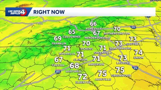 Staying cool and dry Saturday in South Carolina: October 24 forecast
Cool morning ahead, breezy at times with highs in the 70s. Staying dry this weekend. Sunshine lingers into the Sunday. Expect highs in the 60s and lows in the 30s and 40s. Clouds are expected to increase just a bit by…
- Cooler weekend ahead in South Carolina: October 23 forecast
Highs top out in the 60s Expect slightly cooler temperatures on Friday in the Upstate of South Carolina, Western North Carolina and Northeast Georgia. Highs will top out in the upper 60s to low 70s under plenty of…
- Staying sunny, seasonable in South Carolina: October 22 forecast
Sunshine lingers with highs in the 60s and 70s Thursday will feature sunny and seasonable weather in the Upstate of South Carolina, Western North Carolina and Northeast Georgia. After a cool to chilly start, highs will…
- Cold Mornings with Warmer Afternoons in South Carolina: October 20 forecast
Cooler mornings with warm afternoons ahead. Sunshine and comfortable temperatures expected this week in the Upstate. The forecast remains quiet this week as a high pressure keeps the area dry. Highs sit in the 70s with…
- Quiet weather ahead this week in South Carolina: October 19 forecast
Sunshine and comfortable temperatures expected this week in the Upstate. The forecast remains quiet this week as a high pressure keeps the area dry. Highs sit in the 70s with lows in the 40s. The temperatures will be…
- Cold start to Sunday in South Carolina: October 18 forecast
Frost and Freeze across the area this morning, warming up through the week. Afternoon highs will warm into the low to mid-60s by Sunday afternoon. Frost and freeze conditions remain possible Monday and Tuesday mornings…
-
 Storm Warnings Issued Off the North and South Carolina Coast as Conditions Intensify
Storm Warnings are in effect for offshore waters from Oregon Inlet, North Carolina, to Little River Inlet, South Carolina, with north winds of 35 to 40 knots, gusts to 50 knots and seas up to 18 feet. A nor’easter is…
Air quality
Air quality is satisfactory, and air pollution poses little or no risk.
Aiken-Augusta - SC and GA, SC reporting area · 1 hr ago. Data from AirNow (EPA and its state, local and tribal partners); preliminary and subject to change.
Sun & moon
Nearby
- Aiken 47 km
- Orangeburg 41 km
- Oak Grove 55 km
- Boiling Springs 29 km
- Brookdale 45 km
- Barnwell 15 km
- Clearwater 60 km
- Bamberg 23 km
- Denmark 13 km
- Allendale 39 km
- Williston 15 km
- Gloverville 55 km
Forecasters' discussion
From the National Weather Service office in CAE, issued 7 hrs ago
What Has Changed
Aviation discussion updated for 06z TAFs.
Key Messages
- 1. Dry weather continues into next week with near normal daytime temperatures.
Discussion
Key Message 1: Dry weather continues into next week with near normal daytime temperatures.
Not much change to the overall weather pattern this weekend. Expect dry weather to continue through with daytime temperatures around seasonal values and highs in the upper 60s to lower 70s today and the lower 70s on Sunday. Breezy northeasterly winds are expected both days making it feel cooler but gusts are not expected to be high enough to require a Lake Wind Advisory at this time. Upper ridging moves slowly east and may break down during the early to middle portion of next week, resulting slightly warmer temperatures with forecast highs in the lower to mid 70s Monday and Tuesday. As is typical during this type of dry autumnal pattern, warm days will be followed by cool nights with near to below normal overnight temperatures. Rain chances start to return late in the forecast period but it is possible the region remains dry through the end of October.
Aviation
VFR conditions expected through the next 24 hours.
High pressure dominates bringing dry conditions. Calm and clear conditions tonight. Low-level moisture is a tad dry for any fog to develop. Shallow, patchy and intermittent fog is possible at OGB as the last two nights have shown, but chances are low. Winds will increase on Saturday as a strong low-level jet develops tonight. The LLJ should mix out between 14z and 18z Saturday, with bufkit soundings suggesting northeasterly gusts up to 20 knots possible at times late Saturday morning and afternoon. Otherwise, VFR conditions persist with wind gusts subsiding a bit after sunset.
EXTENDED AVIATION OUTLOOK...A bit more moisture increases this weekend possibly leading to areas of patchy fog; especially nears bodies of water this weekend into next week.
Forecasts, observations and alerts in the United States come from the National Weather Service (NOAA); radar from NOAA's Multi-Radar Multi-Sensor system; satellite imagery from NASA's Global Imagery Browse Services (GIBS) and NOAA's GOES satellites; the map from the U.S. Geological Survey's National Map; air quality from AirNow (EPA and its partners); hurricane information from the National Hurricane Center; climate normals and records from NOAA's Regional Climate Centers (ACIS). Forecasts outside the United States and the UV index: MET Norway (CC BY 4.0); observations outside the U.S.: airport reports via NOAA's Aviation Weather Center. Place names: GeoNames (CC BY 4.0). Data are copied on a schedule and may lag the sources; for warnings that affect your safety, follow your local National Weather Service office and emergency officials. Weather news is drawn from the 4Search index and reflects what the press published. Terms of use.