Install
Jackpot, NV Weather
Current conditions
Observed at Elko, Elko Regional Airport · 1 hr ago
Forecast
10-day-
Tuesday
Mostly sunny, with a high near 68. South southeast wind 5 to 15 mph.
-
Tuesday Night
Partly cloudy, with a low around 41. South southeast wind 5 to 10 mph.
-
Wednesday
Mostly sunny, with a high near 68. South southeast wind 5 to 15 mph.
National Weather Service forecast updated 2 hrs ago.
Hourly
Hourly forecast- Now41°
- 7 AM40°
- 8 AM42°
- 9 AM47°
- 10 AM56°
- 11 AM60°
- 12 PM65°
- 1 PM66°
- 2 PM66°
- 3 PM67°
- 4 PM66°
- 5 PM64°
- 6 PM61°
- 7 PM56°
- 8 PM53°
- 9 PM52°
- 10 PM50°
- 11 PM49°
- Wed12 AM48°
- 1 AM47°
- 2 AM46°
- 3 AM45°
- 4 AM43°
- 5 AM43°
10-day forecast
Details- TonightOct 19Mostly Cloudy40°
- TodayOct 20Mostly Sunny41°68°
- WedOct 21Mostly Sunny24%42°68°
- ThuOct 22Scattered Showers And Thunderstorms88%36°64°
- FriOct 23Isolated Rain And Snow Showers61%25°47°
- SatOct 24Sunny30°50°
- SunOct 25Mostly Sunny32°54°
- MonOct 26Mostly Sunny56°
- TueOct 27Partly cloudy35°61°
- WedOct 28Cloudy33°59°
Days after the National Weather Service's seven are MET Norway's outlook, a computer model with no forecaster's review.
Radar
Full mapWeather news near Jackpot
More weather news-
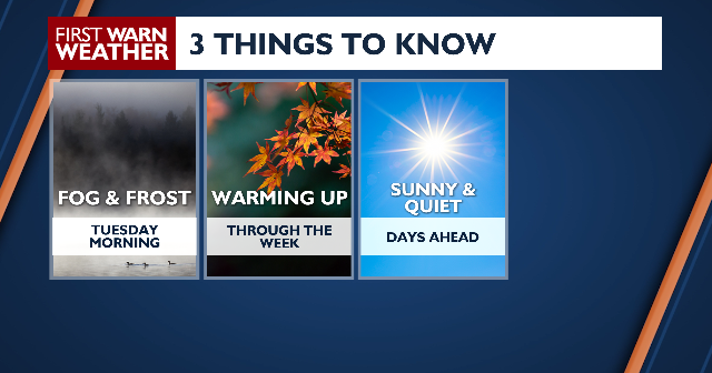 Warming up through the week
âCOPYRIGHT 2026 BY NEWS 8 NOW/NEWS 8000. ALL RIGHTS RESERVED. THIS MATERIAL MAY NOT BE PUBLISHED, BROADCAST, REWRITTEN OR REDISTRIBUTED. News 8+ 24/7 Live Stream Behind The Counter October 2026 Powerball Jackpot Jumps…
-
 Beachgoers and anglers: Here’s what Tuesday’s tides look like
Home » News » Weather » Beachgoers and anglers: Here’s what Tuesday’s tides look like Heading to the coast on Tuesday? Check high and low tide times across South Africa before planning your beach activities. If you’re…
-
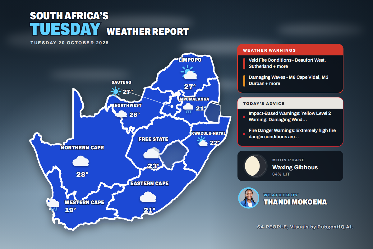 Here is today’s weather by province: Damaging waves expected along the KwaZulu-Natal coast today
Home » Here is today’s weather by province: Damaging waves expected along the KwaZulu-Natal coast today Mahikeng swings from a chilly 6°C at dawn to the country’s warmest reading of 28°C, while Cape Town tops out at…
-
 Weather outlook for Northern Ireland as clocks set to go back and Halloween break looming
And with the clocks going back one hour on Sunday, and an extra hour in bed if you're lucky, we can expect temperatures to stay at a tolerable 12C with lows of 4C thanks to little cloud cover on Monday and early…
-
 Sunny skies forecasted this week in Ottawa
Posted Oct 18, 2026 10:37:58 AM. Environment Canada is forecasting sunny days for Ottawa the week of Oct. 19 to 24, with temperatures steady in the mid-teens. Temperatures will peak at the beginning of the week…
-
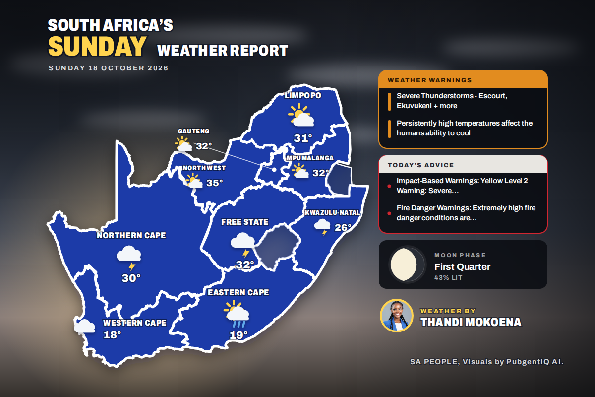 Here is today’s weather by province: Severe thunderstorms threaten Ladysmith Escourt and Dannhauser today
Home » Here is today’s weather by province: Severe thunderstorms threaten Ladysmith Escourt and Dannhauser today Mahikeng is the hottest spot at 35°C, while Cape Town peaks at just 18°C beneath cloud and a fresh SSE…
-
 Hurricane Trudy makes its way toward Mexico as Typhoon Champi threatens Guam
Posted Oct 17, 2026 3:49 am. The center of Trudy will approach the coast on Saturday and pass near it into Sunday. A hurricane warning was in effect from Manzanillo in Colima state to Cabo Corrientes in Jalisco. The…
-
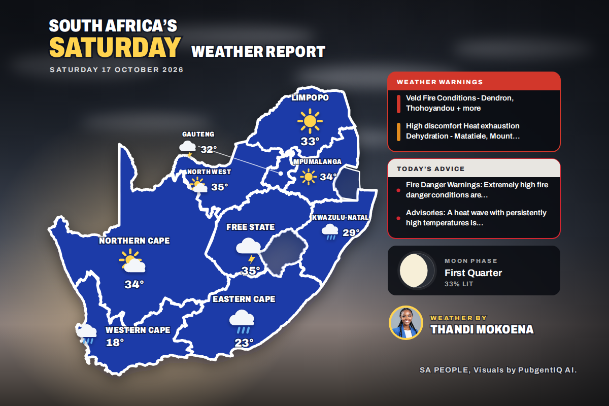 Here is today’s weather by province: Weather advisory issued for Queenstown and surrounding Eastern Cape towns
Home » Here is today’s weather by province: Weather advisory issued for Queenstown and surrounding Eastern Cape towns Kimberley takes the heat crown at 36°C, while Cape Town only reaches 18°C under a fresh SSE breeze…
-
 Beach plans this Saturday? Here’s when the tides will turn
Home » News » Weather » Beach plans this Saturday? Here’s when the tides will turn Planning a trip to the coast this Saturday? Check the high and low tide times for eight coastal towns before heading out. If you’re…
-
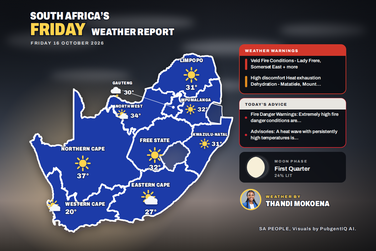 Here is today’s weather by province: Matatiele and Mount Ayliff placed under weather advisory today
Home » Here is today’s weather by province: Matatiele and Mount Ayliff placed under weather advisory today Kimberley tops the charts at 35°C, while Johannesburg is the one to watch for rain, with thunderstorms expected…
Air quality
Air quality is satisfactory, and air pollution poses little or no risk.
Forecast
- TueGood (20)
- WedGood
- ThuGood
Twin Falls, ID reporting area · 46 min ago. Data from AirNow (EPA and its state, local and tribal partners); preliminary and subject to change.
Sun & moon
Almanac
MonthlyBull Spring Idaho, records since 1990. Normals 1991–2020. Data from NOAA's Regional Climate Centers (ACIS).
Forecasters' discussion
From the National Weather Service office in LKN, issued 4 hrs ago
Key Messages
* Periods of valley rain and mountain snow Tuesday thru Friday.
* Isolated thunderstorms expected each afternoon Tuesday thru Thursday.
* Cooler the latter half of the week and this weekend.
Discussion
(Today through next Tuesday)
WEATHER PATTERN OVERVIEW: Deep upper level low pressure continues to circulate off the California coast this morning and moisture from the south will continue to push north. Favorable dynamics will produce isolated to scattered showers with the likelihood of a few rumbles of thunder by this afternoon, primarily within central Nevada and portions of eastern Nevada as activity moves in from the south as indicated. Forecast surface- based CAPE values will be in the 100 to perhaps 150J/kg range with weak instability denoted by slightly negative lifted indicies. Daytime high temperatures will be in the low 60s to low 70s with overnight lows primarily in the 30s.
Wednesday thru Friday, the upper closed low will slowly and gradually move inland on Wednesday. From here, latest numerical model solutions indicate that the low will weaken into an open wave and cross into southern and central Nevada Thursday and Friday with the trof axis situated directly over Nevada Thursday night. Model trends have been consistent in showing this to be a warm storm with snow levels above 8000 feet. Rainfall amounts in the valleys Wednesday thru Friday remain relatively robust at around a half- inch with some valley accumulations nearing an inch within portions of central Nevada. Daytime high temperatures during this period will be warm on Wednesday with readings still in the low 60s to low 70s, but cooling around ten degrees by Thursday with low 50s to low 60s forecast. Temperatures will be a few more degrees cooler Friday. Winds will be breezy to locally windy each afternoon, especially in central Nevada where gusts to 30-40 mph are expected. Overnight lows cool to the mid 20s to mid 30s for Thursday night, becoming mid teens to mid 20s by Friday night.
The upper system is expected to shift east and out of the forecast area Saturday with dry conditions expected into early next week. Temperatures warm a few degrees thru the weekend, residing near seasonal normals early next week.
FORECAST CONFIDENCE & DEVIATIONS: Significant changes to PoP and weather fields thru the short term. Confidence in the short term forecast remains high, though there are slight differences in the timing and location of convective activity Tuesday and Wednesday.
Aviation
-SHRA and/or VCSH will be forecast at all terminals beginning today as active weather moves in from the south. That said, CIGS are expected to remain within VFR category. Lower confidence in TS impacting any terminals this afternoon with the best potential being at KTPH, KELY, and KENV. Will likely include a PROB30 group for TS at the mentioned terminals in the TAF as TS will most likely be present within the broader area. Winds will become breezy to locally windy as well, primarily across the central Nevada terminals with gusts around 25KT.
Fire Weather
An upper level system will slowly move into the Great Basin from the west, bringing rain showers and mountain snow to all FWZs. Light showers begin to move into central Nevada from the south this afternoon with isolated thunderstorms also forecast, primarily within FWZs 426, 427, 425, 469, and 470. Shower and afternoon thunderstorm activity is expected to increase Wednesday and Thursday before dissipating from west to east Friday, eventually exiting Nevada Friday night. Widespread wetting rains are expected over the four day period and valley rainfall accumulations will be greatest within central Nevada with valley locations forecast to receive between one- half inch and one inch. Rainfall accumulations will be greatest on Thursday as the upper level system passes overhead. Breezy to locally windy conditions can also be expected each afternoon thru Friday, especially in central Nevada where gusts as high as 30-40 mph are expected. Cooler temperatures will be in place beginning Thursday and thru the weekend. Weather will be dry and generally fair this weekend.
Forecasts, observations and alerts in the United States come from the National Weather Service (NOAA); radar from NOAA's Multi-Radar Multi-Sensor system; satellite imagery from NASA's Global Imagery Browse Services (GIBS) and NOAA's GOES satellites; the map from the U.S. Geological Survey's National Map; air quality from AirNow (EPA and its partners); hurricane information from the National Hurricane Center; climate normals and records from NOAA's Regional Climate Centers (ACIS). Forecasts outside the United States and the UV index: MET Norway (CC BY 4.0); observations outside the U.S.: airport reports via NOAA's Aviation Weather Center. Place names: GeoNames (CC BY 4.0). Data are copied on a schedule and may lag the sources; for warnings that affect your safety, follow your local National Weather Service office and emergency officials. Weather news is drawn from the 4Search index and reflects what the press published. Terms of use.