Install
Santa Teresa, NM Weather
Current conditions
Forecast for this hour (no station report in the last two hours)
Forecast
10-day-
Sunday Night
A slight chance of showers and thunderstorms before 9pm. Mostly clear, with a low around 36. West wind 0 to 5 mph. Chance of precipitation is 20%.
-
Monday
Sunny, with a high near 57. Southwest wind 0 to 5 mph.
-
Monday Night
Mostly clear, with a low around 38. Southwest wind around 0 mph.
National Weather Service forecast updated 1 day ago.
Hourly
Hourly forecast- Now49°23%
- 7 PM47°23%
- 8 PM45°23%
- 9 PM45°
- 10 PM44°
- 11 PM43°
- Mon12 AM42°
- 1 AM41°
- 2 AM41°
- 3 AM39°
- 4 AM38°
- 5 AM38°
- 6 AM37°
- 7 AM37°
- 8 AM39°
- 9 AM41°
- 10 AM45°
- 11 AM49°
- 12 PM53°
- 1 PM55°
- 2 PM56°
- 3 PM57°
- 4 PM56°
- 5 PM54°
10-day forecast
Details- TonightOct 24Showers And Thunderstorms94%41°
- TodayOct 25Chance Showers And Thunderstorms41%36°56°
- MonOct 26Sunny38°57°
- TueOct 27Sunny34°60°
- WedOct 28Sunny36°61°
- ThuOct 29Mostly Sunny30%40°61°
- FriOct 30Showers And Thunderstorms Likely75%39°57°
- SatOct 31Chance Rain Showers53%53°
- SunNov 1Heavy rain0.94 in37°47°
- MonNov 2Mostly sunny32°50°
Days after the National Weather Service's seven are MET Norway's outlook, a computer model with no forecaster's review.
Radar
Full mapWeather news in New Mexico
More weather news-
 Saturday evening forecast: Heavy rain to continue in parts of New Mexico through Sunday
ALBUQUERQUE, N.M. – Flood warnings remain in parts of west-central New Mexico after radar estimated 2.5 to 4.5 inches of rain near Laguna and along Interstate 40. The Albuquerque metro stayed mostly clear, though…
-
 Severe storms threaten central New Mexico through weekend
Central New Mexico can expect some intense, scattered thunderstorms starting Friday night and lasting throughout the weekend. Storms in the late afternoon and early evening Friday could become "strong to severe," with…
-
 Storms could bring big hail and flash floods to New Mexico overnight into Saturday
ALBUQUERQUE, N.M. – A severe thunderstorm watch covers most of New Mexico through 9 p.m. with wind gusts up to 70 mph, hail up to 3 inches and a flash flooding threat. Some storms around the state could bring heavy rain…
-
 Tornado watch and flood threat in western New Mexico Thursday night
ALBUQUERQUE, N.M. – A tornado watch and flood watch cover western New Mexico as strong storms threaten damaging winds, large hail, torrential rain and a possible tornado. A strong Pacific storm system moved into…
- Tracking severe weather in New Mexico
Severe weather is moving through New Mexico prompting a tornado watch for western New Mexico and a severe thunderstorm watch for Albuquerque. 5:13 pm - Evacuations have been suggested for areas along the San Juan River…
- Severe Thunderstorm Watch issued for Albuquerque and central New Mexico
CURRENT CONDITIONS | CURRENT WATCHES AND WARNINGS | LIVE RADAR | UPLOAD YOUR WEATHER PHOTOS | TURN ON WEATHER NOTIFICATIONS The National Weather Service has issued a severe thunderstorm watch for Bernalillo, Los Alamos…
- Tornado watch issued for parts of western New Mexico
A tornado watch has been issued for parts of western New Mexico through Thursday evening. The tornado watch includes San Juan, Catron, Cibola, Grant, Hidalgo and McKinley Counties. The cities of Farmington, Crownpoint…
- Flood watches issued as Arizona storms spill into New Mexico
Storms that brought heavy rain, egg-sized hail and tornadoes to Arizona on Wednesday struck western New Mexico by the afternoon, generating flood watches set to remain in effect through Friday. Forecasters told the…
-
 Rain slowly pushing eastward in New Mexico but still mostly in Four Corners
ALBUQUERQUE, N.M. — A big upper-level low is slowly moving inland and is still pulling a lot of moisture that will make its way to New Mexico. Most of the activity Thursday will still favor western New Mexico, say from…
-
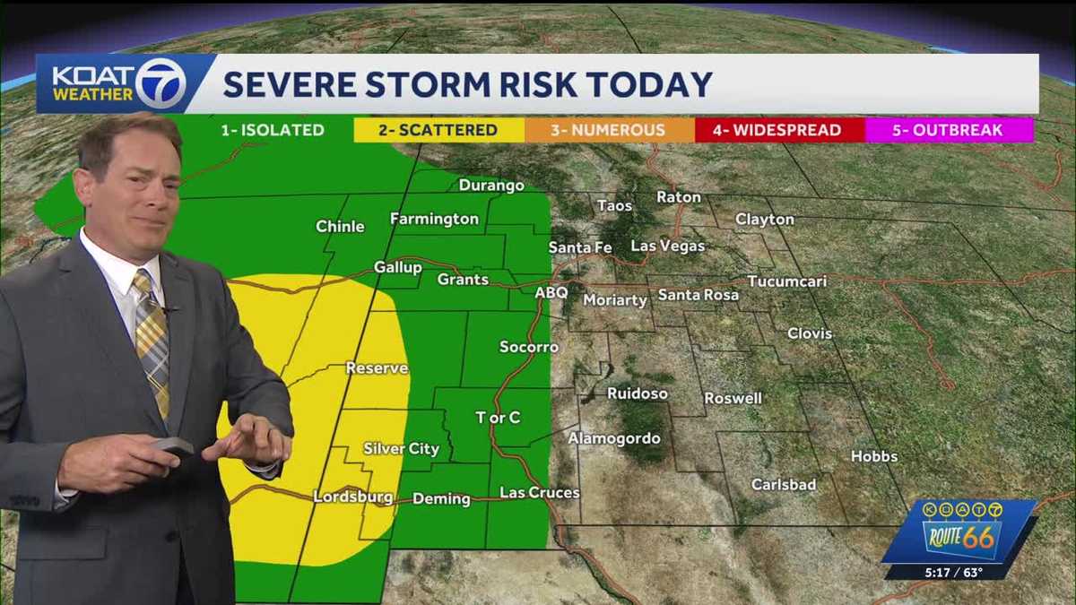 Flood Watches in effect for Western New Mexico, active Severe Thunderstorm Watch for Northeast Arizona
KOAT Flood Watches in effect for Western New Mexico, active Severe Thunderstorm Watch for Northeast Arizona Tropical moisture surge making a slow push eastward over next few days drenching the state, flood threat and…
Air quality
Air quality is satisfactory, and air pollution poses little or no risk.
Coyote, NM reporting area · 1 hr ago. Data from AirNow (EPA and its state, local and tribal partners); preliminary and subject to change.
Sun & moon
Almanac
MonthlyWolf Canyon, records since 1912. Normals 1991–2020. Data from NOAA's Regional Climate Centers (ACIS).
Nearby
- Los Alamos 45 km
- Española 57 km
- White Rock 56 km
Forecasters' discussion
From the National Weather Service office in ABQ, issued 13 hrs ago
Key Messages
Issued at 540 AM MDT Sun Oct 25 2026
- A few storms may again turn severe over east-central and southeast areas this afternoon. Large hail and damaging winds will be the main threats, with a lower risk of an isolated tornado.
- River flooding will continue over parts of central and northwest New Mexico today.
- Moderate-to-locally-heavy rainfall will return along and east of the central mountain chain today and tonight, but the risk of flash flooding will extend westward to the continental divide of northwest New Mexico, and the West-Central Highlands, due to saturated soil there.
Short Term
(Today through Tonight) Issued at 1223 AM MDT Sun Oct 25 2026
An upper level low pressure system will track northeastward across the Four Corners and CO today and tonight, while continuing to draw very rich subtropical moisture northward over northern and central NM. Widespread showers and thunderstorms are forecast to persist today through this evening on the eastern plains, then coverage of precip and rainfall intensity will begin to trend downward there. Farther west to the Four Corners, the continental divide of west central NM, and to the lower Rio Grande Valley, scattered to numerous showers and thunderstorms are forecast to persist through this evening. GEFS ensemble PWATS are forecast to peak this morning around 160-300 percent of normal along and east of the central mountain chain. With actual PWATs around 0.80-1.15" there, stronger storms will again be capable of producing locally heavy rainfall at rates near and over 1"/hr today and tonight. Farther west to the continental divide, PWATs will vary around 0.80-0.60", suggesting rain rates up to 1"/hr in stronger cells. However, with this forecast package we issued a Flash Flood Watch for parts of north central, northwest, and west central NM, because the ground is so saturated from the past two days of heavy rainfall that it will only take moderate rainfall to cause flooding problems there. Will let the day shift assess antecedent moisture and issue a Flash Flood Watch for parts of the eastern plains for Sunday afternoon and night, if needed. Additional rain amounts today through tonight are progged to reach around 0.25-2.0" along and east of the central mountain chain, with mostly lower amounts farther west. NBM 90th Percentile QPF, which indicates what a few of the higher rainfall totals will probably end up being, reaches 2-4" on the eastern plains, with some localized 2" amounts farther west to the east slopes of the Jemez Mountains and upper Rio Grande Valley. In addition, some storms will probably turn severe again today, especially from the central valley eastward. Large hail and damaging winds will be the main threats, but an isolated tornado will also be possible.
Further, a few to six inches of snow are forecast on the highest peaks of the Sangre de Cristo Mountains today through tonight, where 700 mb temperatures look to bottom out around +2 to +4 C. Otherwise, high temperatures across the forecast area will continue to trend cooler today with readings varying from a few to around 10 degrees below 30-year averages.
Long Term
(Monday through Saturday) Issued at 1223 AM MDT Sun Oct 25 2026
On Monday, scattered to numerous showers and thunderstorms will continue over east central and southeast areas, where moist southeast low-level return flow will continue as a weak trailing disturbance crosses aloft. PWATs are forecast to trend downward, so the risk of additional flash flooding will be low on Monday. Otherwise, drier and warmer weather is forecast Monday through midweek as an active storm track north of NM draws dry west and southwest flow over the forecast area. High temperatures will climb near 1991-2020 averages areawide starting Tuesday, then as much as 8 degrees above the averages on the eastern plains Wednesday. Models have come into better agreement on an upper level low pressure system dropping southward along the Pacific NW coast during the latter half of the week. This system will draw a rich return flow of Gulf moisture into the forecast area starting Wednesday night with increasing coverage of showers and thunderstorms over southern areas Thursday. Showers and storms will increase in coverage areawide Friday and Friday night as a short-wave trough crosses NM from the southwest.
Aviation
(12Z TAFS) Issued at 540 AM MDT Sun Oct 25 2026
Widespread showers and thunderstorms will continue to stream north and northeastward across the eastern plains today through tonight. Meanwhile, scattered to numerous cells will develop westward to the continental divide of northwest NM today until midnight tonight. Storms will move toward the north and northeast at speeds around 30-45 KT. A few storms along and east of the Rio Grande will probably turn severe this afternoon and evening by producing large hail and damaging winds. Widespread MVFR and IFR conditions in low clouds, fog, and areas of precipitation are forecast across eastern NM today through tonight.
Forecasts, observations and alerts in the United States come from the National Weather Service (NOAA); radar from NOAA's Multi-Radar Multi-Sensor system; satellite imagery from NASA's Global Imagery Browse Services (GIBS) and NOAA's GOES satellites; the map from the U.S. Geological Survey's National Map; air quality from AirNow (EPA and its partners); hurricane information from the National Hurricane Center; climate normals and records from NOAA's Regional Climate Centers (ACIS). Forecasts outside the United States and the UV index: MET Norway (CC BY 4.0); observations outside the U.S.: airport reports via NOAA's Aviation Weather Center. Place names: GeoNames (CC BY 4.0). Data are copied on a schedule and may lag the sources; for warnings that affect your safety, follow your local National Weather Service office and emergency officials. Weather news is drawn from the 4Search index and reflects what the press published. Terms of use. How to use Weather