Install
Lee Acres, NM Weather
Current conditions
Observed at Farmington, Four Corners Regional Airport · 1 hr ago
Forecast
10-day-
Saturday
A chance of rain showers before 9am, then showers and thunderstorms likely. Mostly cloudy, with a high near 64. Southeast wind 5 to 15 mph. Chance of precipitation is 60%.
-
Saturday Night
Showers and thunderstorms likely. Mostly cloudy, with a low around 46. East wind 5 to 10 mph. Chance of precipitation is 70%.
-
Sunday
A chance of rain showers before noon, then a chance of showers and thunderstorms. Partly sunny, with a high near 60. Chance of precipitation is 40%.
National Weather Service forecast updated 1 day ago.
Hourly
Hourly forecast- Now60°60%
- 6 PM59°68%
- 7 PM56°68%
- 8 PM54°68%
- 9 PM52°68%
- 10 PM51°68%
- 11 PM50°68%
- Sun12 AM49°41%
- 1 AM49°41%
- 2 AM48°41%
- 3 AM47°41%
- 4 AM47°41%
- 5 AM46°41%
- 6 AM46°36%
- 7 AM47°36%
- 8 AM48°36%
- 9 AM48°36%
- 10 AM51°36%
- 11 AM55°36%
- 12 PM58°26%
- 1 PM59°26%
- 2 PM59°26%
- 3 PM60°26%
- 4 PM59°26%
10-day forecast
Details- TonightOct 22Showers And Thunderstorms77%51°
- FriOct 23Chance Showers And Thunderstorms then Slight Chance Showers And Thunderstorms31%48°66°
- TodayOct 24Showers And Thunderstorms Likely68%46°64°
- SunOct 25Chance Rain Showers36%40°60°
- MonOct 26Mostly Sunny39°60°
- TueOct 27Sunny40°62°
- WedOct 28Mostly Sunny41°63°
- ThuOct 29Partly Sunny10%63°
- FriOct 30Cloudy37°60°
- SatOct 31Partly cloudy37°59°
Days after the National Weather Service's seven are MET Norway's outlook, a computer model with no forecaster's review.
Radar
Full mapWeather news in New Mexico
More weather news-
 Severe storms threaten central New Mexico through weekend
Central New Mexico can expect some intense, scattered thunderstorms starting Friday night and lasting throughout the weekend. Storms in the late afternoon and early evening Friday could become "strong to severe," with…
-
 Storms could bring big hail and flash floods to New Mexico overnight into Saturday
ALBUQUERQUE, N.M. – A severe thunderstorm watch covers most of New Mexico through 9 p.m. with wind gusts up to 70 mph, hail up to 3 inches and a flash flooding threat. Some storms around the state could bring heavy rain…
-
 Tornado watch and flood threat in western New Mexico Thursday night
ALBUQUERQUE, N.M. – A tornado watch and flood watch cover western New Mexico as strong storms threaten damaging winds, large hail, torrential rain and a possible tornado. A strong Pacific storm system moved into…
- Tracking severe weather in New Mexico
Severe weather is moving through New Mexico prompting a tornado watch for western New Mexico and a severe thunderstorm watch for Albuquerque. 5:13 pm - Evacuations have been suggested for areas along the San Juan River…
- Severe Thunderstorm Watch issued for Albuquerque and central New Mexico
CURRENT CONDITIONS | CURRENT WATCHES AND WARNINGS | LIVE RADAR | UPLOAD YOUR WEATHER PHOTOS | TURN ON WEATHER NOTIFICATIONS The National Weather Service has issued a severe thunderstorm watch for Bernalillo, Los Alamos…
- Tornado watch issued for parts of western New Mexico
A tornado watch has been issued for parts of western New Mexico through Thursday evening. The tornado watch includes San Juan, Catron, Cibola, Grant, Hidalgo and McKinley Counties. The cities of Farmington, Crownpoint…
- Flood watches issued as Arizona storms spill into New Mexico
Storms that brought heavy rain, egg-sized hail and tornadoes to Arizona on Wednesday struck western New Mexico by the afternoon, generating flood watches set to remain in effect through Friday. Forecasters told the…
-
 Rain slowly pushing eastward in New Mexico but still mostly in Four Corners
ALBUQUERQUE, N.M. — A big upper-level low is slowly moving inland and is still pulling a lot of moisture that will make its way to New Mexico. Most of the activity Thursday will still favor western New Mexico, say from…
-
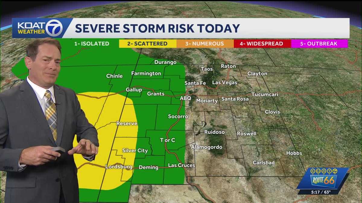 Flood Watches in effect for Western New Mexico, active Severe Thunderstorm Watch for Northeast Arizona
KOAT Flood Watches in effect for Western New Mexico, active Severe Thunderstorm Watch for Northeast Arizona Tropical moisture surge making a slow push eastward over next few days drenching the state, flood threat and…
-
 Heavy rain could bring flash flooding to New Mexico, southwest Colorado through Friday
KRQE A strong storm system will bring widespread rain to New Mexico and southwest Colorado starting Wednesday, with several inches of rain possible in some areas through Friday Heavy rainfall could lead to flash…
Air quality
Air quality is satisfactory, and air pollution poses little or no risk.
Forecast
- SatGood (49)
- SunModerate (54)
San Juan County, NM reporting area · 1 hr ago. Data from AirNow (EPA and its state, local and tribal partners); preliminary and subject to change.
Sun & moon
Almanac
MonthlyFarmington Four Corners Regional Ap, records since 1941. Normals 1991–2020. Data from NOAA's Regional Climate Centers (ACIS).
Nearby
- Farmington 17 km
- Shiprock 59 km
- Kirtland 29 km
- Bloomfield 5 km
- Aztec 14 km
- West Hammond 2 km
- Flora Vista 11 km
Forecasters' discussion
From the National Weather Service office in ABQ, issued 2 hrs ago
Key Messages
Issued at 132 PM MDT Sat Oct 24 2026
- Severe thunderstorms return this afternoon and evening. Large hail and damaging winds will be the main threats, with a lower risk of isolated tornadoes.
- River flooding will continue over parts of central and northwest New Mexico today and tonight.
- Heavy rainfall will impact central and eastern parts of the forecast area the rest of today and tonight with a continued risk of flash flooding. The risk of heavy rainfall and flash flooding will persist east of the central mountain chain Sunday and Sunday night.
Short Term
(This evening through Sunday night) Issued at 132 PM MDT Sat Oct 24 2026
An upper-level low currently centered over the California and Arizona border will track northeastward across the Southwest today. Anomalous moisture, favorable upper-level forcing, and daytime heating will support more widespread showers and storms across the state the remainder of the day, with activity already ongoing across portions of western, central, and northern New Mexico at time of writing. The greatest severe weather potential this afternoon and evening will favor south, central, and southeastern zones, where sufficient instability (~1000 J/kg CAPE) and strong deep-layer shear (40-50 knots) could support supercells capable of producing large hail and damaging outflow wind gusts, and perhaps an isolated tornado.
Heavy rain and flash flooding will also continue to be a significant concern through tonight, especially across central and eastern portions of the state. Forecast PWATs are roughly 2-5 standard deviations above normal in these areas. Widespread rainfall amounts of 0.50 to up to 3 inches are possible along and east of the central mountain chain, with locally higher totals up to 4-4.5 inches across northeastern New Mexico. Additional rainfall may exacerbate ongoing flooding concerns, particularly where storms repeatedly affect the same locations or move over already saturated soils. Even brief heavy downpours could produce dangerous runoff in urban areas, arroyos, low-water crossings, and recent burn scar areas. The current Flash Flood Watch remains in effect, with our far eastern zones and the Upper Tularosa Valley now included in the Watch. Given the potential for another round of heavy rainfall Sunday, additional watch coverage will be likely by the next forecast package.
Speaking of Sunday, the upper low will continue its northeastward trek into the Four Corners and Colorado, shifting the moisture axis and primary focus for shower and storm activity toward eastern New Mexico while drier air starts to spread into western and west-central areas. The greatest flash flooding concerns will likely extend across portions of northeast and southeast New Mexico, where heavy rainfall from the remainder of today could increase vulnerability to any additional precipitation. Scattered precipitation coverage will continue across central areas while overall activity across the west diminishes. Snow accumulations across the highest peaks remains a possibility through Sunday night, and temperatures, specifically MaxTs, will generally be trending below average.
Long Term
(Monday through Friday) Issued at 132 PM MDT Sat Oct 24 2026
Showers and storms may linger across the east-southeast on Monday due to residual moisture and a passing disturbance. However PWATs will be gradually declining, reducing the overall flash flooding threat. Drier air, increasing subsidence from weak ridging, and west-southwesterly flow are expected to promoting warmer and drier trends by midweek. The next system looks to approach the western CONUS by late week into next weekend, and the aforementioned southwesterly flow will likely be able to tap into more anomalous moisture to promote increasing rain chances. Long term models suggest modest shear, but instability doesn't look as favorable as the last couple of days. There is still a good bit of time until we reach this point in the forecast, so expect greater details and forecast refinement in the coming days.
Aviation
(18Z TAFS) Issued at 1139 AM MDT Sat Oct 24 2026
Widespread showers and thunderstorms are ongoing across western, central, and north-central portions of New Mexico late this morning. Activity is progged to diminish in far western zones and propagate eastward over the course of the afternoon and evening hours. Some thunderstorms may turn severe this afternoon and evening, with the primary risks being large hail and damaging wind and a lower chance of an isolated tornado. The greatest severe threat will be over central, south central, and southeast areas. Storms will move fairly quickly toward the north-northeast at around 30-45 KT. While overall coverage of precipitation will decrease west of the central mountain chain around 04Z or so, light showers will linger through the overnight hours across the east, with the potential for brief MVFR/IFR CIGs and VSBYs at KROW.
Forecasts, observations and alerts in the United States come from the National Weather Service (NOAA); radar from NOAA's Multi-Radar Multi-Sensor system; satellite imagery from NASA's Global Imagery Browse Services (GIBS) and NOAA's GOES satellites; the map from the U.S. Geological Survey's National Map; air quality from AirNow (EPA and its partners); hurricane information from the National Hurricane Center; climate normals and records from NOAA's Regional Climate Centers (ACIS). Forecasts outside the United States and the UV index: MET Norway (CC BY 4.0); observations outside the U.S.: airport reports via NOAA's Aviation Weather Center. Place names: GeoNames (CC BY 4.0). Data are copied on a schedule and may lag the sources; for warnings that affect your safety, follow your local National Weather Service office and emergency officials. Weather news is drawn from the 4Search index and reflects what the press published. Terms of use.