Install
Lindenwold, NJ Weather
Current conditions
Observed at Philadelphia, Philadelphia International Airport · 35 min ago
Forecast
10-day-
Saturday
Areas of frost before 9am. Sunny, with a high near 62. Northeast wind 0 to 5 mph.
-
Saturday Night
Areas of frost after midnight. Mostly clear, with a low around 35. West wind 0 to 5 mph.
-
Sunday
Areas of frost before 9am. Sunny, with a high near 66.
National Weather Service forecast updated 1 day ago.
Hourly
Hourly forecast- Now38°
- 9 AM43°
- 10 AM51°
- 11 AM55°
- 12 PM58°
- 1 PM60°
- 2 PM62°
- 3 PM62°
- 4 PM62°
- 5 PM62°
- 6 PM59°
- 7 PM55°
- 8 PM51°
- 9 PM46°
- 10 PM43°
- 11 PM42°
- Sun12 AM40°
- 1 AM39°
- 2 AM38°
- 3 AM37°
- 4 AM36°
- 5 AM36°
- 6 AM35°
- 7 AM35°
10-day forecast
Details- TonightOct 22Mostly Clear44°
- FriOct 23Sunny35°61°
- TodayOct 24Areas Of Frost then Sunny35°62°
- SunOct 25Areas Of Frost then Sunny37°66°
- MonOct 26Sunny48°69°
- TueOct 27Sunny42°65°
- WedOct 28Mostly Sunny44°62°
- ThuOct 29Mostly Sunny67°
- FriOct 30Cloudy51°71°
- SatOct 31Partly cloudy47°62°
Days after the National Weather Service's seven are MET Norway's outlook, a computer model with no forecaster's review.
Radar
Full mapWeather news near Lindenwold
More weather news-
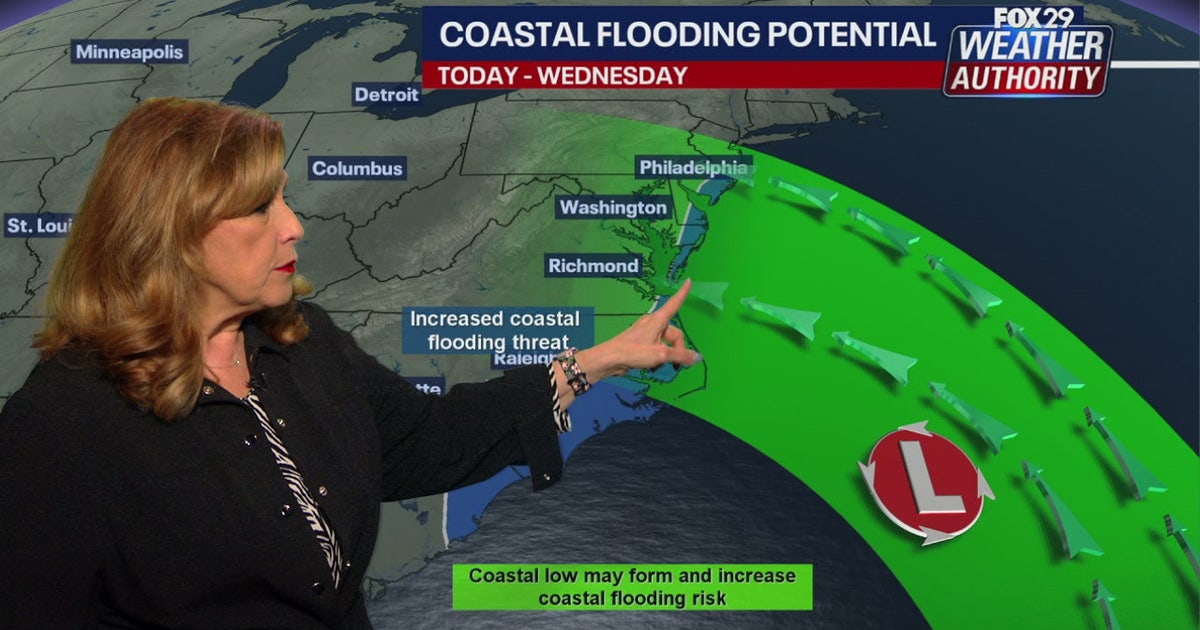 Coastal flooding threat looms for New Jersey, Delaware as nor'easter develops offshore
A developing nor'easter off the Carolina coast is expected to stay offshore but will still bring high winds, heavy surf, and possible coastal flooding along the Jersey Shore and Delaware beaches this week. PHILADELPHIA…
- Philadelphia Weather: Chilly Saturday, Sunny Week Ahead
Philadelphia is starting Saturday, October 17, under light rain and a raw north wind, with temperatures hovering around 50 degrees. The rain is a brief opening act, but the bigger story is the fast fall reset: a high…
-
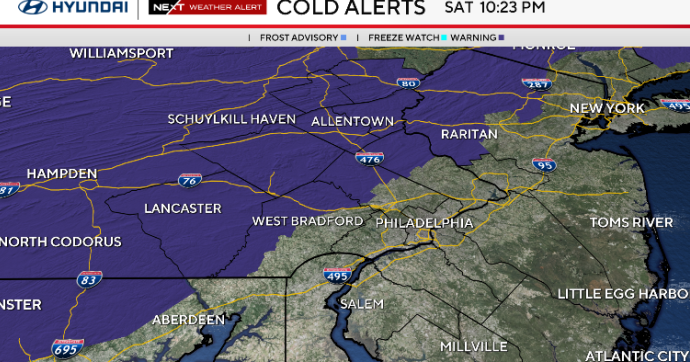 Sunny and chilly Sunday in Philadelphia area, freeze possible in some areas. Here's the weather forecast.
October 17, 2026 / 10:45 PM EDT / CBS Philadelphia Sunday starts cold with temperatures in the 30s and some spots at or below freezing north and west of Philadelphia. A freeze alert is in effect from 1 a.m. to 9 a.m…
- South Philadelphia Gets a Cold Sunday After Friday’s Storm Watch
South Philadelphia residents heading to the Eagles game at 1 p.m. Sunday should expect sunshine and temperatures in the 50s, with the 40s possible for morning tailgaters, FOX 29 Philadelphia reported. The chill follows…
-
 The National Weather Service issued a Sunday freeze warning for these Pa. counties
Upper Bucks, western Montgomery, and western Chester Counties could see temperatures as low as 31 degrees Fahrenheit Sunday, forecasters said. The National Weather Service issued a freeze warning for the early morning…
-
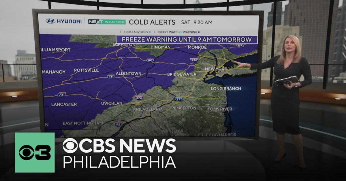 Freeze warning in Pennsylvania after wet Saturday | NEXT Weather
CBS News Freeze warning in Pennsylvania after wet Saturday | NEXT Weather Philadelphia region sees more than 20-degree drop in temperatures Saturday Camden Catholic beats Kipp Cooper Norcross and more in Week 6 of…
-
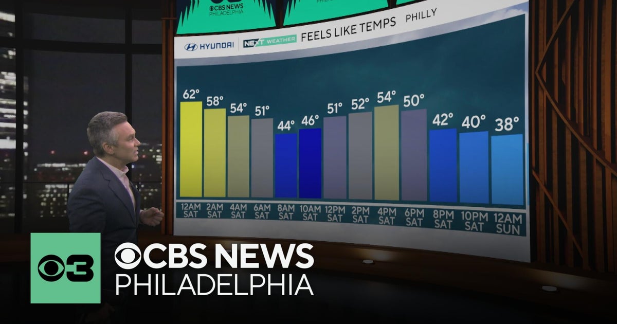 Philadelphia region sees more than 20-degree drop in temperatures Saturday
CBS News Philadelphia region sees more than 20-degree drop in temperatures Saturday Camden Catholic beats Kipp Cooper Norcross and more in Week 6 of Friday Football Frenzy For fans, LeBron James being a Sixer still…
- Nor’easter Taking Shape Offshore Leaves Philadelphia Impact Undecided
A nor'easter forming over the Atlantic could bring gusts of up to 60 mph to parts of the mid-Atlantic coast beginning late Saturday night. Philadelphia Patch reported on Friday, Oct. 16, that forecasters have not…
-
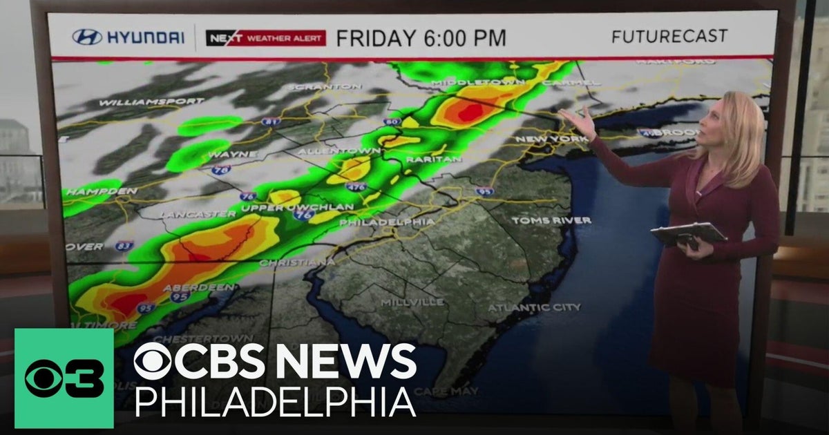 Severe weather could bring showers, thunderstorms to Philadelphia region Friday
CBS News Severe weather could bring showers, thunderstorms to Philadelphia region Friday 2026 Philly Bike Ride takes place Saturday A Chester County teen turned his home into a Halloween haunt for charity Third annual…
-
 Sunshine Sticks Around New Jersey, but Cooler Days Arrive Before the Weekend
Home » New Jersey » Sunshine Sticks Around New Jersey, but Cooler Days Arrive Before the Weekend New Jersey, Weather Report NEW JERSEY — Sunshine dominates the forecast from Tuesday, October 20, through Saturday…
Air quality
Acceptable. Unusually sensitive people should consider limiting prolonged outdoor exertion.
Forecast
- SatModerate (55)
- SunModerate (65)
- MonModerate (65)
Riverline, NJ reporting area · 1 hr ago. Data from AirNow (EPA and its state, local and tribal partners); preliminary and subject to change.
Sun & moon
Almanac
MonthlyPhiladelphia Area, records since 1873. Normals 1991–2020. Data from NOAA's Regional Climate Centers (ACIS).
Nearby
- Philadelphia 20 km
- Trenton 49 km
- Camden 15 km
- Wilmington 48 km
- Cherry Hill 13 km
- Vineland 38 km
- Bensalem 31 km
- South Vineland 42 km
- Abington 35 km
- Jackson 13 km
- Levittown 40 km
- Havertown 32 km
Forecasters' discussion
From the National Weather Service office in PHI, issued 9 hrs ago
What Has Changed
Aviation section updated for 00Z TAFs.
Marine section updated.
Key Messages
1. Elevated tide cycles persist due to Post- Tropical Cyclone Josephine well off the coast, resulting in widespread minor coastal flooding continuing for back bay areas in Ocean County, NJ and Sussex County, DE.
2. Frost and freeze impacts tonight and Saturday night where the growing season continues.
Discussion
KEY MESSAGE 1...Elevated tide cycles persist due to Post- Tropical Cyclone Josephine well off the coast, resulting in widespread minor coastal flooding continuing for back bay areas in Ocean County, NJ and Sussex County, DE.
Post-Tropical Cyclone Josephine has pulled away from the region as it's now over the Canadian Maritimes. However elevated water levels persist, mainly in the back bay areas of Ocean County, NJ and Sussex County, Delaware. The Coastal Flood Advisory for these counties is in effect until 7 AM Saturday.
KEY MESSAGE 2...Frost and freeze impacts tonight and Saturday night where the growing season continues.
A Freeze Warning was issued for areas north and west of the I-95 corridor from midnight until 9 AM Saturday where the growing season remains active. For the I-95 corridor and areas south and east, a Frost Advisory was issued from midnight until 9 AM Saturday for all other zones, excluding Sussex County in Delaware and the barrier islands in New Jersey.
As an upper-level trough pivots across the Northeast tonight, a strong mid-level ridge in the Plains to Midwest shifts eastward through the weekend. This will support strong surface high pressure shifting eastward into the Northeast and Mid-Atlantic through the weekend.
A chilly and dry airmass will accompany this strong surface high, and as the high itself settles more overhead, forecast soundings show surface winds decoupling. This will set the stage for efficient radiational cooling both tonight and Saturday night. The forecast lows are in the upper 20s to mid 30s for much of the area (with the only exception along the immediate coastal strip) with a favorable setup for frost and freeze. Some scattered to broken cirrus will be in place overnight. However, the thin cloud coverage will be the only limiting reagent to the efficient radiational cooling. This will probably slow cooling down by a few degrees at best, likely aiding to prevent a widespread freeze situation, but it is not expected to slam the brakes hard on the efficient radiational cooling setup overnight.
Aviation
The following discussion is for KPHL, KPNE, KTTN, KABE, KRDG, KILG, KMIV, KACY and surrounding areas.
Tonight...VFR. Winds will go calm for a time, then increase slightly out of the north to northeast less than 5 kts after 06Z. High confidence.
Saturday...VFR. Winds 5 kts or less favoring a north to northeast direction early, then shifting more easterly and becoming variable after 18Z. Winds may become calm at times. High confidence.
Saturday night...VFR/SKC. Calm winds. High confidence.
Outlook...
Sunday through Wednesday...VFR. No significant weather expected.
Forecasts, observations and alerts in the United States come from the National Weather Service (NOAA); radar from NOAA's Multi-Radar Multi-Sensor system; satellite imagery from NASA's Global Imagery Browse Services (GIBS) and NOAA's GOES satellites; the map from the U.S. Geological Survey's National Map; air quality from AirNow (EPA and its partners); hurricane information from the National Hurricane Center; climate normals and records from NOAA's Regional Climate Centers (ACIS). Forecasts outside the United States and the UV index: MET Norway (CC BY 4.0); observations outside the U.S.: airport reports via NOAA's Aviation Weather Center. Place names: GeoNames (CC BY 4.0). Data are copied on a schedule and may lag the sources; for warnings that affect your safety, follow your local National Weather Service office and emergency officials. Weather news is drawn from the 4Search index and reflects what the press published. Terms of use.