Install
Meredith, NH Weather
Current conditions
Observed at Laconia, Laconia Municipal Airport · 1 hr ago
Forecast
10-day-
Thursday
Mostly sunny, with a high near 60. Northwest wind 5 to 10 mph, with gusts as high as 25 mph.
-
Thursday Night
Clear, with a low around 37. Northwest wind 5 to 10 mph, with gusts as high as 25 mph.
-
Friday
Sunny, with a high near 52. Northwest wind around 5 mph.
National Weather Service forecast updated 16 hrs ago.
Hourly
Hourly forecast- Now52°
- 12 PM56°
- 1 PM58°
- 2 PM59°
- 3 PM59°
- 4 PM58°
- 5 PM58°
- 6 PM56°
- 7 PM53°
- 8 PM51°
- 9 PM49°
- 10 PM48°
- 11 PM46°
- Fri12 AM45°
- 1 AM43°
- 2 AM42°
- 3 AM41°
- 4 AM39°
- 5 AM39°
- 6 AM38°
- 7 AM37°
- 8 AM38°
- 9 AM39°
- 10 AM41°
10-day forecast
Details- TonightOct 21Mostly Cloudy37°
- TodayOct 22Mostly Sunny37°60°
- FriOct 23Sunny34°52°
- SatOct 24Sunny37°56°
- SunOct 25Sunny42°61°
- MonOct 26Sunny43°63°
- TueOct 27Mostly Sunny37°54°
- WedOct 28Mostly Sunny51°
- ThuOct 29Mostly sunny41°57°
- FriOct 30Cloudy38°56°
Days after the National Weather Service's seven are MET Norway's outlook, a computer model with no forecaster's review.
Radar
Full mapWeather news in New Hampshire
More weather news- New England Could Face Another Fall Nor’easter – Maine, New Hampshire, & Massachusetts Take Note
Even though we normally think of Nor'easters as being a winter weather event, they can happen at any time during the year. In fact, we have already had a Nor'easter this year. It rolled through New England in September…
-
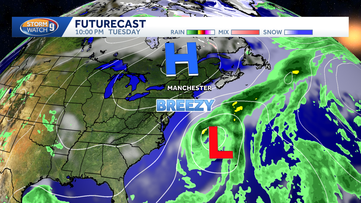 Nor'easter to stay offshore, no significant impacts expected in New Hampshire
A nor'easter is developing off the Carolina coast this week, but it will stay safely offshore as it slowly moves across the western Atlantic. The storm's biggest impacts are expected farther south, where gusty winds…
-
 ‘A Dry And Crisp Fall Week’ In New Hampshire, According To Weather Forecasters
GRAY, ME — Forecasters are calling for another good week of weather in New Hampshire. On Tuesday, expect partly sunny skies with a light wind and highs in the lower 60s. Overnight lows will be in the mid-30s. It will be…
-
 Maclane Westbrook - Mt. Washington, New Hampshire
KPVI There was a problem reporting this. Keep it Clean. Please avoid obscene, vulgar, lewd, racist or sexually-oriented language. Poll: Inflation tops voter concerns, national debt near the bottom 15 vintage dishes that…
-
 Weather Forecasters Warn New Hampshire Hikers: This Is Not The Weekend For Recreating In The Mountains
GRAY, ME — It will be mostly sunny but cold in central and southern New Hampshire this weekend, with weather forecasters warning of wintry conditions in the mountains. On Friday, expect showers for most of the day with…
Air quality
Air quality is satisfactory, and air pollution poses little or no risk.
Forecast
- ThuGood
- FriGood
Belknap County, NH reporting area · 2 hrs ago. Data from AirNow (EPA and its state, local and tribal partners); preliminary and subject to change.
Sun & moon
Almanac
MonthlyLakeport 2, records since 1938. Normals 1991–2020. Data from NOAA's Regional Climate Centers (ACIS).
Nearby
Forecasters' discussion
From the National Weather Service office in GYX, issued 8 hrs ago
What Has Changed
Very little change to the going forecast this Thursday morning.
Key Messages
1. High pressure remains in control of the weather pattern across northern New England through the weekend while Subtropical Storm Josephine passes offshore. Northerly gusts of 25 to 35 MPH possible later today into Friday.
Discussion
KEY MESSAGE 1 DESCRIPTION...
High pressure will remain over southern Quebec today into Thursday night as a dry cold front crosses from the north and Josephine passes well offshore. Partly to mostly sunny skies will prevail with highs into the lower 60s south of the mtns with 50s across the north. The increasing pressure gradient force from distant Subtropical Storm Josephine and high centered to our NW will allow for increasing winds throughout the day with N gusts up to 25-35 mph likely from this afternoon through the first half of Friday.
Josephine will continue to move northeast, well out to sea. With persistent northerly flow aloft, expect a chilly and blustery day on Friday with highs mainly in the mid 40s to mid 50s. The gusty winds will make it feel even colder.
As winds diminish Friday night, a mostly clear sky should prove optimal for radiational cooling and very cold temperatures. The latest NBM is advertising lows in the 20s across the entire forecast area and this may end up being on the warm side depending on the presence of high clouds.
High pressure then dominates the weather pattern through the weekend as an upper level ridge nudges into the region. This will lead to a gradual warmup through the weekend and into next week. Highs on Saturday should mainly be back in the 50s with some 60s returning Sunday and Monday. A cold front will sweep through on Monday which will lead to cooler temperatures into midweek. As of now, this cold front looks to be dry but we could end up seeing some low precipitation chances as we move closer in time.
Aviation
Through 06z Friday: Patchy fog is possible in the river valleys early this morning. Otherwise, VFR conditions prevail with N winds of 10-15 kts. Gusts will increase this afternoon through the first half of Friday with gusts 20-30 kts. Gusts may continue for terminals in southern ME (PWM, AUG, RKD) into the overnight hours.
Outlook...
Friday-Monday...VFR prevails under high pressure. This should lead to light diurnal wind patterns.
Forecasts, observations and alerts in the United States come from the National Weather Service (NOAA); radar from NOAA's Multi-Radar Multi-Sensor system; satellite imagery from NASA's Global Imagery Browse Services (GIBS) and NOAA's GOES satellites; the map from the U.S. Geological Survey's National Map; air quality from AirNow (EPA and its partners); hurricane information from the National Hurricane Center; climate normals and records from NOAA's Regional Climate Centers (ACIS). Forecasts outside the United States and the UV index: MET Norway (CC BY 4.0); observations outside the U.S.: airport reports via NOAA's Aviation Weather Center. Place names: GeoNames (CC BY 4.0). Data are copied on a schedule and may lag the sources; for warnings that affect your safety, follow your local National Weather Service office and emergency officials. Weather news is drawn from the 4Search index and reflects what the press published. Terms of use.