Install
Contoocook, NH Weather
Current conditions
Observed at Concord Municipal Airport · 1 hr ago
Forecast
10-day-
Tonight
Clear, with a low around 27. Northwest wind around 0 mph.
-
Sunday
Sunny, with a high near 65. West wind around 0 mph.
-
Sunday Night
Mostly clear, with a low around 33. Southwest wind around 0 mph.
National Weather Service forecast updated 3 hrs ago.
Hourly
Hourly forecast- Now36°
- Sun12 AM35°
- 1 AM34°
- 2 AM32°
- 3 AM31°
- 4 AM30°
- 5 AM29°
- 6 AM28°
- 7 AM28°
- 8 AM30°
- 9 AM37°
- 10 AM45°
- 11 AM53°
- 12 PM58°
- 1 PM62°
- 2 PM64°
- 3 PM64°
- 4 PM63°
- 5 PM61°
- 6 PM56°
- 7 PM50°
- 8 PM45°
- 9 PM42°
- 10 PM40°
10-day forecast
Details- TonightOct 24Clear27°
- SunOct 25Sunny33°65°
- MonOct 26Sunny31°66°
- TueOct 27Sunny22°53°
- WedOct 28Sunny30°56°
- ThuOct 29Sunny43°64°
- FriOct 30Sunny38°66°
- SatOct 31Mostly Sunny63°
- SunNov 1Cloudy35°64°
- MonNov 2Partly cloudy46°70°
Days after the National Weather Service's seven are MET Norway's outlook, a computer model with no forecaster's review.
Radar
Full mapWeather news in New Hampshire
More weather news-
 Cold Halloween night expected in New Hampshire. See full holiday forecast
AccuWeather just released its Halloween weekend forecast, predicting "a spooky mix of chilly temperatures, gusty winds, rain and even mountain snow" across the country. While the weather service predicts New England…
-
 Another Great Autumn Weather Weekend In New Hampshire, Forecasters Say
GRAY, ME — Forecasters are calling for another nice fall weekend in the Granite State. On Friday, expect sunny skies, highs in the mid-50s, and light winds. Overnight lows will be in the mid-20s. Expect similar weather…
-
 New Hampshire foliage map: Southern regions hit their peak during great weekend weather
WMUR New Hampshire foliage map: Southern regions hit their peak during great weekend weather As October continues on, the peak of fall foliage is moving farther south. While the mountains in the north are past peak…
- New England Could Face Another Fall Nor’easter – Maine, New Hampshire, & Massachusetts Take Note
Even though we normally think of Nor'easters as being a winter weather event, they can happen at any time during the year. In fact, we have already had a Nor'easter this year. It rolled through New England in September…
-
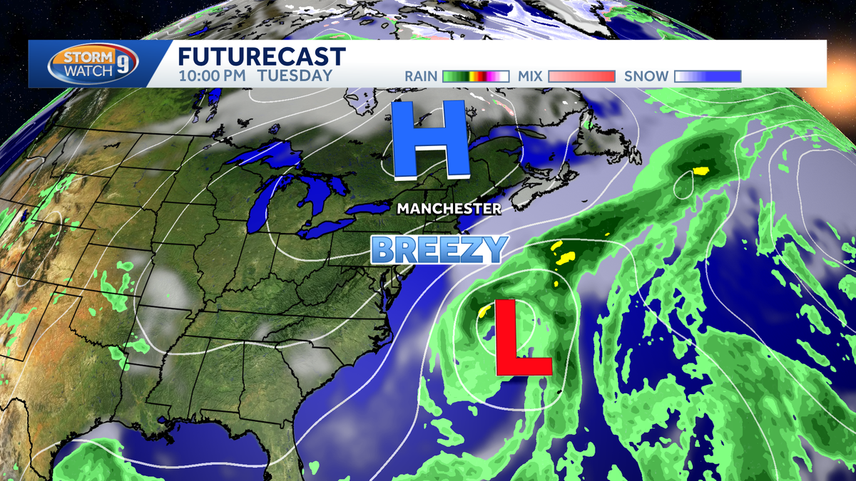 Nor'easter to stay offshore, no significant impacts expected in New Hampshire
A nor'easter is developing off the Carolina coast this week, but it will stay safely offshore as it slowly moves across the western Atlantic. The storm's biggest impacts are expected farther south, where gusty winds…
-
 ‘A Dry And Crisp Fall Week’ In New Hampshire, According To Weather Forecasters
GRAY, ME — Forecasters are calling for another good week of weather in New Hampshire. On Tuesday, expect partly sunny skies with a light wind and highs in the lower 60s. Overnight lows will be in the mid-30s. It will be…
-
 Maclane Westbrook - Mt. Washington, New Hampshire
KPVI There was a problem reporting this. Keep it Clean. Please avoid obscene, vulgar, lewd, racist or sexually-oriented language. Poll: Inflation tops voter concerns, national debt near the bottom 15 vintage dishes that…
Air quality
Forecast
- SatGood
- SunGood
- MonGood
Merrimack County, NH reporting area. Data from AirNow (EPA and its state, local and tribal partners); preliminary and subject to change.
Sun & moon
Almanac
MonthlyConcord Area, records since 1868. Normals 1991–2020. Data from NOAA's Regional Climate Centers (ACIS).
Nearby
- Manchester 33 km
- Nashua 55 km
- Concord 14 km
- East Concord 14 km
- Derry Village 49 km
- Merrimack 44 km
- Keene 56 km
- Derry 49 km
- Bedford 35 km
- Laconia 39 km
- Windham 57 km
- Claremont 54 km
Forecasts, observations and alerts in the United States come from the National Weather Service (NOAA); radar from NOAA's Multi-Radar Multi-Sensor system; satellite imagery from NASA's Global Imagery Browse Services (GIBS) and NOAA's GOES satellites; the map from the U.S. Geological Survey's National Map; air quality from AirNow (EPA and its partners); hurricane information from the National Hurricane Center; climate normals and records from NOAA's Regional Climate Centers (ACIS). Forecasts outside the United States and the UV index: MET Norway (CC BY 4.0); observations outside the U.S.: airport reports via NOAA's Aviation Weather Center. Place names: GeoNames (CC BY 4.0). Data are copied on a schedule and may lag the sources; for warnings that affect your safety, follow your local National Weather Service office and emergency officials. Weather news is drawn from the 4Search index and reflects what the press published. Terms of use.