Install
Osceola, NE Weather
Current conditions
Forecast for this hour (no station report in the last two hours)
Forecast
10-day-
Saturday
Rain showers likely after 7am. Partly sunny, with a high near 70. Chance of precipitation is 60%.
-
Saturday Night
Rain showers likely. Mostly cloudy, with a low around 48. Chance of precipitation is 60%.
-
Sunday
A chance of rain showers. Partly sunny, with a high near 64. Chance of precipitation is 30%.
National Weather Service forecast updated 4 days ago.
Hourly
Hourly forecast- Now68°59%
- 4 PM68°59%
- 5 PM67°59%
- 6 PM65°59%
- 7 PM63°48%
- 8 PM61°48%
- 9 PM58°48%
- 10 PM56°48%
- 11 PM55°48%
- Sun12 AM54°48%
- 1 AM53°30%
- 2 AM52°30%
- 3 AM51°30%
- 4 AM50°30%
- 5 AM49°30%
- 6 AM49°30%
- 7 AM49°27%
- 8 AM50°27%
- 9 AM52°27%
- 10 AM54°27%
- 11 AM56°27%
- 12 PM59°27%
- 1 PM61°20%
- 2 PM63°20%
10-day forecast
Details- TonightOct 19Clear45°
- TueOct 20Sunny10%50°70°
- WedOct 21Sunny50°74°
- ThuOct 22Sunny58°75°
- FriOct 23Mostly Sunny13%59°76°
- TodayOct 24Rain Showers Likely59%48°70°
- SunOct 25Chance Rain Showers30%46°64°
- MonOct 26Slight Chance Rain Showers23%62°
- TueOct 27Sunny34°49°
- WedOct 28Sunny37°60°
Days after the National Weather Service's seven are MET Norway's outlook, a computer model with no forecaster's review.
Radar
Full mapWeather news near Osceola
More weather news-
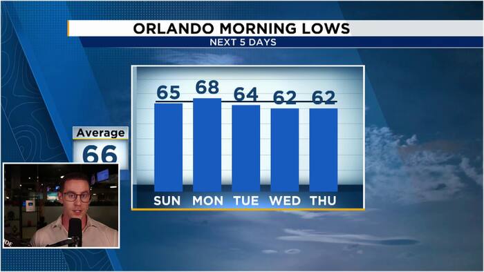 Windy & Cooler Sunday as 60s return to Central Florida
WKMG Jordan Patrick, Certified Meteorologist Windy & Cooler Sunday as 60s return to Central Florida Hundreds honor Brevard County Agent Kevin Morris after fatal I-95 crash Injuries avoided as truck hits school bus in…
-
 352 WEEKEND WEATHER FORECAST OCT. 16-18: Overnight temps and rain chances to drop
Evenings and nights this weekend will approach "fire pit" lows in the bottom of the 60s across North Central Florida. MARION COUNTY, FL (352today.com) – Will it or won’t it feel like fall? That’s really the question on…
-
 Cold Front Alert: A weekend cold front will bring cool and breezy conditions to Central Florida.
WKMG Cold Front Alert: A weekend cold front will bring cool and breezy conditions to Central Florida. Ex-US Sen. Mel Martinez, a Republican, endorses Democrat Bale Dalton in House District 7 race MICHELLE PARKER CASE…
- Nearly 99% of Iowa Remains Drought-Free
Washington, DC — For Iowa overall, 98.64% of the state is free of drought or abnormal dryness, while 1.36% remains abnormally dry (D0). There is no Moderate Drought (D1) or worse anywhere in Iowa. Those numbers are…
-
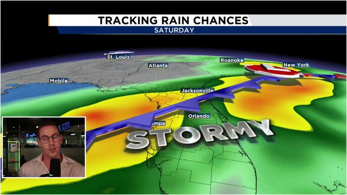 Warm & dry Thursday before rain chances return
WKMG Family of 5-year-old killed by falling classroom display board hires attorney, considers lawsuit Central Florida Silver Alert issued after woman with Alzheimer’s disappears Fight over proposed Flagler County…
-
 Warm weather continues across Central Florida before windy, wet weekend
WFTV Warm weather continues across Central Florida before windy, wet weekend Osceola County begins $36 million construction of Cross Prairie Parkway Connector America faces a growing blue-collar jobs crisis Study…
-
 Morning Forecast: Wednesday, October 14, 2026
WFTV Warm weather continues across Central Florida before windy, wet weekend Osceola County begins $36 million construction of Cross Prairie Parkway Connector America faces a growing blue-collar jobs crisis Study…
-
 #Drought news October 22, 2026: Improvements occurred across portions of #Kansas, #Nebraska, #Colorado, #Wyoming, #Utah, #Arizona and #NewMexico
Drought news October 22, 2026: Improvements occurred across portions of #Kansas, #Nebraska, #Colorado, #Wyoming, #Utah, #Arizona and #NewMexico coyotegulch.blog Click on a thumbnail graphic to view a gallery of drought…
- Fall at its finest in Nebraska: enjoy it while it lasts before more wind and weekend rain chances
LINCOLN, Neb. (KOLN) - A weak weather system passing south of the region will bring a small chance for spotty showers and sprinkles across southern Nebraska tonight, but don’t let that dampen your plans. The rain chance…
-
 Warming trend through the work week across Nebraska ends with more wind, fire danger
LINCOLN, Neb. (KOLN) - The pleasant pattern continues through the week. Highs will reach the mid 60s to low 70s Monday and Tuesday, with similar conditions Wednesday. By Thursday and Friday, temperatures will push into…
Air quality
Air quality is satisfactory, and air pollution poses little or no risk.
Grand Island, NE reporting area · 1 hr ago. Data from AirNow (EPA and its state, local and tribal partners); preliminary and subject to change.
Sun & moon
Almanac
MonthlyYork 3n, records since 2008. Normals 1991–2020. Data from NOAA's Regional Climate Centers (ACIS).
Nearby
- Columbus 32 km
- York 35 km
- Seward 48 km
- Schuyler 50 km
- Aurora 52 km
- Central City 39 km
- David City 36 km
Forecasters' discussion
From the National Weather Service office in GID, issued 1 day ago
Key Messages
- Winds this afternoon could gust up to 35 to 45 MPH out of the south in some areas.
- Rain and storm chances increase tonight through Monday. The highest chances will be Sunday and Monday (80% to near 100% in some areas).
- A cold front will push into the area on Saturday. Temperatures will be on a cooling trend through Monday (highs in the 50s and 60s).
Discussion
Issued at 201 PM CDT Fri Oct 23 2026
An upper level ridge extends from Texas to the Upper Midwest with an upper trough just behind the upper ridge. Winds across south central and central Nebraska and north central Kansas are gusting out of the south in response to a strengthening surface trough across western Nebraska and eastern Colorado. Wind gusts up to 35 to 45 MPH are expected this afternoon across portions of the area. Temperatures this afternoon are expected to warm up into the mid 70s to lower 80s. Winds will weaken some this evening (around 15 to 20 MPH sustained) and moreso late tonight (around 5 to 10 MPH) but will remain out of the south. Low temperatures tonight will be in the low 50s to low 60s. Light rain showers may develop across portions of the area this afternoon in response to a near shortwave trough, but the main development of rain and possibly isolated thunderstorms is not expected until later this evening into tonight.
A cold front will begin to push into the area on Saturday as the upper trough begins to move over the region. Rain and storm chances will increase on Saturday (up to around 70% in some areas) near and behind the front. High temperatures on Saturday are somewhat uncertain due to strength and timing of the front but generally expect temperatures to range from the low 60s to upper 70s. Low temperatures Saturday night are expected to range from the mid/upper 30s to mid 50s. The southern portion of the previously mentioned upper trough will still be to the west and southwest of the area (just beginning to move over Nebraska and Kansas) on Sunday which will keep upper lift over the area. This will result in more rain (and possibly isolated storm) chances on Sunday and Sunday night (chances ranging from around 40% to near 100%). Temperature uncertainty will continue into Sunday but generally expect high temperatures to range from the mid 50s to mid 70s. The upper trough is expected to be over the region on Monday allowing for rain and storm chances to continue (around 60% to 90%). High temperatures on Monday will mainly be in the 50s and 60s. Low temperatures Monday night are expected to range from the low 30s to low 50s.
High temperatures in the 50s and 60s will continue for Tuesday with mostly dry conditions. There may be a slight warm up for Wednesday (highs in the 60s and 70s) with temperatures cooling again for Thursday (highs in the 50s and 60s). Low temperatures Tuesday night and Wednesday night will generally be in the mid 30s to low 50s. Various low-end (15% to near 30%) precipitation chances will be present Tuesday night through Thursday night.
Aviation
Issued at 1233 PM CDT Fri Oct 23 2026
For KGRI/KEAR Airports:
Gusty south winds are expected through this afternoon. Winds will decrease a little this evening and become more southeasterly. Wind shear is expected beginning around 00z to 01z and continuing until 14z. Winds will decrease even more late tonight with rain showers expected. Low ceilings are expected as well as a more westerly wind shift beginning around 14z. Northerly winds are expected by 18z Saturday.
Gid Watches
NE...None. KS...None.
Forecasts, observations and alerts in the United States come from the National Weather Service (NOAA); radar from NOAA's Multi-Radar Multi-Sensor system; satellite imagery from NASA's Global Imagery Browse Services (GIBS) and NOAA's GOES satellites; the map from the U.S. Geological Survey's National Map; air quality from AirNow (EPA and its partners); hurricane information from the National Hurricane Center; climate normals and records from NOAA's Regional Climate Centers (ACIS). Forecasts outside the United States and the UV index: MET Norway (CC BY 4.0); observations outside the U.S.: airport reports via NOAA's Aviation Weather Center. Place names: GeoNames (CC BY 4.0). Data are copied on a schedule and may lag the sources; for warnings that affect your safety, follow your local National Weather Service office and emergency officials. Weather news is drawn from the 4Search index and reflects what the press published. Terms of use.