Install
Magnolia, MS Weather
Current conditions
Forecast for this hour (no station report in the last two hours)
Forecast
10-day-
Saturday
Sunny, with a high near 80. East wind 5 to 10 mph.
-
Saturday Night
Clear, with a low around 48. East wind 0 to 5 mph.
-
Sunday
Sunny, with a high near 81. East wind 5 to 10 mph.
National Weather Service forecast updated 2 days ago.
Hourly
Hourly forecast- Now66°
- 11 AM70°
- 12 PM74°
- 1 PM77°
- 2 PM78°
- 3 PM79°
- 4 PM79°
- 5 PM74°
- 6 PM70°
- 7 PM65°
- 8 PM62°
- 9 PM59°
- 10 PM57°
- 11 PM55°
- Sun12 AM54°
- 1 AM53°
- 2 AM52°
- 3 AM51°
- 4 AM50°
- 5 AM49°
- 6 AM49°
- 7 AM48°
- 8 AM54°
- 9 AM59°
10-day forecast
Details- ThuOct 22Sunny51°83°
- FriOct 23Sunny49°83°
- TodayOct 24Sunny48°80°
- SunOct 25Sunny49°81°
- MonOct 26Mostly Sunny51°80°
- TueOct 27Mostly Sunny51°81°
- WedOct 28Mostly Sunny50°82°
- ThuOct 29Partly cloudy51°79°
- FriOct 30Cloudy56°76°
- SatOct 31Cloudy51°74°
Days after the National Weather Service's seven are MET Norway's outlook, a computer model with no forecaster's review.
Radar
Full mapWeather news near Magnolia
More weather news-
 Magnolia Three-Day Weather/Sky Report: Sunny, warm weather through Saturday
Our feline correspondent, Walter Cronkat, gets his exercise while aboard the International Space Station. Magnolia will experience mostly sunny skies and afternoon temperatures in the lower 80s through Saturday, October…
-
 Magnolia Three-Day Weather/Sky Report: Sunny, warm weather forecast through Friday
Sunny skies, warm afternoons and cool nights are forecast for Magnolia through Friday, October 23, with little prospect of rainfall. The weather should provide favorable conditions for observing the Orionid meteor…
-
 Magnolia Three-Day Weather/Sky Report: Sunny days ahead
South Arkansas can expect three consecutive days of sunshine, cool mornings and warm afternoons through Thursday, October 22. Rain chances are virtually nonexistent, with afternoon temperatures reaching the lower to…
-
 Magnolia Three-Day Weather/Sky Report: Orionid meteor shower approaches peak
South Arkansas enters the new workweek as October's Orionid meteor shower approaches its annual peak. Daytime highs will be near 80. Overnight lows will be near 45. All times in this report are Central Daylight. Monday…
-
 Magnolia Three-Day Weather/Sky Report: Sunny skies, warming temperatures through Tuesday
Sunshine, dry conditions and steadily warming temperatures are forecast for Columbia County through Tuesday, October 20, with afternoon highs climbing into the lower 80s. The National Weather Service expects clear to…
-
 Magnolia Three-Day Weather/Sky Report: Sunny, cool weekend
Sunny skies, cool nights and gradually warming daytime temperatures are forecast for Magnolia through Monday, October 19, as South Arkansas experiences a stretch of dry autumn weather. The National Weather Service…
-
 Cool jackets Thursday morning, T-shirts by lunch! Perfect fall day ahead in South Mississippi
WLOX If you’re heading out the door Thursday morning, take a light jacket! Temps are running from the 40s and 50s inland to right around 60 on the coast. It’s that crisp, fall feel to start the day. Now, the bigger…
-
 The fall-like feel continues for South Mississippi
It’s already feeling a little cool tonight, and even more so by morning as temperatures fall back to the upper 40s and low 50s. Expect plenty of sunshine over the next several days, with afternoon highs mostly in the…
-
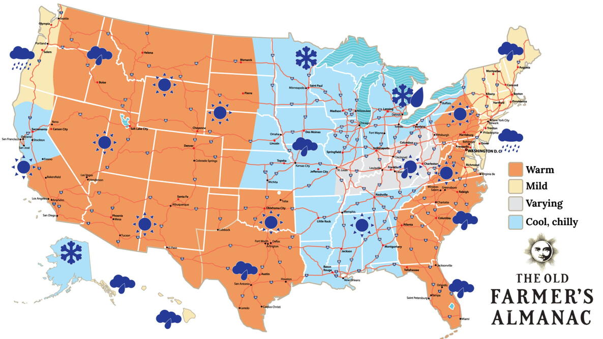 Old Farmer’s Almanac predicts Thanksgiving weather in Mississippi
The Old Farmer’s Almanac has released its weather forecast for Thanksgiving 2026, predicting a mix of sunshine, rain, and snow across the country. But what does the forecast have in store for Mississippi? According to…
-
 Your Mississippi forecast for Tuesday, October 20
Tuesday will be sunny and dry, and there's an elevated risk of fires across Mississippi. According to the Mississippi Forestry Commission, over 30 counties Tuesday will be sunny and dry, and there’s an elevated risk of…
Sun & moon
Almanac
MonthlyMccomb Airport, records since 1948. Normals 1991–2020. Data from NOAA's Regional Climate Centers (ACIS).
Nearby
- McComb 11 km
- Brookhaven 48 km
- Holly Springs 50 km
- Amite 47 km
- Franklinton 44 km
- Kentwood 23 km
Forecasters' discussion
From the National Weather Service office in LIX, issued 4 hrs ago
Key Messages
Updated at 544 AM CDT Sat Oct 24 2026
- Elevated fire danger will remain in place through the weekend. The current and worsening drought conditions and dry fuels combined with low humidity will lead to potential for rapid fire growth. Winds will strengthen a bit over the weekend leading to increasing concern. Residents should obey all burn bans in place and exercise extreme caution with any open flames outdoors even in areas that do not currently have burn bans in place.
- Strengthening winds across the coastal waters will lead to hazardous conditions for small craft through the weekend across all open Gulf waters of southeast Louisiana and Mississippi, as well the sounds and lakes east of the Mississippi River.
Short Term
(Now through Tuesday) Issued at 1216 AM CDT Sat Oct 24 2026
Upper ridge extends from east Texas to the Great Lakes, with troughs over Florida and near Las Vegas. At the surface, high pressure centered over New England extended southwest to the northern Gulf Coast. Clear skies across the area at midnight with temperatures in the 60s along the south shore of Lake Pontchartrain, and mainly in the 50s elsewhere.
The upper ridge is going to shift only slightly eastward over the next few days, being centered south of Mobile on Tuesday. Surface high pressure will continue to control the weather across the eastern half of the country through Tuesday with northeast to east winds continuing. The surface pressure gradient will tighten a little over the next day or two, providing for somewhat stronger easterly winds, especially south of Interstate 10. For fire weather concerns, see that section of the discussion below. GFS soundings and precipitable water forecasts indicate that moisture levels should remain near or below the 25th percentile for late October (0.80 inches) through Tuesday and beyond. Other than possibly some cirrus clouds and a few cumulus clouds at times, expect abundant sunshine, warm daytime temperatures and cool nights through Tuesday. Highs in the mid 70s to lower 80s are about 5 degrees above normal, and overnight lows in the 50s for most areas are just above normal.
Long Term
(Tuesday night through Friday) Issued at 1216 AM CDT Sat Oct 24 2026
Not a lot to say that hasn't already been said over the last several days. Dry high pressure will continue to dominate the area's weather through the work week. Even as the ridge axis meanders a bit in response to northern stream impulses riding up and over the ridge, it keeps a pretty strong hold on the southeast CONUS. Deep southerly flow will bring moisture into Texas and western portions of Louisiana, but the location of the surface high keeps our local flow more easterly than southerly.
With the persistent dry conditions, expect to see continued large diurnal temperature ranges with lows falling into upper 40s to mid 50s across northern areas and upper 50s to lower 60s in southern areas. Afternoon highs will generally warm into the upper 70s to lower 80s most places daily.
Next rain chance looks to be beyond the current forecast period, but could come next weekend or during the first part of the following week as another cold front moves into and through the area. Time will tell whether there is sufficient moisture return ahead of this front to result in wetting rains.
Aviation
(12Z TAFS) Issued at 544 AM CDT Sat Oct 24 2026
VFR through the forecasts period. General east winds 10-12 knots possible at most terminals from mid morning through late afternoon today.
Forecasts, observations and alerts in the United States come from the National Weather Service (NOAA); radar from NOAA's Multi-Radar Multi-Sensor system; satellite imagery from NASA's Global Imagery Browse Services (GIBS) and NOAA's GOES satellites; the map from the U.S. Geological Survey's National Map; air quality from AirNow (EPA and its partners); hurricane information from the National Hurricane Center; climate normals and records from NOAA's Regional Climate Centers (ACIS). Forecasts outside the United States and the UV index: MET Norway (CC BY 4.0); observations outside the U.S.: airport reports via NOAA's Aviation Weather Center. Place names: GeoNames (CC BY 4.0). Data are copied on a schedule and may lag the sources; for warnings that affect your safety, follow your local National Weather Service office and emergency officials. Weather news is drawn from the 4Search index and reflects what the press published. Terms of use.