Install
Eyota, MN Weather
Current conditions
Observed at Rochester, Rochester International Airport · 46 min ago
Forecast
10-day-
Friday
A slight chance of rain showers after 3pm. Mostly sunny. High near 72, with temperatures falling to around 70 in the afternoon. South wind 8 to 14 mph, with gusts as high as 23 mph. Chance of precipitation is 20%.
-
Friday Night
A slight chance of rain showers before 7pm. Mostly cloudy. Low around 58, with temperatures rising to around 60 overnight. South wind 12 to 16 mph, with gusts as high as 24 mph. Chance of precipitation is 20%.
-
Saturday
Mostly sunny, with a high near 73. South wind 10 to 16 mph, with gusts as high as 26 mph.
National Weather Service forecast updated 6 hrs ago.
Hourly
Hourly forecast- Now55°
- 7 AM55°
- 8 AM55°
- 9 AM57°
- 10 AM61°
- 11 AM65°
- 12 PM69°
- 1 PM70°
- 2 PM71°
- 3 PM72°20%
- 4 PM70°18%
- 5 PM70°17%
- 6 PM68°15%
- 7 PM65°11%
- 8 PM64°
- 9 PM63°
- 10 PM63°
- 11 PM62°
- Sat12 AM61°
- 1 AM61°
- 2 AM61°
- 3 AM61°
- 4 AM60°
- 5 AM60°
10-day forecast
Details- TonightOct 22Mostly Clear55°
- TodayOct 23Mostly Sunny then Slight Chance Rain Showers20%58°72°
- SatOct 24Mostly Sunny11%51°73°
- SunOct 25Mostly Cloudy12%47°59°
- MonOct 26Chance Rain Showers36%43°54°
- TueOct 27Slight Chance Rain Showers21%46°54°
- WedOct 28Chance Rain Showers33%44°59°
- ThuOct 29Slight Chance Rain Showers20%56°
- FriOct 30Sunny32°43°
- SatOct 31Cloudy34°54°
Days after the National Weather Service's seven are MET Norway's outlook, a computer model with no forecaster's review.
Radar
Full mapWeather news in Minnesota
More weather news-
 Minnesota sees chances for rain and more seasonable temps soon | Next Weather 10 p.m. Oct. 22, 2026
CBS News Minnesota is a local news organization that is part of CBS News and Stations. Also referred to as WCCO-TV and channel 4, CBS News Minnesota offers local breaking news, weather coverage and investigative…
-
 Minnesota gets 3 more days in the 70s, then a cold front cuts the weekend in half | Oct. 22, 2026
Thursday and likely Friday and Saturday all reach the mid 70s, then a cold front moves through Saturday evening and night, dropping highs into the 50s Sunday and the lower 50s Monday through Wednesday, WCCO…
-
 Amazing fall weather in Minnesota | Oct. 22, 2026
CBS News Baltimore 8am CBS News Boston 8am CBS News Chicago 7am CBS News Colorado This Morning 6am CBS News Los Angeles Mornings 5am CBS News Miami 8am CBS News New York 8am CBS News Texas 7am
-
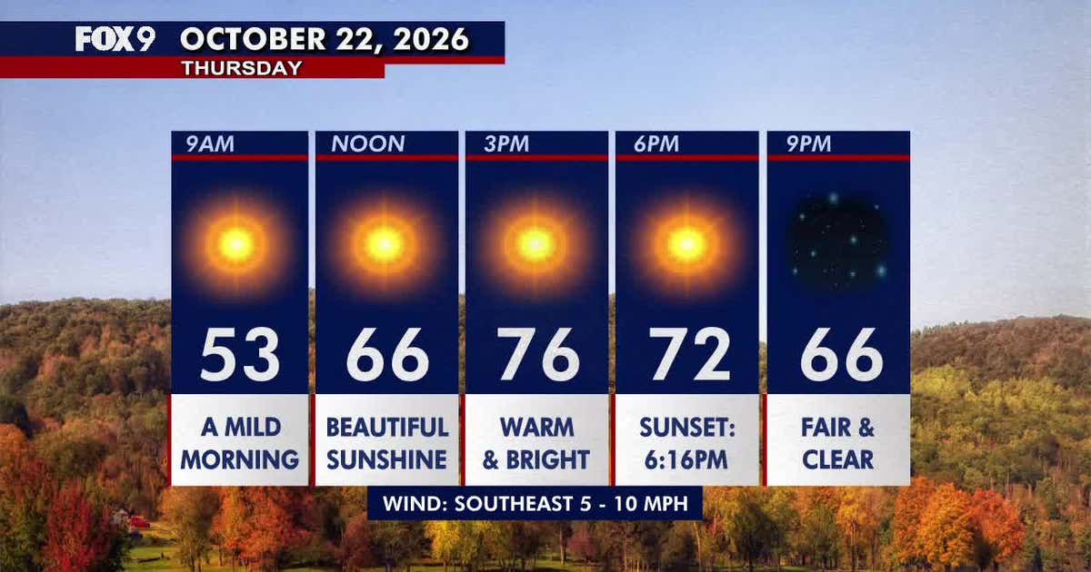 Minnesota weather: Beautiful, warm Thursday before a breezy Friday
Thursday brings plenty of sunshine and warm temperatures in the 70s across Minnesota. FOX 9 meteorologist Jared Piepenburg looks ahead to a breezier Friday, shower chances Saturday and a significant cooldown Sunday…
-
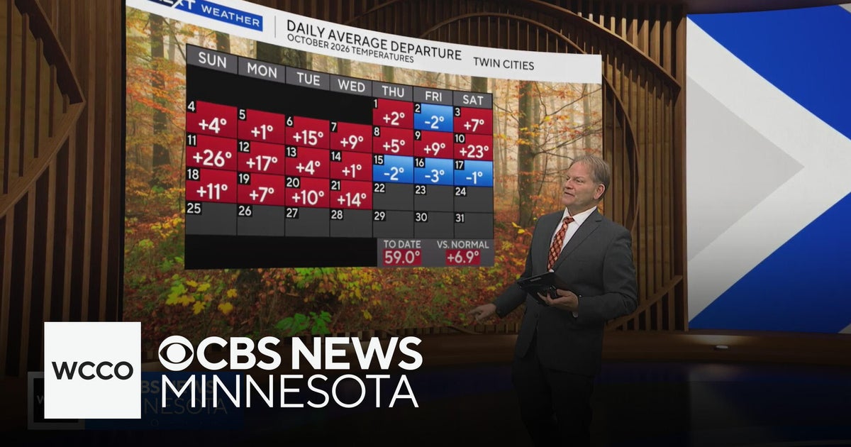 In the midst of a warm Minnesota fall, but cool-down is coming | Oct. 21, 2026
CBS News Minnesota is a local news organization that is part of CBS News and Stations. Also referred to as WCCO-TV and channel 4, CBS News Minnesota offers local breaking news, weather coverage and investigative…
-
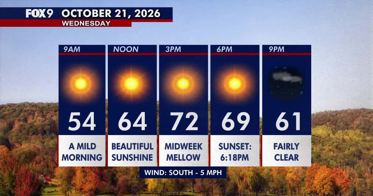 Minnesota weather: Sunny, comfortable Wednesday with highs in the 70s
Wednesday brings plenty of sunshine and comfortable low-70s temperatures across much of Minnesota. Above-average warmth continues through Friday before rain chances return Saturday and cooler weather arrives Sunday. FOX…
-
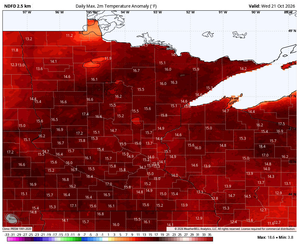 70-degree highs the next few days across southern Minnesota
Minor rain chances ahead Temperatures warm even more Wednesday into Saturday. We’ll see highs in the 70s for southern and western Minnesota. A few showers are possible Friday in western Minnesota and statewide this…
-
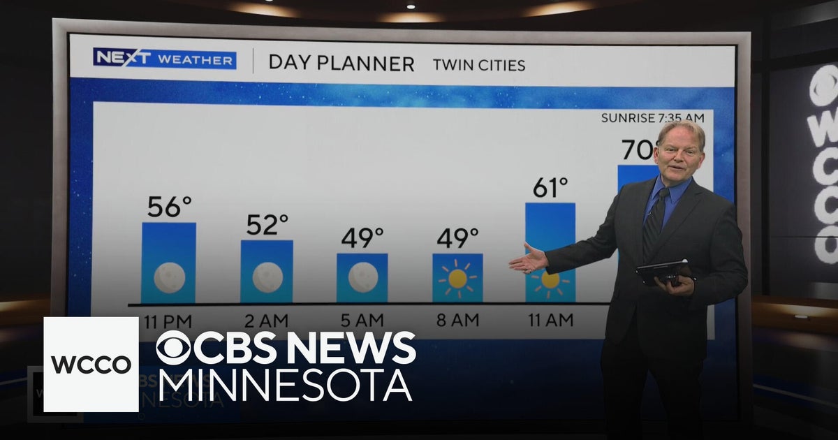 No rain in sight for Minnesota, but several days in the 70s on the way
WBZ This Morning 6am CBS News Chicago 5am CBS News Detroit 6am CBS News Miami 6am CBS News New York This Morning CBS News Philadelphia 6am KDKA-TV Morning News 6am CBS News Texas 5am
-
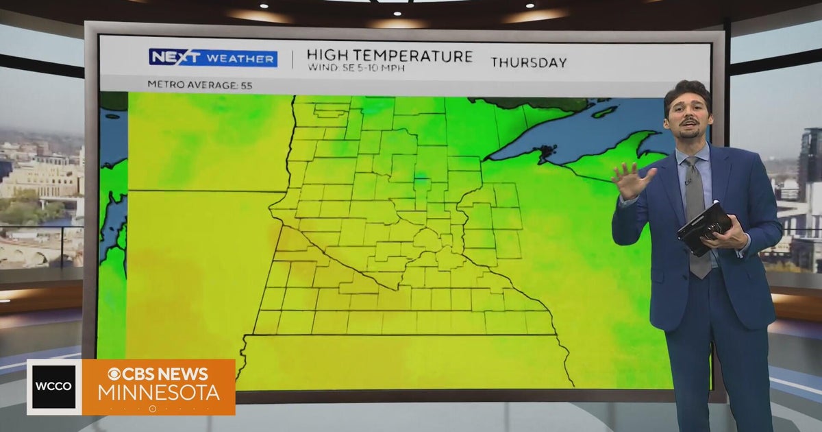 Minnesota weather stays unusually warm, with highs 15 to 20 degrees above normal | Oct. 20, 2026
CBS News Minnesota weather stays unusually warm, with highs 15 to 20 degrees above normal | Oct. 20, 2026 Preview: Golf 101 at Park 365 in Roseville Twin Cities man, 18, accused in MOA terror plot, and more headlines…
-
 More sunny, mild late October weather in Minnesota Tuesday
Updated on: October 20, 2026 / 6:34 AM CDT / CBS Minnesota Tuesday is another sunny and mild October day in the Twin Cities, with highs in the 70s south of Interstate 94 and upper 60s up north. Wednesday will be more of…
Air quality
Acceptable. Unusually sensitive people should consider limiting prolonged outdoor exertion.
Forecast
- FriGood (50)
- SatGood
- SunGood
Rochester Area, MN reporting area · 1 hr ago. Data from AirNow (EPA and its state, local and tribal partners); preliminary and subject to change.
Sun & moon
Almanac
MonthlyRochester Area, records since 1886. Normals 1991–2020. Data from NOAA's Regional Climate Centers (ACIS).
Nearby
- Rochester 20 km
- Winona 48 km
- Kasson 42 km
- Stewartville 26 km
- Byron 34 km
- Lake City 51 km
- Goodview 43 km
- Saint Charles 13 km
- Zumbrota 49 km
- Pine Island 41 km
- Plainview 20 km
- Chatfield 16 km
Forecasters' discussion
From the National Weather Service office in ARX, issued 4 hrs ago
Key Messages
- Small (10-20%) chance for a light shower north of Interstate 90 this afternoon and evening and again late Saturday into early Sunday.
- Quite a bit of uncertainty for early next week with potential for widespread rain in our region, nothing at all, or rain for just some of us. Regardless, temperatures trend cooler and towards normal through the beginning of next week.
Discussion
Issued at 110 AM CDT Fri Oct 23 2026
This Evening and Late Saturday: Low Potential for Light Rain
This afternoon/evening, weak shortwave looks to ride the upper ridge that has been keeping us warm and dry. This feature, along with some modest moist advection at 850mb, could (10-20% per 23.00z NBM/HREF and 22.12z LREF) produce a light shower as the shortwave passes over areas north of Interstate 90. No hazards are expected.
Moving into the weekend, strong northern stream upper low barrels eastward over Canada with the associated cold front pushing south through the Upper Midwest. However, with this feature failing to phase with a southern stream upper low that looks to linger over the Four Corners, the front will eventually stall somewhere near our CWA. As this occurs, mid-level moisture will continue to be advected northward on the western side of a ridge centered in the Ohio Valley. Thus, as weak shortwaves eject northeast from the Four Corners upper low, some light rain could result given the combination of modest cooling aloft, mid level moisture, and lift associated with the stalled front. Think its a pretty good bet some spots will pick up some rain but most guidance keeps best moist fetch just to our northwest. Have therefore carried some low (10- 20%) PoPs in our area for now.
Sunday - Wednesday: Greater Precipitation Potential, Trending Cooler
Greater precipitation potential exists Monday through Tuesday as the cutoff low across the Desert Southwest begins to lift northward. How this feature evolves as it moves northward and where the heaviest rainfall associated with it will occur remains rather uncertain though. The GEFS/AIGEFS members largely suggest the low takes a more southern trajectory, keeping higher probabilities for precipitation across a majority of the Upper Mississippi River Valley (60-80%) whereas the EPS/AIFS Ens on the other hand suggest a more northern and western solution, keeping higher probabilities across Minnesota into northern Wisconsin. Given the uncertainty, probabilities for precipitation remain on the lower end, currently sitting around 30- 40% in the 23.01z NBM though these probabilities may increase as the models begin to converge on a solution.
Aviation
Issued at 110 AM CDT Fri Oct 23 2026
VFR conditions are expected over the next 24 hours, save the usual river fog around OVS. Small (10-20%) chance for a brief shower along and north of an AUM-VOK line but flight rule reductions are not expected. Winds will remain generally out of the south as well.
Arx Watches
WI...None. MN...None. IA...None.
Forecasts, observations and alerts in the United States come from the National Weather Service (NOAA); radar from NOAA's Multi-Radar Multi-Sensor system; satellite imagery from NASA's Global Imagery Browse Services (GIBS) and NOAA's GOES satellites; the map from the U.S. Geological Survey's National Map; air quality from AirNow (EPA and its partners); hurricane information from the National Hurricane Center; climate normals and records from NOAA's Regional Climate Centers (ACIS). Forecasts outside the United States and the UV index: MET Norway (CC BY 4.0); observations outside the U.S.: airport reports via NOAA's Aviation Weather Center. Place names: GeoNames (CC BY 4.0). Data are copied on a schedule and may lag the sources; for warnings that affect your safety, follow your local National Weather Service office and emergency officials. Weather news is drawn from the 4Search index and reflects what the press published. Terms of use.