Install
Wixom, MI Weather
Current conditions
Observed at Pontiac, Oakland County International Airport · 24 min ago
Forecast
10-day-
Tonight
Mostly clear, with a low around 43. Northwest wind 0 to 5 mph.
-
Thursday
Sunny, with a high near 65. North northwest wind 5 to 8 mph.
-
Thursday Night
Mostly clear, with a low around 41. North northeast wind 3 to 7 mph.
National Weather Service forecast updated 1 day ago.
Hourly
Hourly forecast- Now44°
- 5 AM44°
- 6 AM44°
- 7 AM44°
- 8 AM44°
- 9 AM46°
- 10 AM52°
- 11 AM57°
- 12 PM61°
- 1 PM63°
- 2 PM65°
- 3 PM65°
- 4 PM65°
- 5 PM65°
- 6 PM63°
- 7 PM59°
- 8 PM54°
- 9 PM52°
- 10 PM49°
- 11 PM48°
- Fri12 AM46°
- 1 AM45°
- 2 AM44°
- 3 AM44°
10-day forecast
Details- WedOct 21Areas Of Fog then Sunny43°65°
- TodayOct 22Sunny41°65°
- FriOct 23Sunny40°63°
- SatOct 24Sunny43°64°
- SunOct 25Mostly Sunny47°68°
- MonOct 26Partly Sunny17%43°64°
- TueOct 27Slight Chance Light Rain17%38°55°
- WedOct 28Cloudy49°69°
- ThuOct 29Rain0.16 in43°71°
- FriOct 30Sunny38°55°
Days after the National Weather Service's seven are MET Norway's outlook, a computer model with no forecaster's review.
Radar
Full mapWeather news in Michigan
More weather news-
 Sunshine and Mild Temperatures Continue Across Southeast Michigan
ClickOnDetroit | WDIV Local 4 Trader Joe’s is expanding nationwide, including new Metro Detroit store Sunshine and Mild Temperatures Continue Across Southeast Michigan Oakland County Little League umpire shared child…
-
 How El Niño could impact the coming Michigan winter
The National Oceanic and Atmospheric Administration's seasonal weather outlook for winter 2026-27 is here, and it suggests the current El Niño could have a significant impact on Michigan. The NOAA predicts…
-
 Your WTOL 11 weather impact forecast: What to expect in northwest Ohio, southeast Michigan
WTOL Your WTOL 11 weather impact forecast: What to expect in northwest Ohio, southeast Michigan To stream WTOL on your phone, you need the WTOL app. Download the WTOL app Next up in 5 Example video title will go here…
-
 Powerful Fall Storm Expected to Bring Heavy Winds and Waterspouts to Lake Michigan
At SSBCrack News, our dedicated editorial team brings you the latest and most reliable updates on Defence, Geopolitics, Military Affairs, Science, and Technology. Driven by a passion for national security and strategic…
- NOAA: El Niño will bring milder, drier late fall, winter for Michigan
Subfreezing morning temperatures and gusty conditions gave way to a calm, quiet weekend across Lower Michigan, while long-range forecasters point to a warmer and drier late autumn and winter ahead across the Great Lakes…
-
 Frost advisory in Southeast Michigan
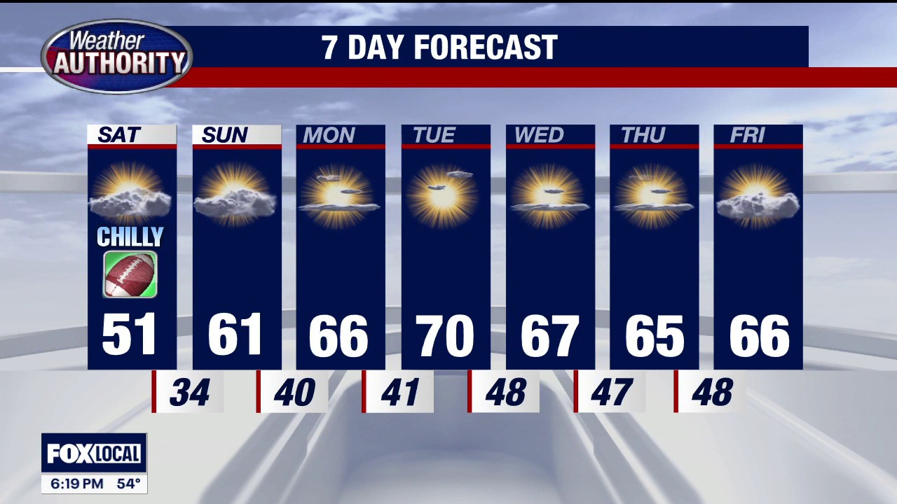
FOX 2 Detroit Temps could dip as low as 33 degrees from 3 a.m. - 8 a.m. on Saturday, with the potential to result in frost formation in the early morning hours of Saturday, Oct. 17.
-
 Frost advisory issued for Southeast Michigan early Saturday morning
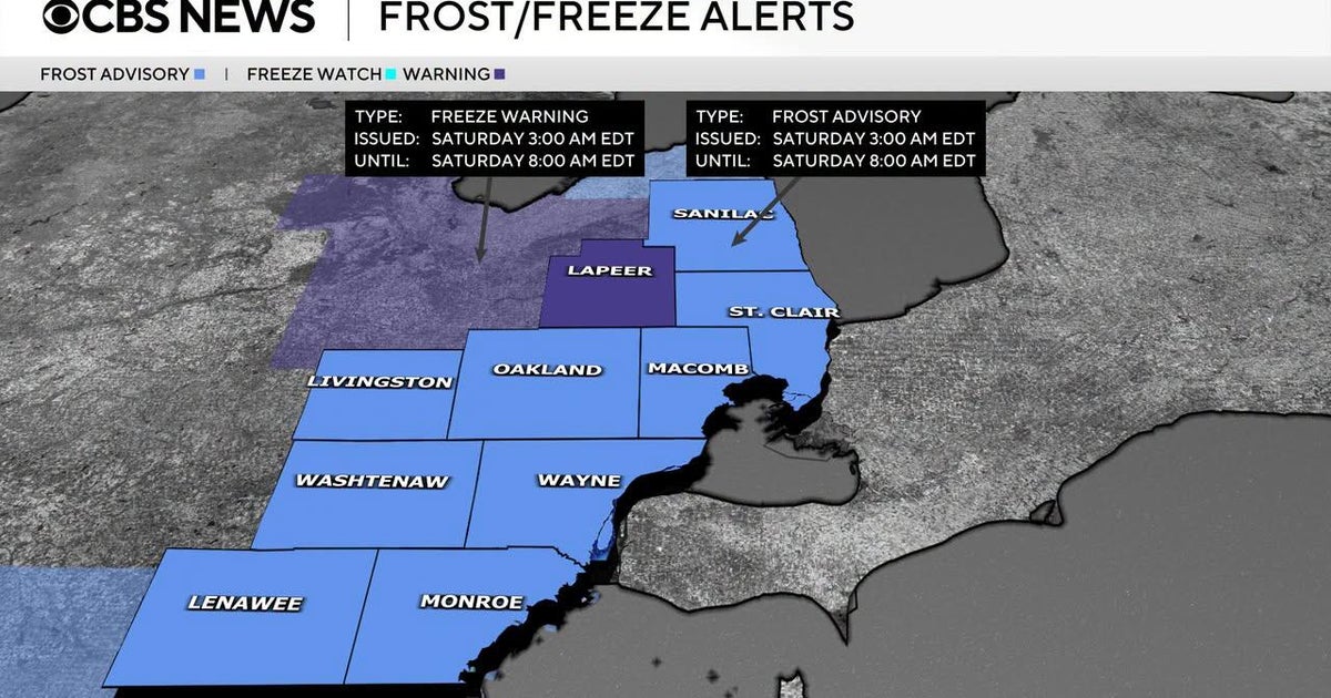
October 16, 2026 / 3:30 PM EDT / CBS Detroit If you are holding onto the last of your outdoor plants, it is time to take action on Friday night. The National Weather Service has issued a combination of freeze warnings…
-
 Justin Liles: After a good freeze, warmer weather returns to Wisconsin, Minnesota, and Michigan this weekend
Scattered light showers across north-central Wisconsin will quickly fade this afternoon, with winds diminishing as high pressure moves overhead tonight. A hard freeze is expected across northwest Wisconsin, where lows…
-
 Dangerous Freeze Watch for Parts of Indiana and Michigan as Temperatures Drop
A Freeze Watch is in effect for northern, east central and southeast Indiana from late Saturday night through Sunday morning, with lows as cold as 31 degrees possible. A Frost Advisory comes first, for parts of northern…
- Blustery Blast Hits Milwaukee: Lake Michigan Winds, Saturday Frost Possible
Milwaukee is facing chilly temperatures and a blustery Friday, with showers expected mainly before noon. The high is expected to reach about 53 degrees, with blustery winds and peak gusts of 35 to 40 mph. The National…
Air quality
People with heart or lung disease, older adults, children and teenagers should reduce prolonged or heavy exertion outdoors.
Forecast
- ThuModerate
- FriModerate
Southeast, MI reporting area · 1 hr ago. Data from AirNow (EPA and its state, local and tribal partners); preliminary and subject to change.
Sun & moon
Almanac
MonthlyAnn Arbor U Of Mich, records since 1881. Normals 1991–2020. Data from NOAA's Regional Climate Centers (ACIS).
Nearby
Forecasters' discussion
From the National Weather Service office in DTX, issued 15 hrs ago
Key Messages
- Mild and dry through the week.
Dtw Threshold Probabilities
* None.
Prev Discussion
Issued at 312 AM EDT Wed Oct 21 2026
DISCUSSION...
The combination of clear skies under light east to southeasterly flow has resulted in the proliferation of dense fog through southern and central Michigan, and to a lesser extent across the Thumb. The favorable flow has brought about better moisture advection derived from Lake Erie inland, where continued advection along with gentle upsloping will see dense fog expand west and northwest through central MI. This will continue to promote fog across Monroe and Lenawee counties, where a dense fog advisory is in effect until 10 AM EDT. Portions of western Washtenaw, the Tri-Cities and Thumb will likely see periodic fog, possibly dense at times, through daybreak, with sunshine then works the lift and scour out fog through the remaining morning hours.
The familiar persistence forecast will again take hold today as high pressure sits over the Great Lakes, which will be reinforced through Friday as a longwave ridge expands through the Plains and Midwest/Great Lakes. Dry weather and above normal temperatures continue as a result through the weekend. Daytime highs will return into the upper 60s today and tomorrow and may make a push into the 70s by tomorrow afternoon. A very subtle decrease in highs (low to mid 60s) will be likely Friday with northeast flow coming off the lake, but as the aforementioned high pressure system starts to depart into the western Atlantic, low-level flow re-orients south to southwesterly, resulting in the gentle uptick in waa pushing highs back in the mid to upper 60s. Fog, dense at times, remains highly sensitive to wind direction as shallow lake moisture advection has been the main driver of recent events. Tomorrow morning fog is a possibility under clear skies, but the unfavorable flow lowers confidence relative to today. Friday morning will be much more conducive to advective fog given the light east to northeast flow off of Lake Huron and Saginaw Bay. Patchy to areas of dense fog will be possible through the Tri-Cities and Thumb with lowered confidence for the degree of expansion inland. Outside of morning fog concerns, dry and sunny weather continues through the weekend.
MARINE...
High pressure remains over the region through the end of the week resulting in benign marine conditions. The current high now centered over Quebec, will slowly shifts east through tonight with a dry cold front then passing southward early Thursday. This front will quickly be followed by another area of high pressure that will then hold through most of the weekend. Wind gusts will stay below 20 knots through the end of the week. Winds will be southerly today before flipping around to the north for Thursday behind the cold front early in the morning.
Dtx Watches
MI...None. Lake Huron...None. Lake St Clair...None. Michigan waters of Lake Erie...None.
Forecasts, observations and alerts in the United States come from the National Weather Service (NOAA); radar from NOAA's Multi-Radar Multi-Sensor system; satellite imagery from NASA's Global Imagery Browse Services (GIBS) and NOAA's GOES satellites; the map from the U.S. Geological Survey's National Map; air quality from AirNow (EPA and its partners); hurricane information from the National Hurricane Center; climate normals and records from NOAA's Regional Climate Centers (ACIS). Forecasts outside the United States and the UV index: MET Norway (CC BY 4.0); observations outside the U.S.: airport reports via NOAA's Aviation Weather Center. Place names: GeoNames (CC BY 4.0). Data are copied on a schedule and may lag the sources; for warnings that affect your safety, follow your local National Weather Service office and emergency officials. Weather news is drawn from the 4Search index and reflects what the press published. Terms of use.