Install
Plymouth, MA Weather
Current conditions
Observed at Plymouth, Plymouth Municipal Airport · 1 hr ago
Forecast
10-day-
Sunday
Patchy frost before 8am. Sunny, with a high near 63. Southwest wind 1 to 6 mph.
-
Sunday Night
Clear, with a low around 38. Southwest wind around 7 mph.
-
Monday
Sunny, with a high near 65. Southwest wind around 7 mph.
National Weather Service forecast updated 1 day ago.
Hourly
Hourly forecast- Now35°
- 7 AM35°
- 8 AM38°
- 9 AM43°
- 10 AM50°
- 11 AM56°
- 12 PM60°
- 1 PM61°
- 2 PM62°
- 3 PM63°
- 4 PM62°
- 5 PM61°
- 6 PM58°
- 7 PM55°
- 8 PM52°
- 9 PM50°
- 10 PM49°
- 11 PM47°
- Mon12 AM46°
- 1 AM44°
- 2 AM44°
- 3 AM45°
- 4 AM46°
- 5 AM46°
10-day forecast
Details- TonightOct 23Patchy Frost34°
- SatOct 24Patchy Frost then Sunny34°55°
- TodayOct 25Patchy Frost then Sunny38°63°
- MonOct 26Sunny43°65°
- TueOct 27Sunny36°51°
- WedOct 28Sunny39°52°
- ThuOct 29Sunny49°60°
- FriOct 30Sunny65°
- SatOct 31Sunny47°59°
- SunNov 1Cloudy49°62°
Days after the National Weather Service's seven are MET Norway's outlook, a computer model with no forecaster's review.
Radar
Full mapWeather news in Massachusetts
More weather news-
 Sunny skies and frosty nights ahead for Massachusetts this weekend
A stretch of dry, pleasant fall weather has arrived across Massachusetts, bringing sunny afternoons and sharply cold nights through the weekend and into next week. Temperatures overnight will dip well below freezing in…
- Hard freeze coming to Massachusetts this weekend
Massachusetts is in for a stretch of quiet, dry weather, but forecasters say residents should prepare for a hard freeze this weekend as temperatures plunge well below freezing across much of the state. Post-Tropical…
-
 Dangerous Josephine Tropical Storm Triggers Warnings for Massachusetts and Rest of New England Coast
Subtropical Storm Josephine is racing northeast away from the U.S. East Coast, with Tropical Storm Warnings and a Hurricane Force Wind Warning in effect for offshore waters from the Mid-Atlantic to the Hague Line. The…
-
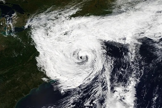 Deadly nor’easter dumps several inches of rain, strong winds in Massachusetts, Rhode Island and we aren’t done
A deadly slow-moving September nor’easter dumped several inches of rain on Fall River and the rest of southeastern Massachusetts over the weekend, according to the National Weather Service in Boston/Norton, while the…
-
 Dangerous Storm and Gale Warnings Issued for New York, Massachusetts, and the Rest of New England
The nor’easter’s strongest winds are shifting north, with Storm Warnings for waters south of New England, Gale Warnings for Massachusetts and Rhode Island waters, and coastal flooding on Long Island. The storm stays…
-
 Massachusetts Coast Braces for Strong Winds and Rough Seas
SuaraGarut.ID A powerful storm off the Massachusetts coast is expected to bring strong northeastern winds, rough seas and scattered showers on Wednesday, with the greatest impacts along the southern shoreline, according…
-
 Futurecast: Storm won’t directly hit Massachusetts, but its impacts will reach the coast
DEDHAM, Mass. — A distant nor’easter will keep Massachusetts breezy for the next several days, bringing rough surf and the potential for beach erosion before conditions gradually improve later this week. Closely…
- New England Could Face Another Fall Nor’easter – Maine, New Hampshire, & Massachusetts Take Note
Even though we normally think of Nor'easters as being a winter weather event, they can happen at any time during the year. In fact, we have already had a Nor'easter this year. It rolled through New England in September…
Air quality
Acceptable. Unusually sensitive people should consider limiting prolonged outdoor exertion.
Forecast
- SunGood
- MonGood
- TueGood
North Bristol-Plymouth, MA reporting area · 1 hr ago. Data from AirNow (EPA and its state, local and tribal partners); preliminary and subject to change.
Sun & moon
Almanac
MonthlyBrockton, records since 1894. Normals 1991–2020. Data from NOAA's Regional Climate Centers (ACIS).
Nearby
- Boston 55 km
- Cambridge 59 km
- New Bedford 42 km
- Dorchester 50 km
- Brockton 32 km
- Fall River 49 km
- Quincy 43 km
- Somerville 60 km
- Pawtucket 60 km
- Brookline 56 km
- Taunton 36 km
- Weymouth 37 km
Forecasts, observations and alerts in the United States come from the National Weather Service (NOAA); radar from NOAA's Multi-Radar Multi-Sensor system; satellite imagery from NASA's Global Imagery Browse Services (GIBS) and NOAA's GOES satellites; the map from the U.S. Geological Survey's National Map; air quality from AirNow (EPA and its partners); hurricane information from the National Hurricane Center; climate normals and records from NOAA's Regional Climate Centers (ACIS). Forecasts outside the United States and the UV index: MET Norway (CC BY 4.0); observations outside the U.S.: airport reports via NOAA's Aviation Weather Center. Place names: GeoNames (CC BY 4.0). Data are copied on a schedule and may lag the sources; for warnings that affect your safety, follow your local National Weather Service office and emergency officials. Weather news is drawn from the 4Search index and reflects what the press published. Terms of use.